democratic party Maps
4 geographic visualizations tagged with "democratic party"

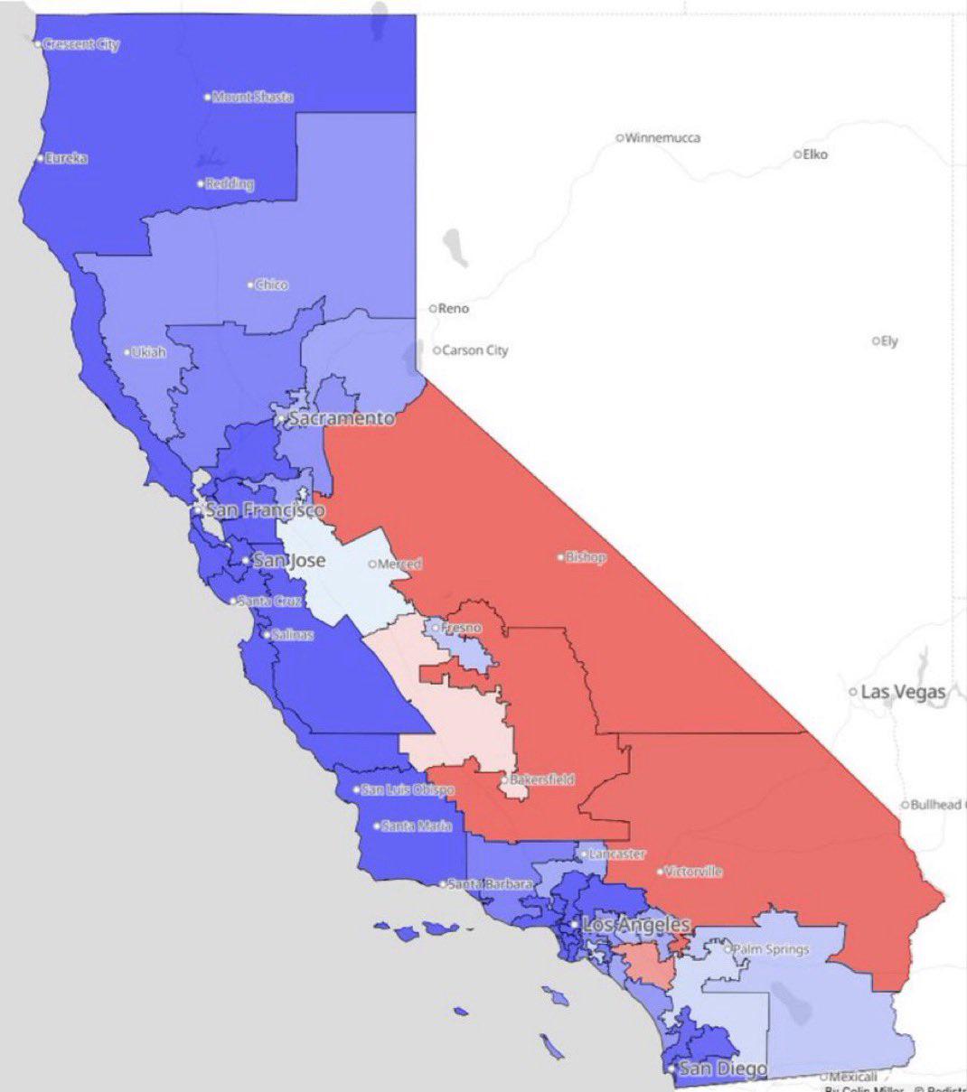
California Proposed Congressional Map for 2024
The visualization titled "California’s New Proposed Congressional Map, Where Democrats Could Pick Up To 5 Seats, Canceli...
👁 116📅 8/16/2025

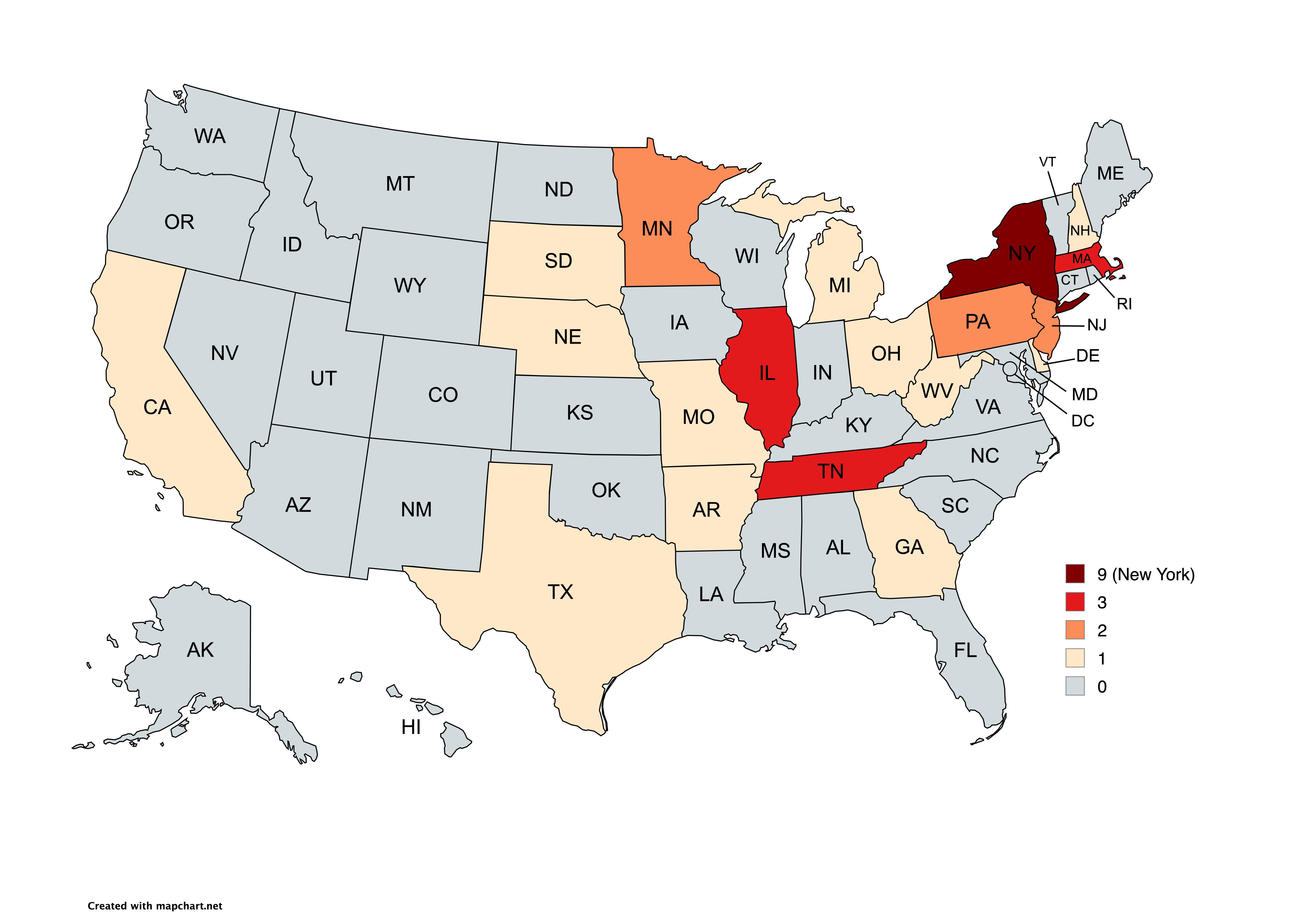
Map of Democratic Party Presidential Nominees by State
...
👁 86📅 8/14/2025

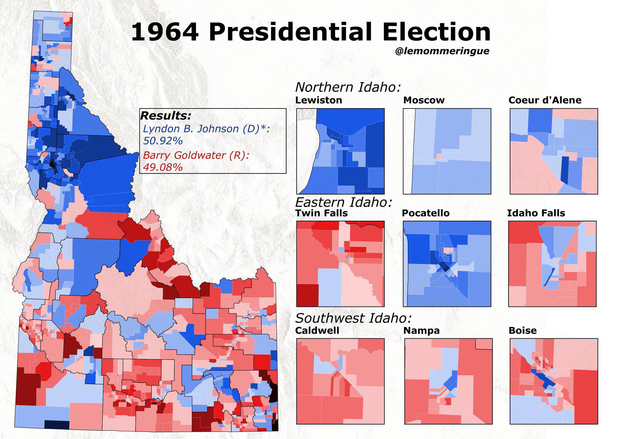
1964 Presidential Election Results Map of Idaho
The interactive map titled "The 1964 Presidential Election in Idaho, the last time a Democrat carried Idaho in a preside...
👁 6📅 10/19/2025

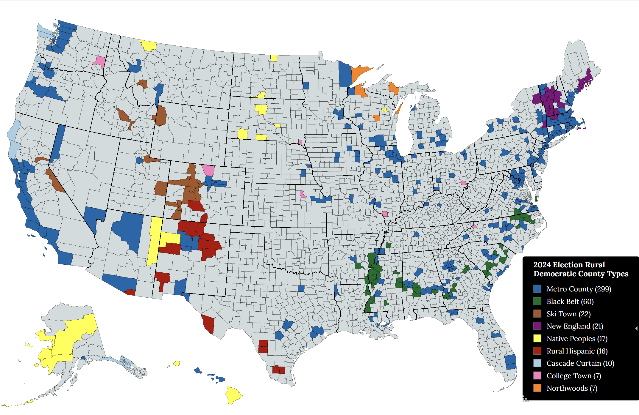
Rural Democratic Voting County Types Map
The "Rural Democratic Voting County Types of the 2024 U.S. Presidential Election" map provides a visual representation o...
👁 48📅 9/4/2025