Treaty of Alcáçovas Colonial Partition Map

Alex Cartwright
Senior Cartographer & GIS Specialist
Alex Cartwright is a renowned cartographer and geographic information systems specialist with over 15 years of experience in spatial analysis and data...
Geographic Analysis
What This Map Shows
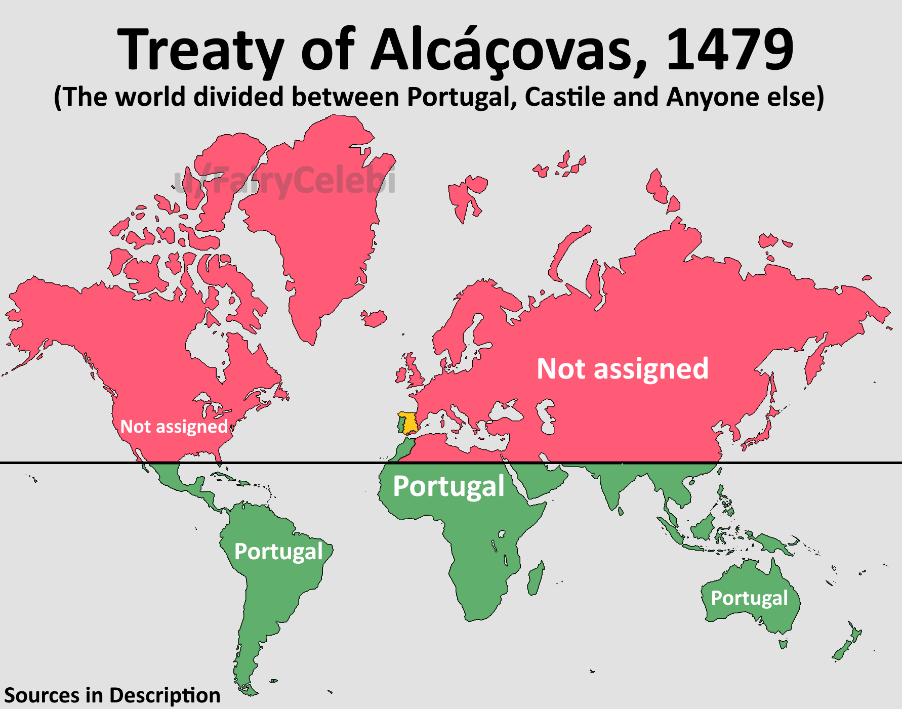
The visualization titled "Treaty of Alcáçovas Colonial Partition Map" illustrates the territorial divisions recognized by the Treaty of Alcáçovas, signed on September 4, 1479. This landmark agreement between the Catholic Monarchs of Castile and Aragon and the Kingdom of Portugal marked a significant moment in European colonial history. The map outlines the territories assigned to each kingdom, showcasing the areas where Portugal was granted rights to explore and colonize, as well as those territories acknowledged for Castile.
With the backdrop of the War of the Castilian Succession, this map serves as a historical reminder of the early stages of European colonial ambitions, setting the stage for future treaties and territorial disputes.
Deep Dive into Colonial Partitioning
The Treaty of Alcáçovas is often regarded as the world’s first colonial partition treaty, laying foundational principles for European colonialism. At its core, the treaty delineated spheres of influence between two burgeoning powers—Castile and Portugal—during a time when the exploration of new lands was not only encouraged but sanctioned by the Catholic Church.
Interestingly, the treaty did not just resolve immediate conflicts but opened a Pandora's box of future colonial endeavors. Castile received recognition of its claims over the Canary Islands, which were already being utilized as a strategic base for further exploration. On the other hand, Portugal was granted rights over territories that included Madeira, the Azores, Cape Verde, and Guinea. The significance of these islands cannot be understated; they served as pivotal waypoints for maritime navigation and trade routes that would soon extend across the Atlantic and beyond.
Moreover, the treaty’s most critical feature was the provision allowing Portugal to explore and conquer lands situated south of the Canary Islands—this included the Kingdom of Fez in modern-day Morocco. At the time, European knowledge of the world was limited, and the vast expanses of land that lay beyond the known territories were largely unexplored. The map highlights these boundaries and the ambitious aspirations that accompanied them.
One fascinating aspect of the treaty is the lack of clarity regarding the global landscape. Neither Castile nor Portugal had a comprehensive understanding of the world’s geography; America and Oceania were still undiscovered. Consequently, the treaty established a precedent for future treaties, such as the Treaty of Tordesillas in 1494, which would attempt to clarify these ambiguous claims further.
Regional Analysis
Examining the map reveals distinct regional implications stemming from the Treaty of Alcáçovas. For Portugal, the territories of Madeira and the Azores were not merely geographical entities but critical assets for navigation and trade. Madeira, for instance, became a center for sugar production, which would later drive European economies. The Azores, strategically located in the Atlantic, became vital waypoints for ships traversing between Europe and the Americas.
In contrast, Castile’s recognition of the Canary Islands had immediate implications for its ambitions in the Americas. The islands served as launching points for expeditions into the New World. The competition between Castile and Portugal for these valuable territories foreshadowed the intense colonial rivalry that would characterize the following centuries.
Moreover, looking at the territorial claims of the Kingdom of Fez, we see the early intertwining of European interests with African dynamics. The map underscores how European powers began to encroach upon African territories under the guise of exploration and evangelization, a theme that would resonate throughout colonial history.
Significance and Impact
The Treaty of Alcáçovas was not merely a document signing but a pivotal moment that shaped the future of European colonial expansion. Its ramifications were felt not just in the immediate territories assigned but also in the broader context of international relations and colonial practices. The division of the world into spheres of influence set a precedent for subsequent treaties that would further define colonial boundaries.
Understanding the significance of this treaty is crucial in grasping the complex history of colonialism. It illustrates how legal agreements can dictate the fate of nations and peoples, often without their consent. The impact of such treaties continues to reverberate today, as many former colonies grapple with the legacies of colonialism.
In a modern context, the map serves as a reminder of the historical injustices and territorial claims that still influence global geopolitics today. As we witness new forms of colonialism—economic, cultural, and technological—reflecting on the Treaty of Alcáçovas helps us question the patterns of power and control that persist in our world.
The map, therefore, is not just a historical artifact; it is a lens through which we can examine the ongoing implications of colonial legacies in contemporary society.
Visualization Details
- Published
- September 8, 2025
- Views
- 50
Comments
Loading comments...