Flåm Line Route Map Norway

Marcus Rodriguez
Historical Geography Expert
Marcus Rodriguez specializes in historical cartography and geographic data analysis. With a background in both history and geography, he brings unique...
Geographic Analysis
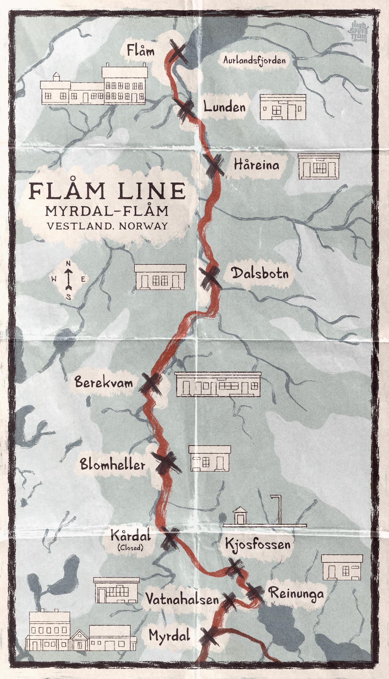
What This Map Shows\nThe illustrated map of the Flåm Line in Norway provides a detailed representation of one of the world’s steepest and most scenic railway journeys. Spanning approximately 20 kilometers, this railway connects the village of Flåm, located at the end of the Aurlandsfjord, to Myrdal on the Bergen Line. The visualization highlights key features along the route, including stunning landscapes, notable stops, and geographical landmarks that define this breathtaking journey.
However, the Flåm Line is more than just a travel route; it’s a showcase of Norway’s dramatic topography and engineering prowess. The map captures the essence of the line, leading travelers through lush valleys, cascading waterfalls, and towering mountains, making it a significant subject for geographical exploration.
Deep Dive into the Flåm Line\nThe Flåm Line is not just an ordinary railway; it’s a marvel of engineering and a testament to Norway’s commitment to connecting its picturesque yet rugged terrain. Completed in 1940, the line was built primarily for freight purposes but has since become a popular tourist attraction. It offers a unique perspective on Norway's natural beauty, showcasing the interplay between human ingenuity and the landscape.
One of the fascinating aspects of the Flåm Line is its steep incline. The railway ascends more than 860 meters in just 20 kilometers, with gradients of up to 1:18. This means that for every 18 meters traveled horizontally, the train climbs 1 meter vertically. It’s this dramatic rise that affords passengers spectacular views of the surrounding fjords and mountains.
Interestingly, the line passes through 20 tunnels, some of which were carved directly into the mountainsides to maintain the integrity of the landscape. The most notable of these is the 1,400-meter-long Flåm Tunnel, which is an engineering feat in itself, allowing the train to navigate steep gradients without compromising safety or comfort.
Moreover, the Flåm Line is known for its scenic waterfalls, notably the Kjosfossen waterfall, which cascades down the mountainside along the route. This waterfall is not only a breathtaking sight but also serves as a reminder of Norway's dynamic hydrology, where rivers and streams are integral to the country’s identity. Did you know that Norway has about 1,190 waterfalls over 15 meters in height, making it a paradise for nature lovers?
The climate along the Flåm Line varies significantly due to its altitude. The lower sections near Flåm enjoy a maritime climate characterized by mild winters and cool summers, while as you ascend, the climate shifts to a colder, alpine environment. This variation in climate contributes to the diverse ecosystems found along the route, from lush green forests at lower elevations to rocky, snow-covered peaks at higher altitudes.
Regional Analysis\nWhen examining the Flåm Line in the context of its geographical surroundings, several key regions stand out. Flåm itself is situated in the Aurlandsfjord, a UNESCO World Heritage site, which is known for its steep cliffs and deep waters. The fjord provides an important habitat for marine life, and its surrounding areas are rich in both flora and fauna.
On the other hand, Myrdal marks the junction with the Bergen Line, which connects to the larger railway network of Norway. This region experiences more extreme weather conditions, often with heavy snowfall in winter, making it a popular destination for winter sports.
Interestingly, the contrast between these two endpoints highlights the diversity of the Norwegian landscape. While Flåm is characterized by lush greenery and vibrant life, Myrdal presents a stark, rugged terrain that showcases the harsher side of Norway’s climate. This duality in environments not only enriches the travel experience but also reflects the broader geographical features of Norway.
Significance and Impact\nThe Flåm Line is significant for many reasons beyond its stunning vistas. Economically, it plays a crucial role in the tourism sector, drawing visitors from around the globe eager to experience its breathtaking landscapes. In recent years, this has led to increased investment in infrastructure and services in the region, enhancing accessibility and boosting local economies.
Moreover, the railway is vital for preserving the cultural heritage of Norway, as it connects communities and promotes sustainable tourism. As people become more aware of the environmental impacts of travel, the Flåm Line stands as a model for how tourism can be balanced with ecological preservation.
Looking towards the future, the Flåm Line may serve as a case study in sustainable transport solutions, especially as discussions around climate change and carbon footprints become more prominent. The integration of electric trains and greener technologies could further enhance the line’s appeal and effectiveness as a transportation route.
In conclusion, the illustrated map of the Flåm Line is not just a guide to a remarkable journey; it represents the convergence of natural beauty, engineering achievement, and cultural significance in one of the world’s most stunning landscapes. As travelers embark on this scenic route, they are not only witnessing the splendor of Norway but also engaging with a critical component of its ecological and economic framework.
Visualization Details
- Published
- September 7, 2025
- Views
- 72
Comments
Loading comments...