urban heat islands Maps
3 geographic visualizations tagged with "urban heat islands"

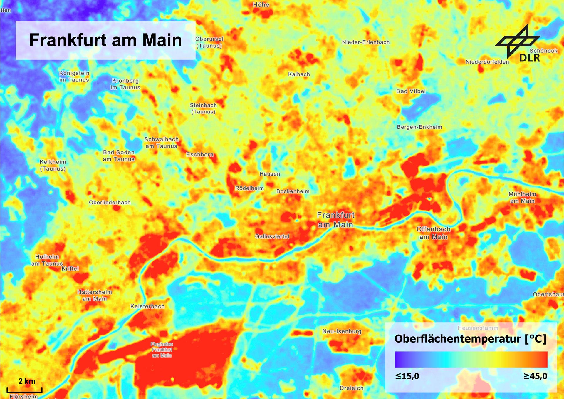
Urban Heat Islands Map of Frankfurt (2013-2024)
The map titled "How Urban Heat Islands Show Up in Frankfurt: Summer Surface Temperatures (2013–2024) Comparing Built vs....
👁 140📅 8/17/2025

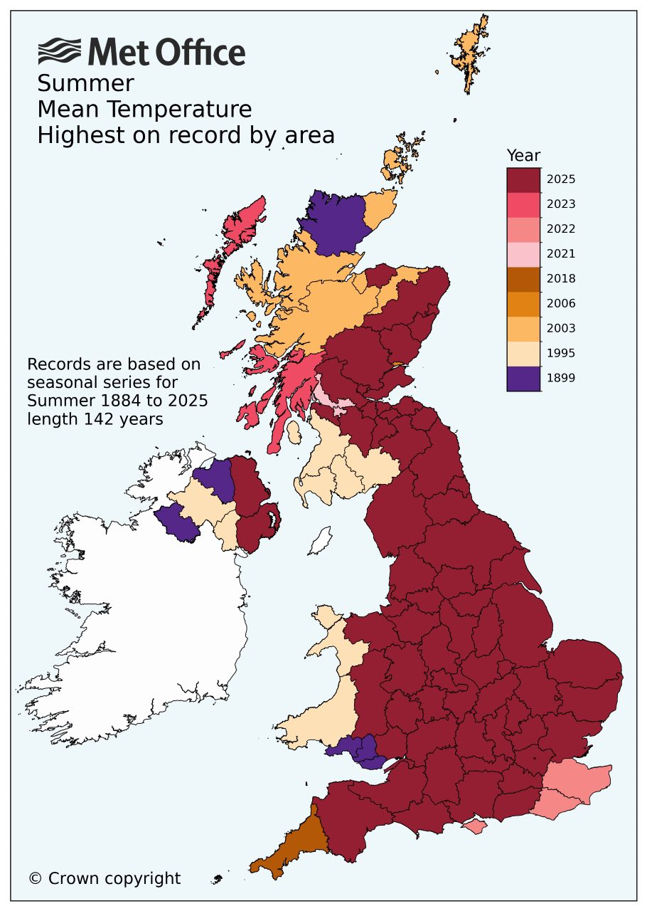
UK Counties Summer Mean Highest Temperature Record Map
The map titled "Map showing the years of each UK county's summer mean highest temperature record since 1899" provides a ...
👁 92📅 9/3/2025

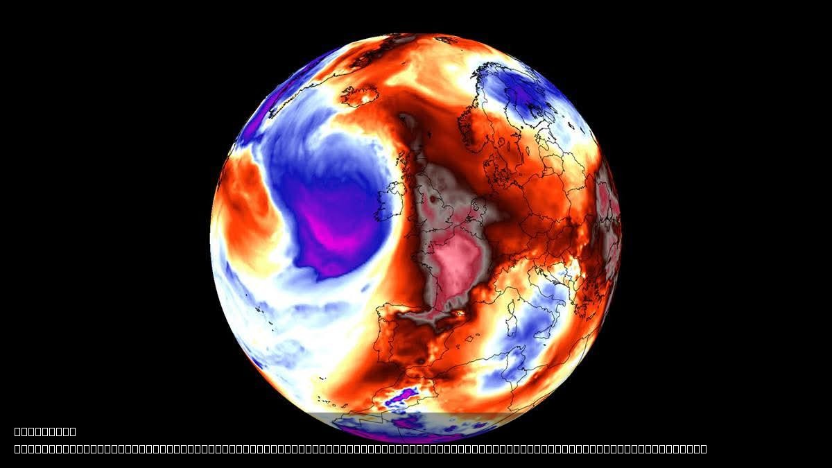
Heatwave Map of Europe 2023
This visualization presents a detailed map highlighting the regions of Europe currently affected by a significant heatwa...
👁 188📅 8/5/2025