nmapa.org logo
nmapa.org
HomeGalleryTagsAboutPrivacyDisclaimer
Home›Tags›trade networks

trade networks Maps

2 geographic visualizations tagged with "trade networks"
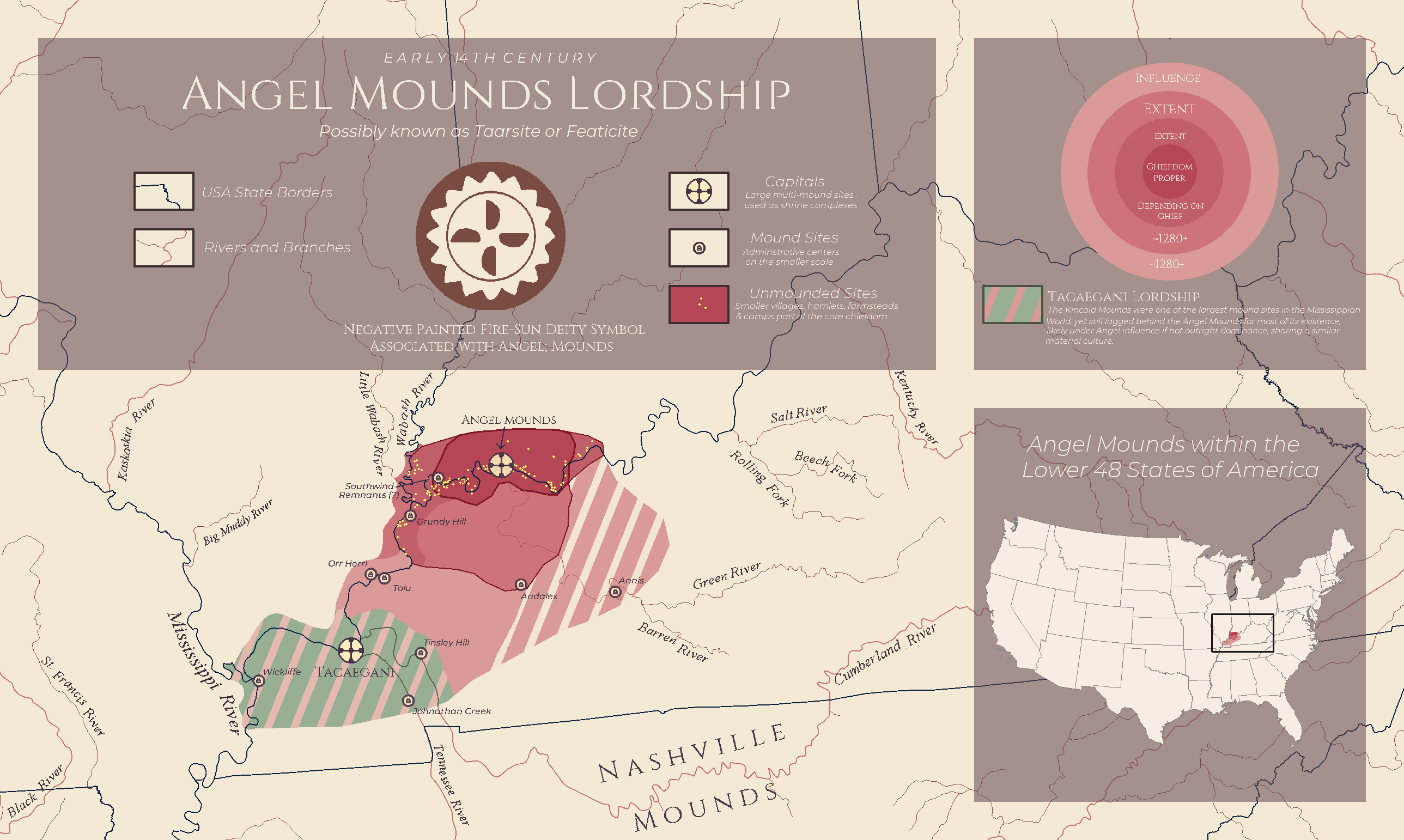
Angel Mounds Lordship Map of 14th Century Kentucky

Angel Mounds Lordship Map of 14th Century Kentucky

The "Angel Mounds Lordship: 14th Century Kentucky Map" provides a fascinating glimpse into the socio-political landscape...

👁 32📅 9/18/2025
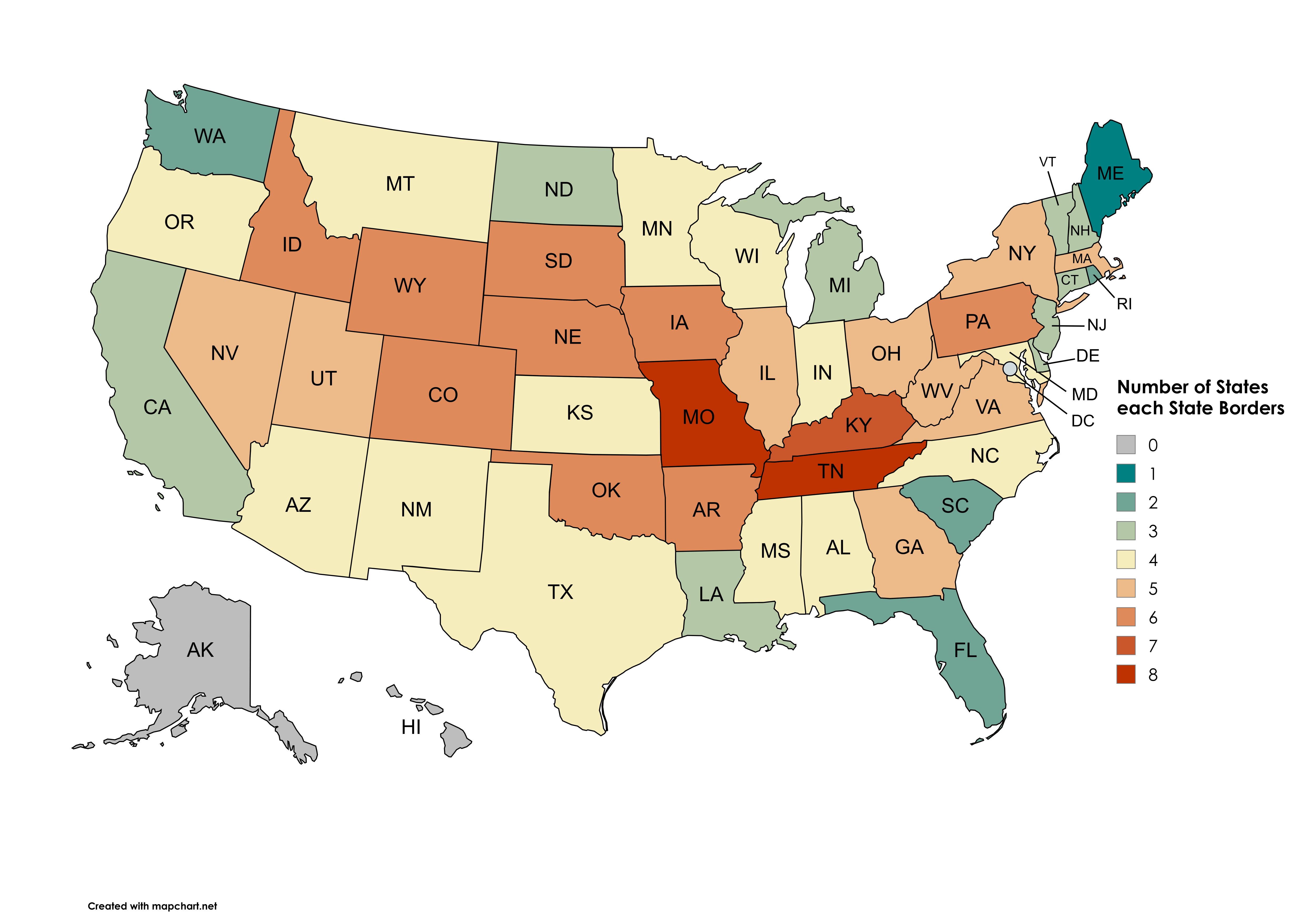
Map of States Each State Borders

Map of States Each State Borders

This visualization illustrates the number of states each U.S. state borders, excluding Washington D.C., water borders, a...

👁 20📅 9/26/2025
← Browse All TagsBrowse All Maps
nmapa.org logo

nmapa.org

Your premium gateway to the world's most fascinating maps and geographical visualizations. Explore, discover, and understand our planet through the art of cartography.

Explore

  • Home
  • About
  • Gallery

Legal

  • Privacy Policy
  • Disclaimer
  • Terms of Service

© 2025 nmapa.org. All rights reserved. Made with ❤️ for geography enthusiasts worldwide.