nmapa.org logo
nmapa.org
HomeGalleryTagsAboutPrivacyDisclaimer
Home›Tags›territories

territories Maps

3 geographic visualizations tagged with "territories"
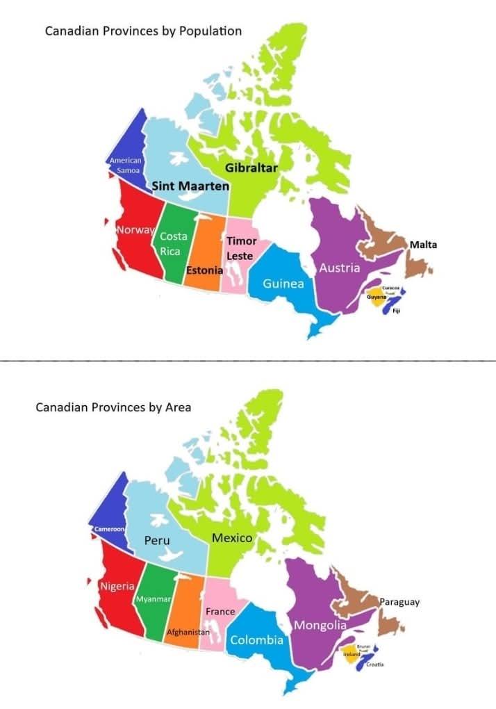
Canadian Provinces and Territories Size and Population Map

Canadian Provinces and Territories Size and Population Map

This map presents a fascinating comparison between the provinces and territories of Canada and various countries that sh...

👁 16📅 9/20/2025
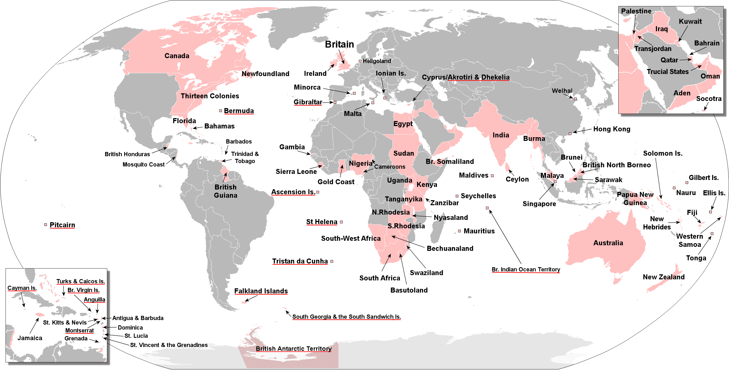
Map of Territories Ever Held by the British Empire

Map of Territories Ever Held by the British Empire

This visualization presents an anachronous map detailing the vast territories once held by the British Empire at various...

👁 80📅 8/11/2025
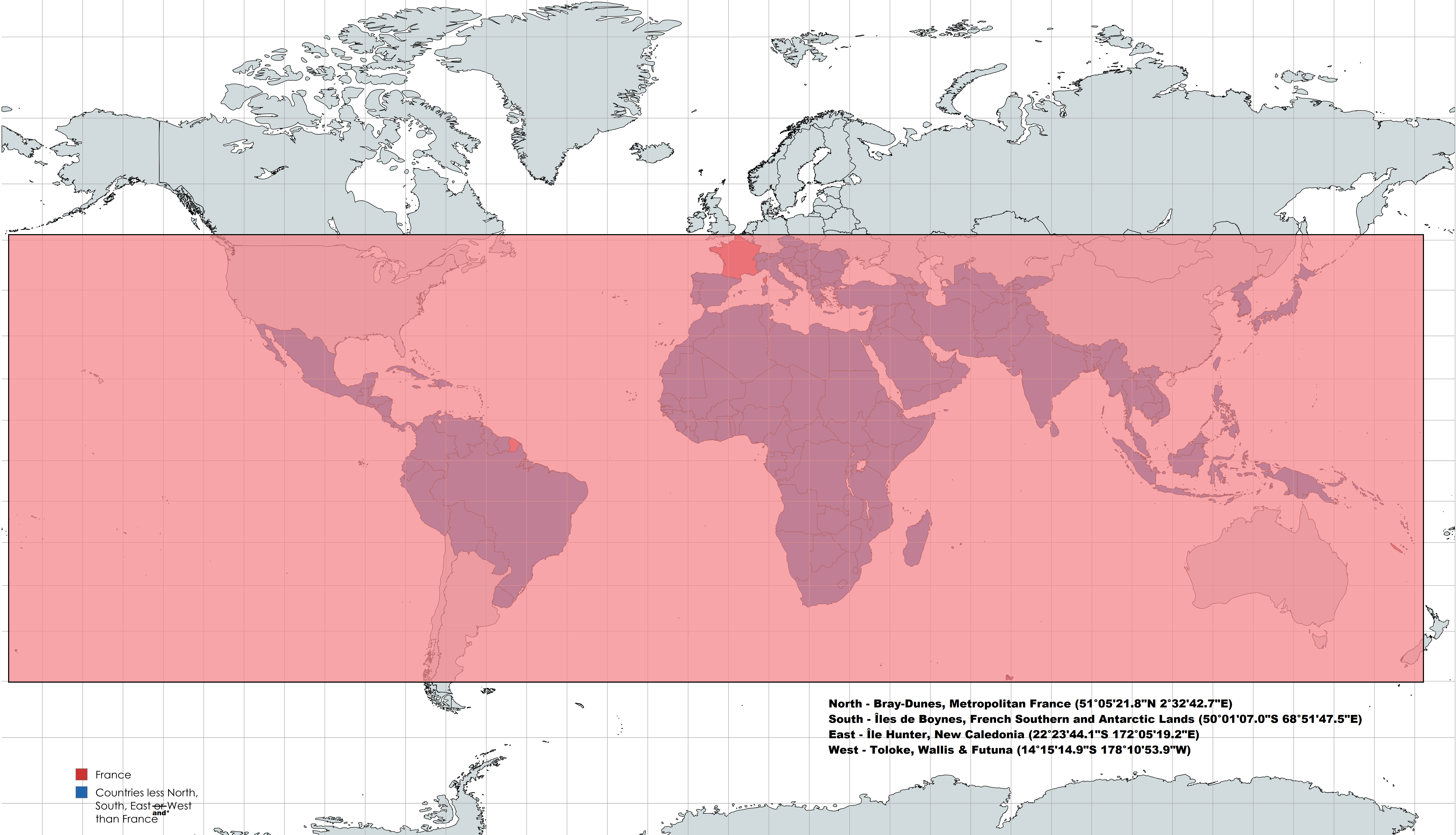
France's Geographical Extremes Map

France's Geographical Extremes Map

This intriguing map highlights an interesting geographical fact: France is positioned further North, South, East, and We...

👁 74📅 8/12/2025
← Browse All TagsBrowse All Maps
nmapa.org logo

nmapa.org

Your premium gateway to the world's most fascinating maps and geographical visualizations. Explore, discover, and understand our planet through the art of cartography.

Explore

  • Home
  • About
  • Gallery

Legal

  • Privacy Policy
  • Disclaimer
  • Terms of Service

© 2025 nmapa.org. All rights reserved. Made with ❤️ for geography enthusiasts worldwide.