territorial changes Maps
15 geographic visualizations tagged with "territorial changes"
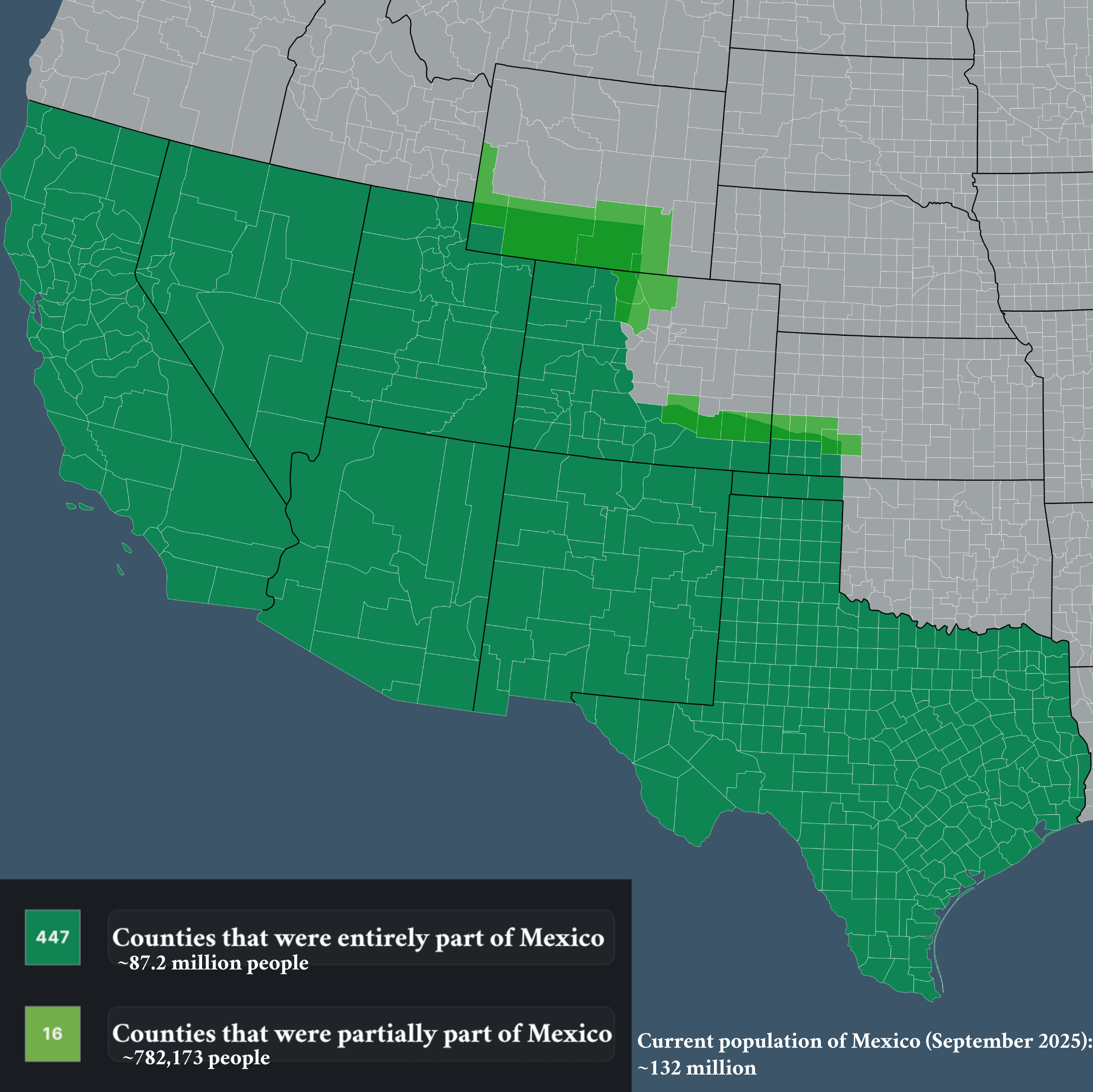
Map of Counties that Used to be Part of Mexico
The visualization titled "Counties that used to be part of Mexico" provides an insightful look into the historical terri...
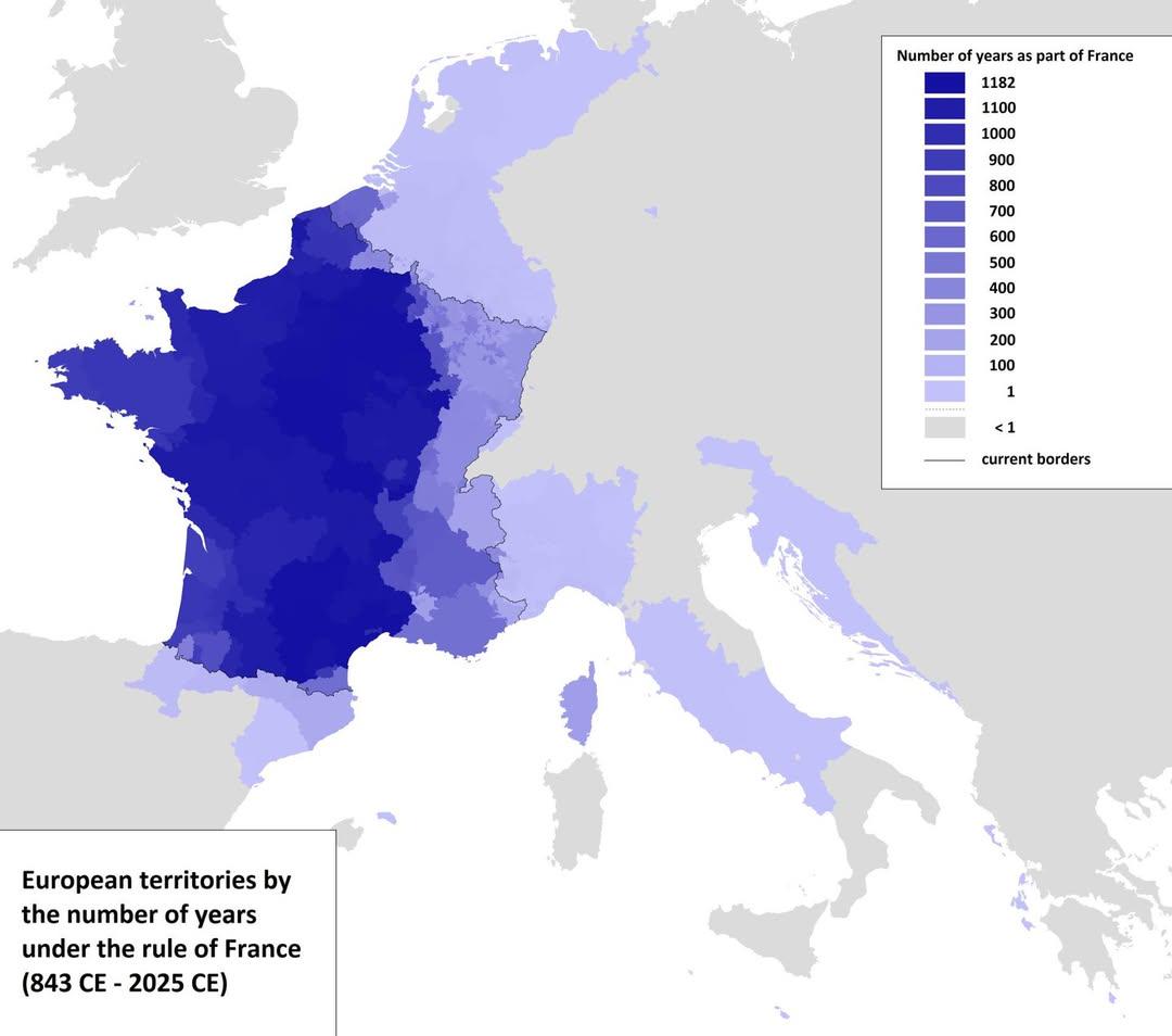
Map of European Territories By Years Under France
The visualization titled 'Map of European Territories By The Number of Years Spent Being Part of France' offers a compre...
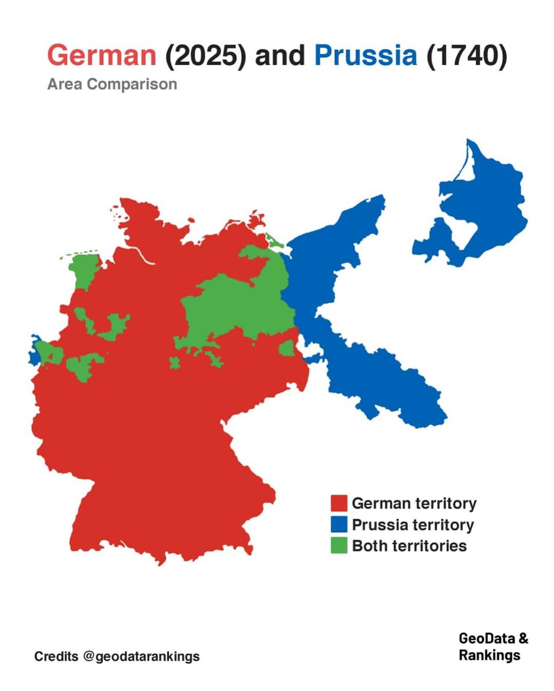
Germany and Prussia Area Comparison Map
The map titled "Germany in 2025 and Prussia in 1740 area comparison" visually represents the territorial extent of moder...
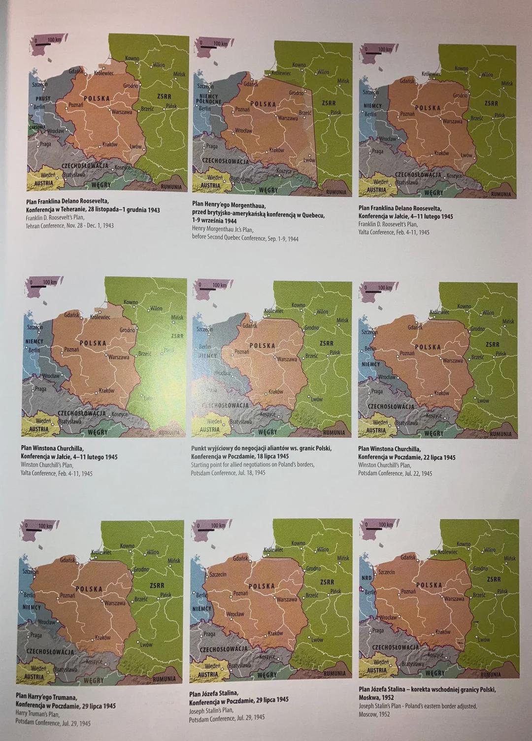
Post-War Border Proposals Map of Poland and Germany
...
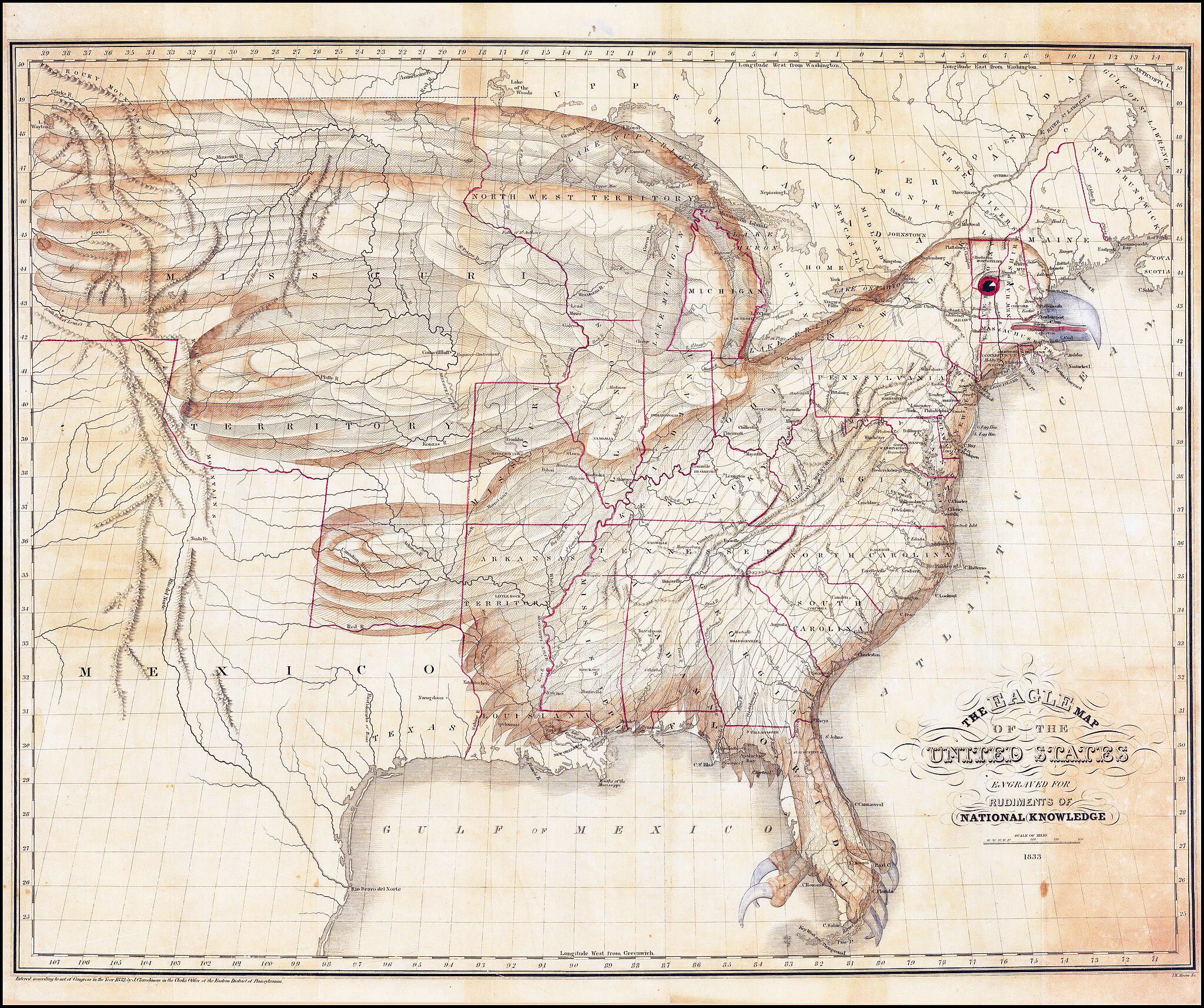
Map of the United States as an Eagle (1833)
The \...
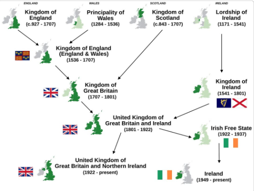
Simplified History Map of The British & Irish Isles
This visualization titled "Simplified History of The 4 Countries Of The British & Irish Isles" provides a clear overview...
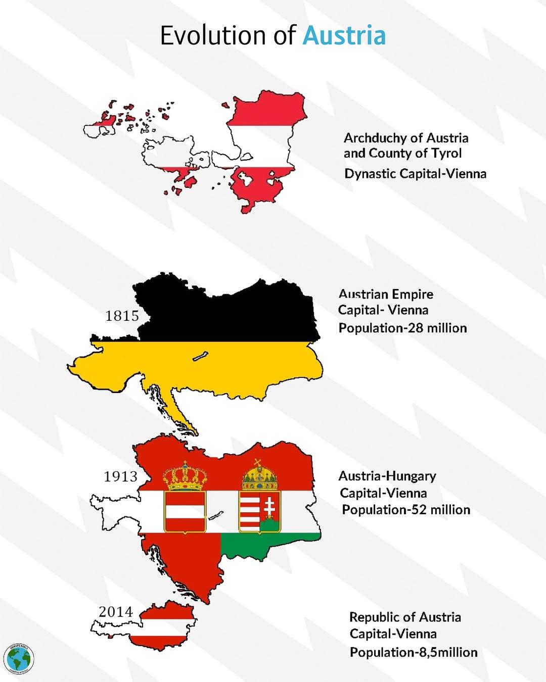
Historical Evolution of Austria Map
The "Historical Evolution of Austria" map provides a comprehensive overview of the territorial changes that Austria has ...
Map of the First Balkan War (1912)
...
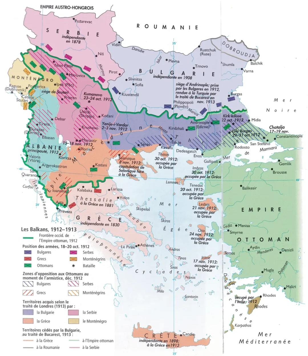
Balkan Wars 1912-1913 Map
The map titled "The Balkan Wars (1912-1913) Map" illustrates the territorial changes and military engagements that trans...
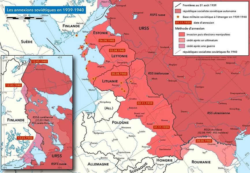
Soviet Annexations in 1939-1940 Map
One of the most significant events was the invasion of Poland in September 1939. The Soviet forces entered from the east...
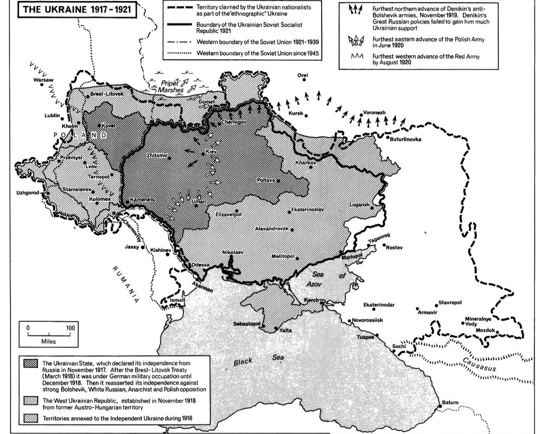
Ukrainian Boundaries Evolution Map 1917-1921
The "Evolution of Ukrainian Boundaries, 1917-1921" map illustrates a tumultuous period in Ukraine's history, showcasing ...
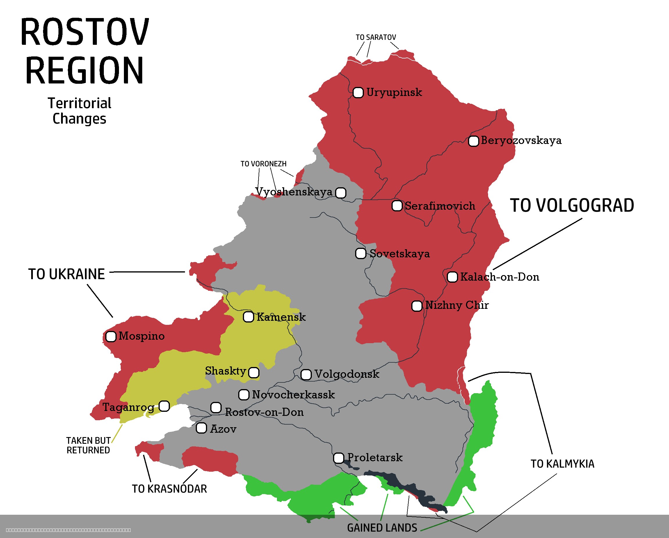
Rostov Region Territorial Changes Map 1917-2025
The "Rostov Region Territorial Changes Map 1917-2025" provides a comprehensive visual representation of the territorial ...
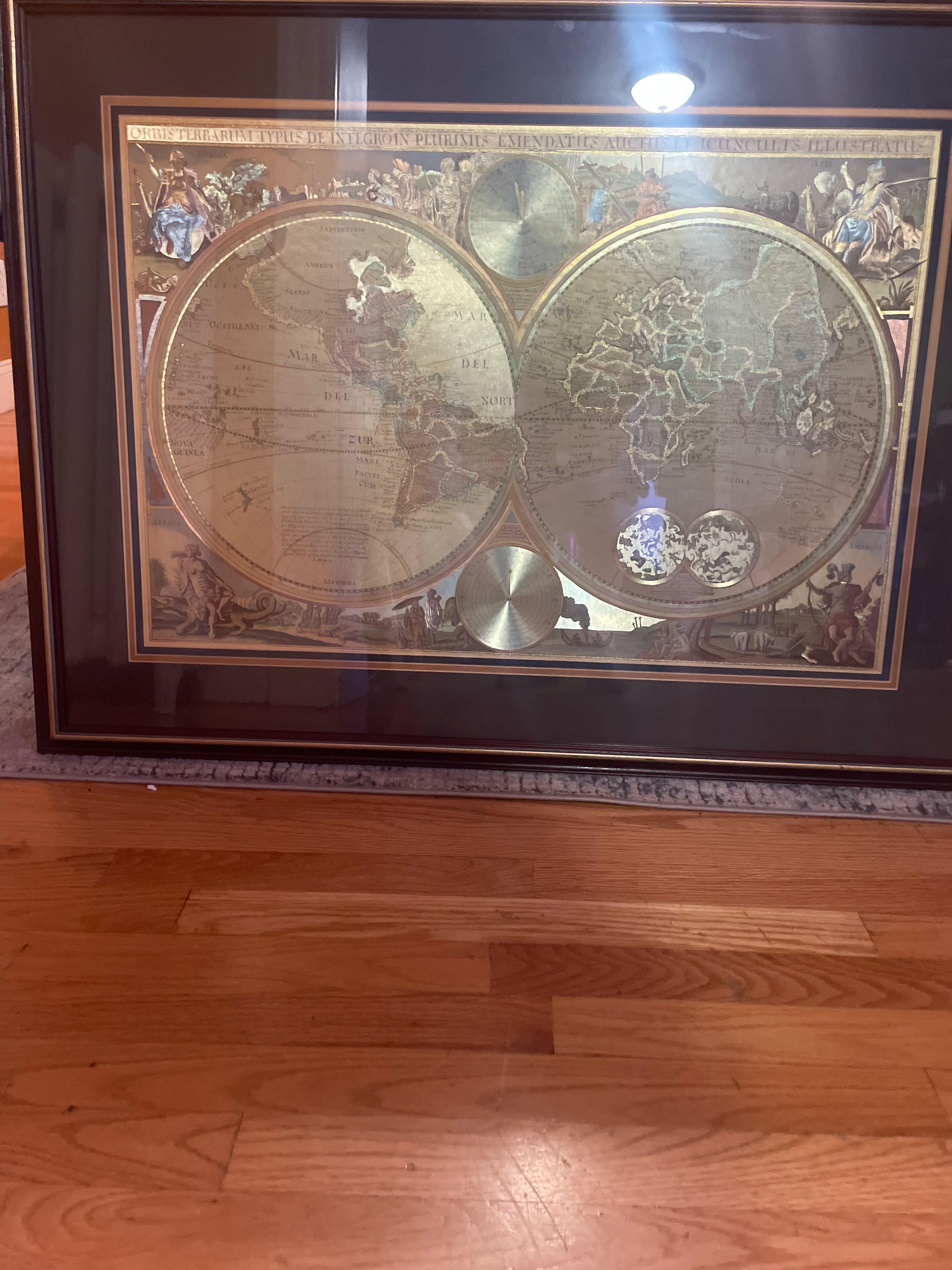
Historical Map of Unidentified Regions
Have you ever wondered why certain regions on old maps are marked as 'unexplored' or 'unknown'? This is a reflection of ...
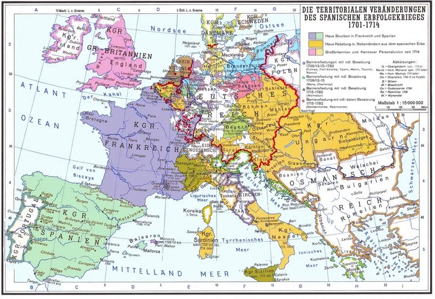
Territorial Changes After the War of Spanish Succession Map
One of the most significant results of the war was the cession of territories from Spain to various European powers. For...
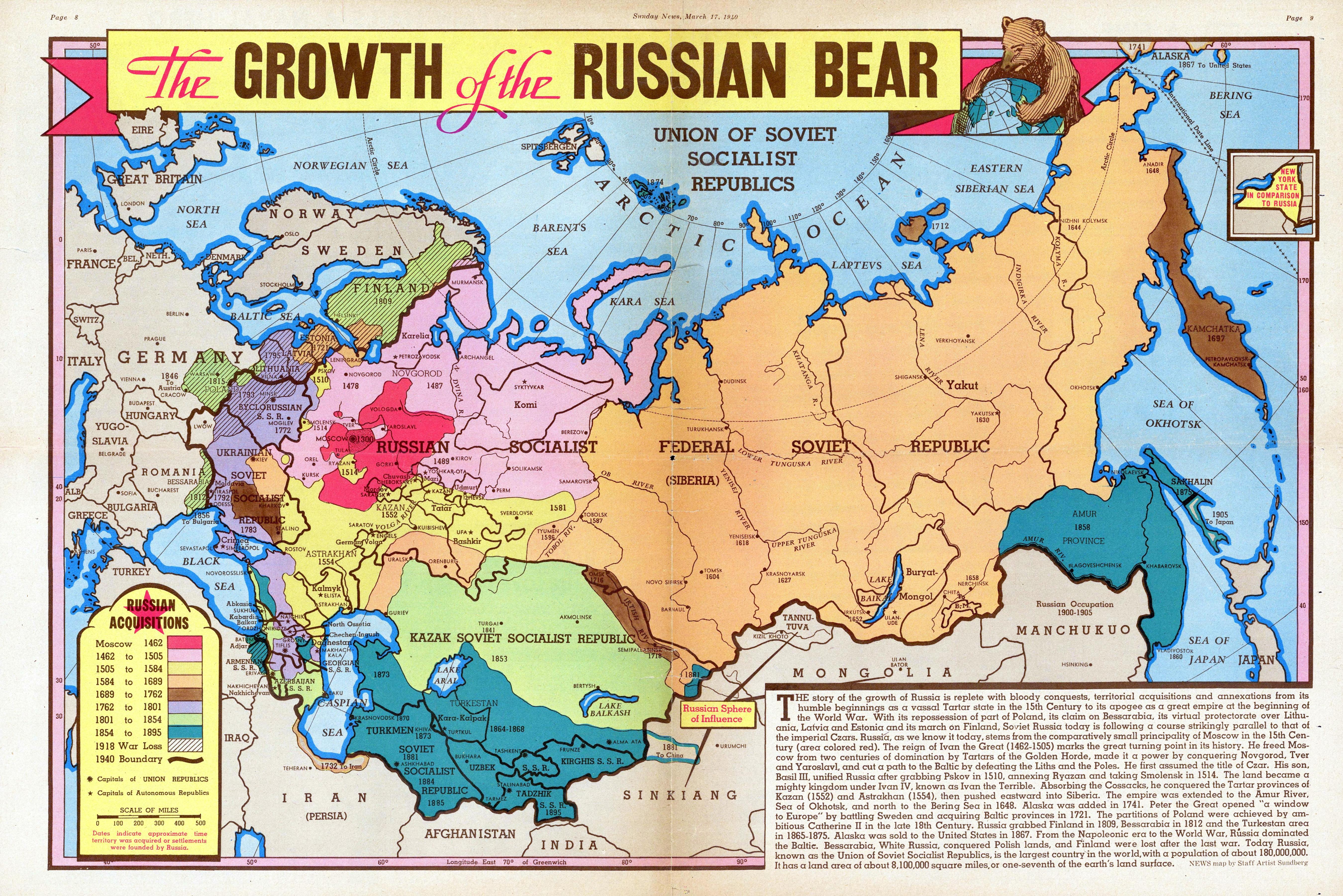
Territorial Changes of Russia Map
The "Growth of the Russian Bear" map from 1940 provides a detailed look at the territorial changes of Russia and the Sov...