south korea Maps
8 geographic visualizations tagged with "south korea"
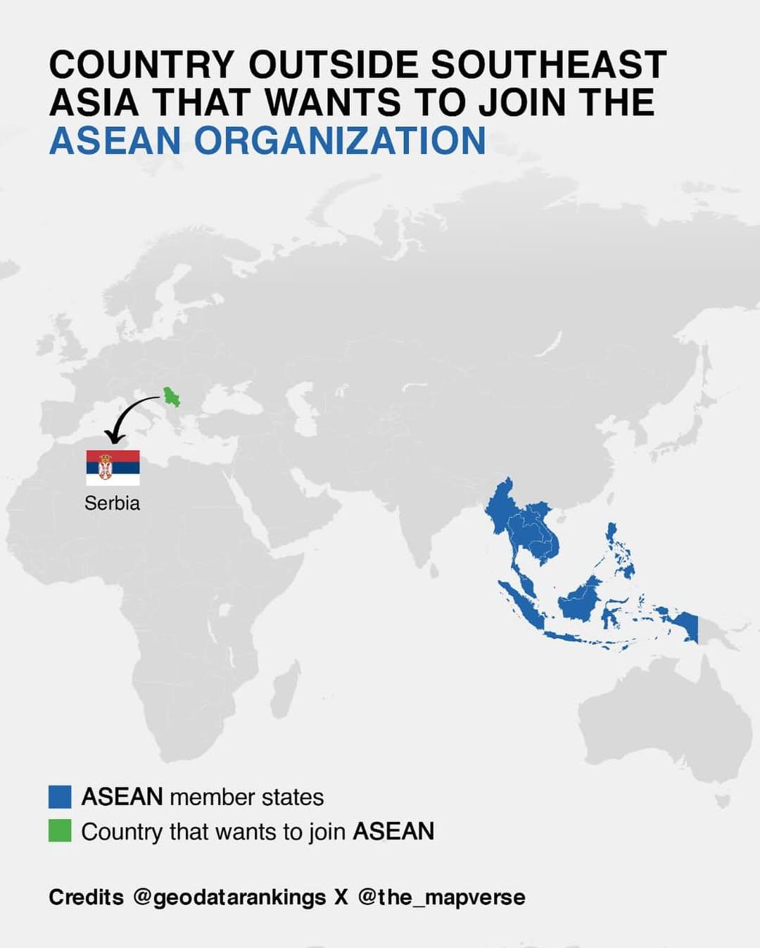
Map of Countries Outside Southeast Asia Wanting to Join ASEAN
This map illustrates the various countries outside of Southeast Asia that have expressed interest in joining the Associa...
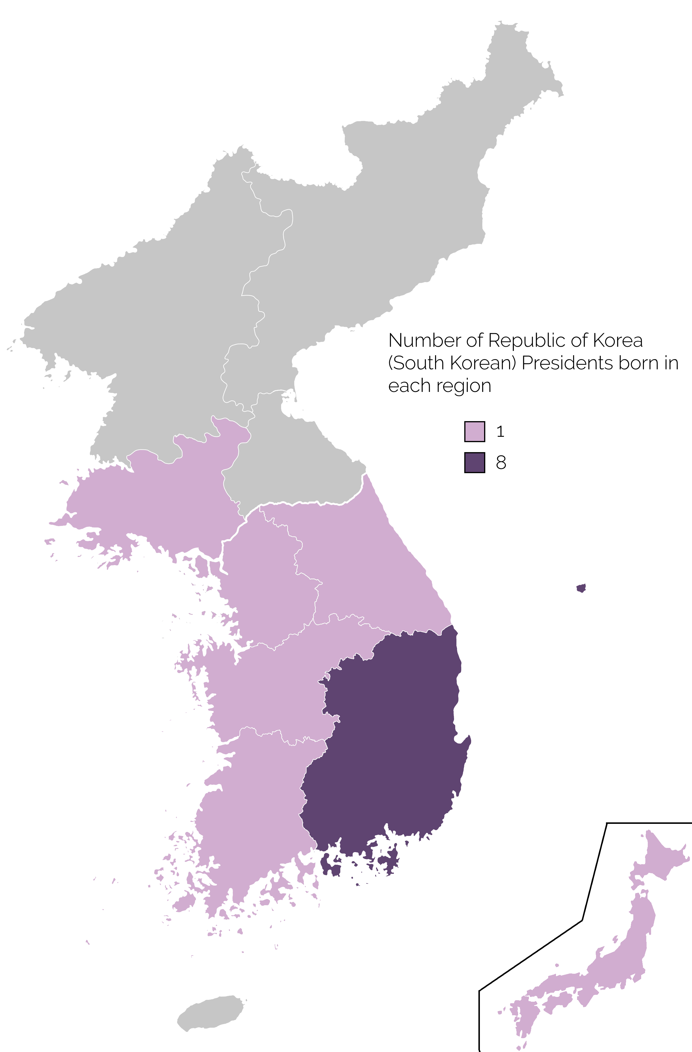
Map of Birthplaces of South Korean Presidents
The map titled 'Birthplace of South Korean Presidents' provides a visual representation of the geographic origins of the...
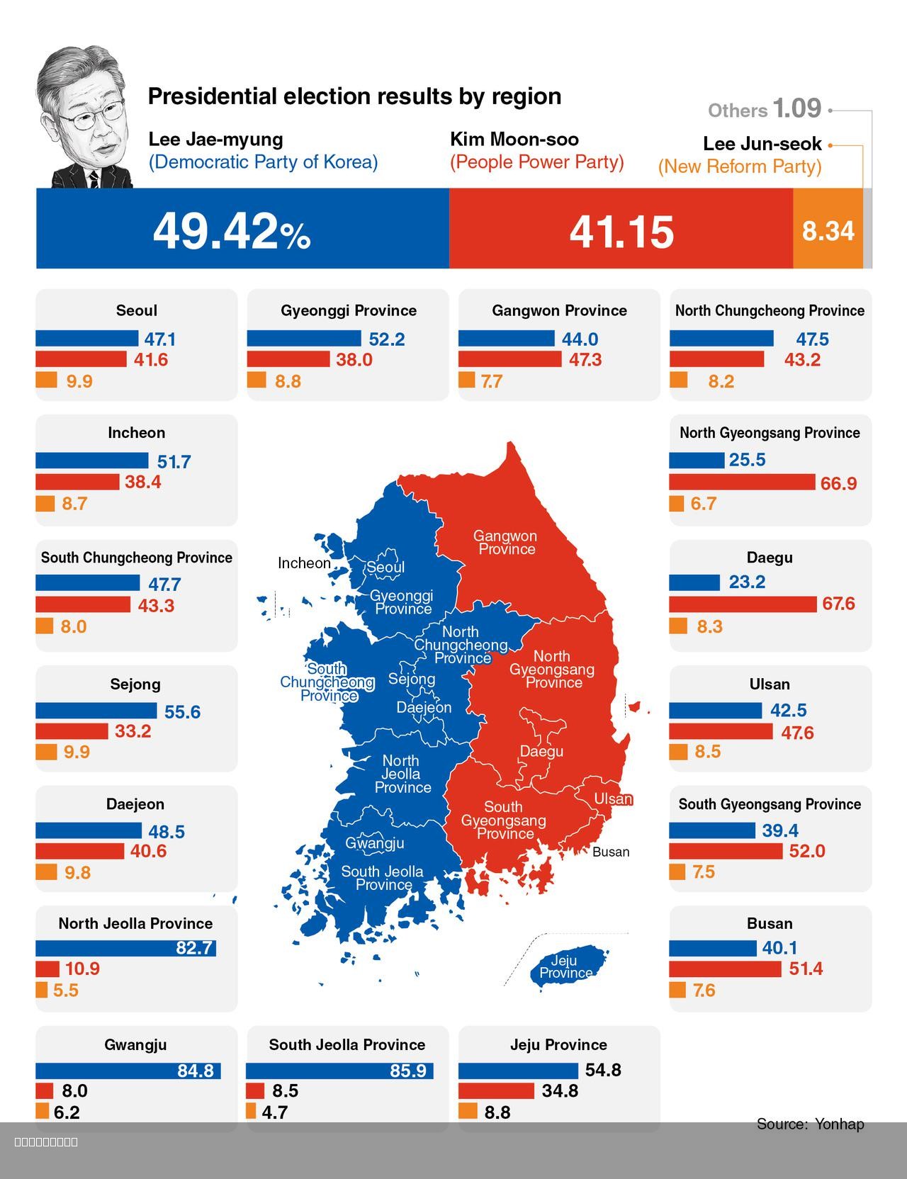
2025 South Korea Presidential Election Map
The 2025 South Korea Presidential Election Map illustrates the election results, focusing on the stark contrast between ...

Historical Map of the Koreas
This visualization presents a concise historical overview of the Koreas through eight distinct maps, each illustrating p...
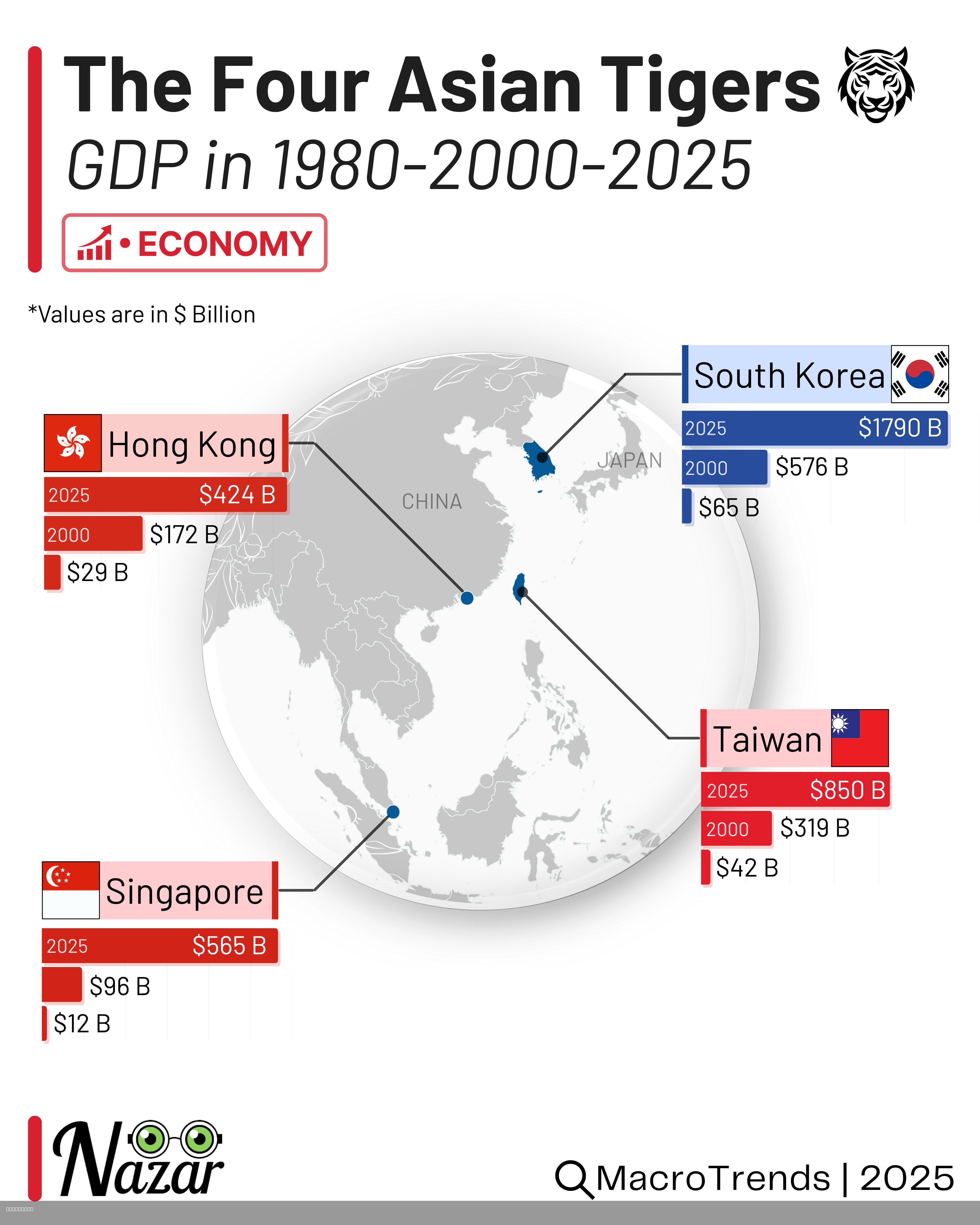
Four Asian Tigers Economic Development Map
This map highlights the economic development and growth trajectories of the Four Asian Tigers: South Korea, Taiwan, Hong...
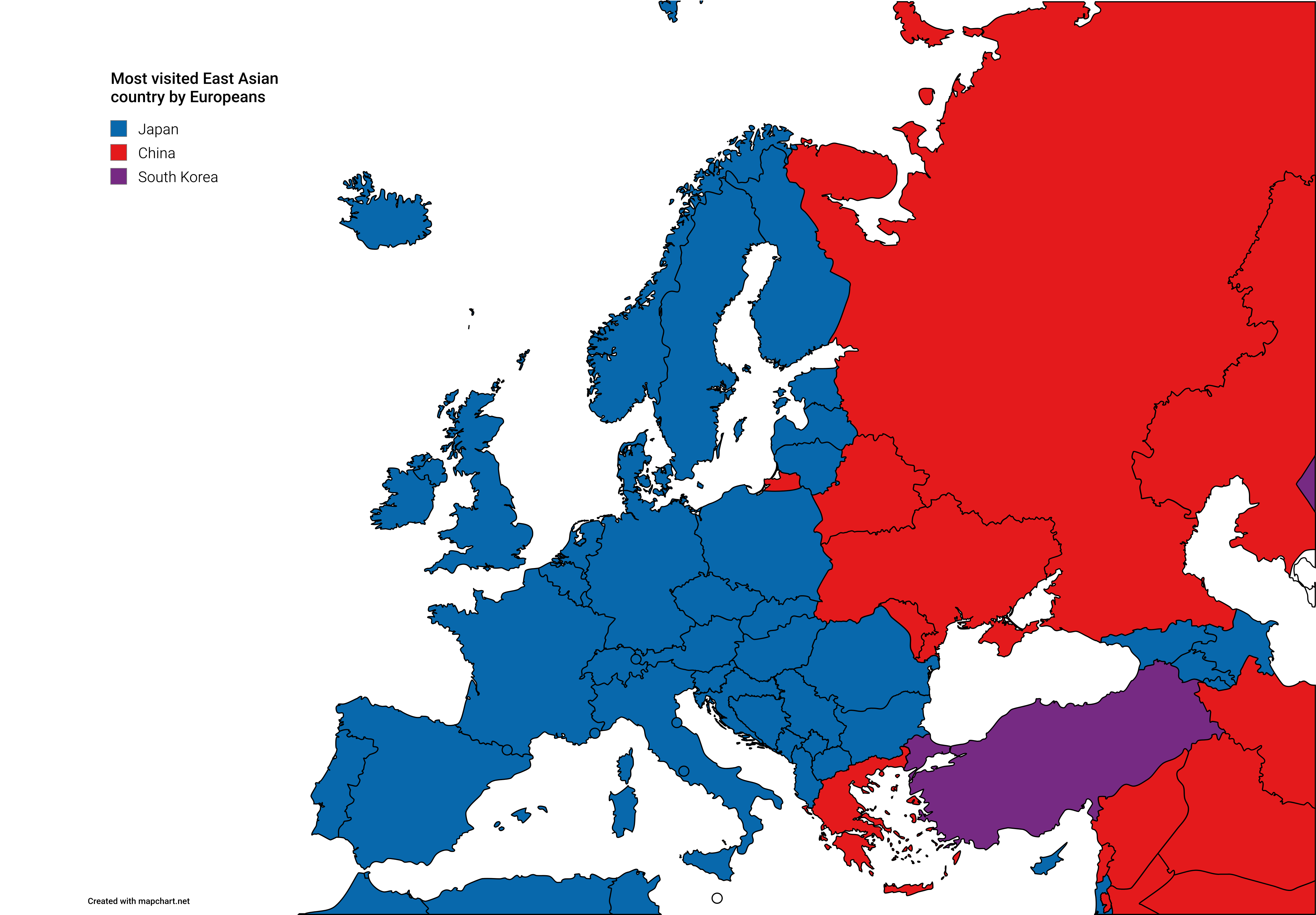
Map of Most Visited East Asian Countries by Europeans
The visualization titled 'Most Visited East Asian Countries by Europeans' presents an insightful look into travel patter...
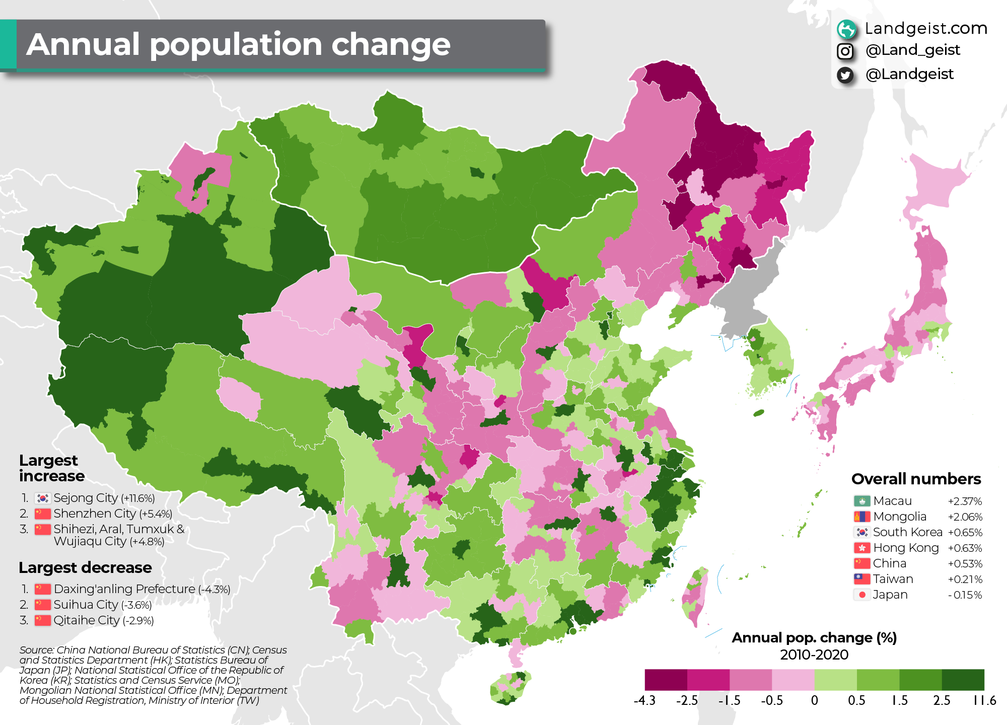
Annual Population Change Map of East Asia 2010-2020
This map illustrates the annual population change in East Asia from 2010 to 2020, providing a vivid snapshot of demograp...
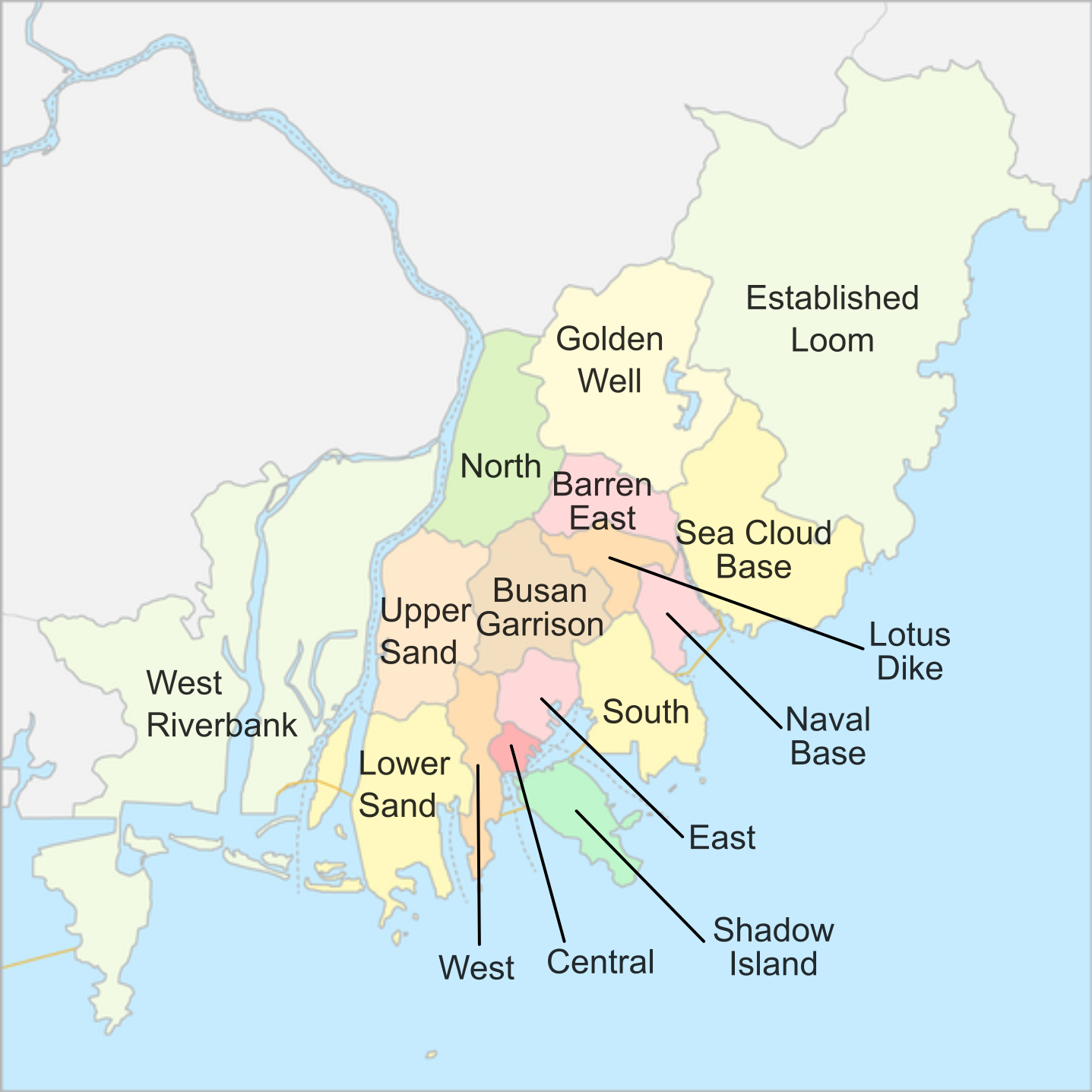
Busan District Map Overview
The "Busan's district map (Translated)" presents a clear and organized visualization of Busan's various districts, showc...