public transit Maps
4 geographic visualizations tagged with "public transit"

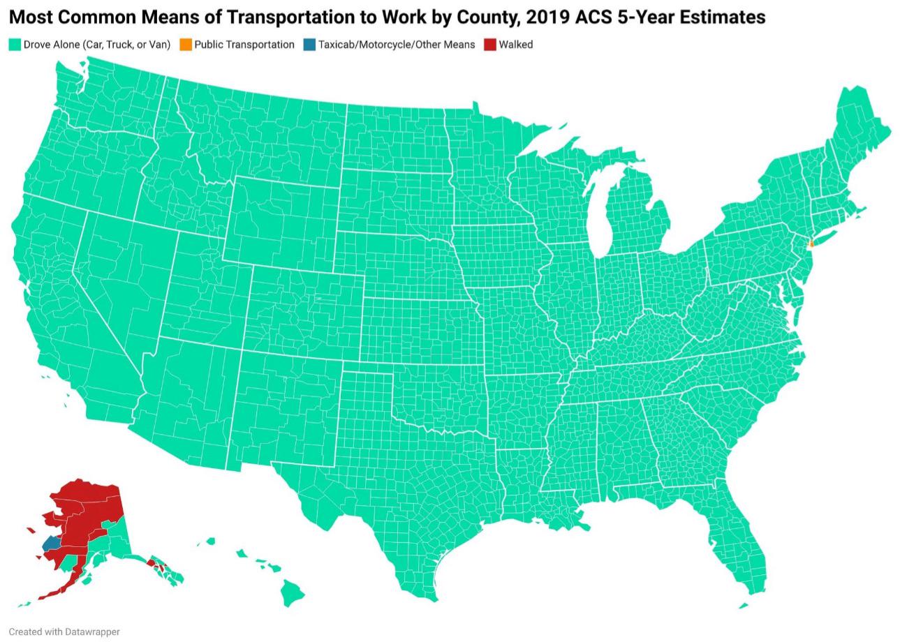
How Americans Get to Work Map
This map provides a visual representation of the various modes of transportation that Americans utilize to commute to wo...
👁 76📅 8/30/2025

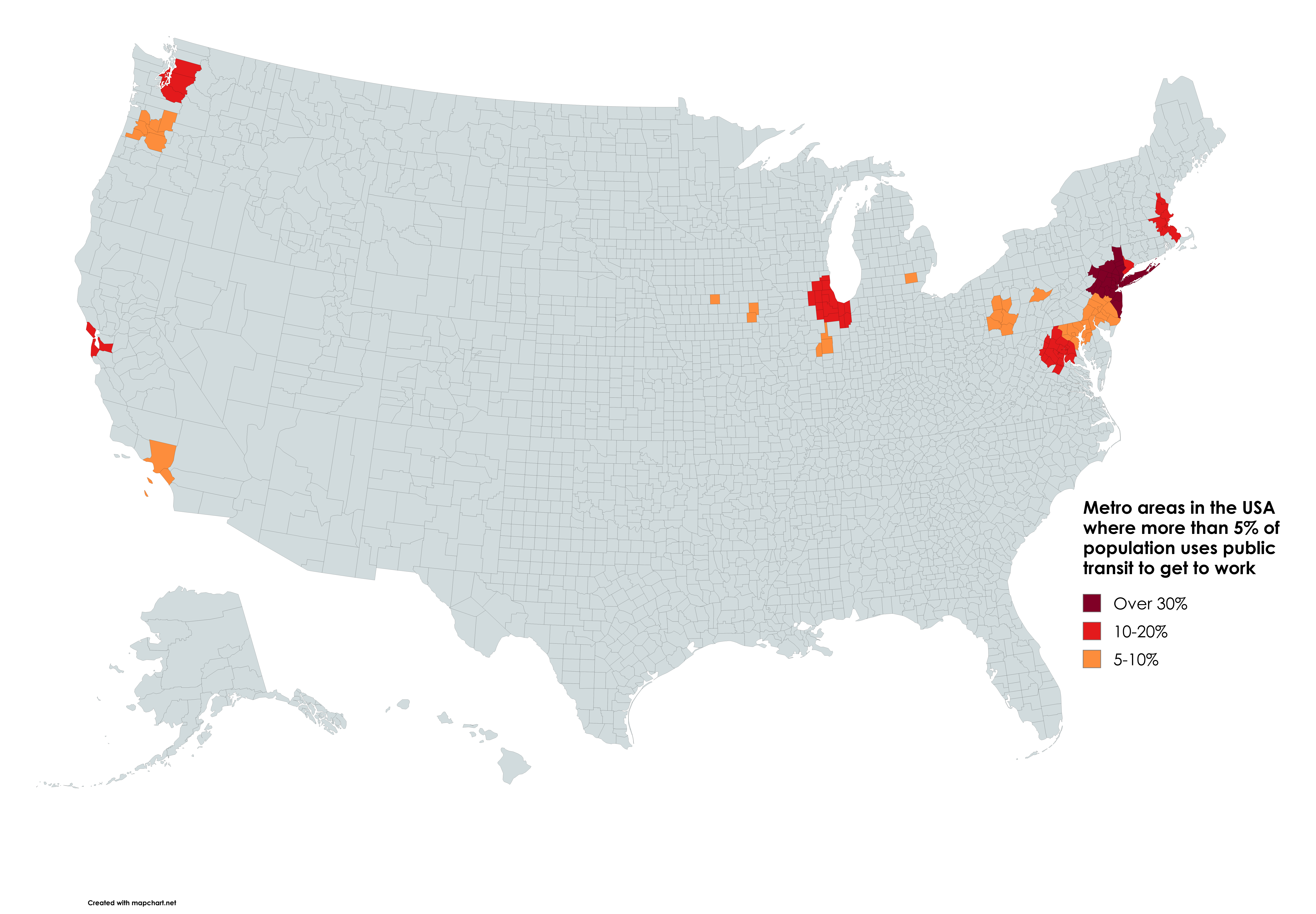
Public Transit Usage by Metro Area Map
According to the latest data from the U.S. Census Bureau, cities like New York, San Francisco, and Washington D.C. showc...
👁 74📅 8/31/2025

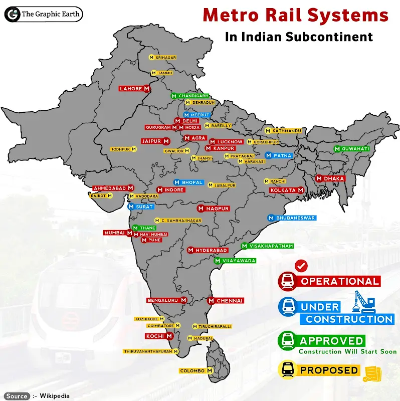
Metro Rail System in Indian Subcontinent Map
The "Metro Rail System in Indian Subcontinent Map" provides a comprehensive overview of the extensive metro rail network...
👁 62📅 9/16/2025

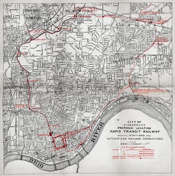
Cincinnati Abandoned Subway Map
The Cincinnati Abandoned Subway Map, created in 1914 by Edwards & Baldwin, illustrates the ambitious yet ultimately unre...
👁 68📅 8/22/2025