political history Maps
24 geographic visualizations tagged with "political history"
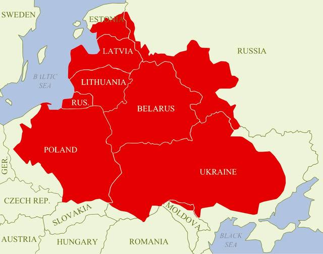
Polish–Lithuanian Commonwealth Maximum Extent Map
The visualization titled "Polish–Lithuanian Commonwealth at its maximum extent over modern borders" depicts the historic...
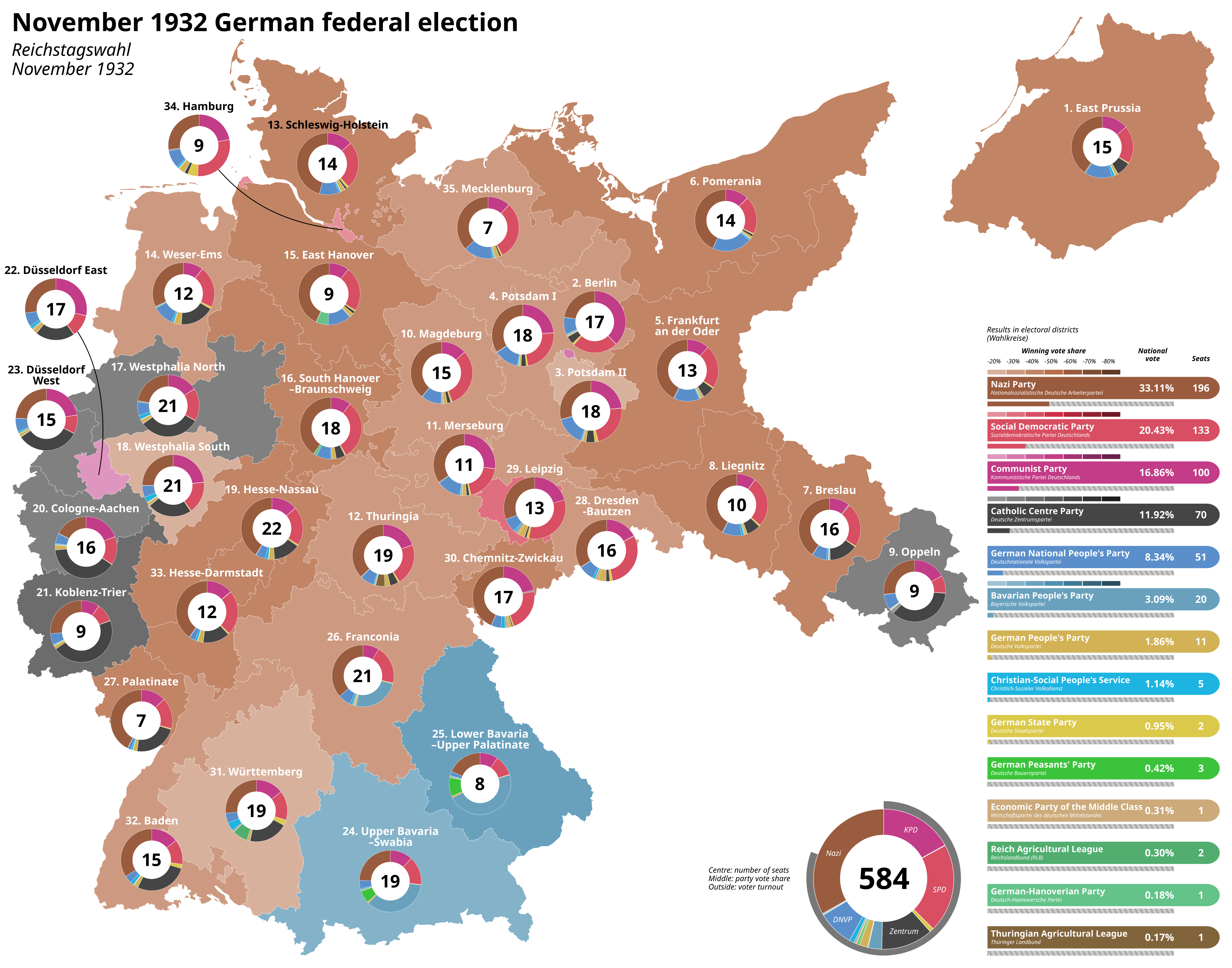
Last Free German Election of the Weimar Period Map
The "Last Free German Election of the Weimar Period Map" vividly illustrates the political landscape of Germany during t...
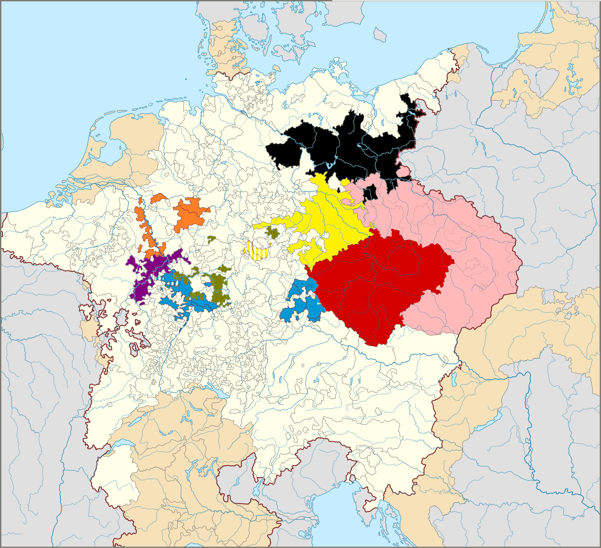
Map of The Seven Prince Electors in Germany
This map illustrates the territories of the Seven Prince Electors, who played a crucial role in the election of the Empe...
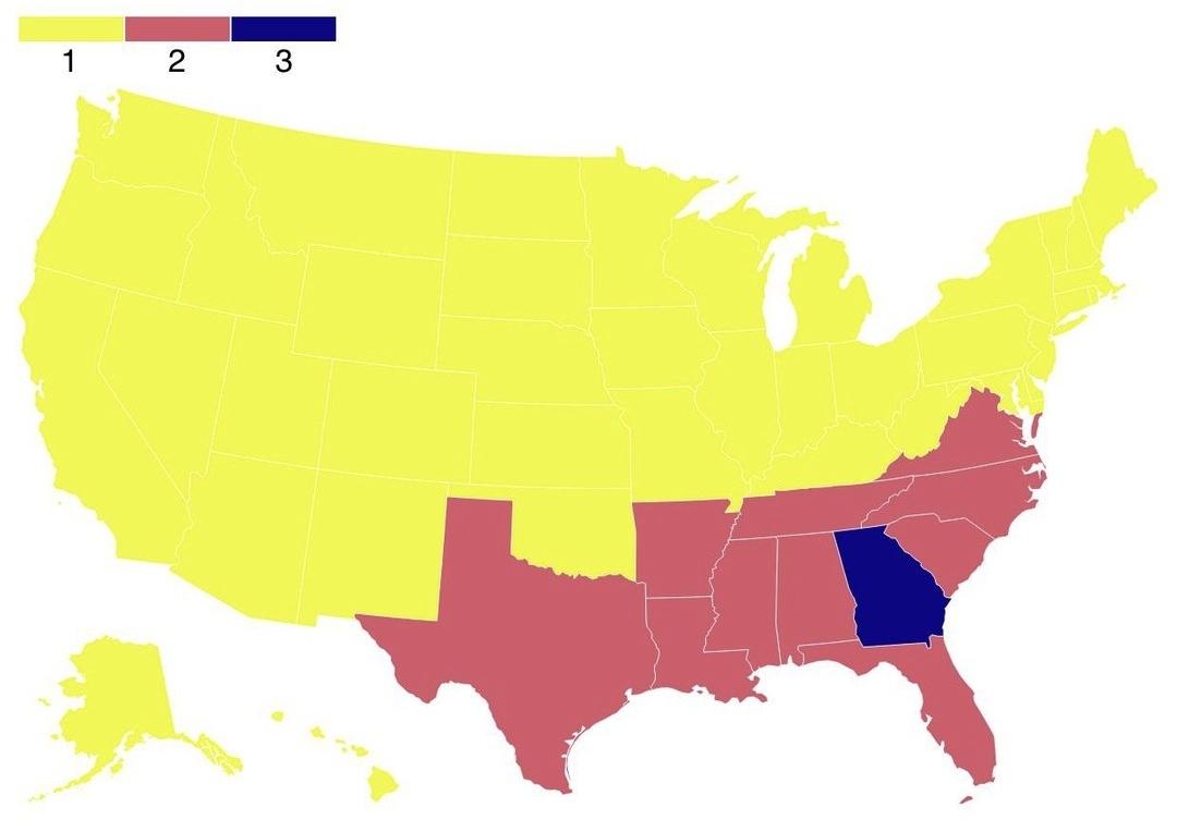
Map of States by Admission into the Union
The map titled "Map of States by Admission into the Union" provides a visual representation of the number of times each ...
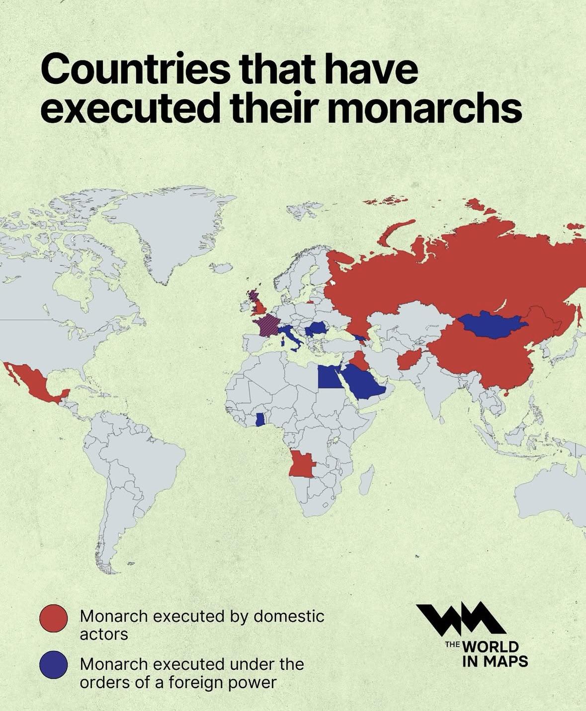
Map of Countries That Have Executed Their Monarchs
This map visually represents countries that have historically executed their monarchs, a stark reminder of the often tum...
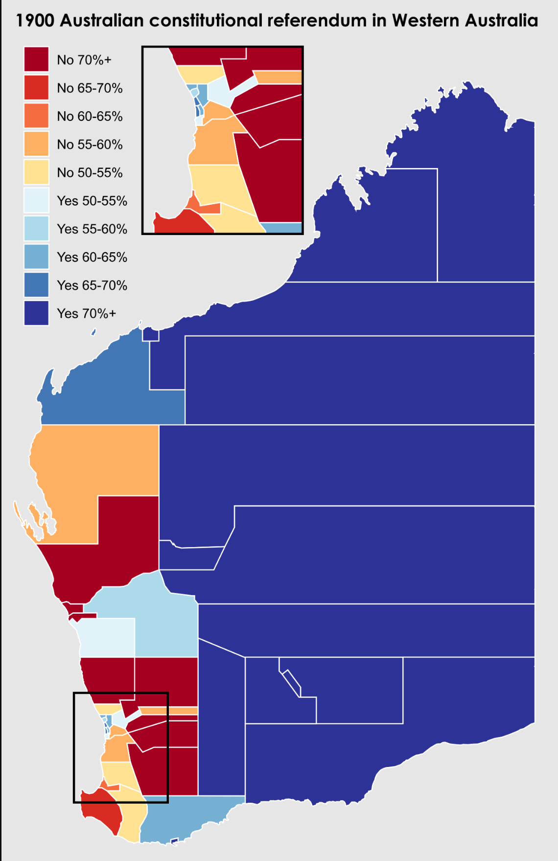
1900 Western Australian Referendum Results Map
Interestingly, rural areas, which made up a significant portion of the colony, tended to favor joining the Commonwealth....
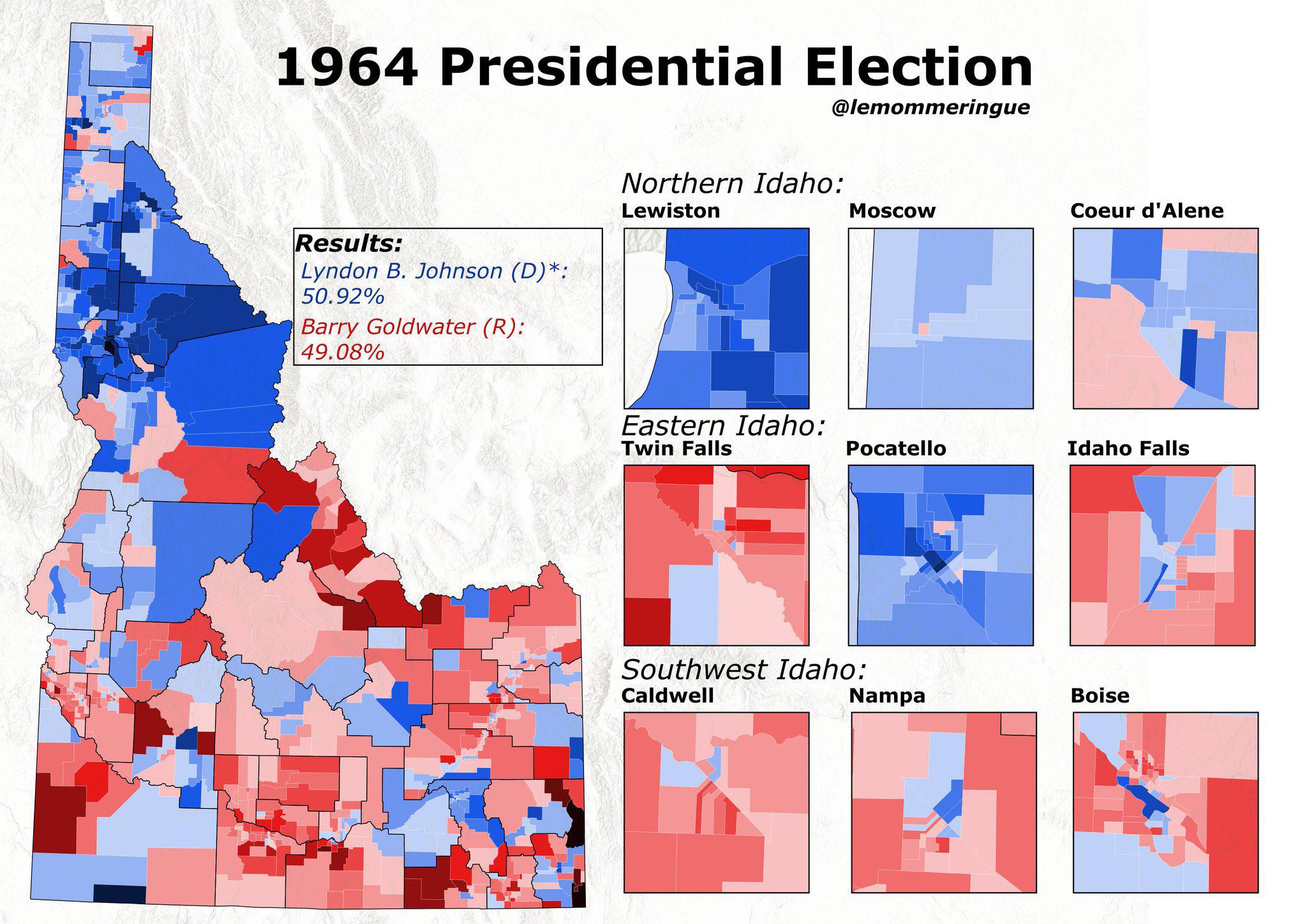
1964 Presidential Election Results Map of Idaho
The interactive map titled "The 1964 Presidential Election in Idaho, the last time a Democrat carried Idaho in a preside...

Historical Map of the Koreas
This visualization presents a concise historical overview of the Koreas through eight distinct maps, each illustrating p...
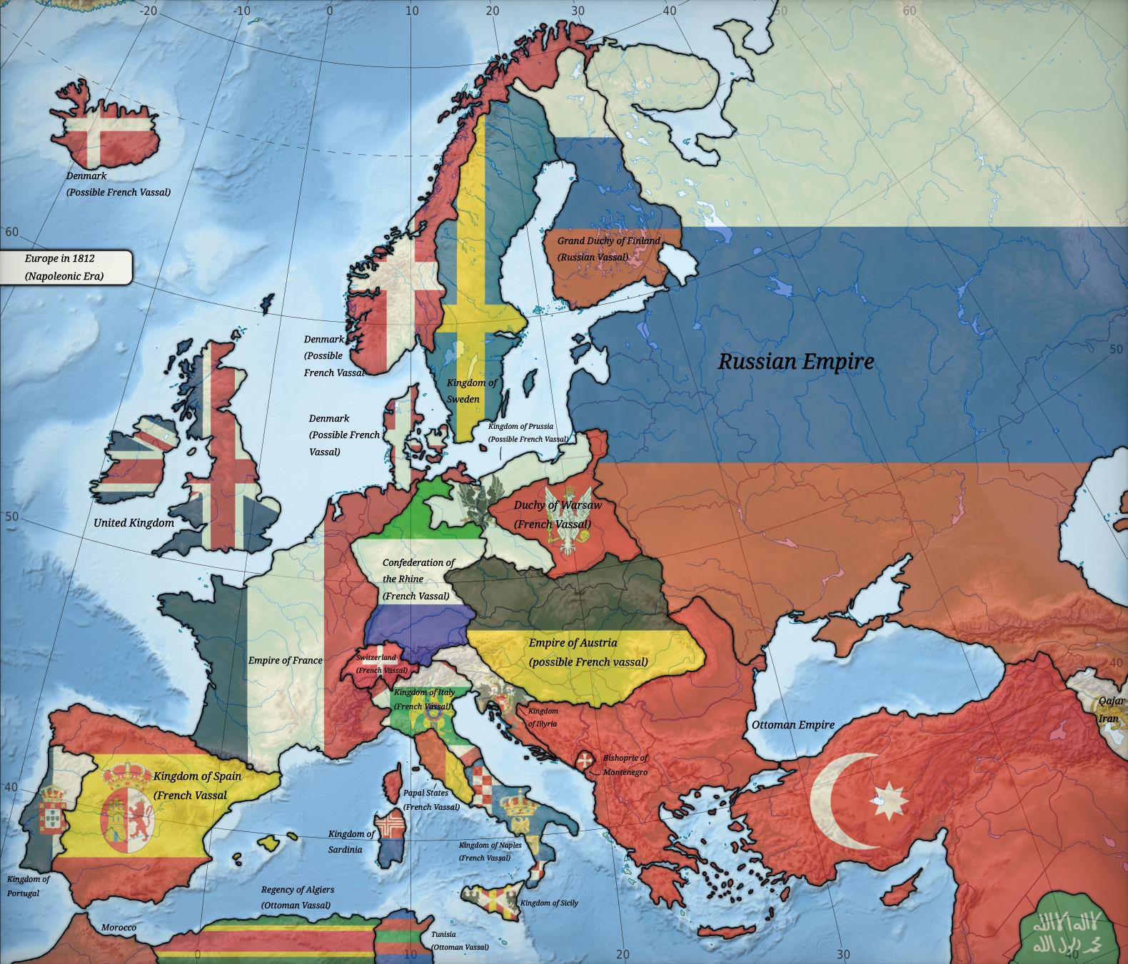
Political Map of Europe in 1812
The map titled "Europe in 1812" provides a detailed political landscape of Europe during a pivotal moment in history. It...
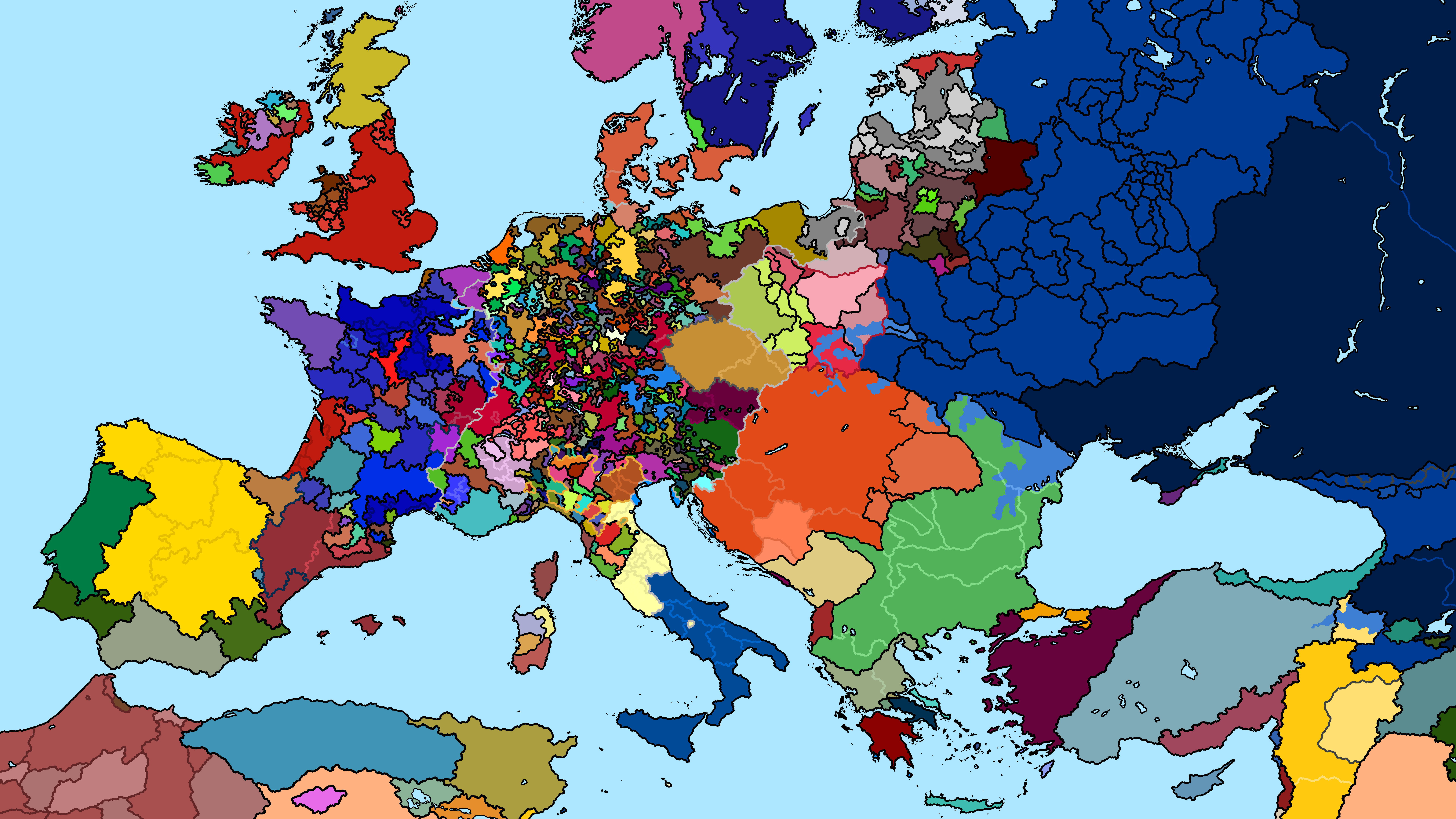
Political Map of Europe 1240 AD
The "Map of Europe 1240 AD" presents a snapshot of the political landscape in medieval Europe. During this time, the con...
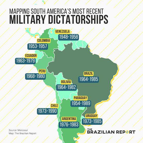
South America Military Dictatorships Map
The "South America Military Dictatorships Map" provides a stark visual representation of the political turmoil that grip...
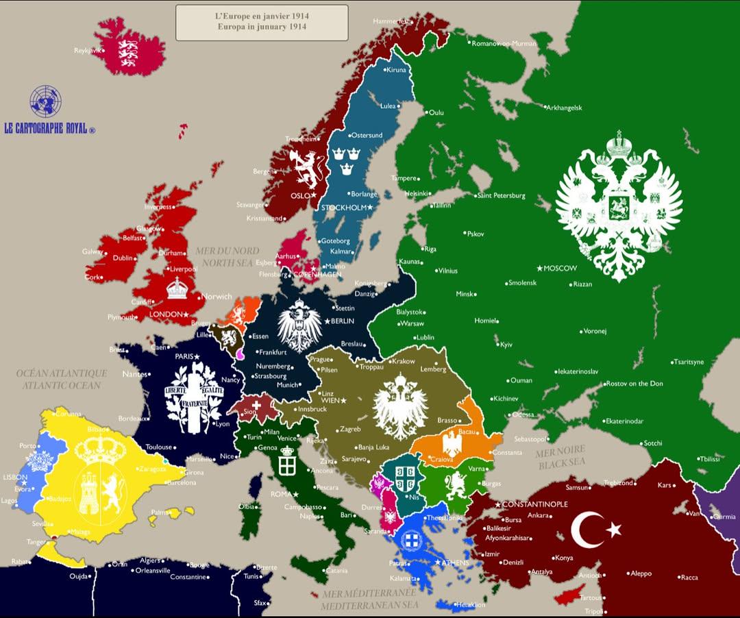
Political Map of Europe January 1914
The "Europe in January 1914" map provides a snapshot of the political landscape of Europe just months before the outbrea...
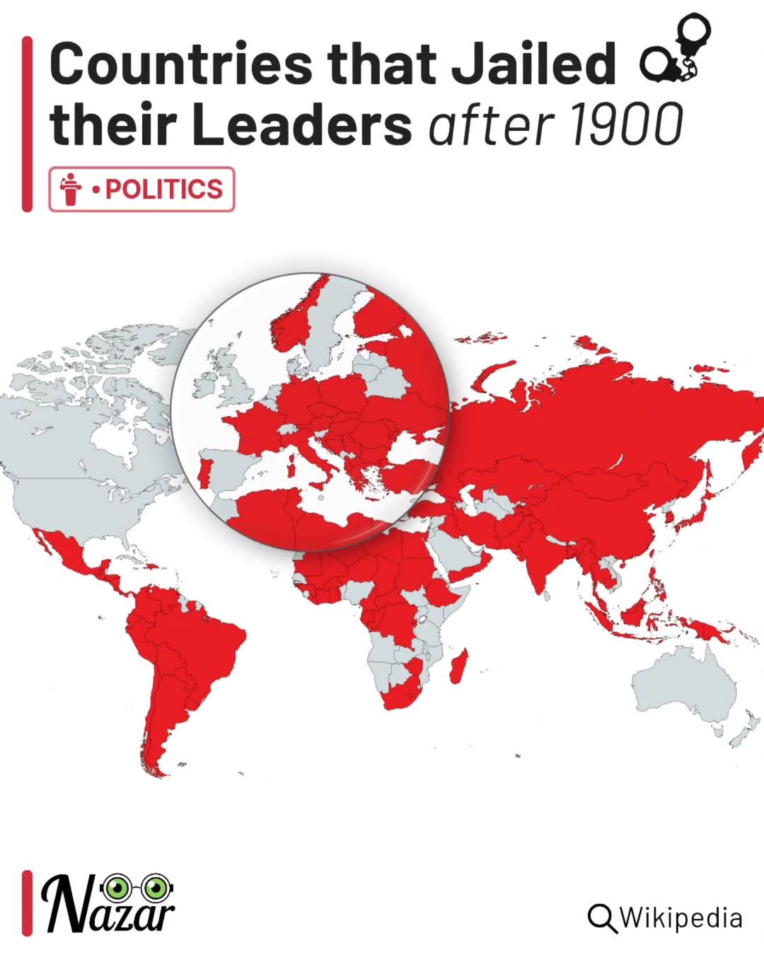
Map of Countries That Jailed Their Leaders Post-1900
The map titled "Countries that jailed their leaders (after 1900)" visually represents various nations around the world t...
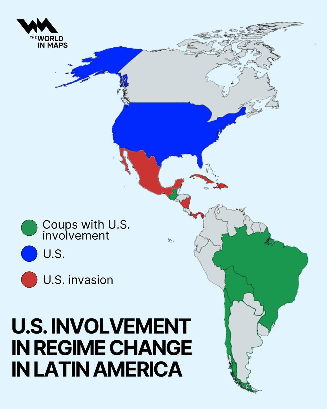
US Involvement in Regime Change in Latin America Map
The visualization titled "US Involvement in Regime Change in Latin America" provides a geographical representation of va...
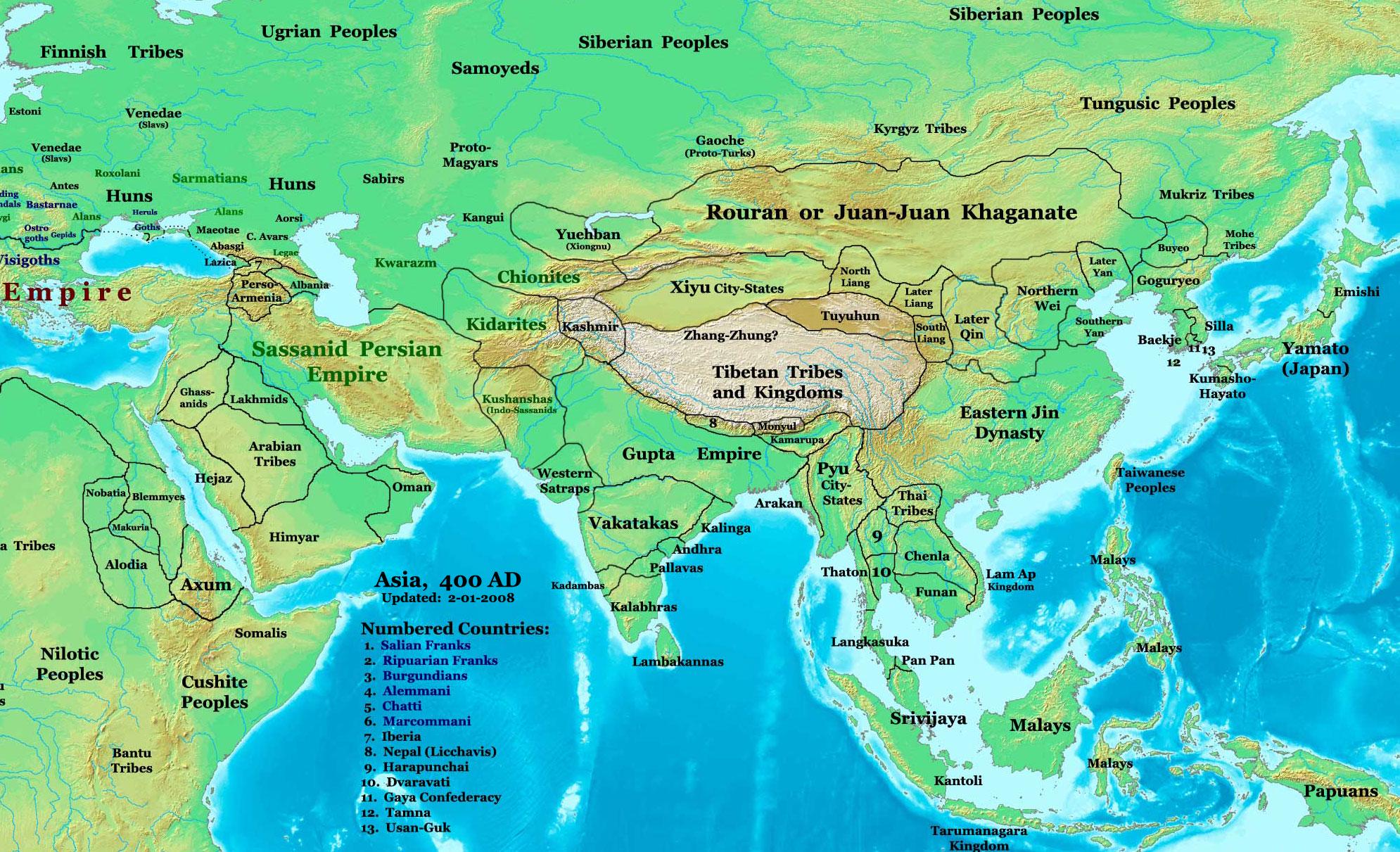
Geopolitical Map of Asia, 400 CE
The "Asia, 400 CE" map offers a fascinating glimpse into the geopolitical landscape of Asia during the early centuries o...
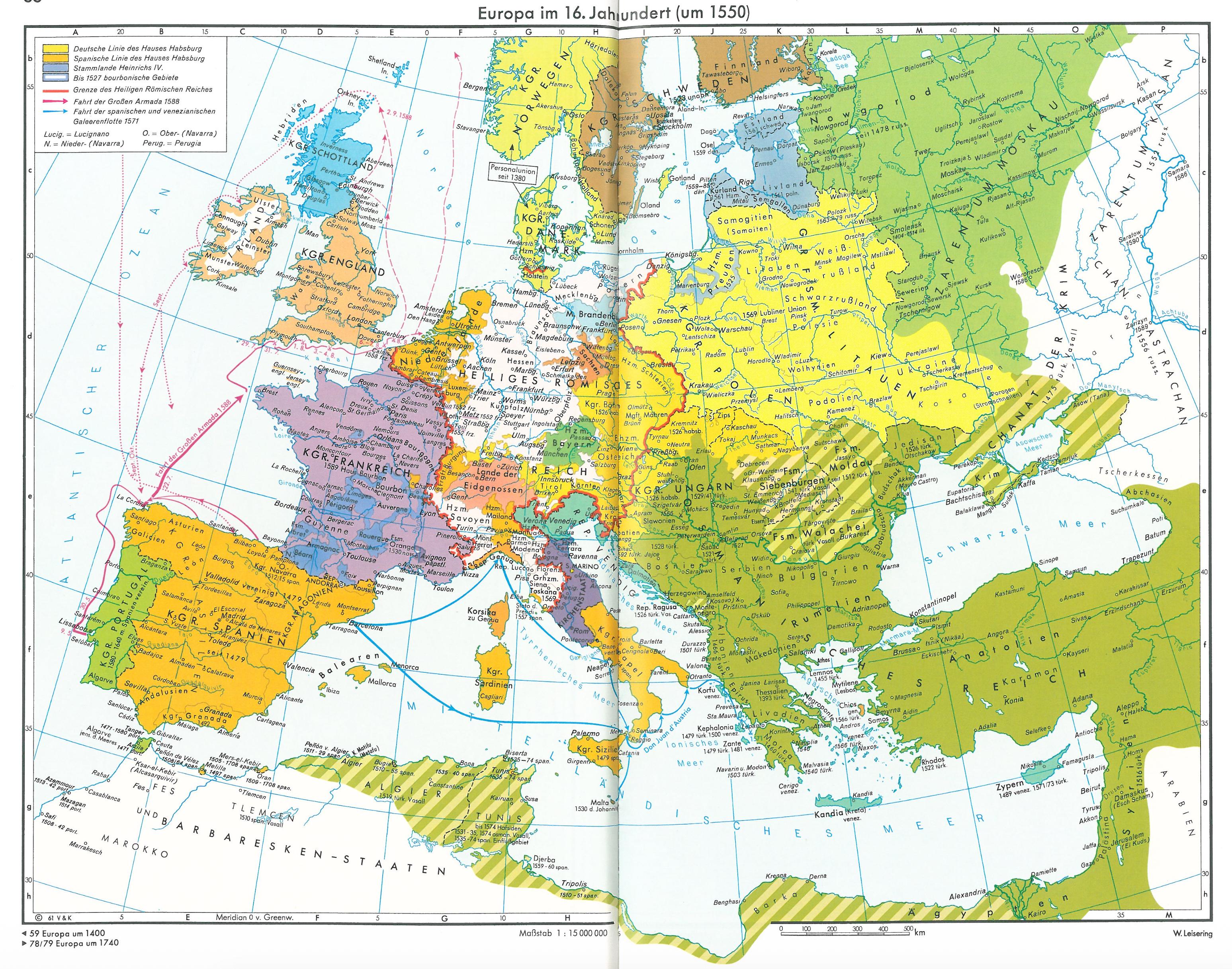
Political Map of Europe in the 16th Century
The map titled \...
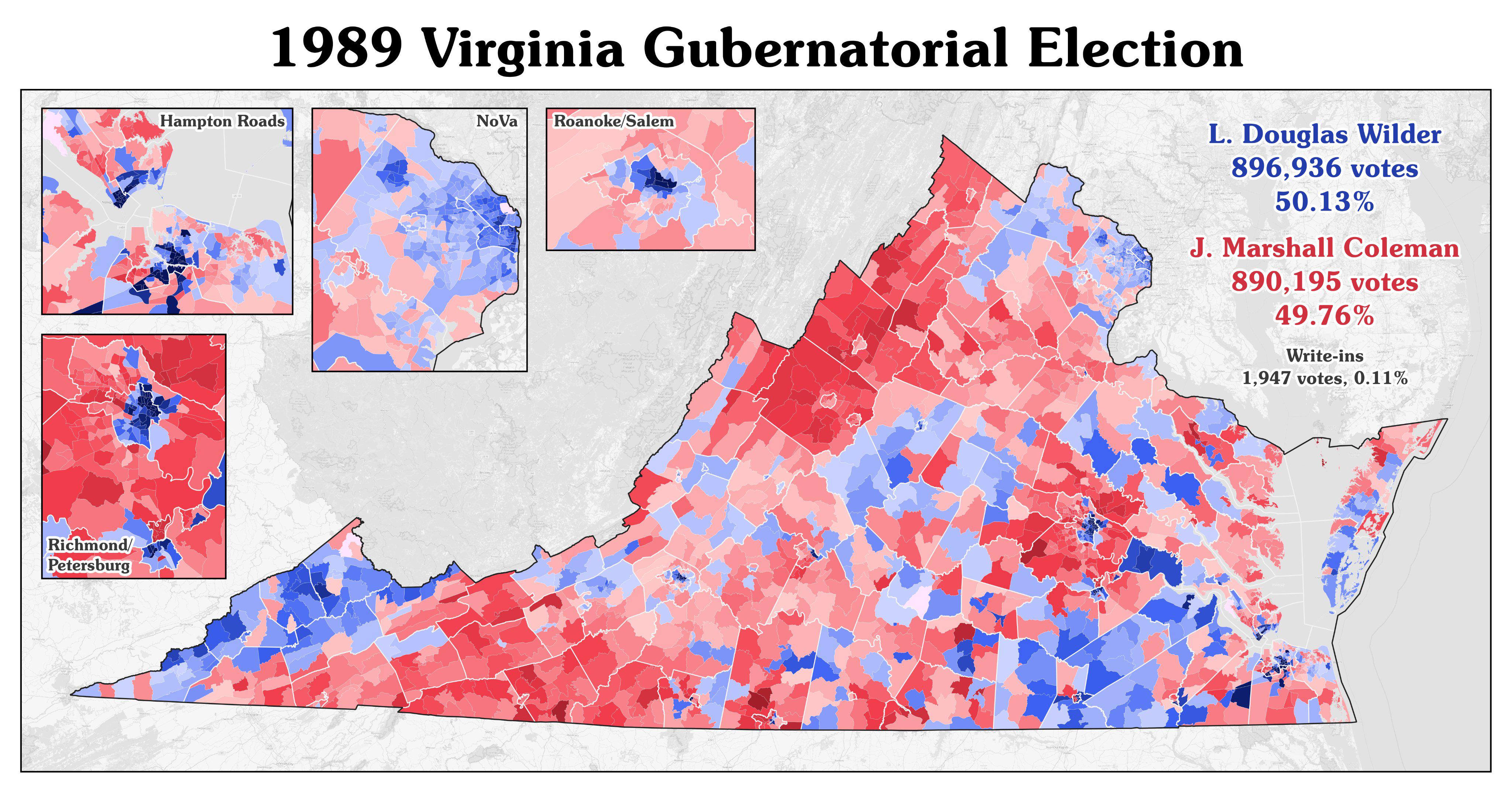
1989 Virginia Gubernatorial Election Map
Virginia's population had evolved significantly by the late 20th century. The state was experiencing urbanization, with ...
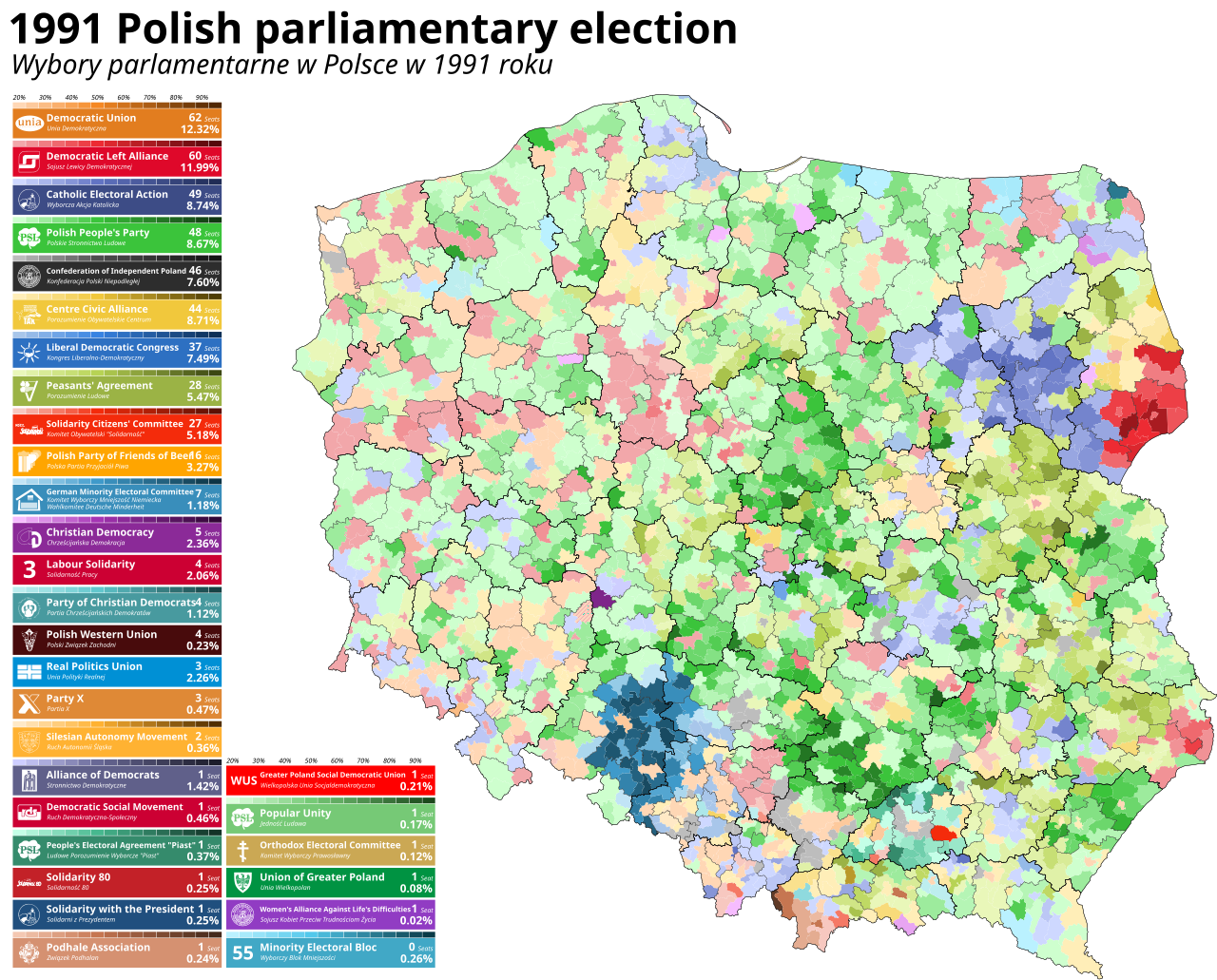
1991 Polish Parliamentary Election Map
This map visualizes the results of the 1991 Polish parliamentary election, marking a pivotal moment in Poland's history ...
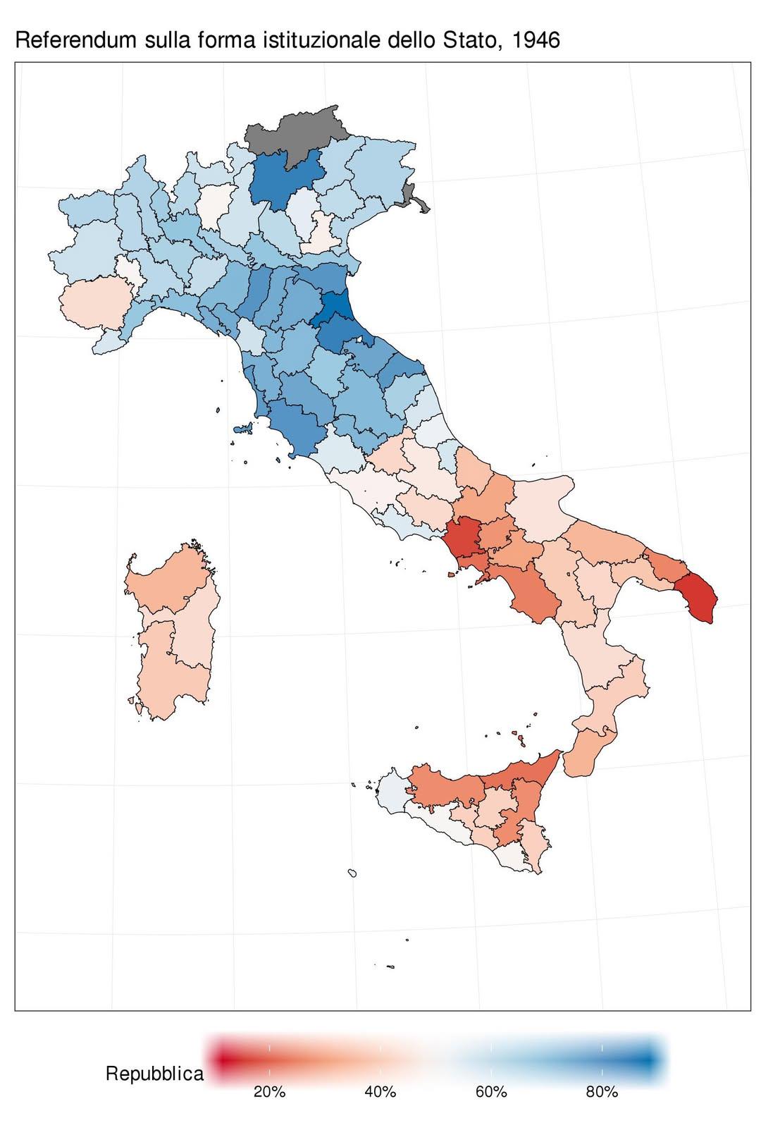
1946 Italian Referendum Voting Results Map
The map titled "How Italians voted in the 1946 referendum: Republic (blue) vs Monarchy (red)" visually represents the re...
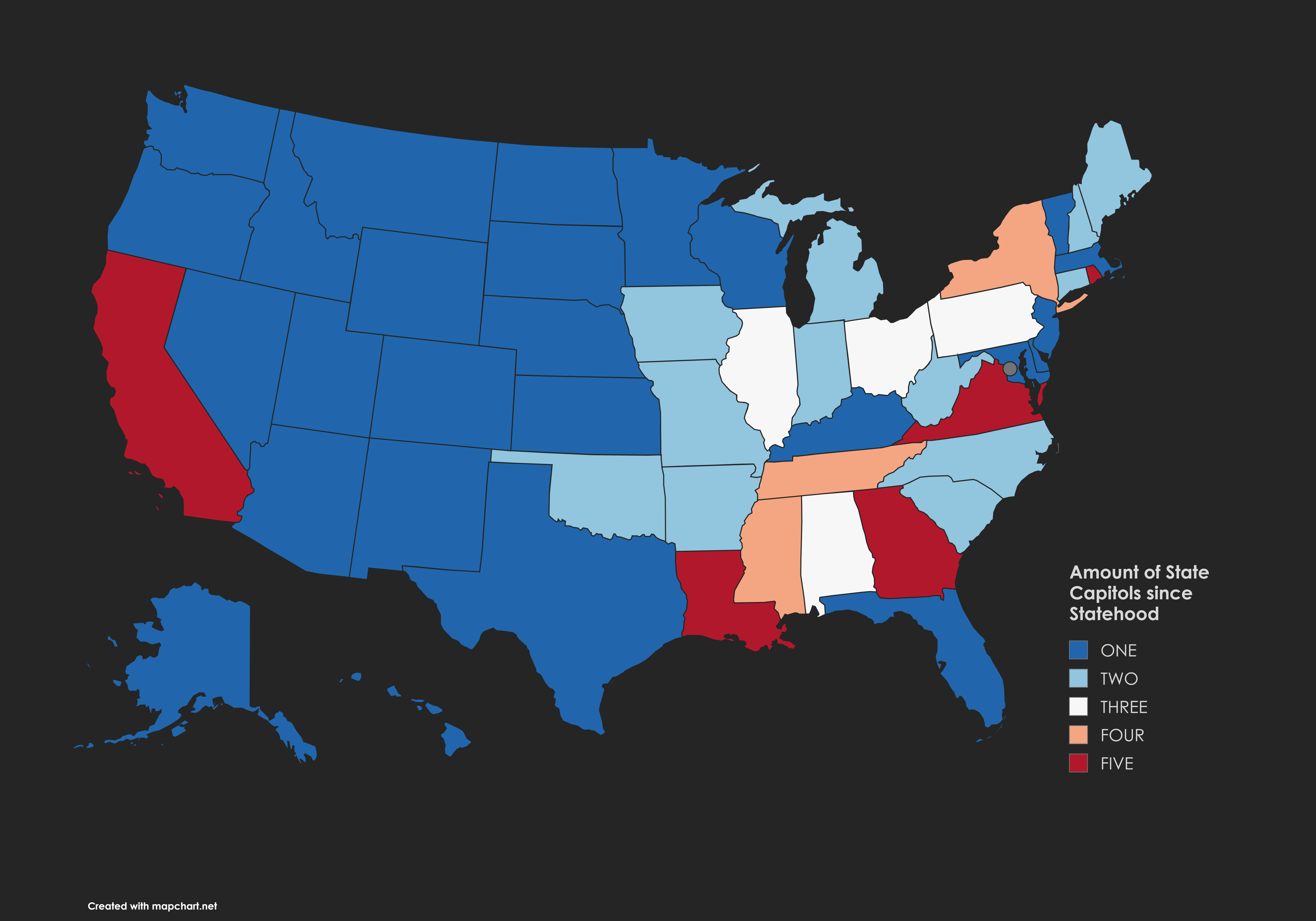
Map of State Capitols Since Statehood
The "Amount of State Capitols Since Statehood" map provides a visual representation of the number of state capitals that...
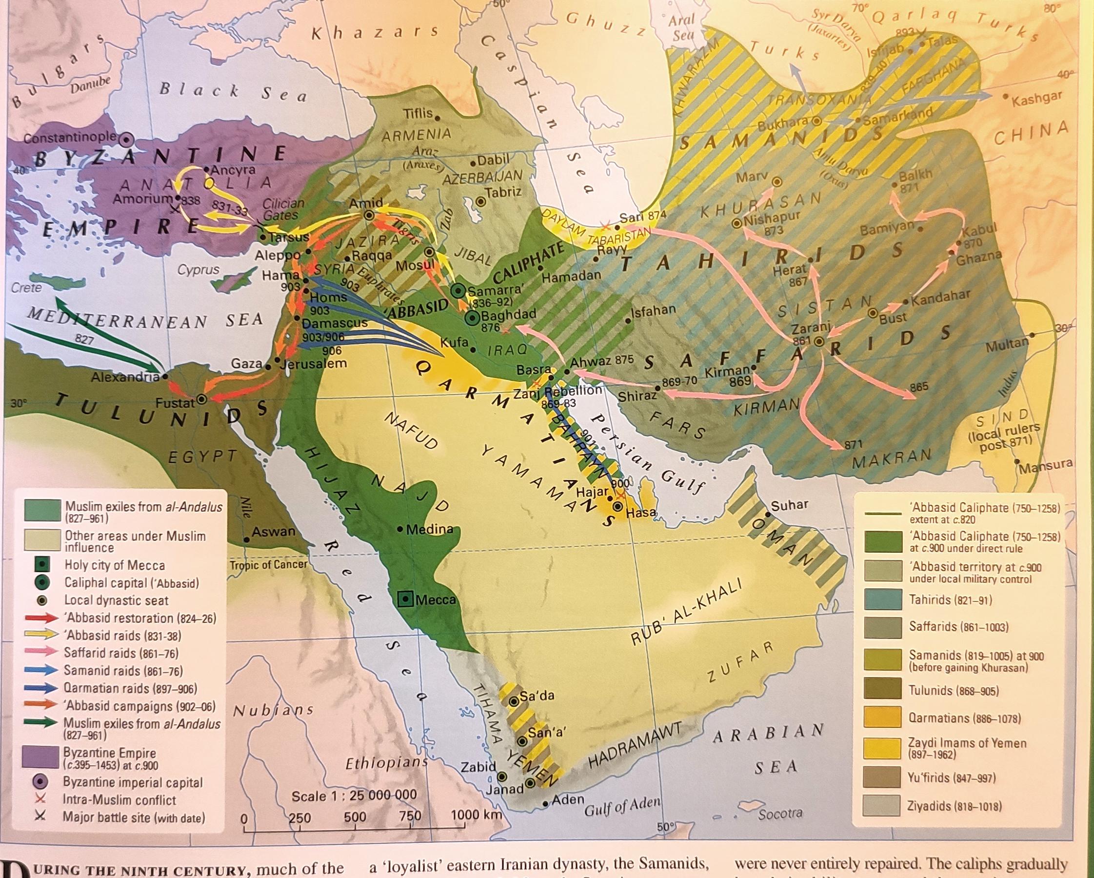
Political Map of the Middle East in the 9th Century
This map provides a detailed political visualization of the Middle East during the 9th century, highlighting the various...
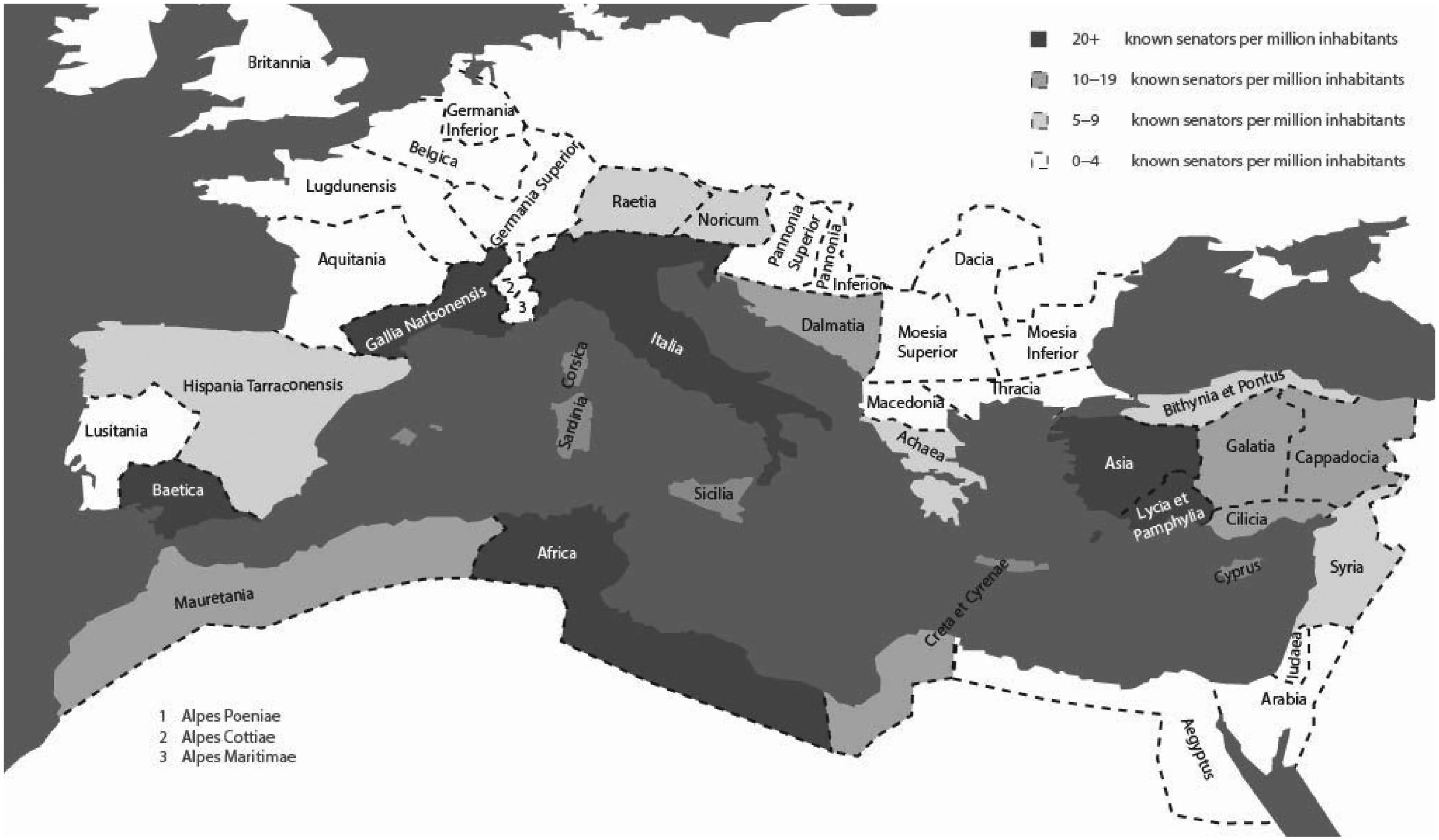
Map of Provincial Origins of Senators During Pax Romana
This map illustrates the diverse provincial origins of senators during the Pax Romana, a period of relative peace and st...
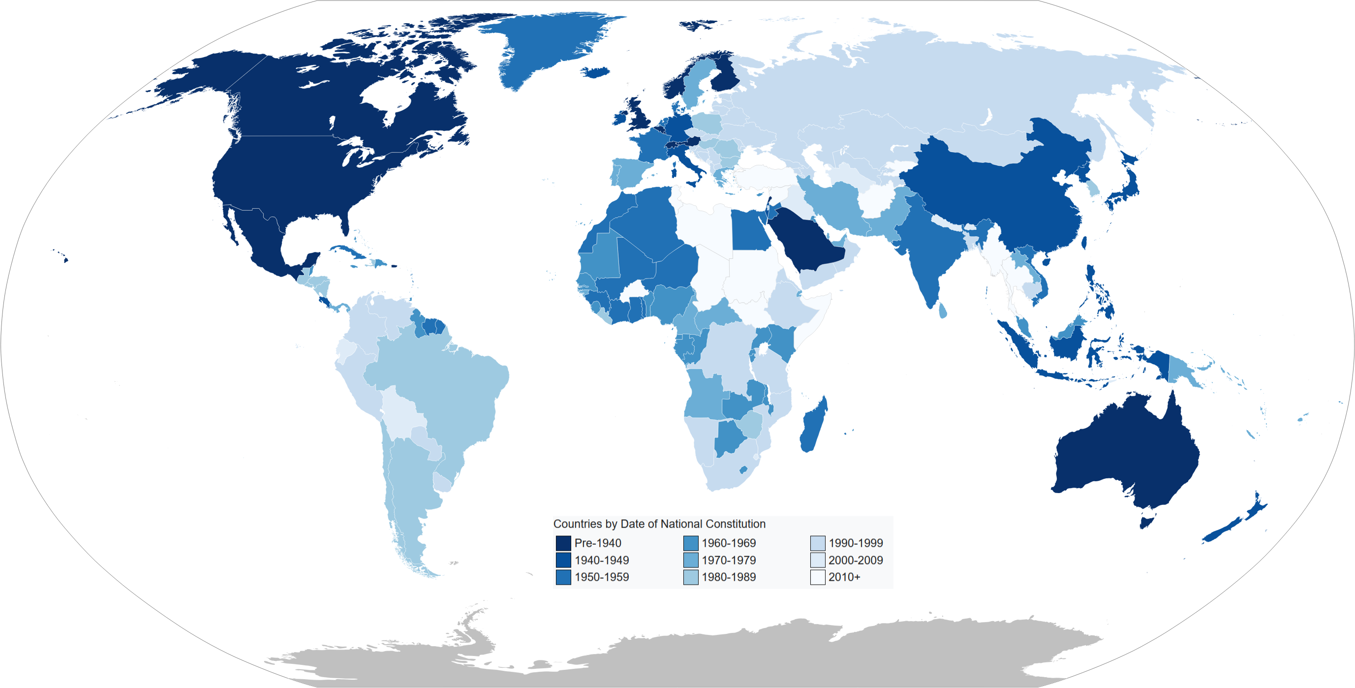
Map of Current Constitution Ages by Country
...
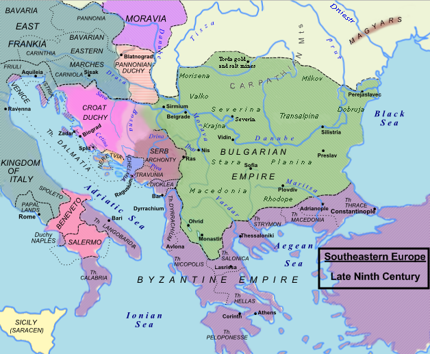
Political Map of Southeastern Europe in the Late 9th Century
The map of Southeastern Europe in the late 9th century AD provides a detailed representation of the political landscape ...