maps Maps
24 geographic visualizations tagged with "maps"
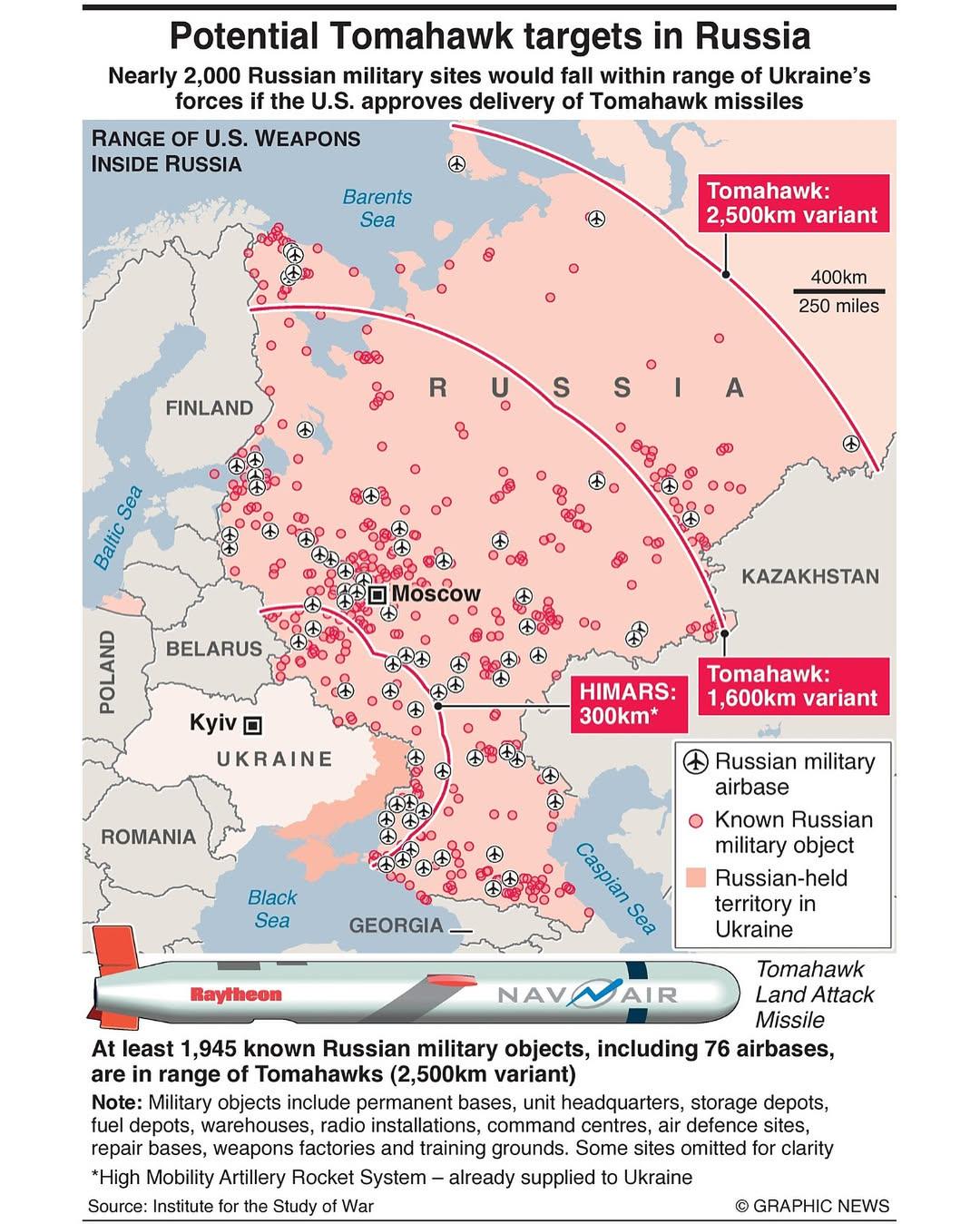
Potential Tomahawk Targets in Russia Map
The "Potential Tomahawk Targets in Russia" map provides a detailed visualization of strategic military locations across ...
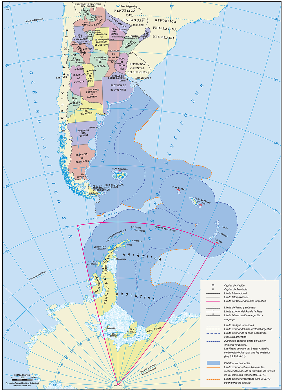
Official Map of the Argentine Republic
The official map of the Argentine Republic provides a comprehensive representation of the country's geographical feature...

World Map Used in North Korea
The world map utilized in North Korea is a unique representation that reflects the country's ideological stance and its ...
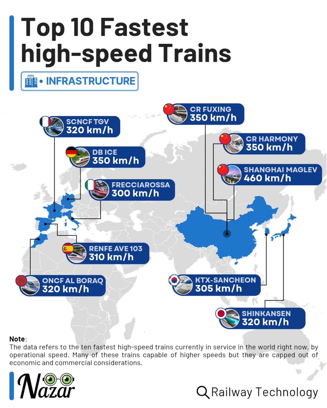
Top 10 Fastest High-Speed Trains Map
This map showcases the fastest high-speed trains in the world, ranking them based on their maximum operational speeds. F...
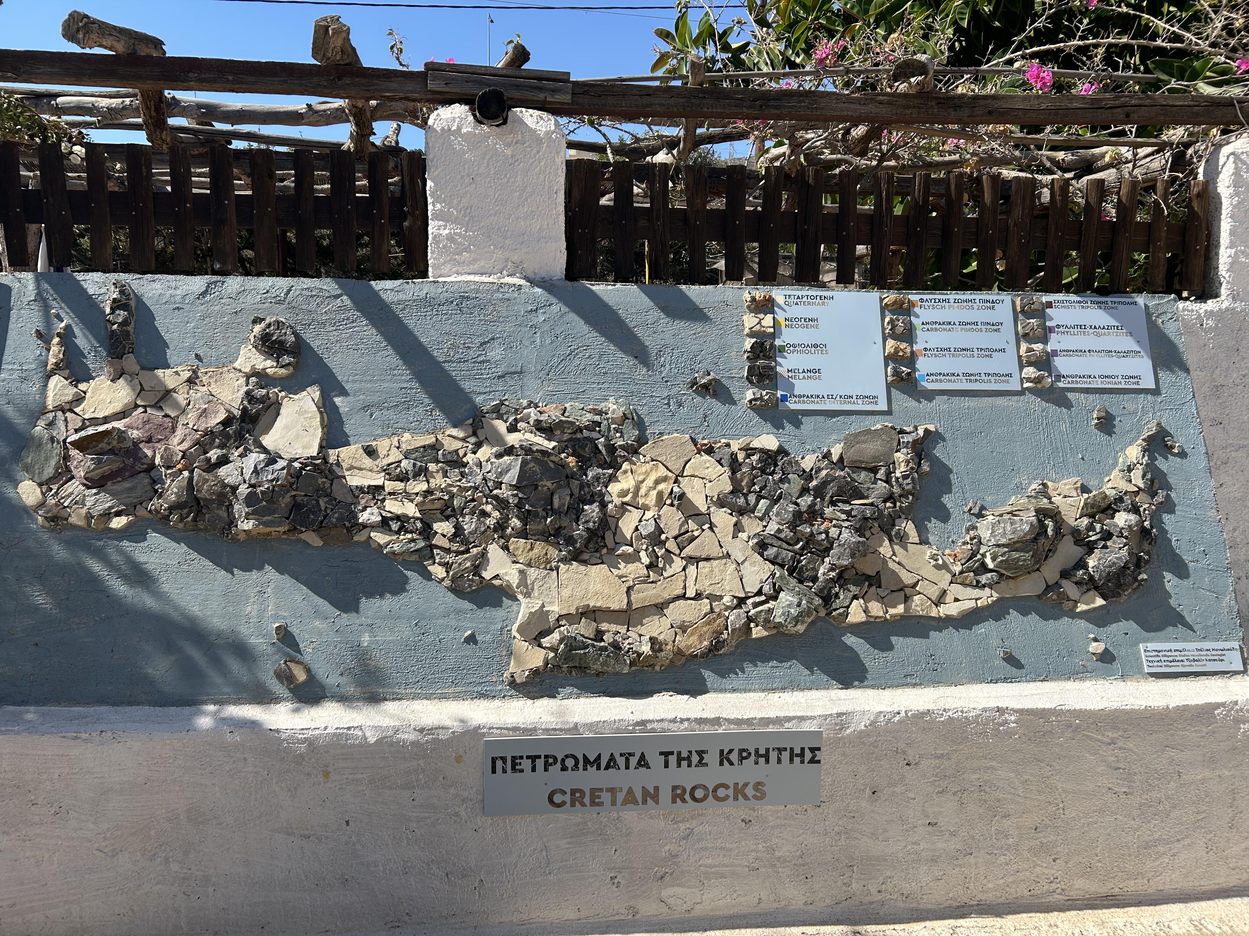
Rock Map of Crete
The Rock Map of Crete, located at the Lychnostatis Open Air Museum in Limenas Chersonisou, provides a detailed represent...
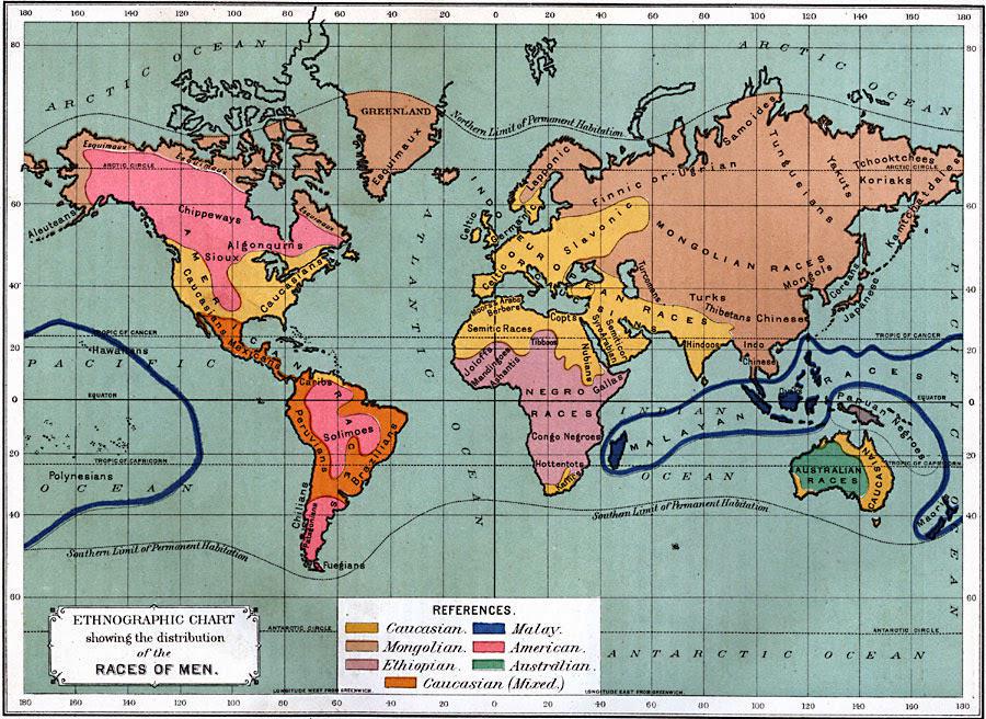
Races of Men Map 1891
The "Races of Men" map from 1891 offers a fascinating insight into the ethnographic beliefs of the time, depicting human...

Gun Violence Map of the United States
The \...
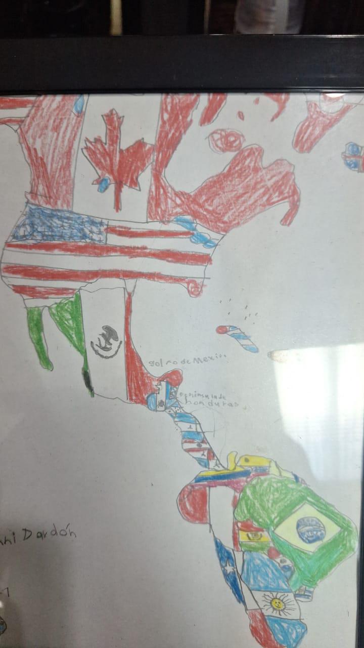
Childhood Drawing Map of America
This charming visualization, a drawing made by a six-year-old, represents a simplistic yet heartfelt interpretation of A...
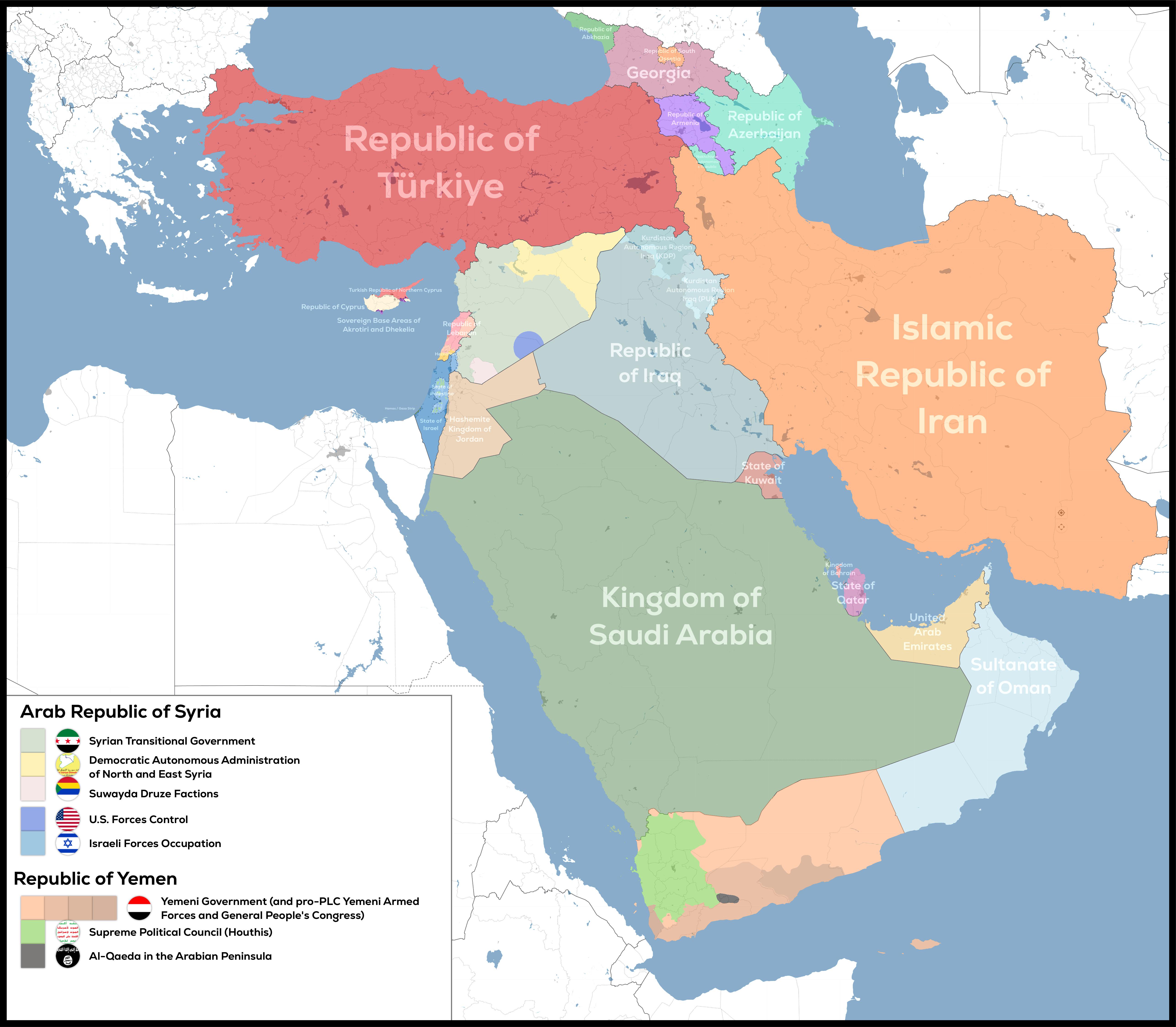
De Facto Geopolitical Map of West Asia
The "De-Facto Geopolitical Map of West Asia" provides a striking illustration of the current territorial control in this...
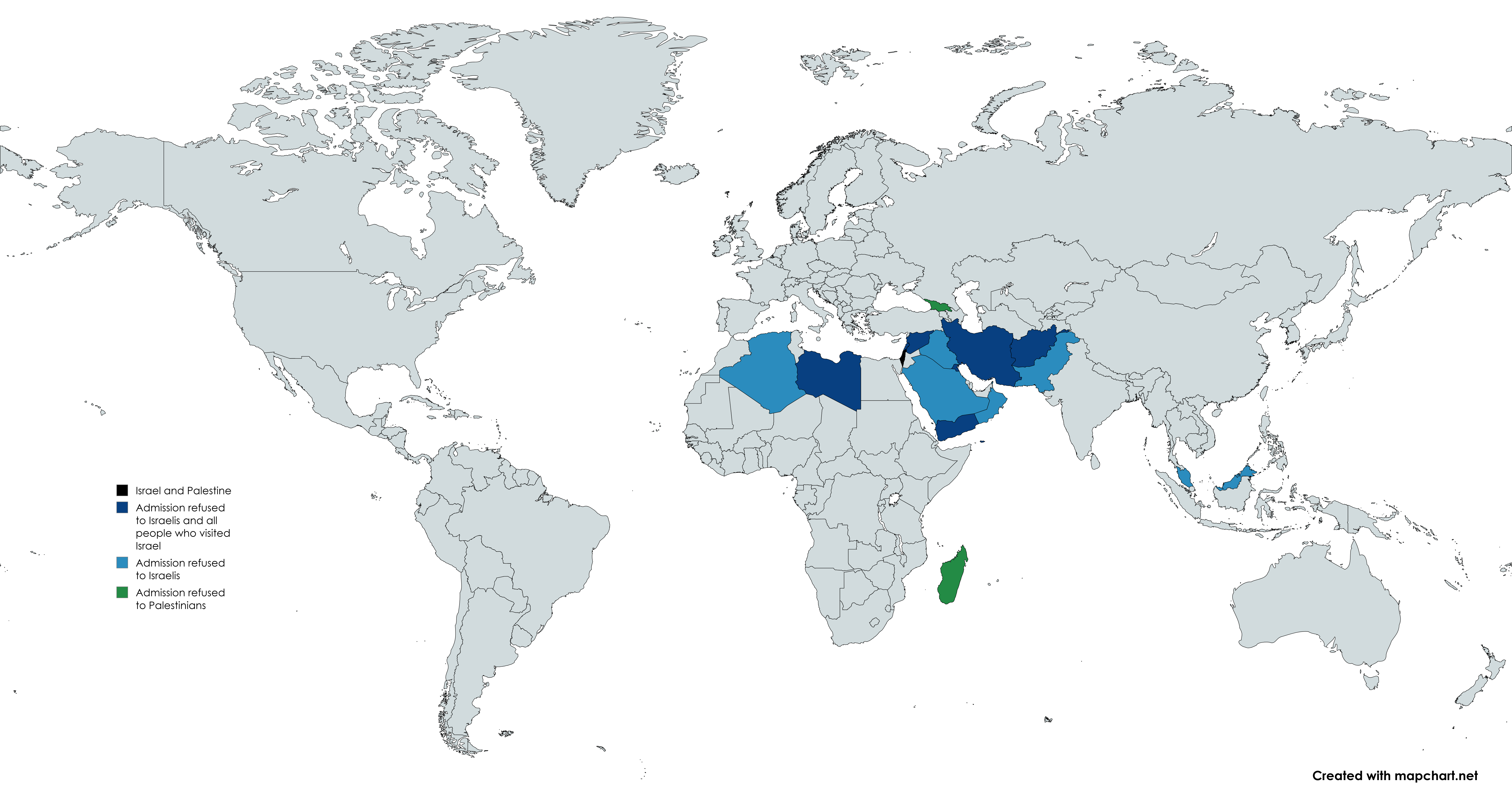
Map of Countries Refusing Access to Israeli or Palestinian Citizens
The map titled "Countries refusing access to Israeli or Palestinian citizens" provides a clear visual representation of ...
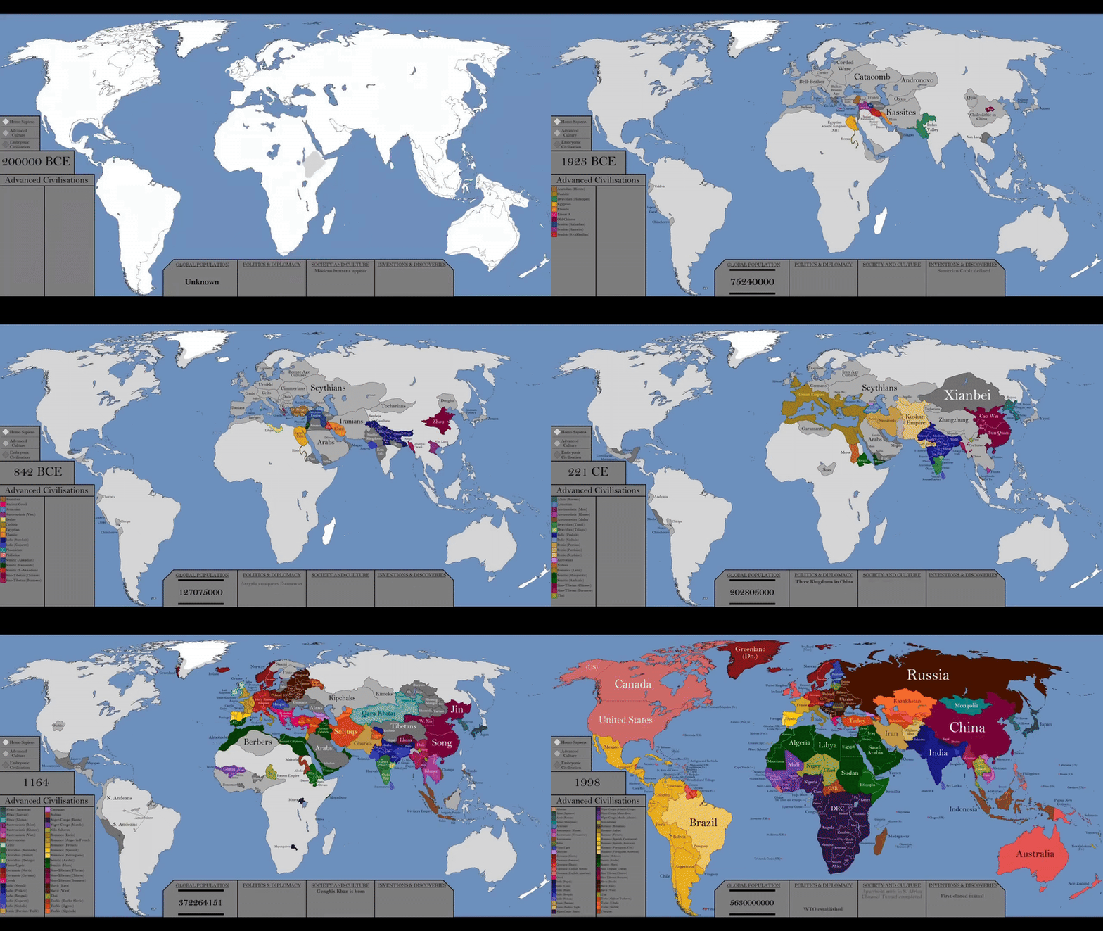
World History Timeline Map by Year
The visualization titled "The Entire History of the World Every Year In Just 30 Seconds" presents a remarkable timeline ...
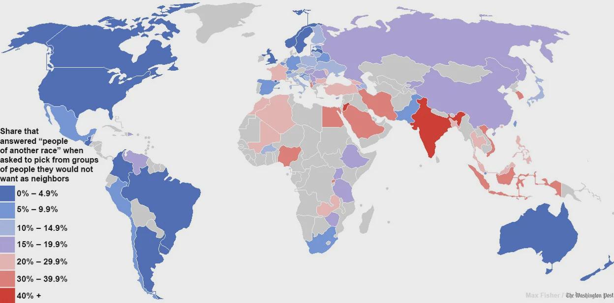
Racial Tolerance Map of the World
The map titled "Map of the world’s most and least racially tolerant countries" by Max Fisher in The Washington Post prov...
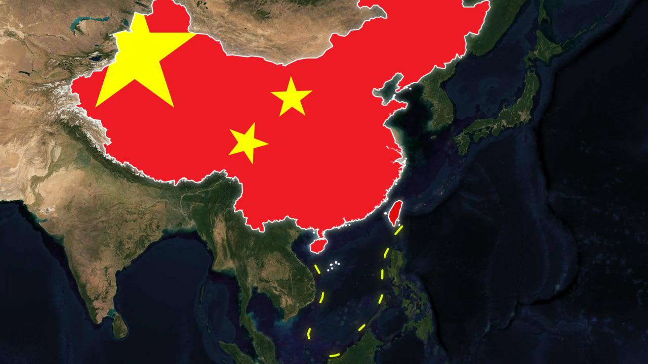
China's Controversial Border Map
The map in question illustrates the shifting borders of China as viewed through various platforms like Apple Maps and Go...
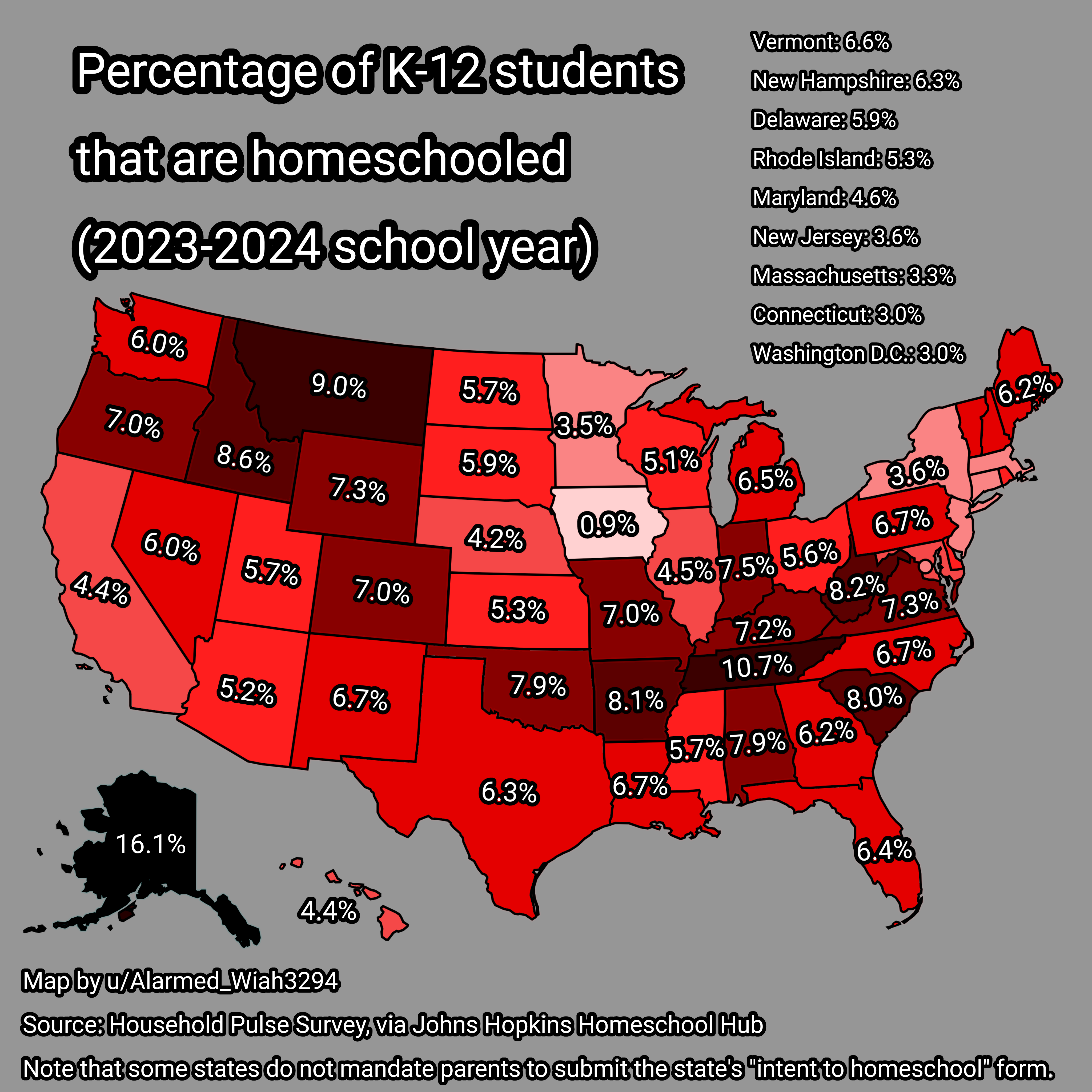
Homeschooling Rates Map for K-12 Students in USA 2023-2024
...
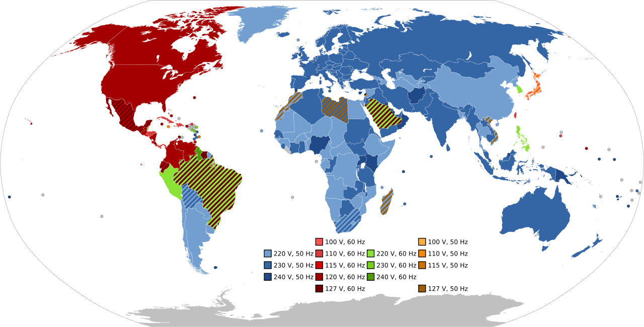
Frequency and Voltage Supplied by Country Map
The visualization titled "Most Common Frequency and Voltage Supplied in Each Country" provides a comprehensive overview ...

Historical Map of the Koreas
This visualization presents a concise historical overview of the Koreas through eight distinct maps, each illustrating p...
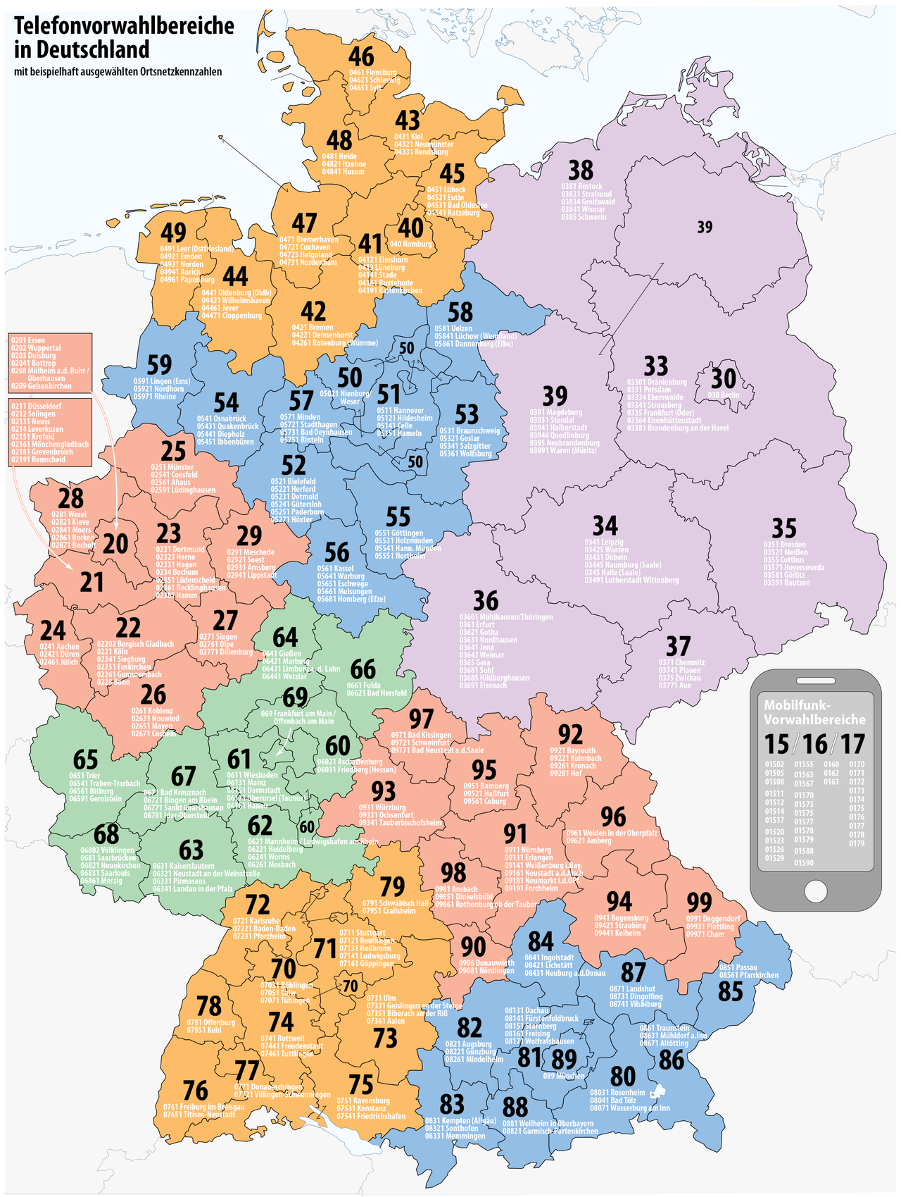
Telephone Number Area Codes in Germany Map
The "Telephone Number Area Codes in Germany Map" provides a comprehensive visual representation of the various area code...
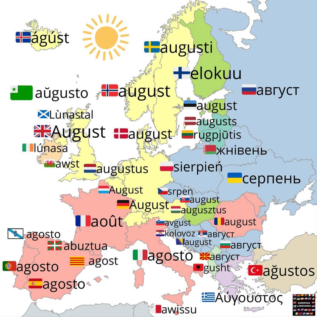
How to Say August in Different Languages Map
This map provides a visual representation of how the month of August is pronounced in various languages around the world...
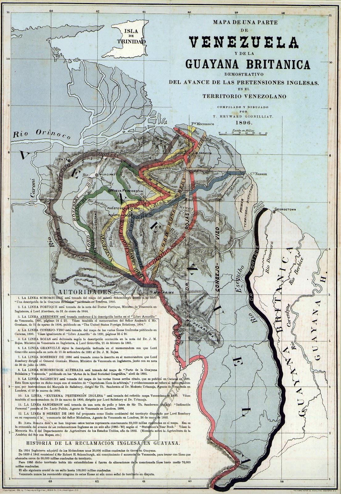
Proposed Boundaries for Guyana Map
The "Proposed Boundaries for Guyana Map" visualizes the various territorial claims and proposed administrative borders w...
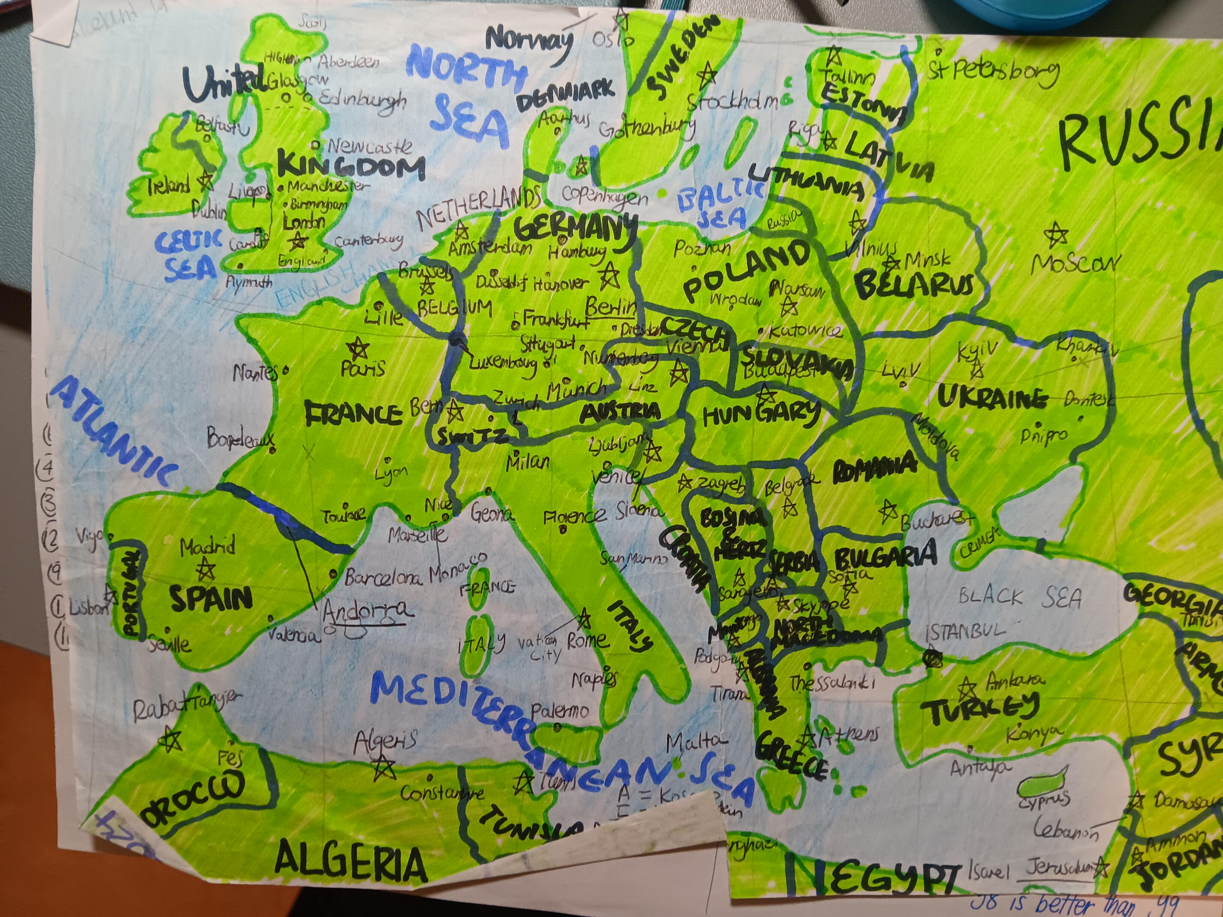
Hand-Drawn Map of Europe
One of the most fascinating aspects of European geography is its varied climate zones. Northern Europe experiences a pol...
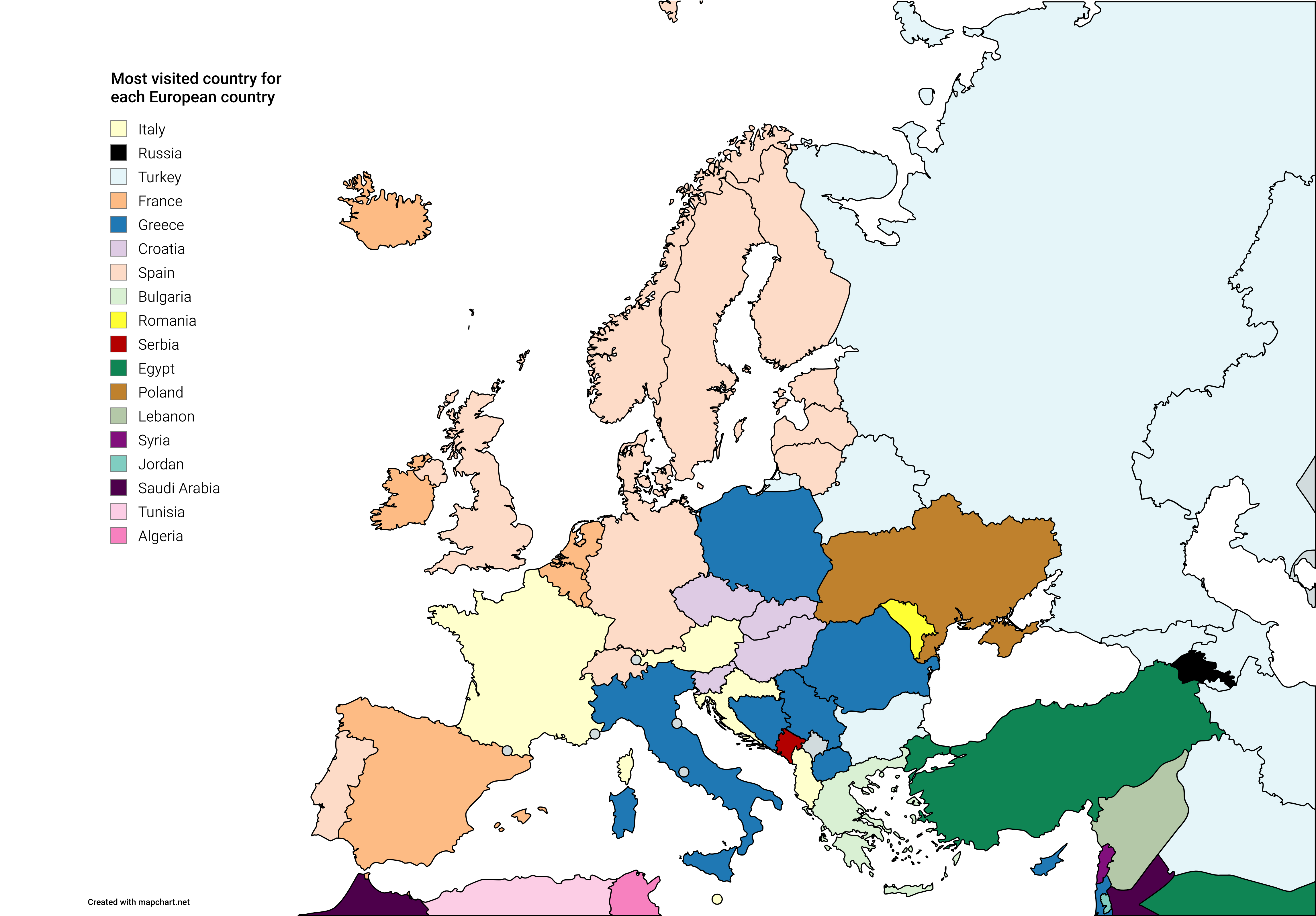
Most Visited Countries by Europeans Map
Additionally, cultural and historical connections greatly impact travel trends. Countries with rich histories, renowned ...
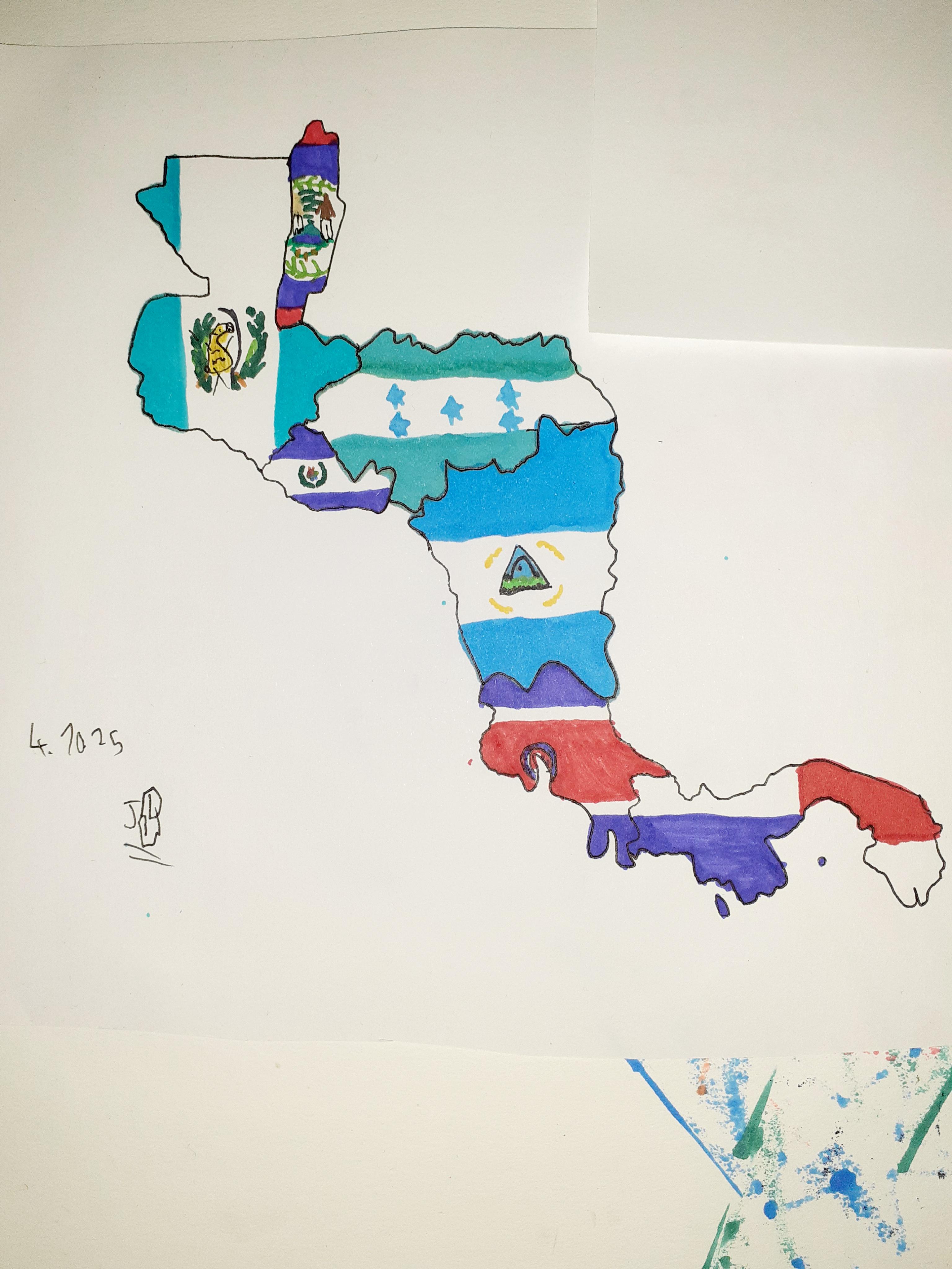
Self-Drawn Map of Central America
The self-drawn map of Central America presents a unique perspective on the region, showcasing its geographical features ...
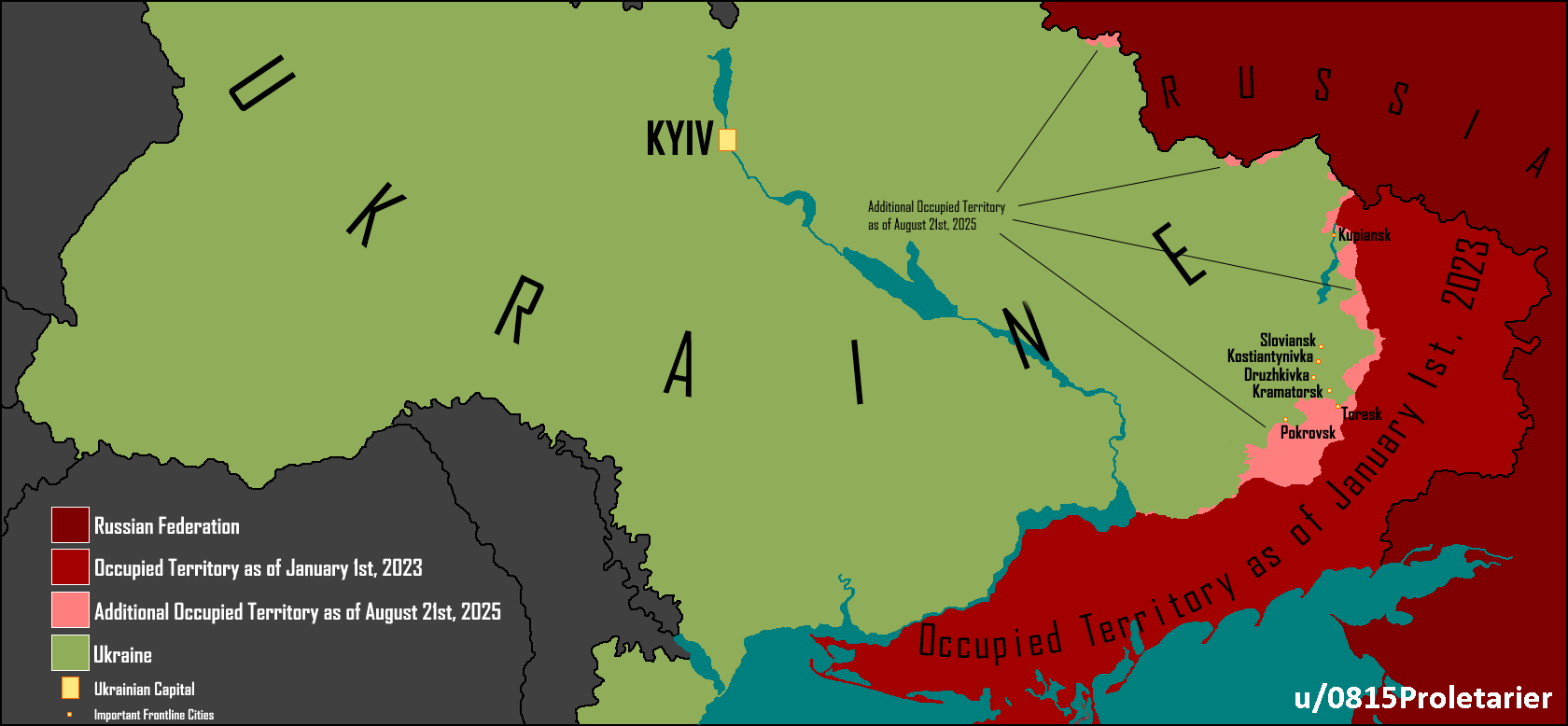
Ukrainian Occupied Territory Comparison Map
The visualization titled "Ukrainian Occupied Territory Comparison. January 1st, 2023 vs. August 21st, 2025" provides a c...
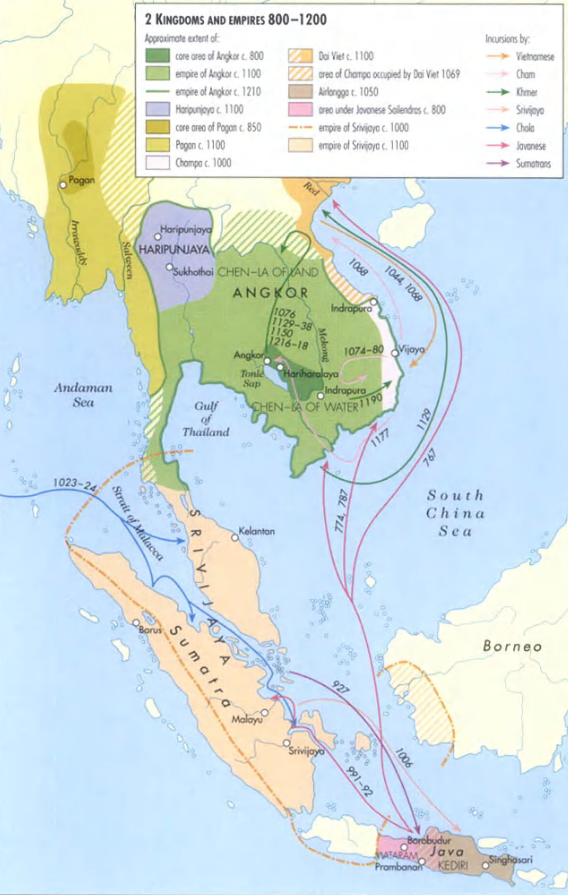
Kingdoms and Empires of Southeast Asia Map
This map highlights the kingdoms and empires that flourished in Southeast Asia between 800 and 1200 AD. It provides a vi...