israeli-palestinian conflict Maps
4 geographic visualizations tagged with "israeli-palestinian conflict"

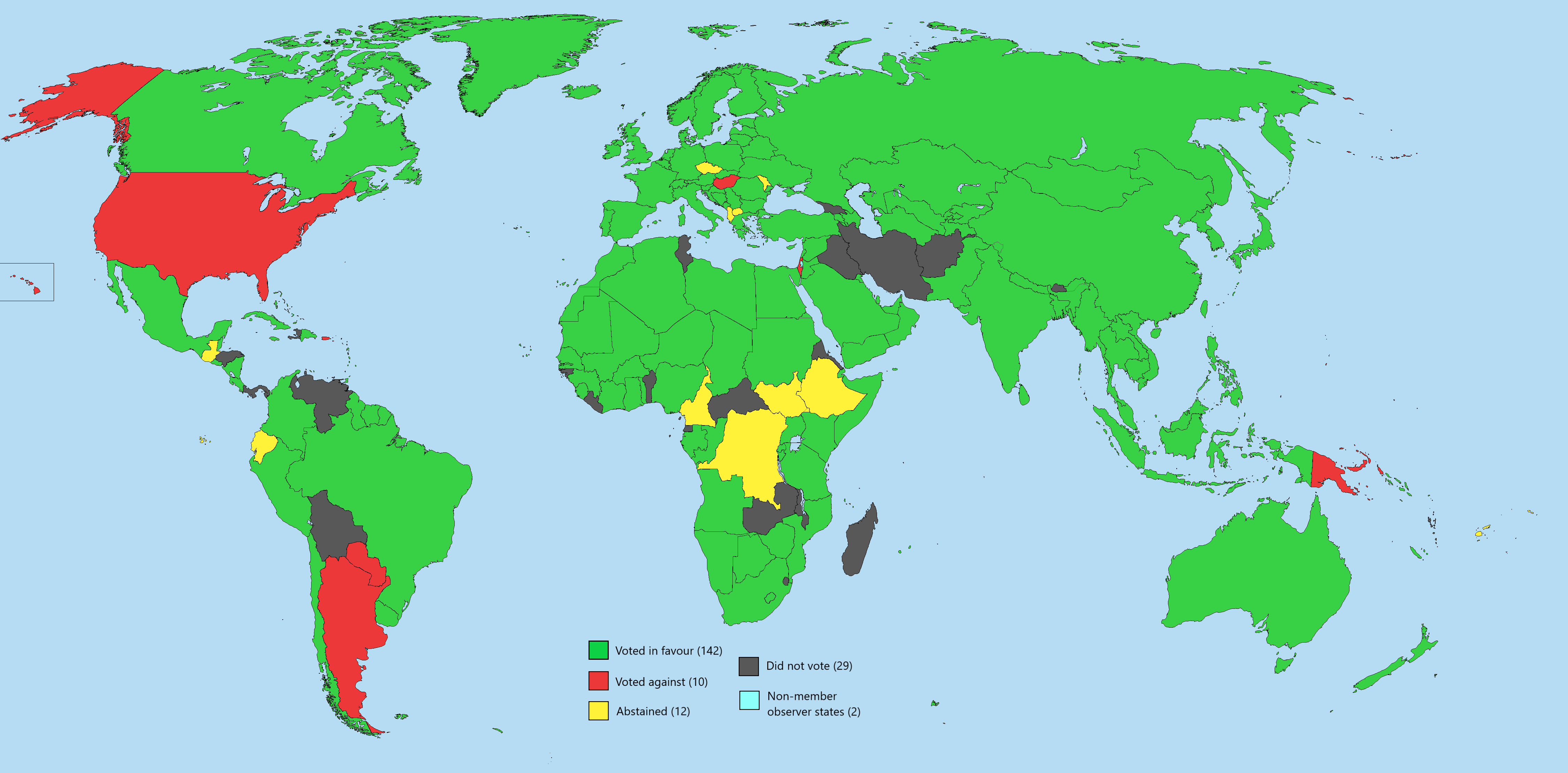
UN General Assembly Vote Two-State Solution Map
The map titled "UN General Assembly Vote on Implementing a Two-State Solution Free of Hamas" visually represents the vot...
👁 84📅 9/14/2025

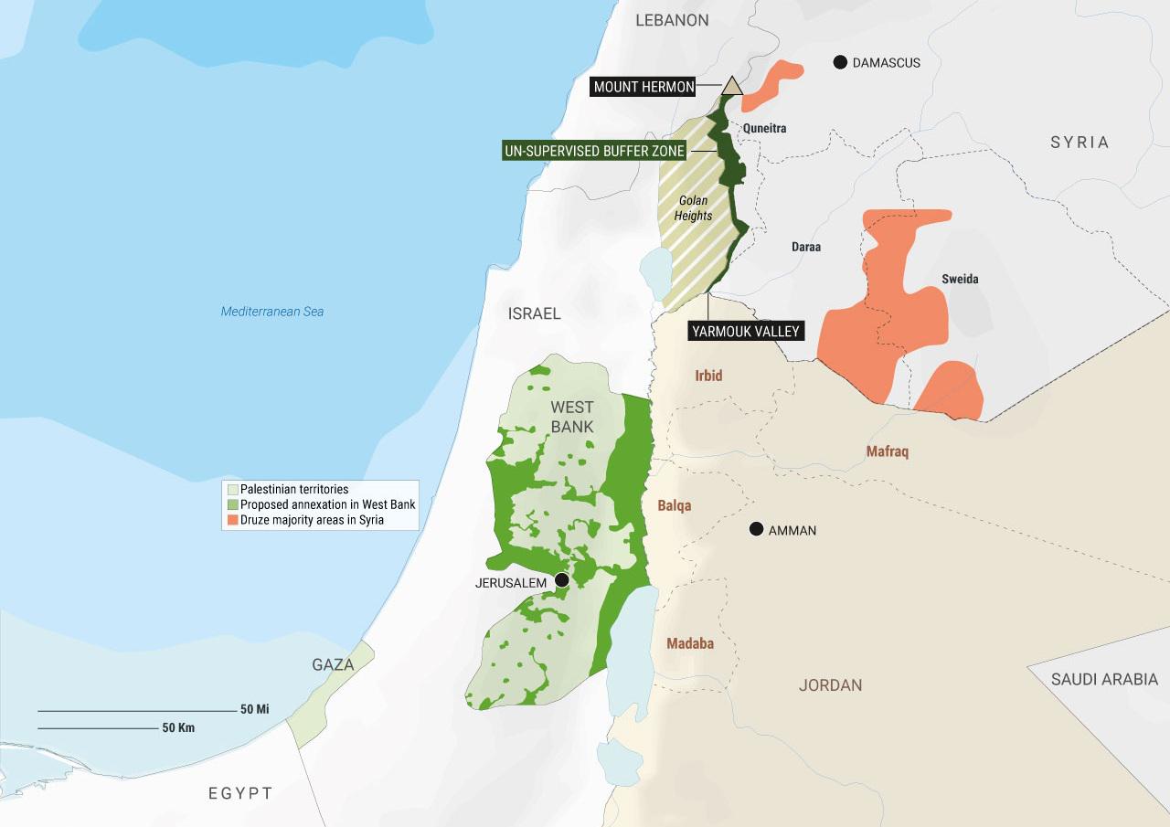
Map of Proposed Annexation Locations in West Bank
The visualization titled "Palestinian territories, proposed annexation locations in the West Bank, and Druze majority ar...
👁 62📅 9/4/2025

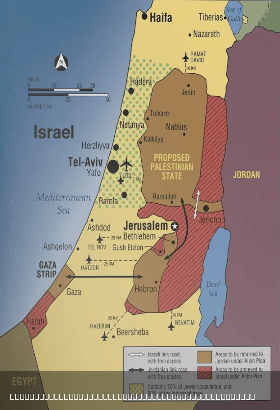
Allon Plan of 1967 Map for Israeli–Palestinian Conflict
The \...
👁 98📅 8/6/2025

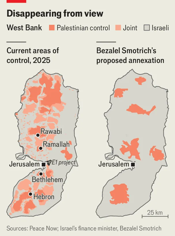
West Bank Proposed Annexation Map: Bantustans
The West Bank Proposed Annexation Map: Bantustans visualization showcases the complex geopolitical landscape of the West...
👁 54📅 9/21/2025