international standards Maps
3 geographic visualizations tagged with "international standards"

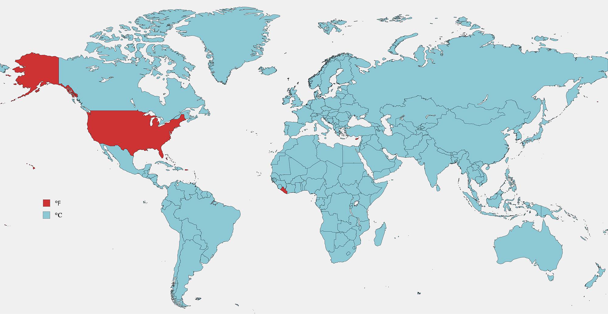
Fahrenheit vs Celsius Usage Map by Country
The visualization titled "Countries that Use Fahrenheit vs Celsius" provides a clear depiction of the global temperature...
👁 168📅 9/6/2025

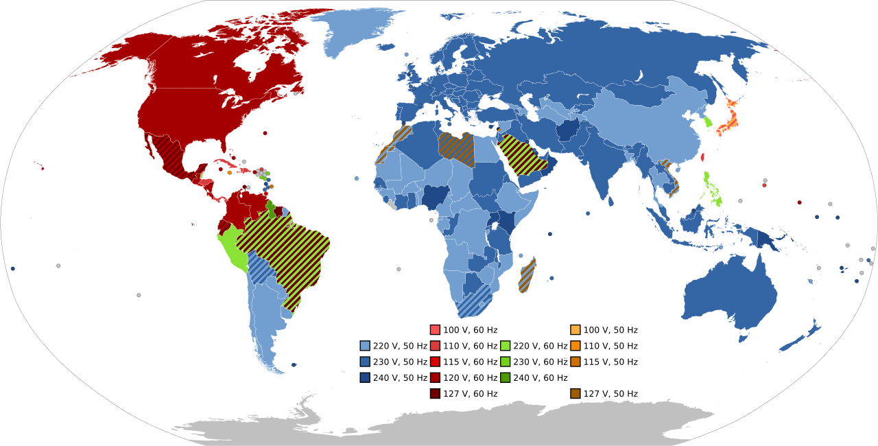
Frequency and Voltage Supplied by Country Map
The visualization titled "Most Common Frequency and Voltage Supplied in Each Country" provides a comprehensive overview ...
👁 50📅 10/9/2025

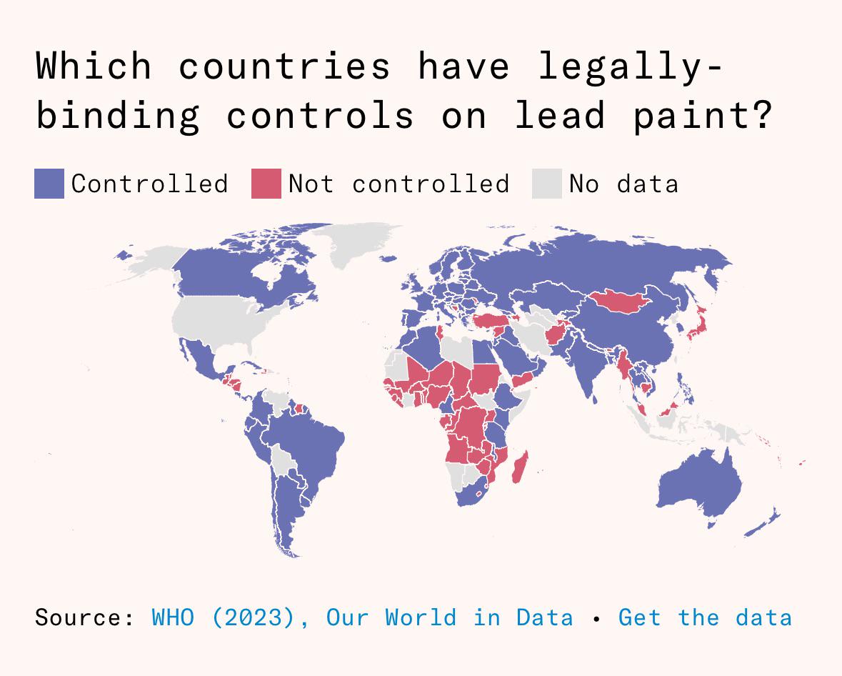
Lead Paint Regulation Map by Country
This visualization illustrates the global landscape of countries that have implemented legally-binding controls on lead ...
👁 102📅 9/5/2025