hydrology Maps
6 geographic visualizations tagged with "hydrology"
India's Continental Divide Map
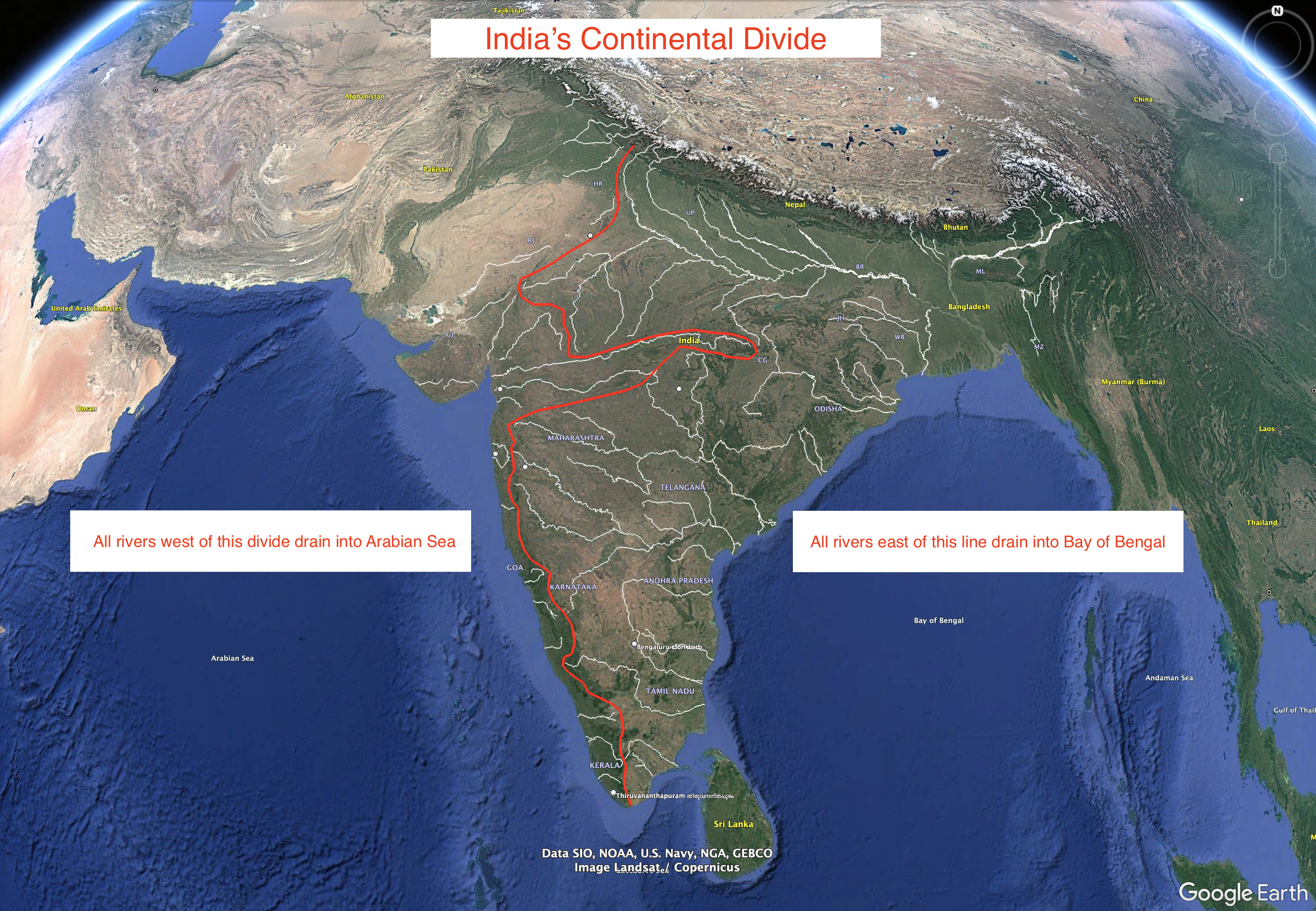
This visualization represents an approximation of India's continental divide, illustrating how the landmass is oriented ...
Asian River Networks Map
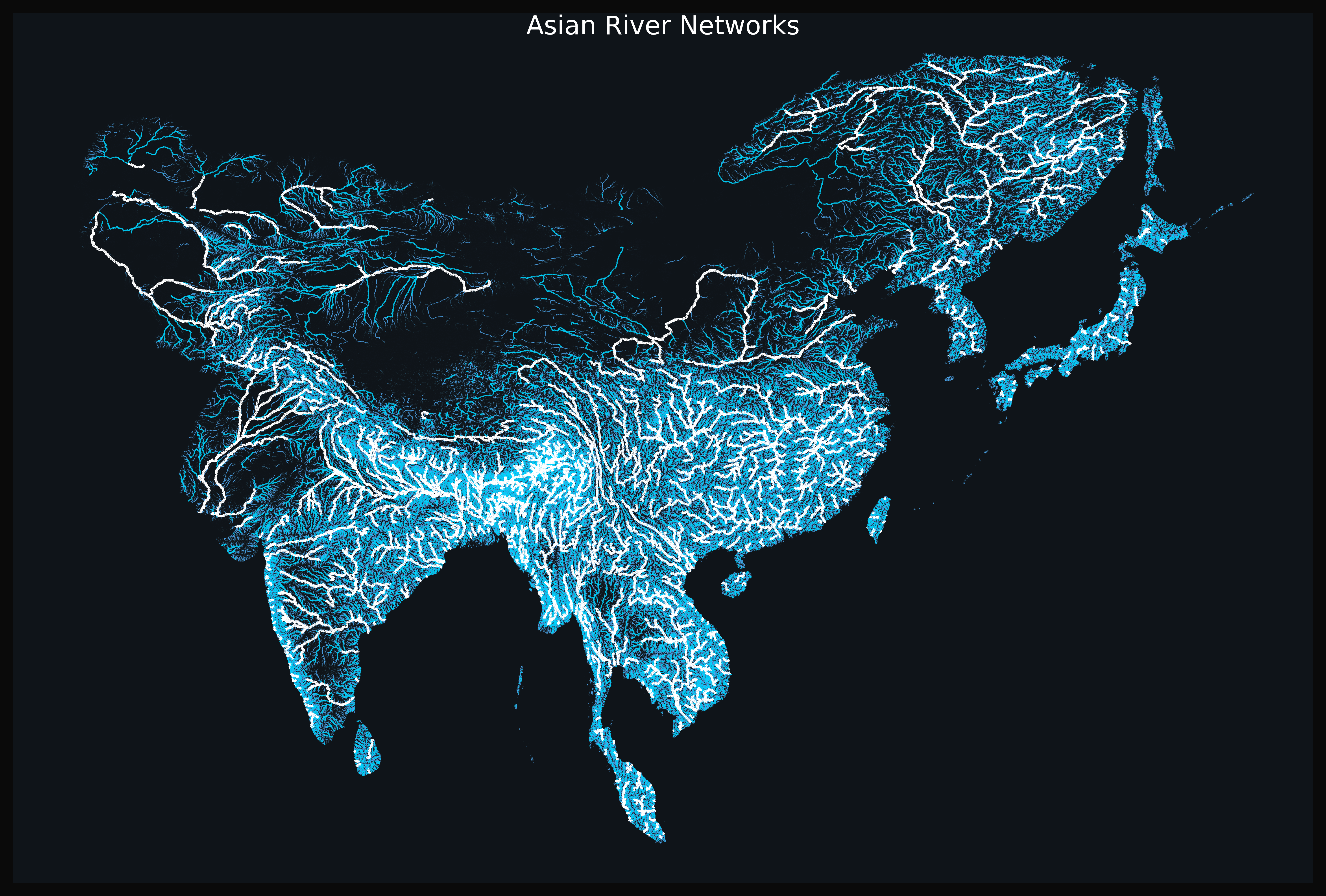
The "Asian River Networks Map" provides a detailed visualization of the intricate web of river systems across the contin...
Water Cycle Journey Map of South Asia
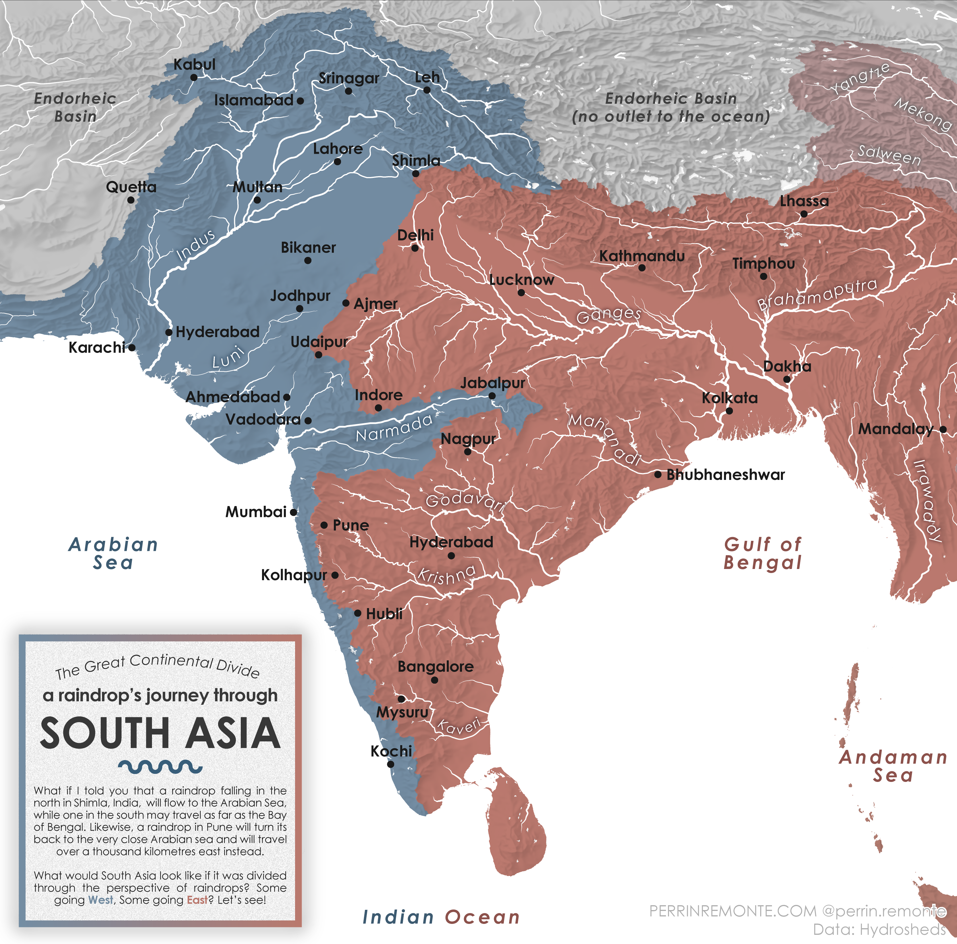
The visualization titled "A Raindrop's Journey through South Asia" provides an intriguing look at the water cycle within...

Paraíba River Valley Geography Map
The map of the Paraíba River Valley in Brazil provides a visual representation of this significant geographical feature,...
Lake Eyre Basin Map Australia
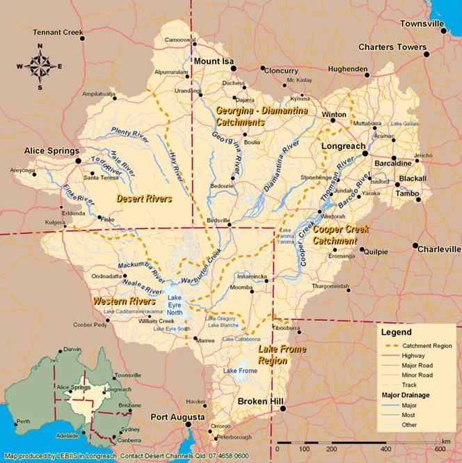
This visualization focuses on the Lake Eyre Basin, the largest endorheic lake system in Australia. Covering an expansive...
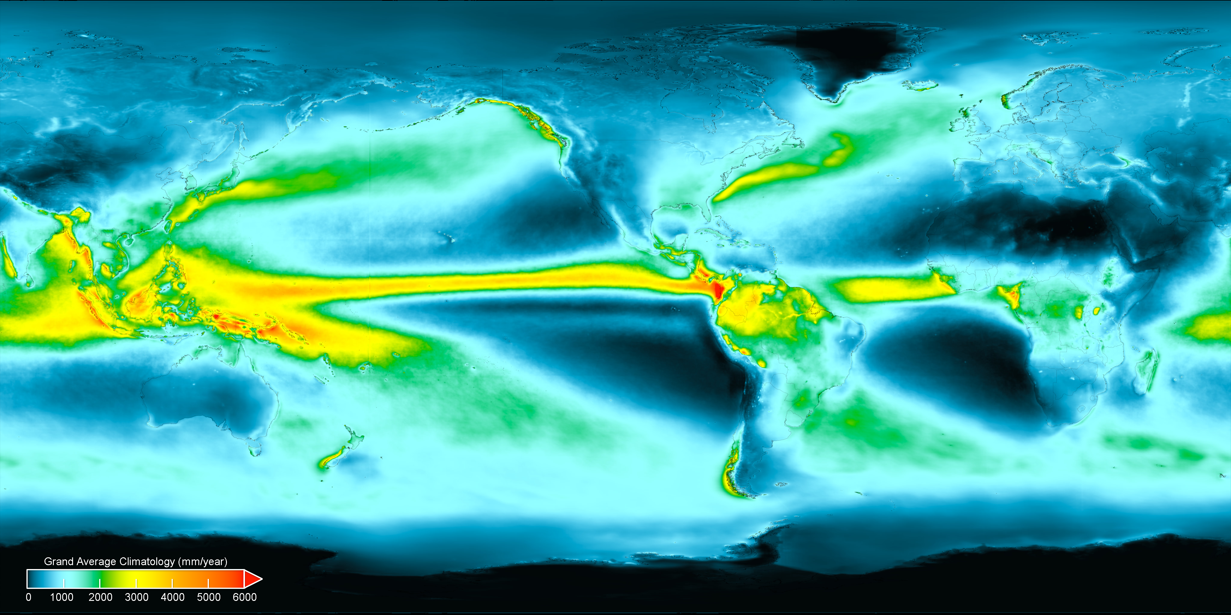
Average Annual Precipitation World Map
Interestingly, precipitation can be categorized into two main types: rain and snow. In warmer climates, rain is the prim...