holy roman empire Maps
6 geographic visualizations tagged with "holy roman empire"
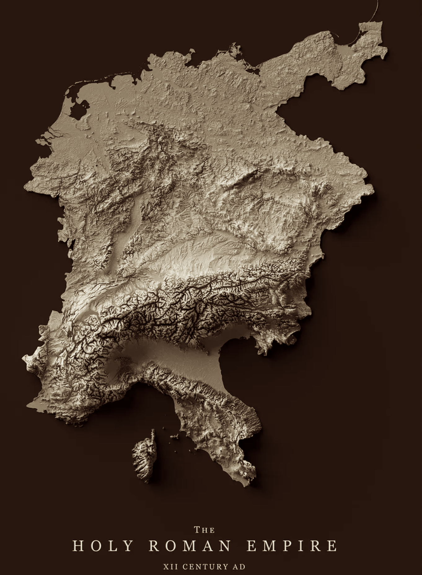
Relief Map of the Holy Roman Empire 12th Century
The relief map of the Holy Roman Empire in the 12th century provides a vivid representation of the geographical features...
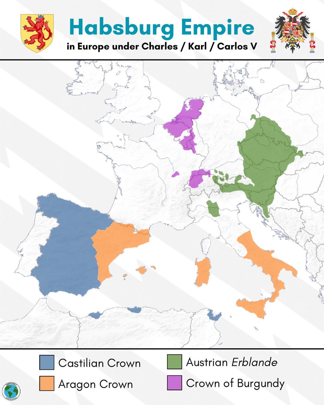
Habsburg Empire Map of Europe under Charles V
The map titled "The Habsburg Empire in Europe under Charles V" provides a detailed visualization of the vast territories...
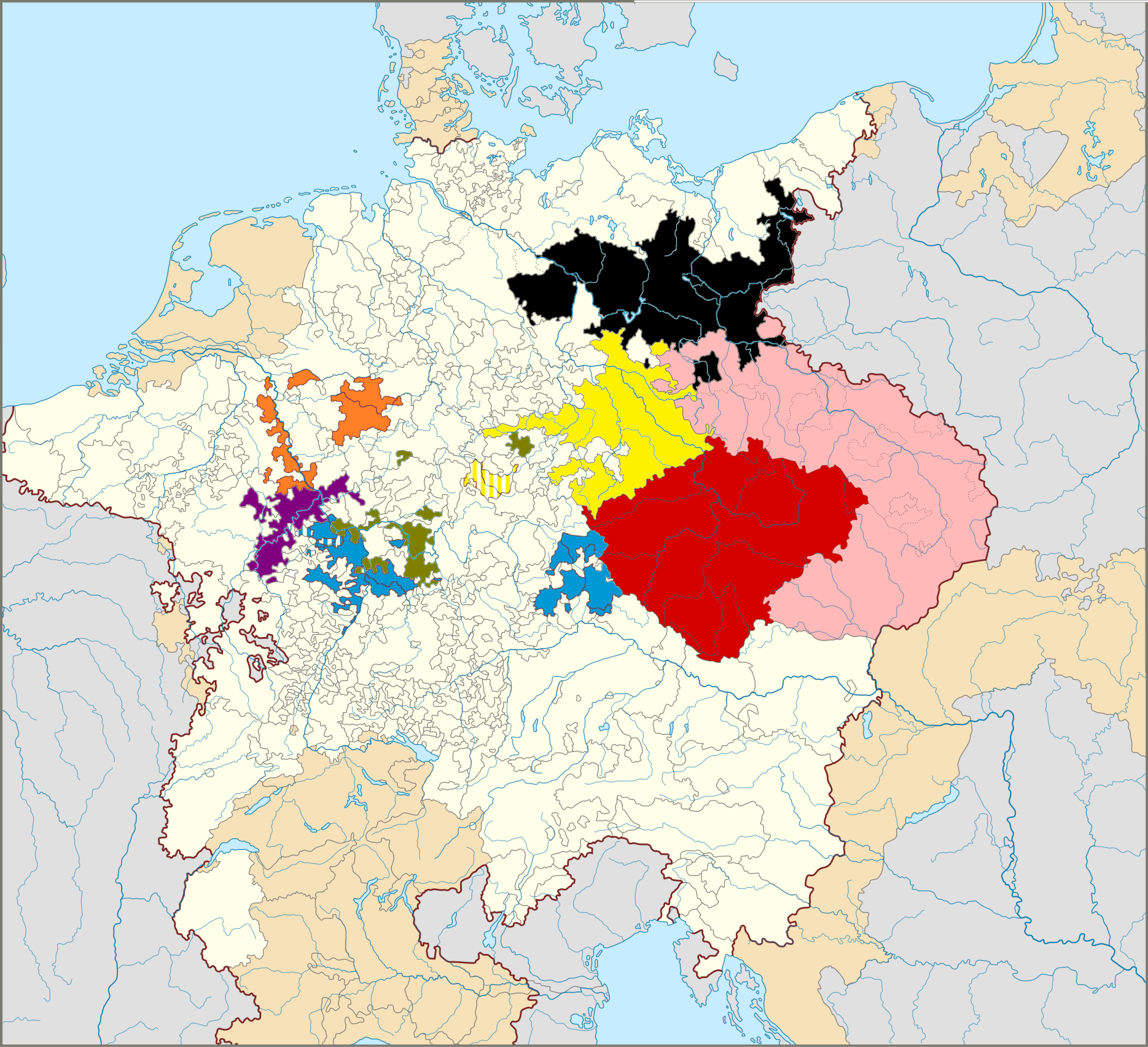
Map of The Seven Prince Electors in Germany
This map illustrates the territories of the Seven Prince Electors, who played a crucial role in the election of the Empe...
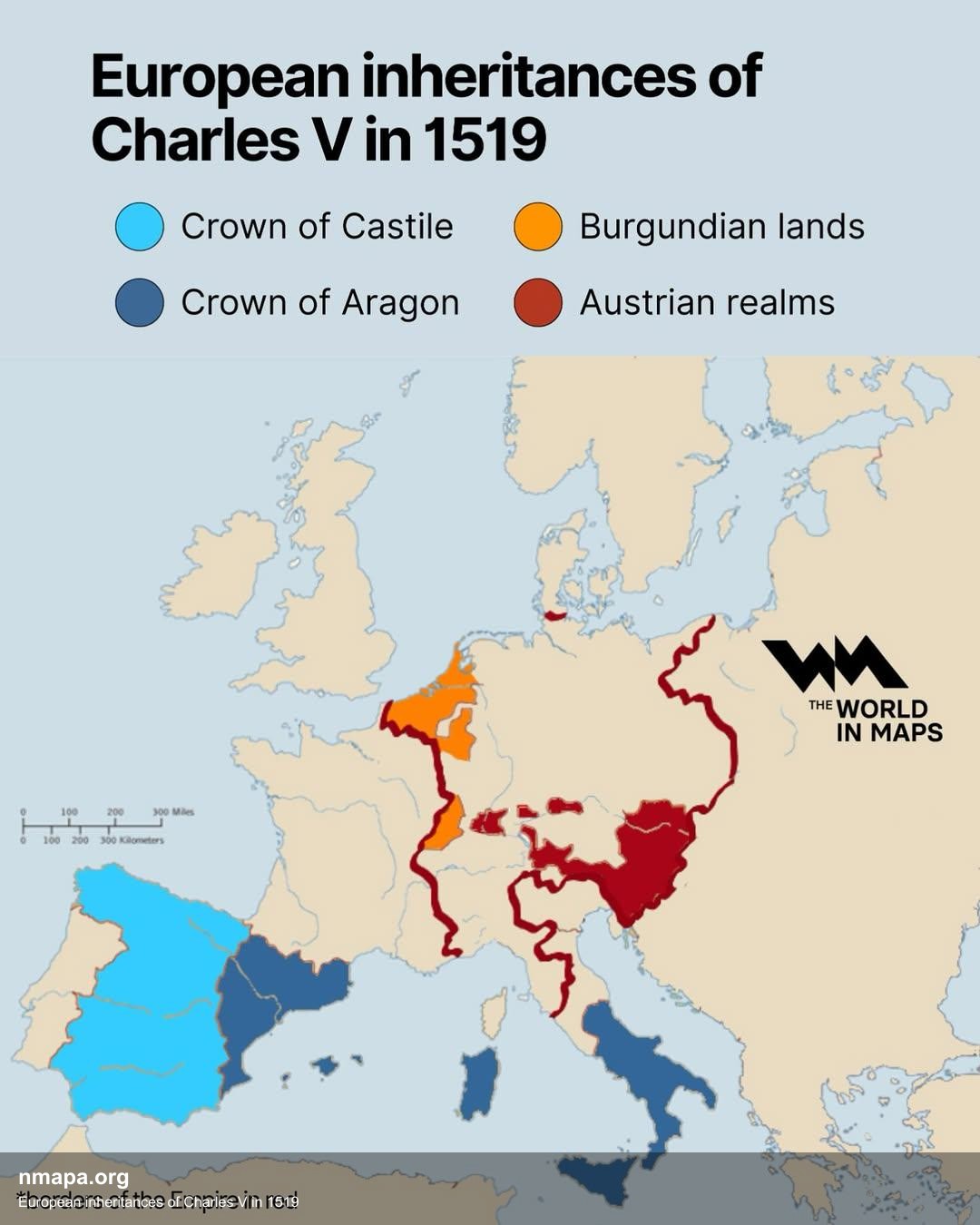
European Inheritances of Charles V in 1519 Map
This map illustrates the vast and complex territories inherited by Charles V in 1519, depicting the extensive European d...
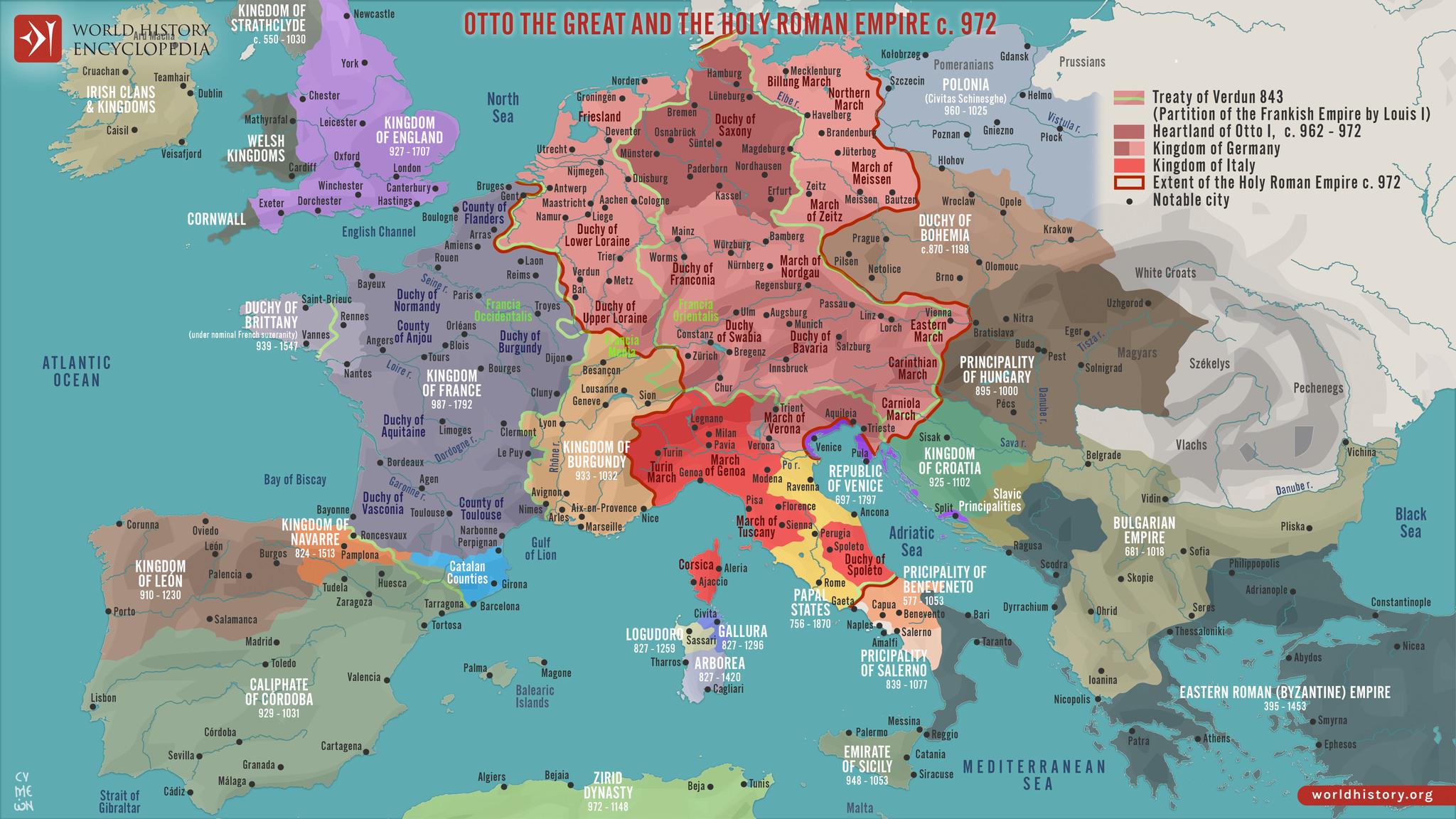
Political Map of Europe in 972
The "Map of Europe in 972" provides a fascinating glimpse into the political landscape of medieval Europe, depicting the...
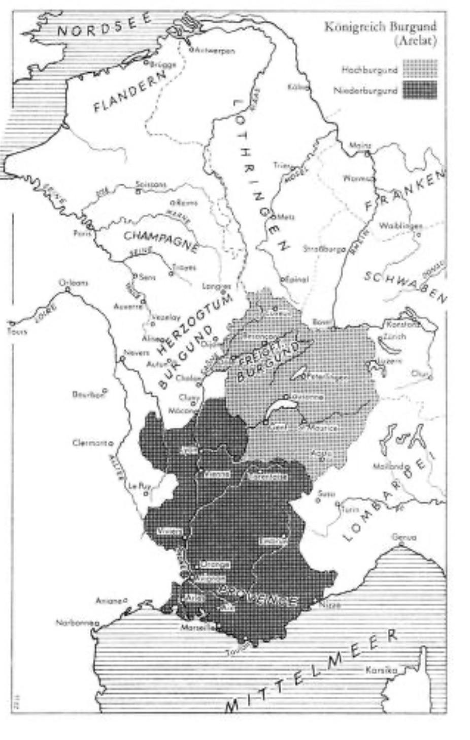
Map of the Kingdom of Burgundy Arelat, 10th–11th Century
This map provides a detailed representation of the Kingdom of Burgundy, known as Arelat, during the 10th and 11th centur...