great lakes Maps
5 geographic visualizations tagged with "great lakes"
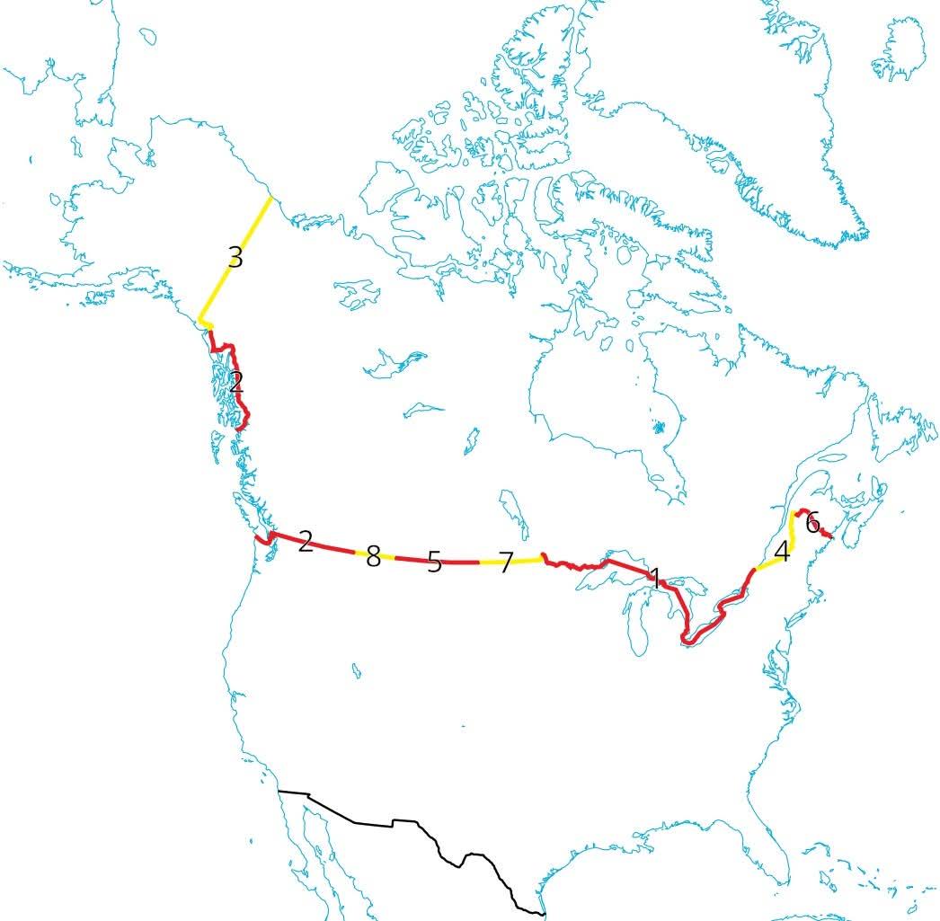
Ontario USA Border Map: Land vs Water
The visualization titled "Ontario has the longest border with the USA, but of the 2700+kms less than 1km of that is actu...
👁 68📅 9/23/2025
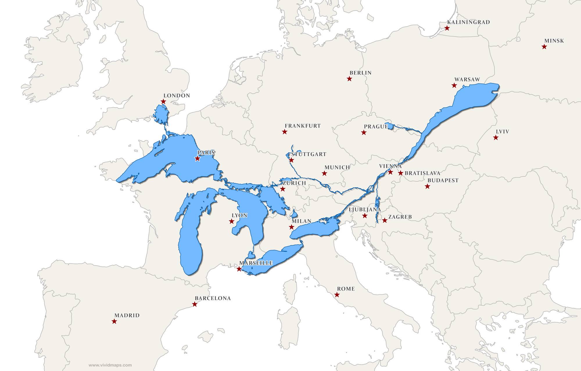
Great Lakes and St. Lawrence Seaway Map Over Europe
This fascinating map superimposes the Great Lakes and the St. Lawrence Seaway over Europe, providing a unique perspectiv...
👁 80📅 9/3/2025
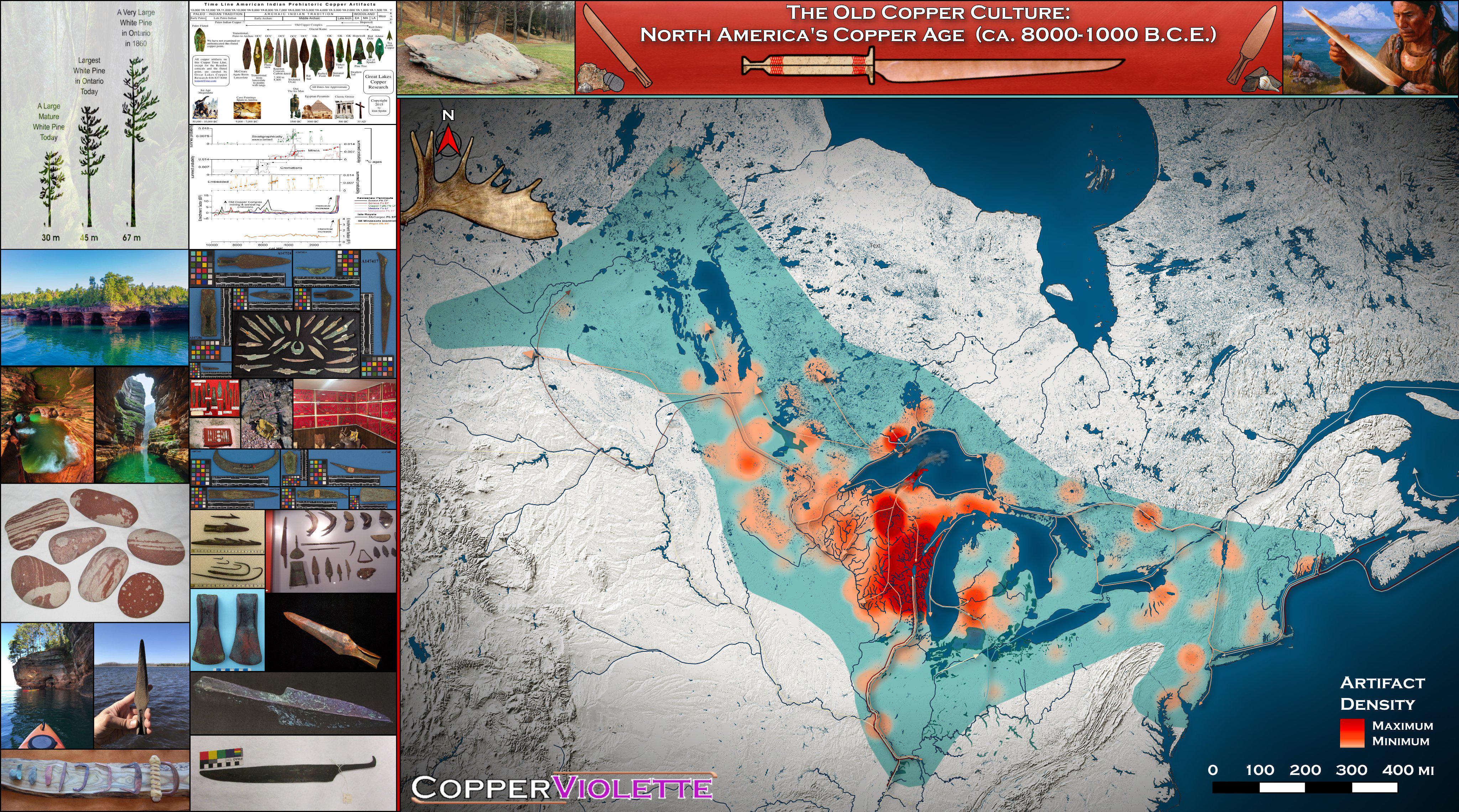
Old Copper Culture of North America Map
This 4K map titled "The Old Copper Culture: North America's Forgotten Copper Age (ca. 8000-1000 B.C.E.)" provides a deta...
👁 94📅 8/28/2025
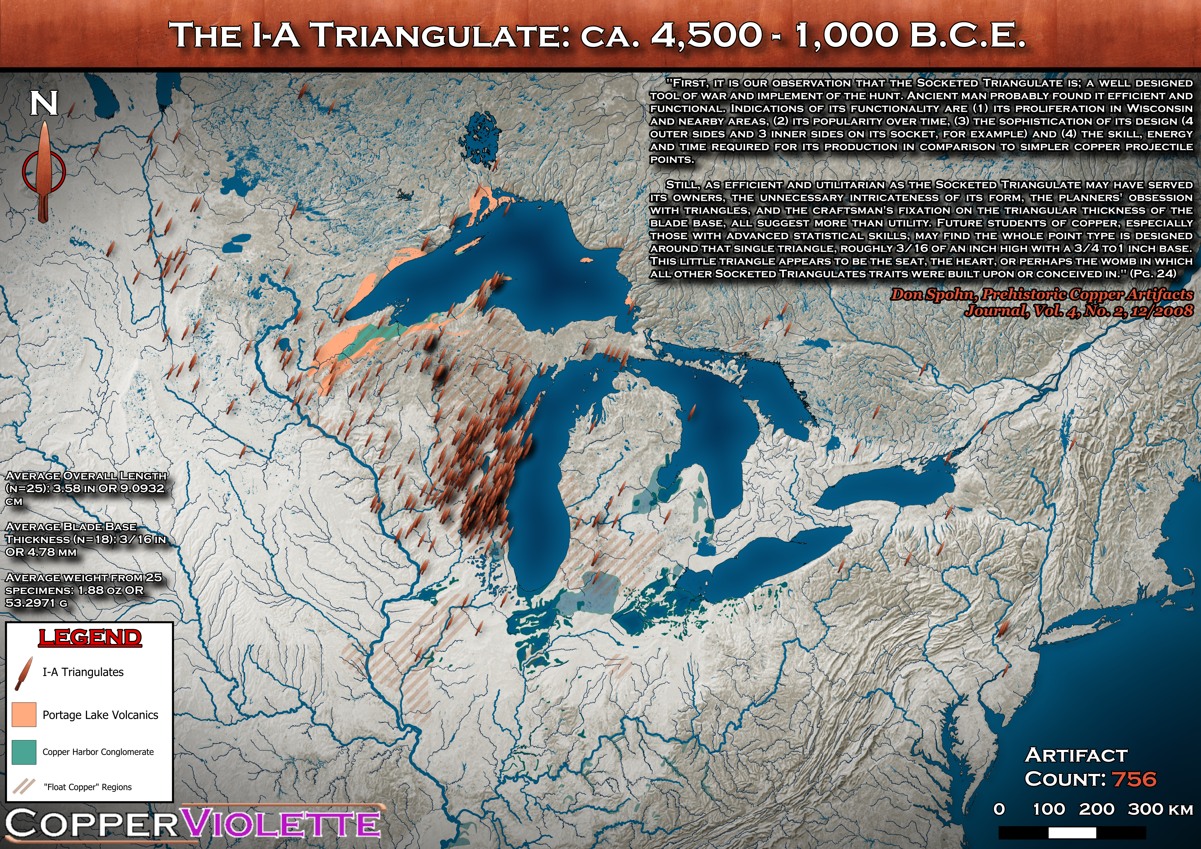
I-A Triangulates Distribution Map of the Old Copper Culture
This detailed visualization represents the distribution of I-A Triangulates, a prominent type of spearhead produced by t...
👁 66📅 9/20/2025
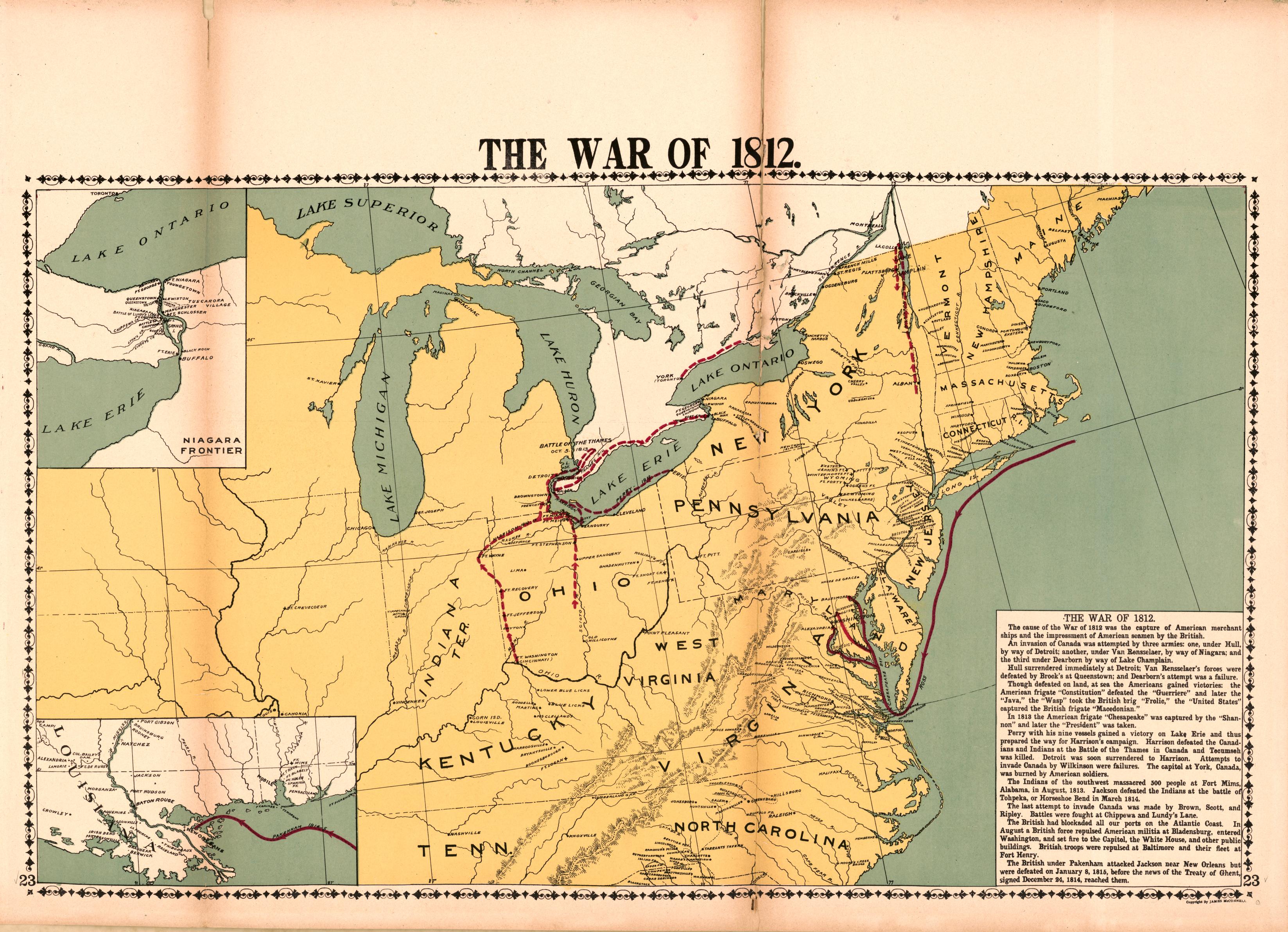
War of 1812 Battle Locations Map
The \...
👁 110📅 8/8/2025