education Maps
53 geographic visualizations tagged with "education"

Cultural Characteristics Map of New England
The map titled "New Englanders be New Englanding" presents a fascinating look at the unique cultural characteristics and...
Correlation Map of Socioeconomic Factors
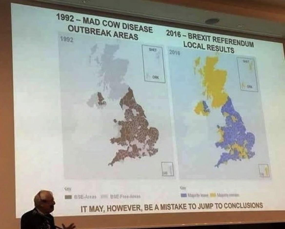
The "Correlation" map provides a visual representation of the relationships between various socioeconomic factors across...
Top 3 Languages Taught in Australian Schools Map
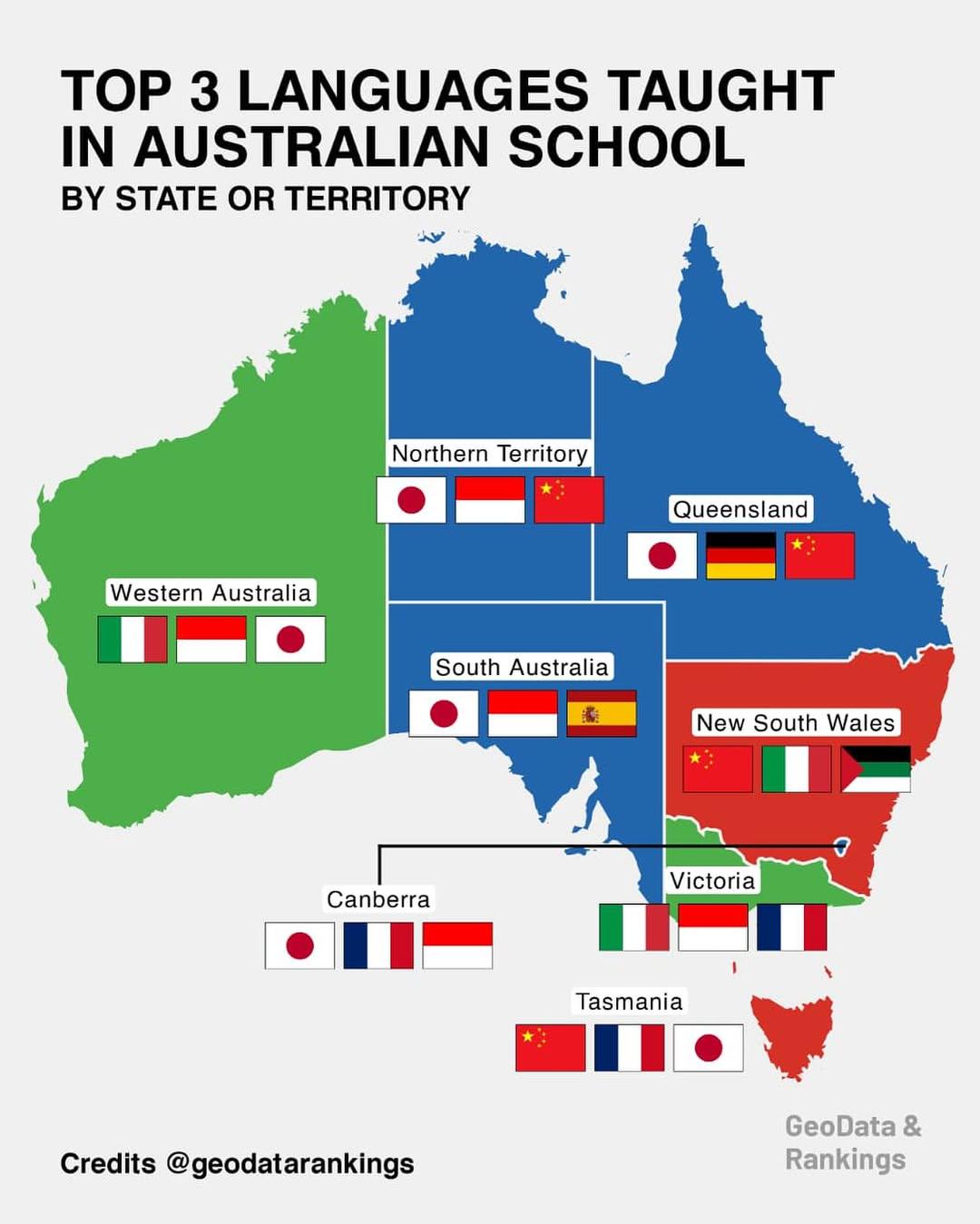
This map provides a comprehensive overview of the top three languages taught in schools across various states and territ...
Map of Armenia in an Armenian School
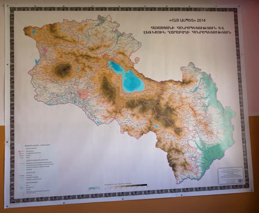
This map provides a detailed overview of Armenia, highlighting its geographical features, political boundaries, and sign...
Best and Worst US States by Overall Well-Being Map
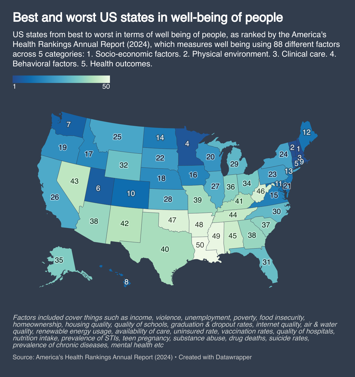
This map provides a comprehensive overview of the overall well-being of each U.S. state, ranking them based on various f...
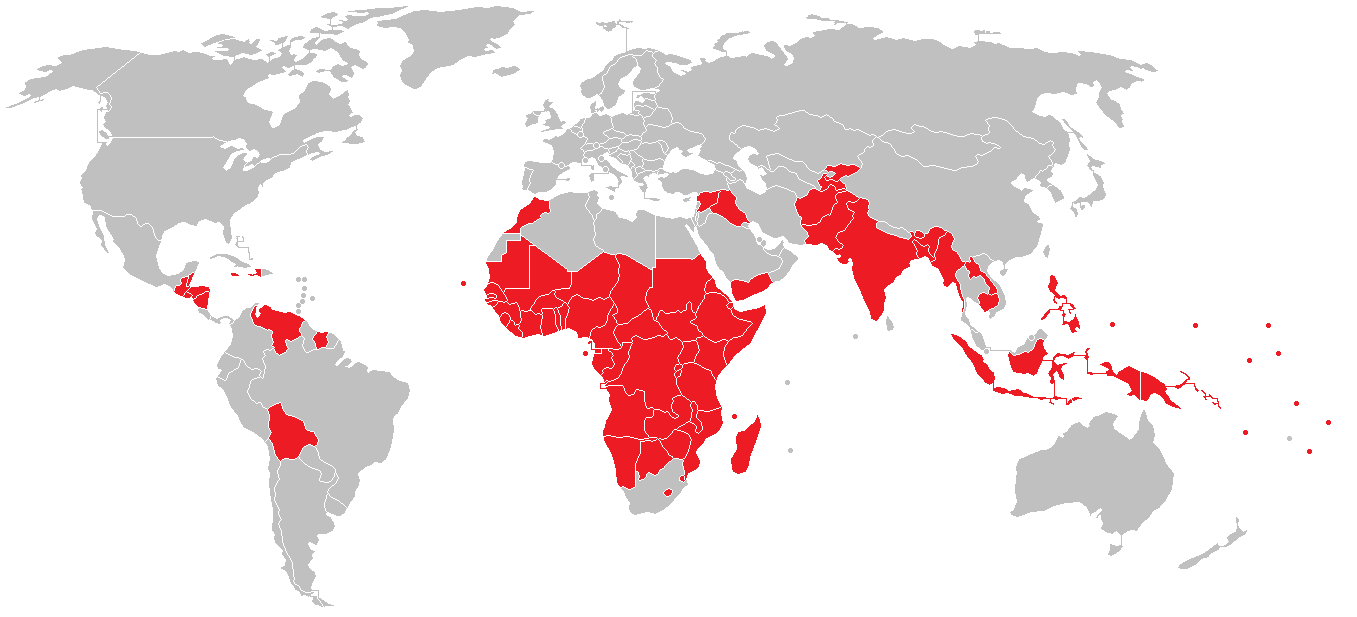
Countries with Lower HDI than West Bank Map
The visualization titled "Countries with Lower HDI than the West Bank & Gaza Strip in 2022" highlights a significant asp...
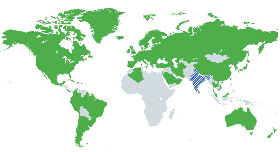
Countries with Higher HDI than Goa Map
Interestingly, Goa has consistently been recognized for its high HDI within India, attributed to its relatively high lit...
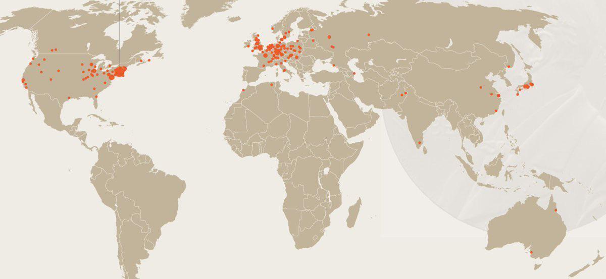
Map of Birthplaces of Nobel Physics Winners
The field of physics has evolved dramatically over the decades, and so have the backgrounds of its winners. Initially, m...
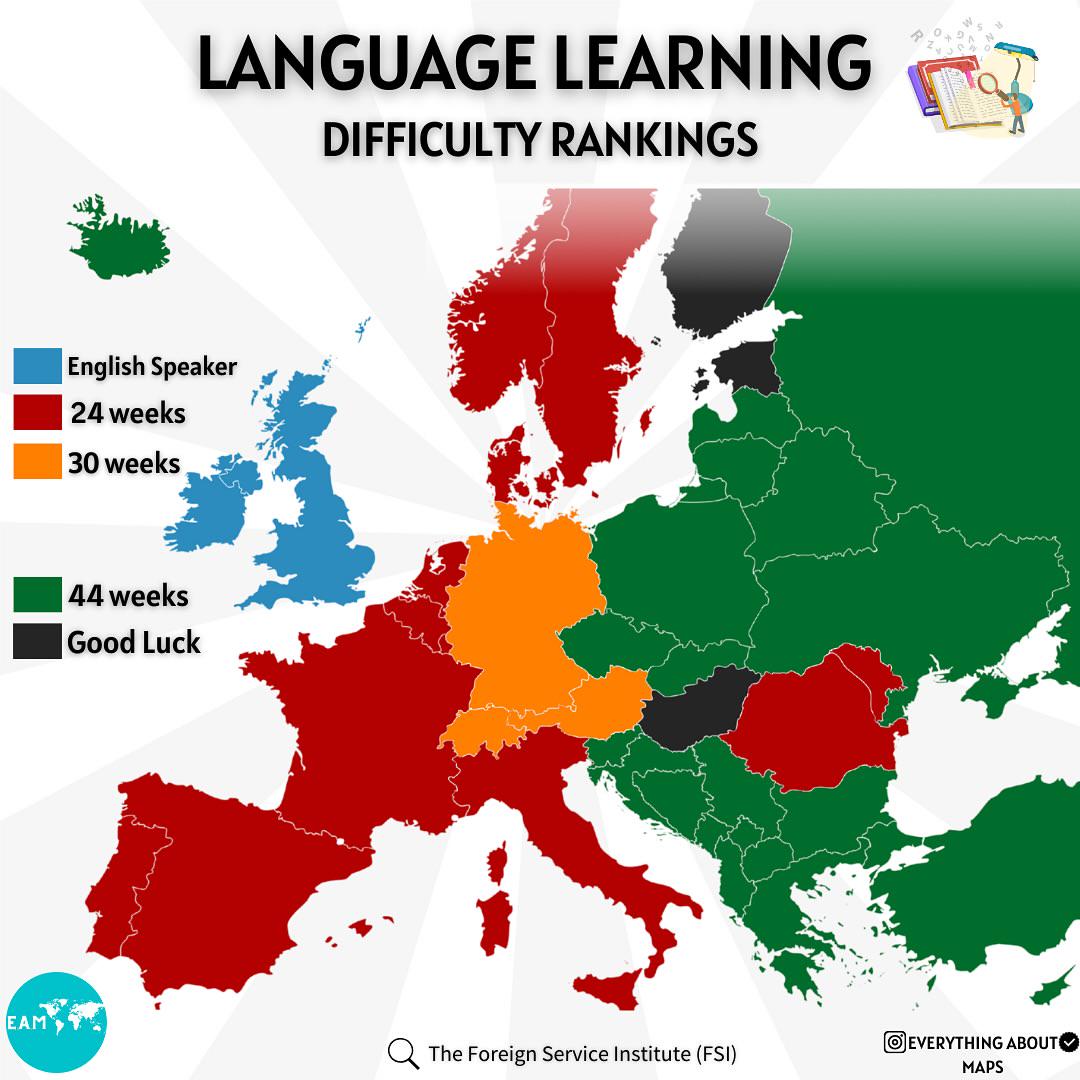
Language Learning Difficulty Rankings Map
The "Language Learning Difficulty Rankings" map provides a visual representation of how challenging it is for native Eng...
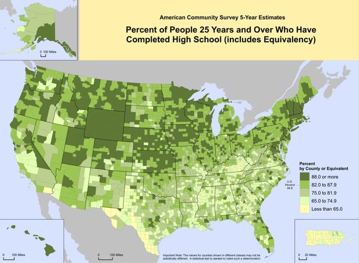
High School Graduation Rates Map of the US
This map visualizes the percentage of individuals over the age of 25 in the United States who have completed high school...
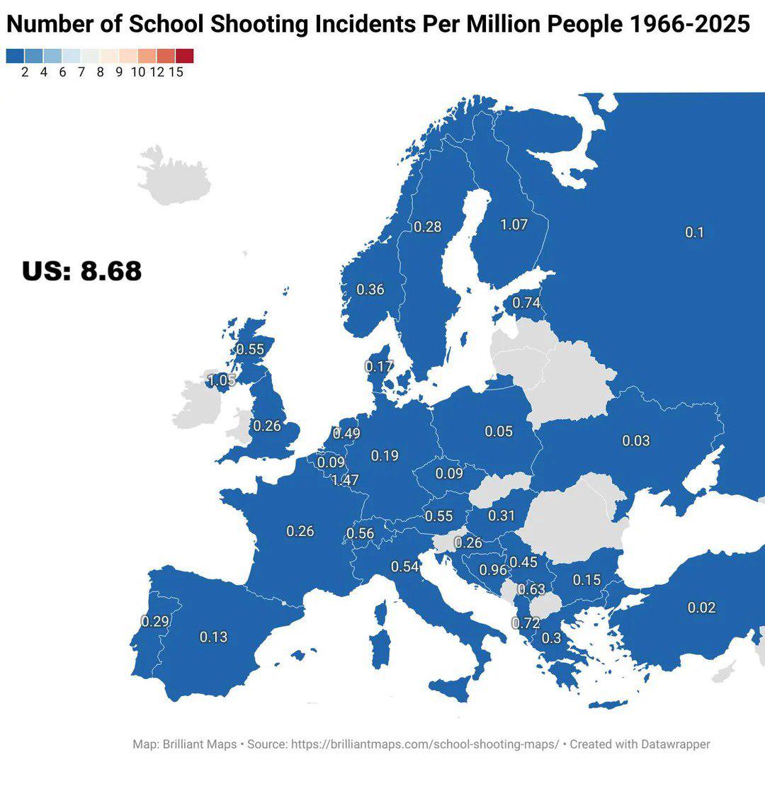
School Shooting Incidents Per Million People Map
The map titled "Number of School Shooting Incidents per Million People 1966-2025" provides a stark visual representation...
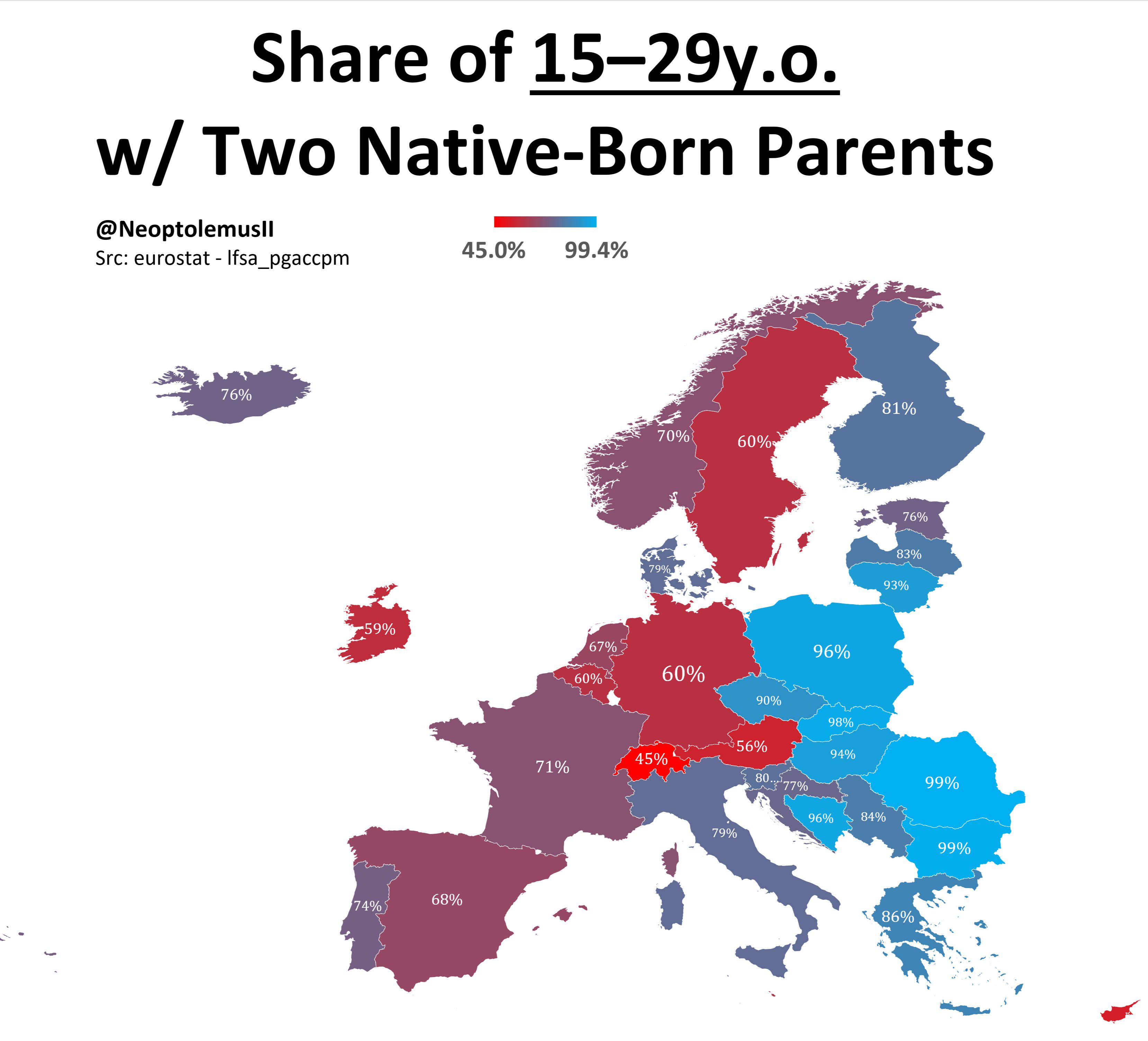
Map of Share of 15-19 Year Olds with Two Native Born Parents
The visualization titled \...
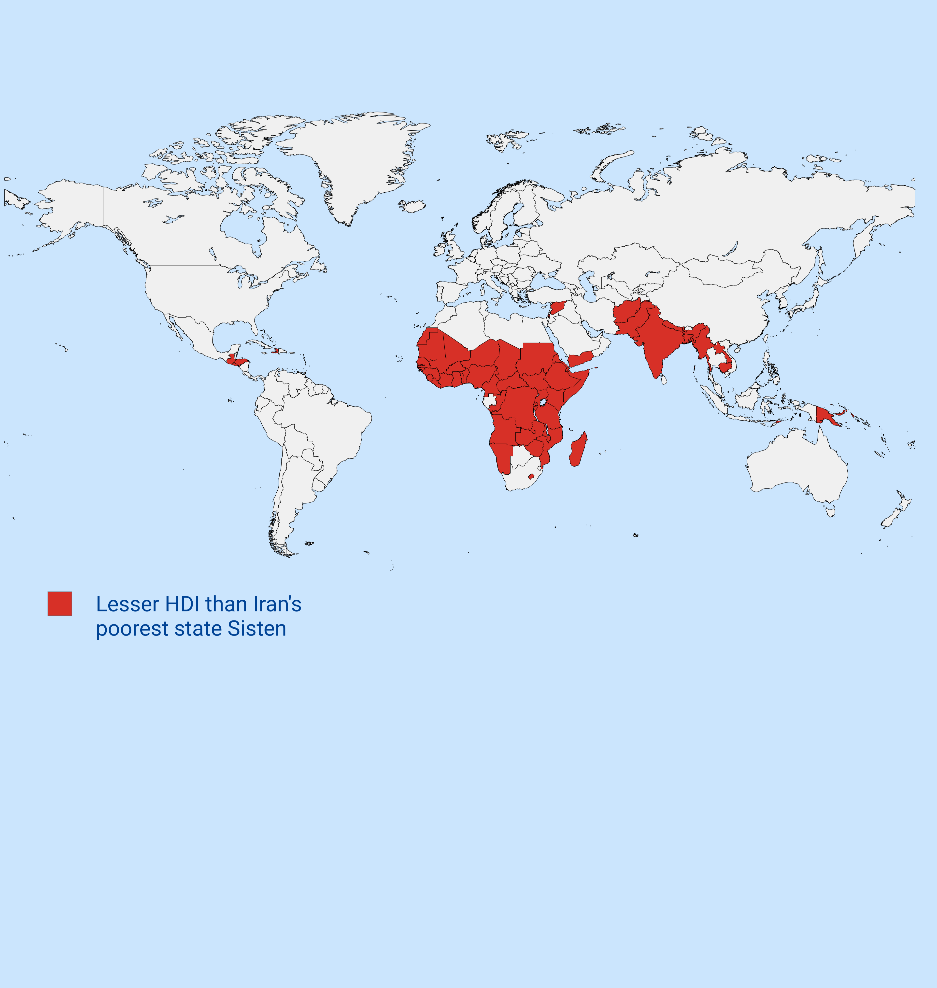
Countries with Lower HDI than Iran's Poorest State Map
The map titled "Countries with Lower HDI than Iran's Poorest State" visually represents nations that exhibit a lower Hum...
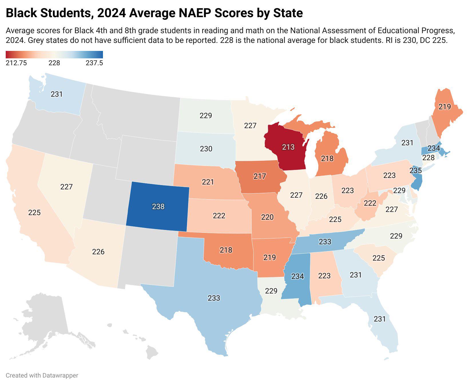
Black Student Test Scores by US State Map
The "Black Student Test Scores by US State" map visualizes the academic performance of Black students across various sta...
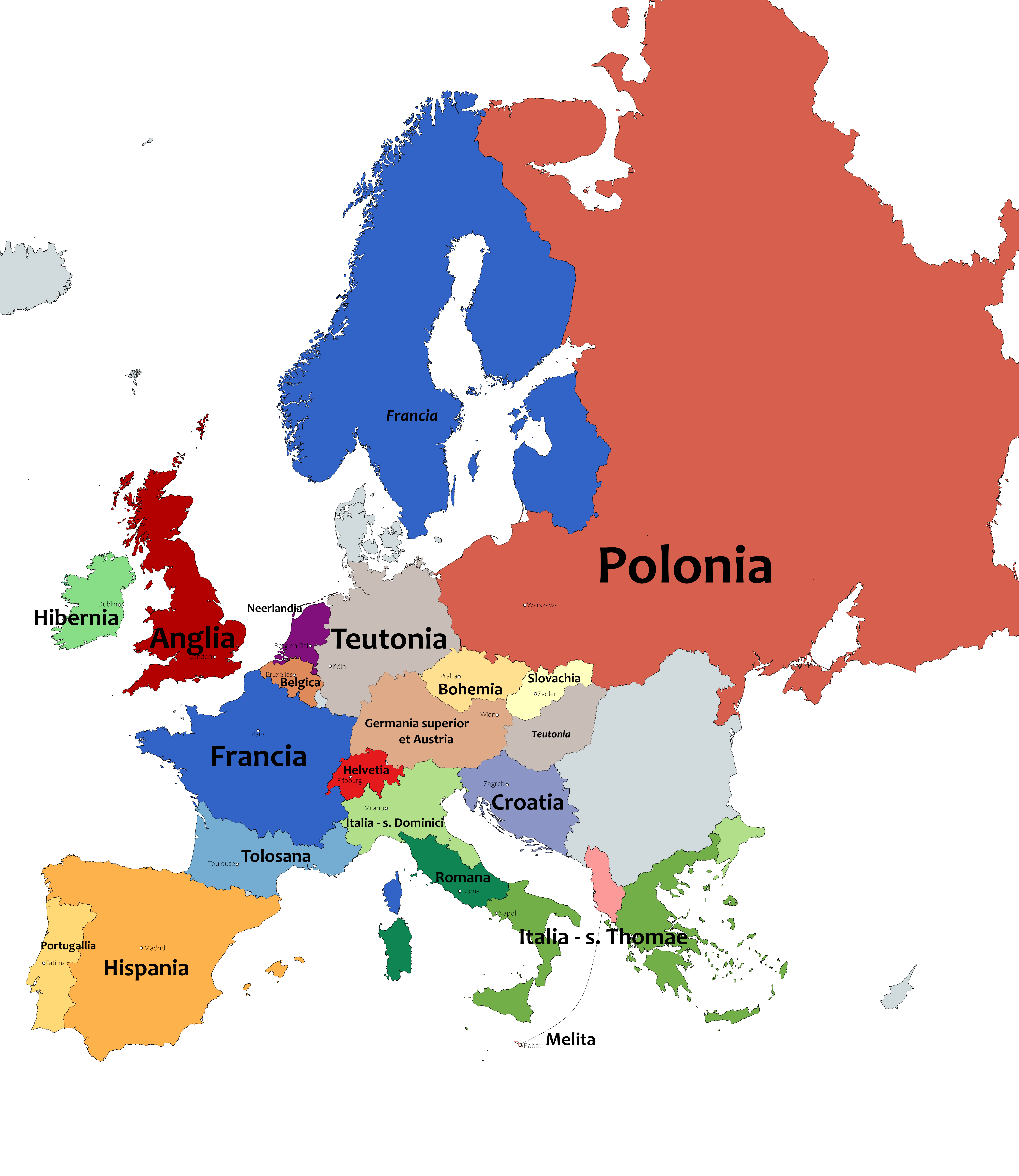
Provinces of the Dominican Order in Europe Map
This map outlines the provinces of the Dominican Order in Europe as of 2020, visually representing the geographical dist...
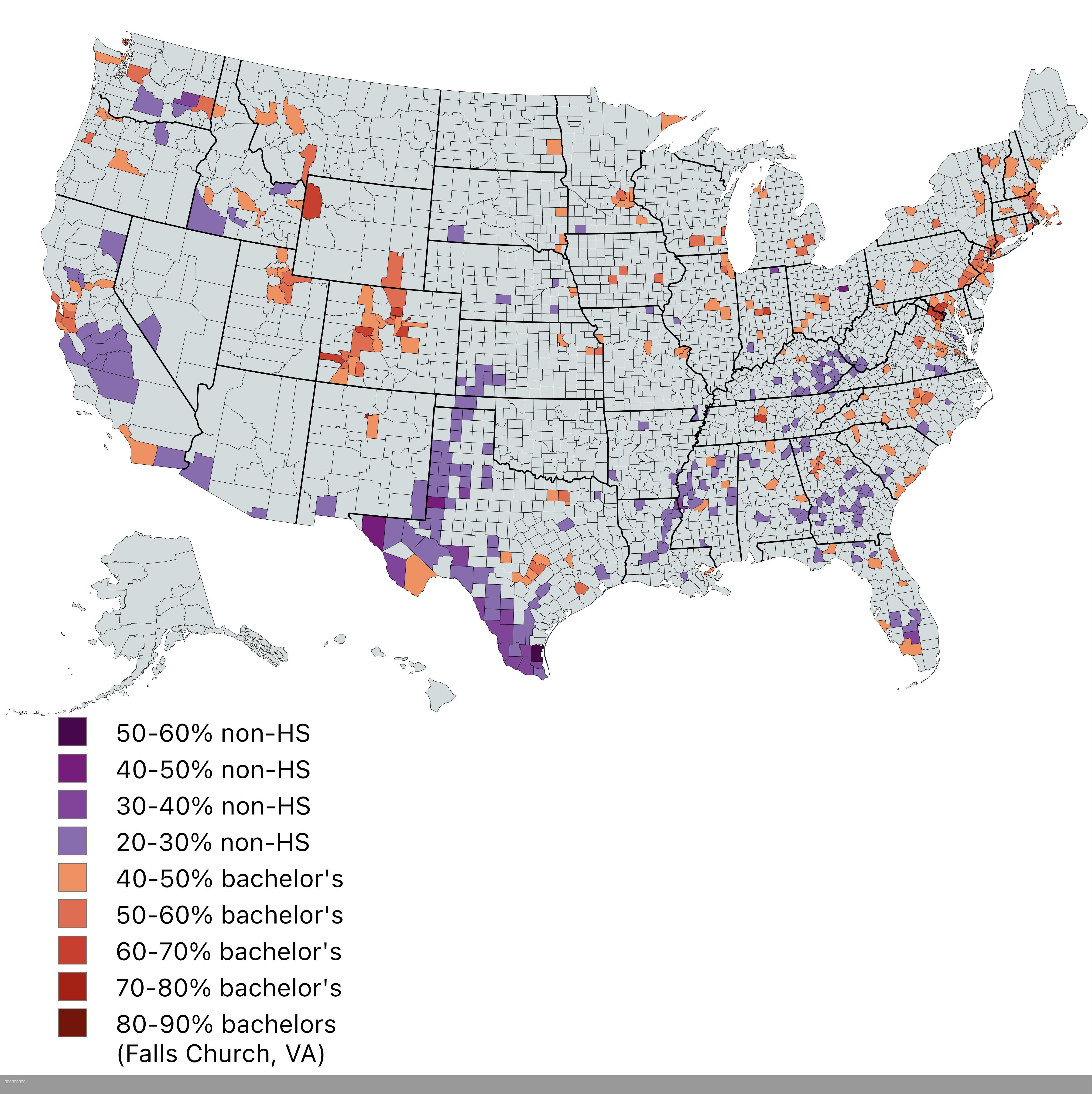
Map of Most and Least Educated US Counties
This map presents a striking contrast between the most and least educated counties in the United States, showcasing area...
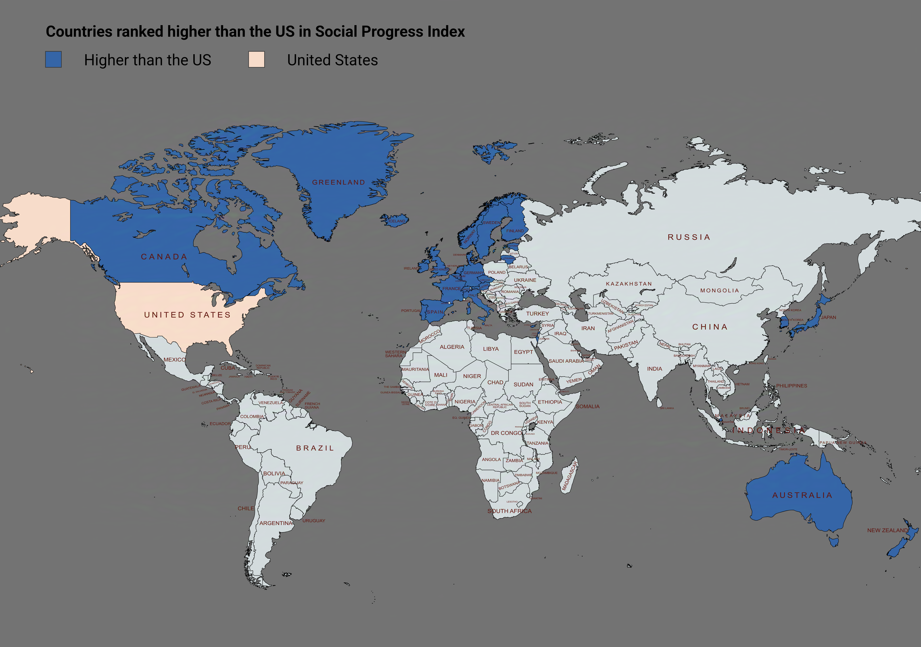
Social Progress Index Rankings Map by Country
The visualization titled "Countries Ranked Higher Than the US in Social Progress Index" provides a compelling overview o...

Map of Universities Producing the Most Billionaires
The visualization titled "Universities Producing the Most Billionaires" provides a compelling overview of the educationa...
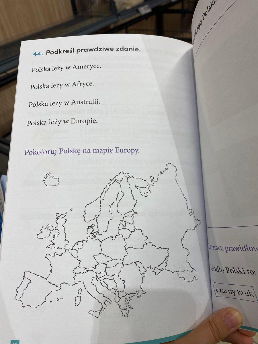
Polish Exercise Book for Primary School Map
The "Polish Exercise Book for Primary School" map is a fascinating representation of educational resources, specifically...
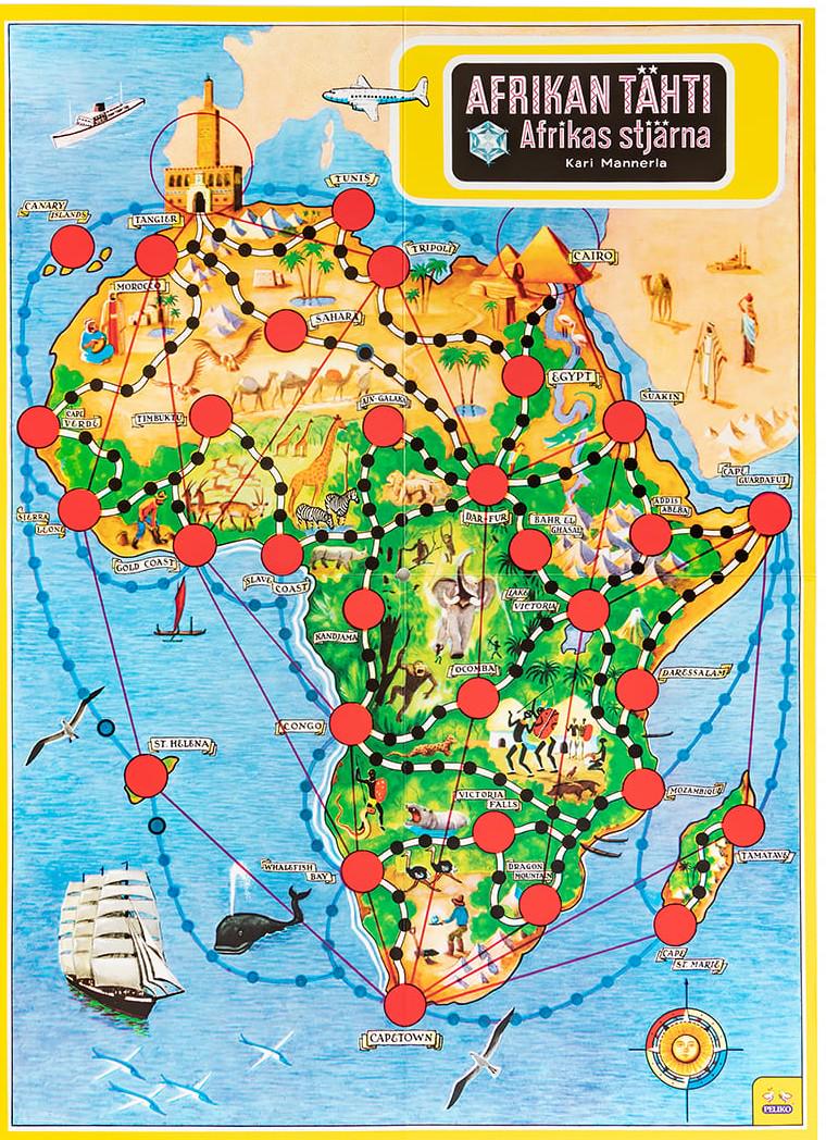
Geographical Distribution of Board Games in Africa Map
This map titled "Africa on a Board Game" illustrates the geographical distribution and popularity of various board games...
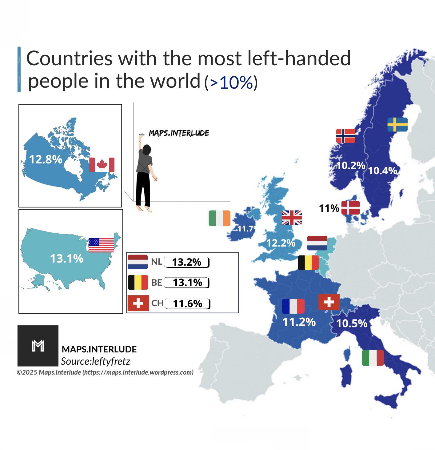
Countries with the Most Left-Handed People Map
The visualization titled "Countries with the Most Left-Handed People Map" illustrates the percentage of left-handed indi...
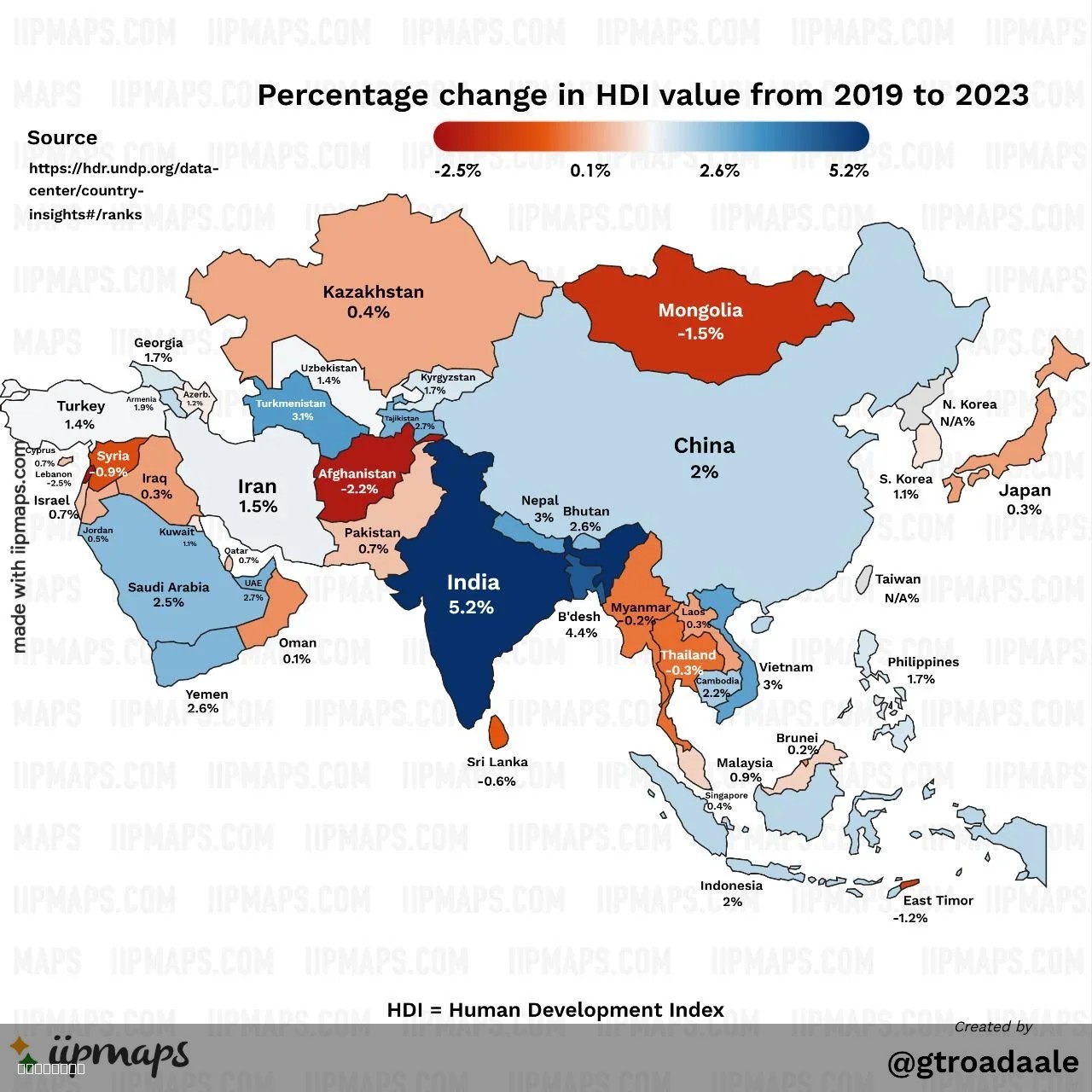
Human Development Index Map of Asia
...
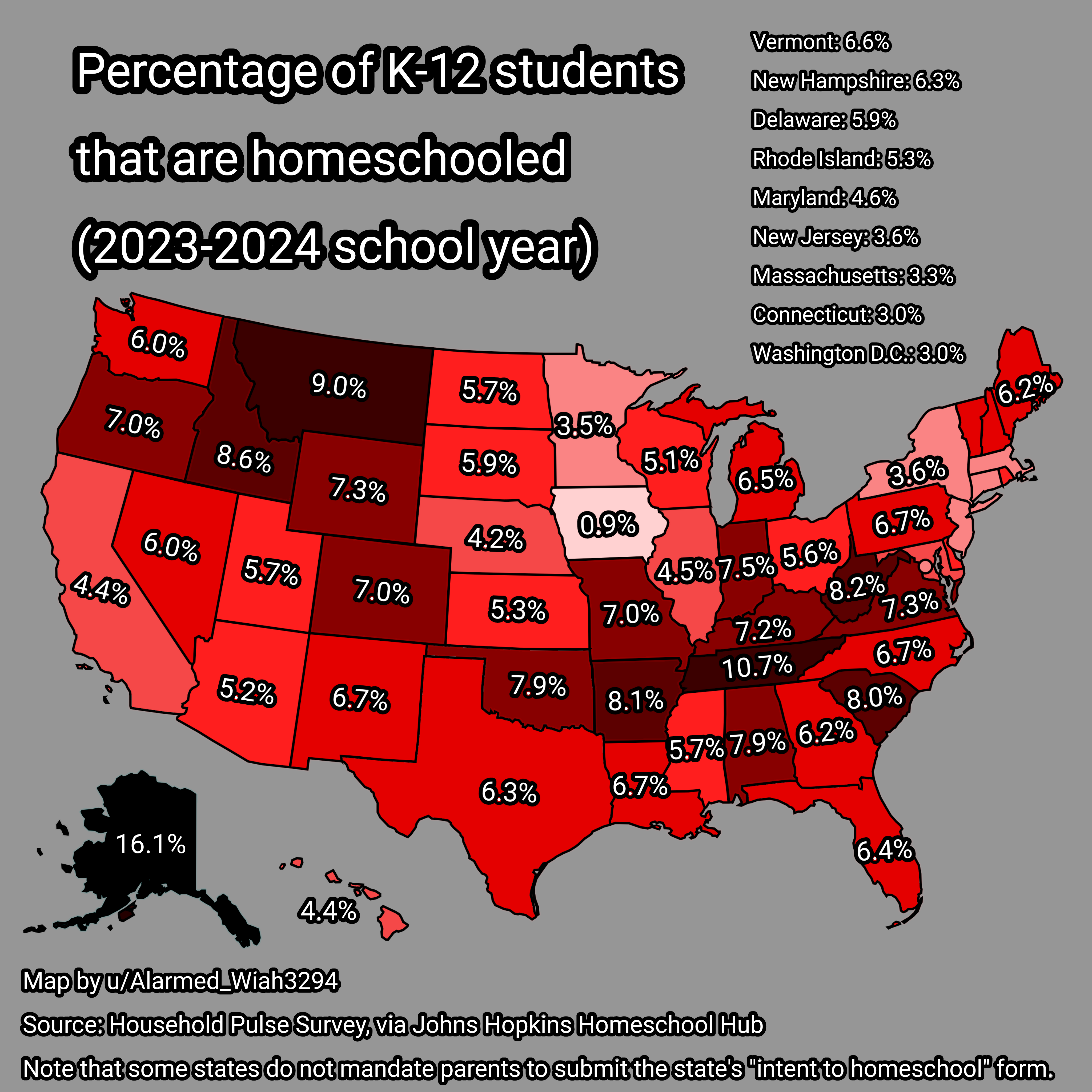
Homeschooling Rates Map for K-12 Students in USA 2023-2024
...
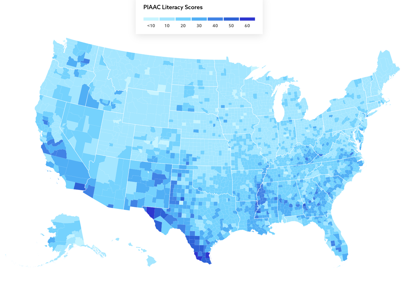
Literacy Skills Map of U.S. Adults
The map titled "Over 36 million adults in the U.S. lack basic literacy skills" provides a visual representation of adult...
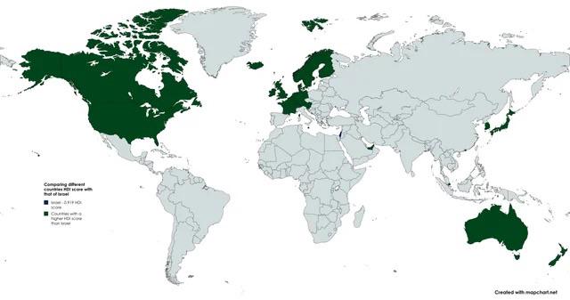
Countries with Higher HDI than Israel Map
The "Countries with Higher HDI than Israel Map" presents a visual representation of nations that boast a higher Human De...
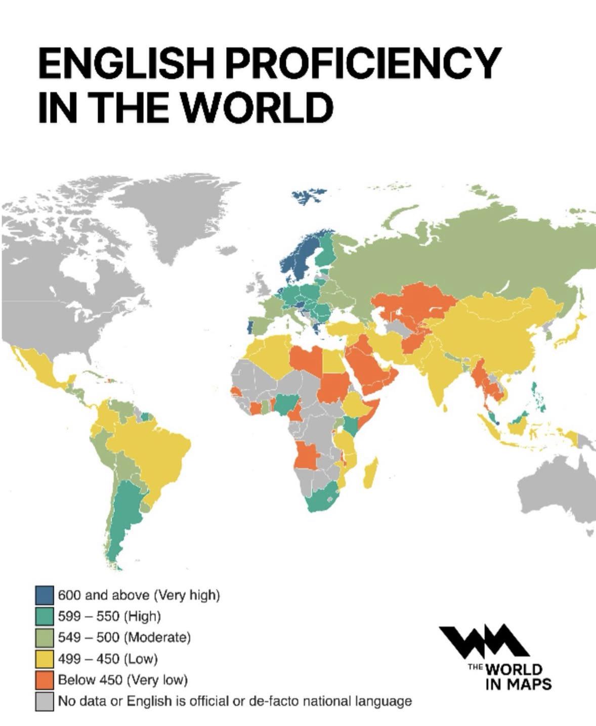
English Proficiency in the World Map
The "English Proficiency in the World Map" provides a clear visual representation of how well different countries and re...
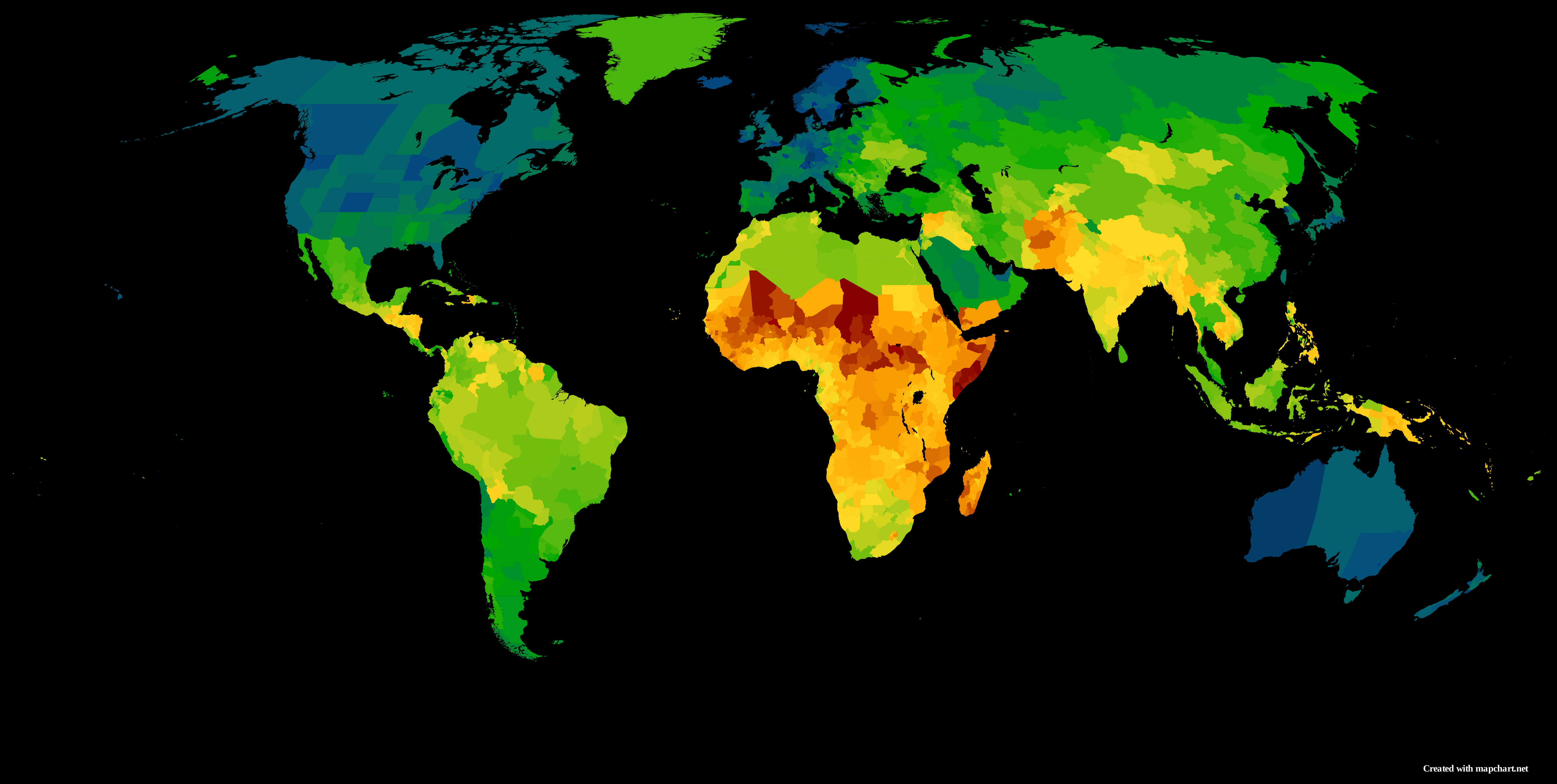
2022 Global Subnational Human Development Index Map
Interestingly, the HDI values can range from 0 to 1, with higher values indicating better overall development. Regions s...
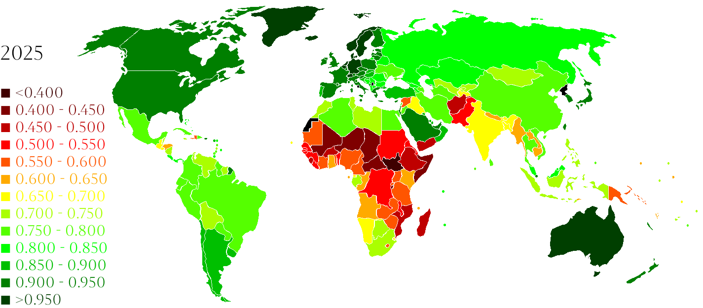
Human Development Index by Country Map
The visualization titled "Countries ranked by Human Development Index (2025 data) [OC]" displays a comprehensive overvie...

Map Showing Missing New Zealand
The visualization titled 'Map at school forgot New Zealand' highlights a curious omission in a geographical representati...
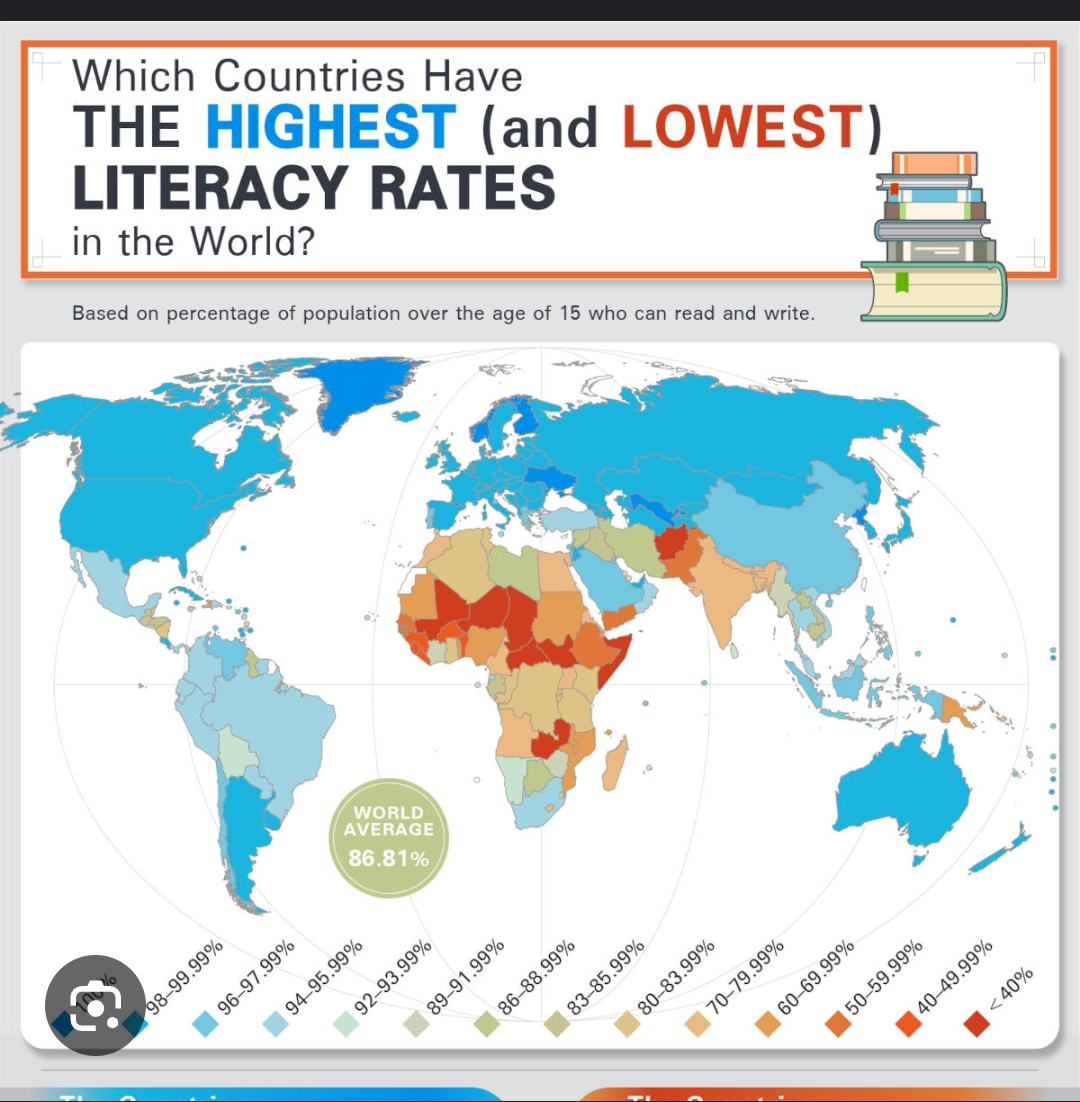
Global Literacy Rate Map Nearly 90%
The visualization titled "Literacy Rate Reached Almost 90% Worldwide" provides a comprehensive overview of the global li...
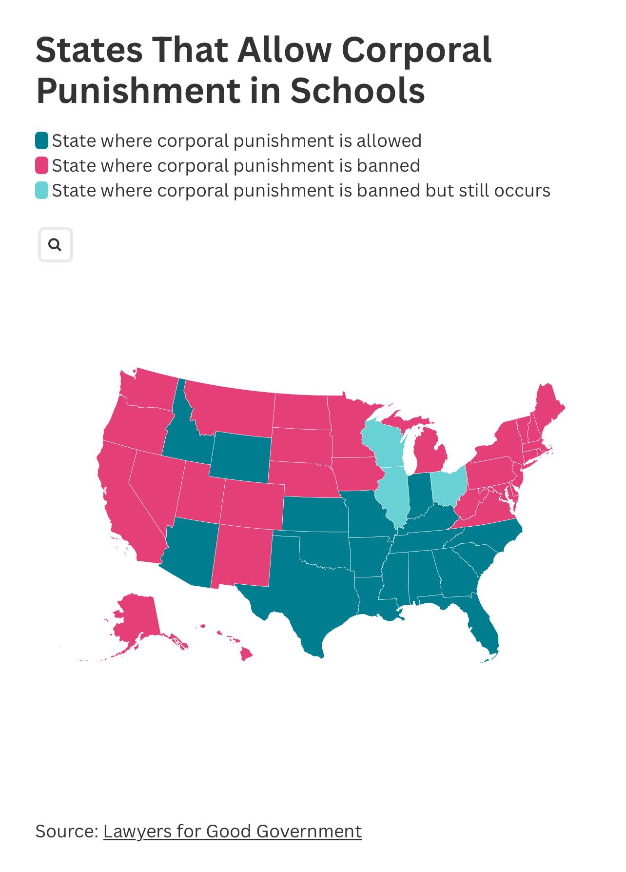
Corporal Punishment in Schools Map by State
The map titled "States in the United States That Allow Corporal Punishment in Schools" provides a visual representation ...
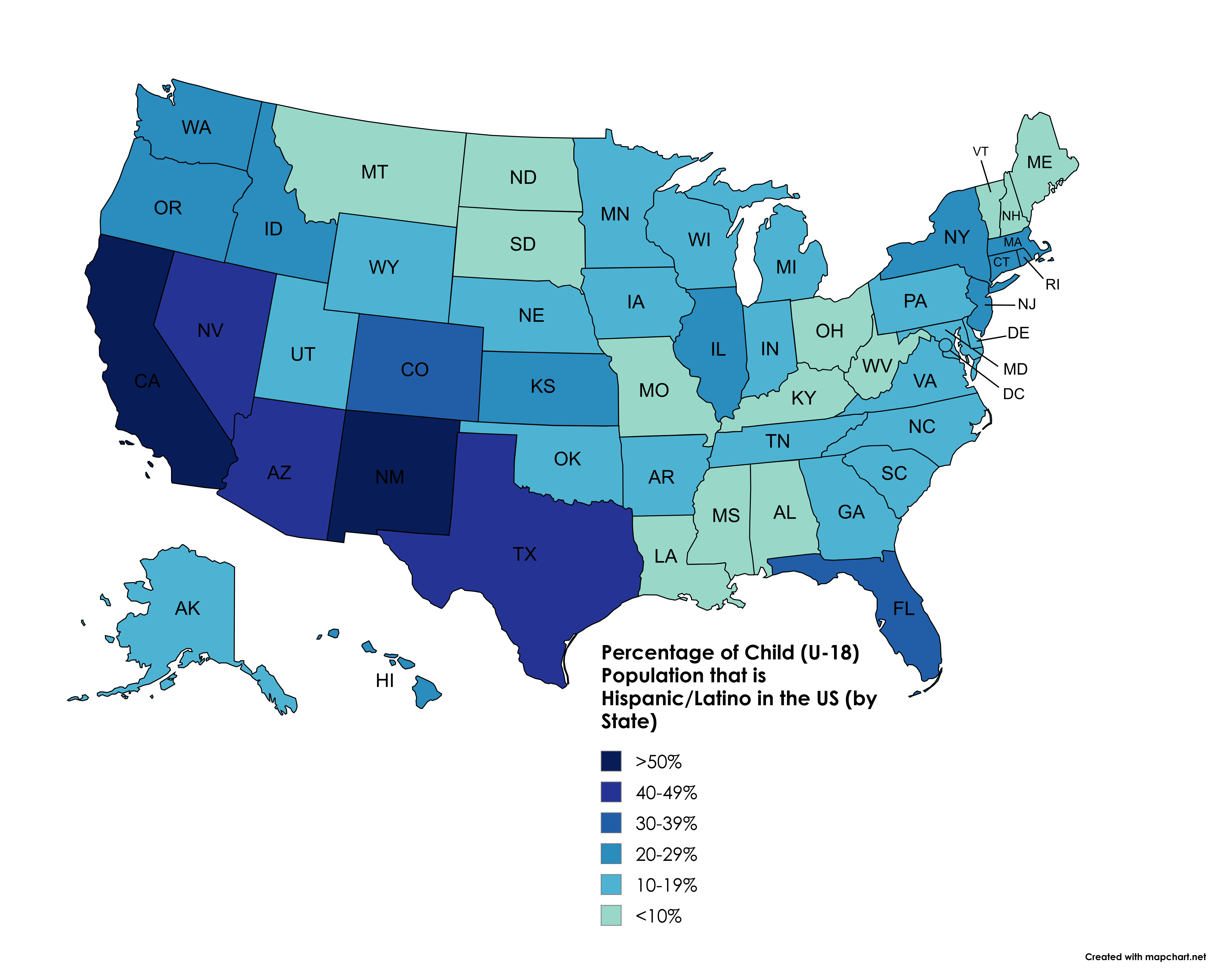
Hispanic/Latino Child Population Percentage Map by State
This map illustrates the percentage of the child population under the age of 18 that identifies as Hispanic or Latino ac...
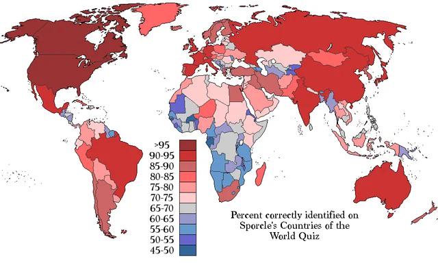
Countries Identified in Sporcle Quiz Map
The visualization titled "Percentage of people who identified each country on Sporcle’s 'countries of the world quiz'" o...
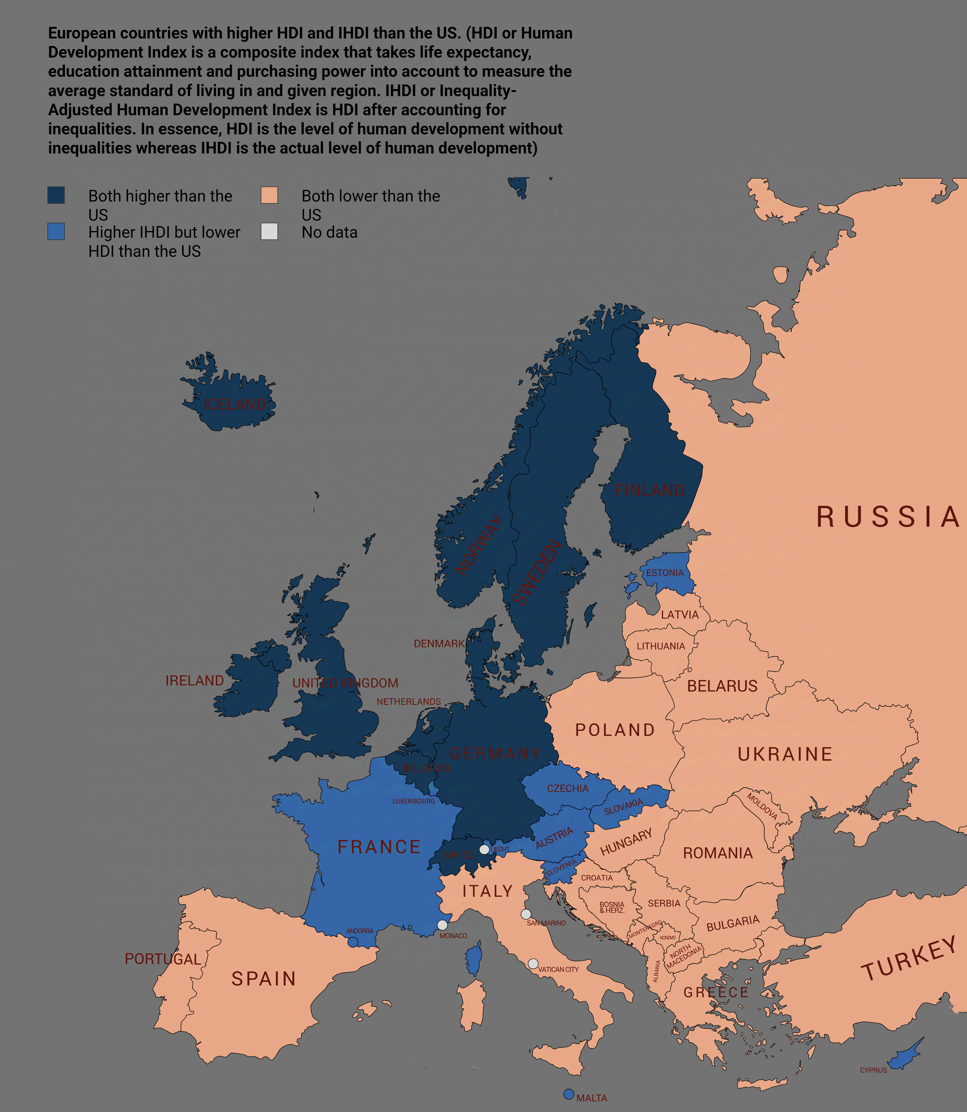
Map of European Countries with Higher HDI and IHDI than the US
This map visualizes European countries that boast a higher Human Development Index (HDI) and Inequality-adjusted Human D...
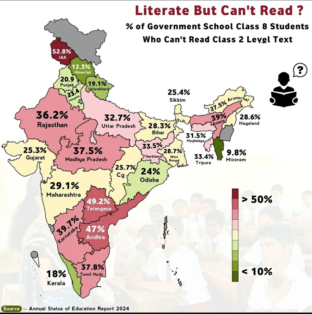
Map of Students Who Can't Read Grade 2 Text in India
This map highlights a critical issue in India's educational landscape: the percentage of students who are unable to read...
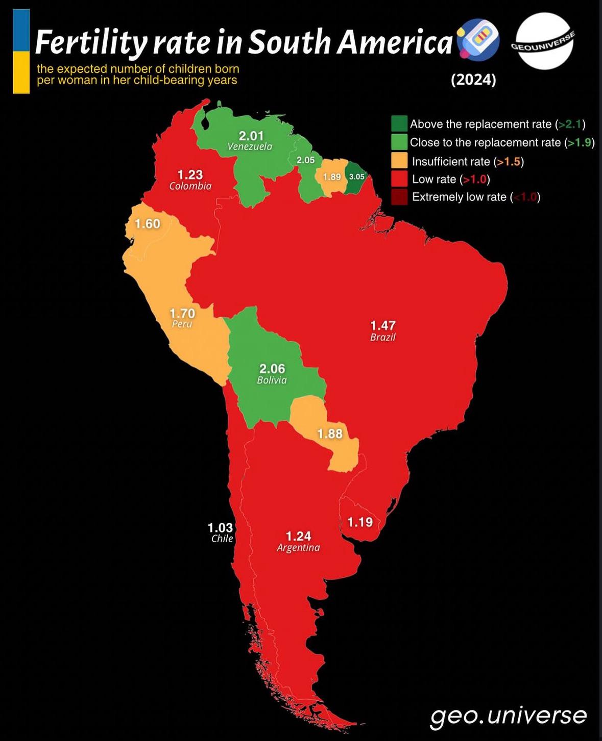
Fertility Rate Map of South America
The "Fertility Rate Map of South America" provides a visual representation of the birth rates across different countries...
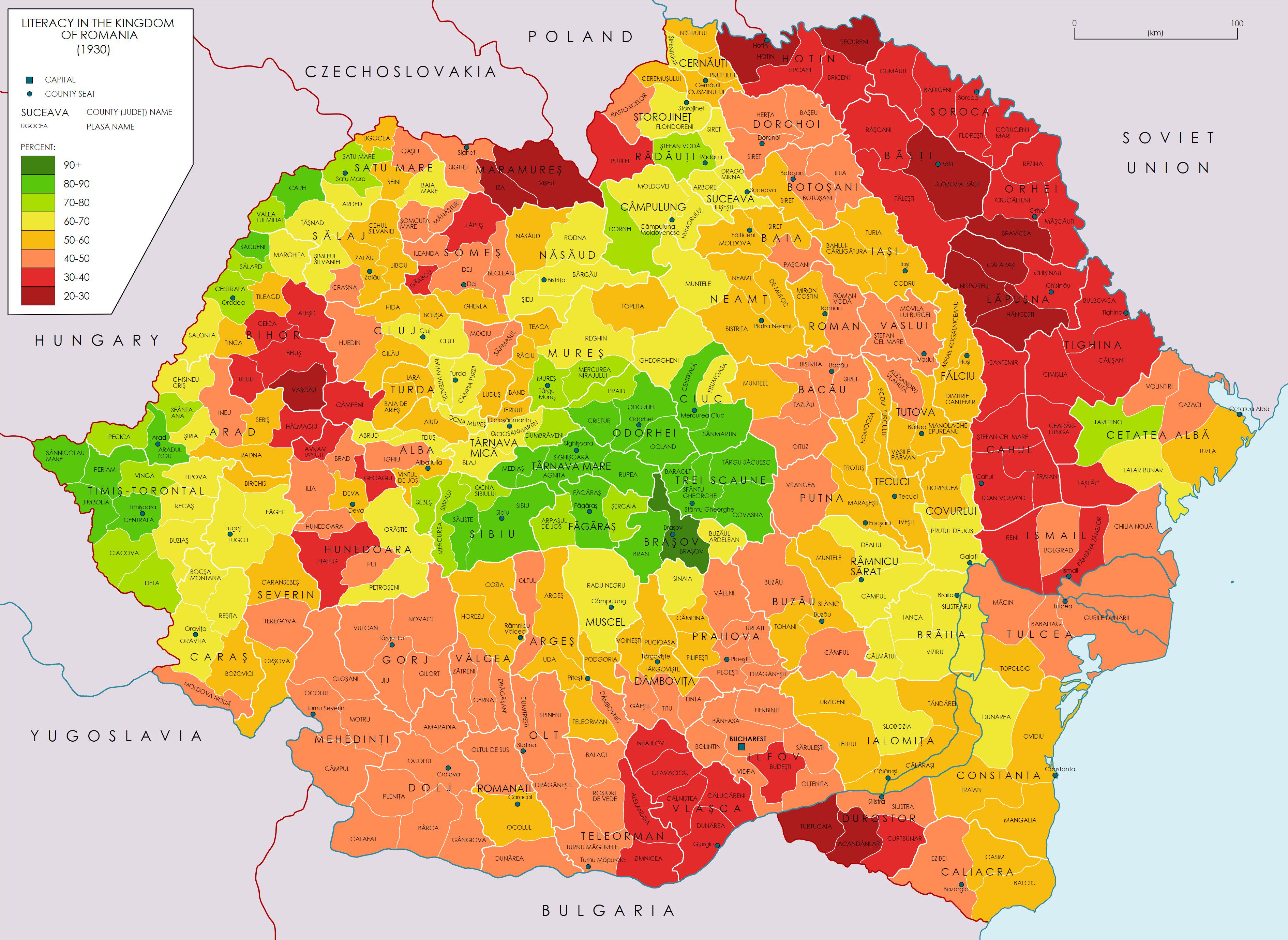
Literacy Rates in Romania 1930 Map
The map titled 'Literacy Rates in the Kingdom of Romania in 1930' provides a visual representation of literacy levels ac...
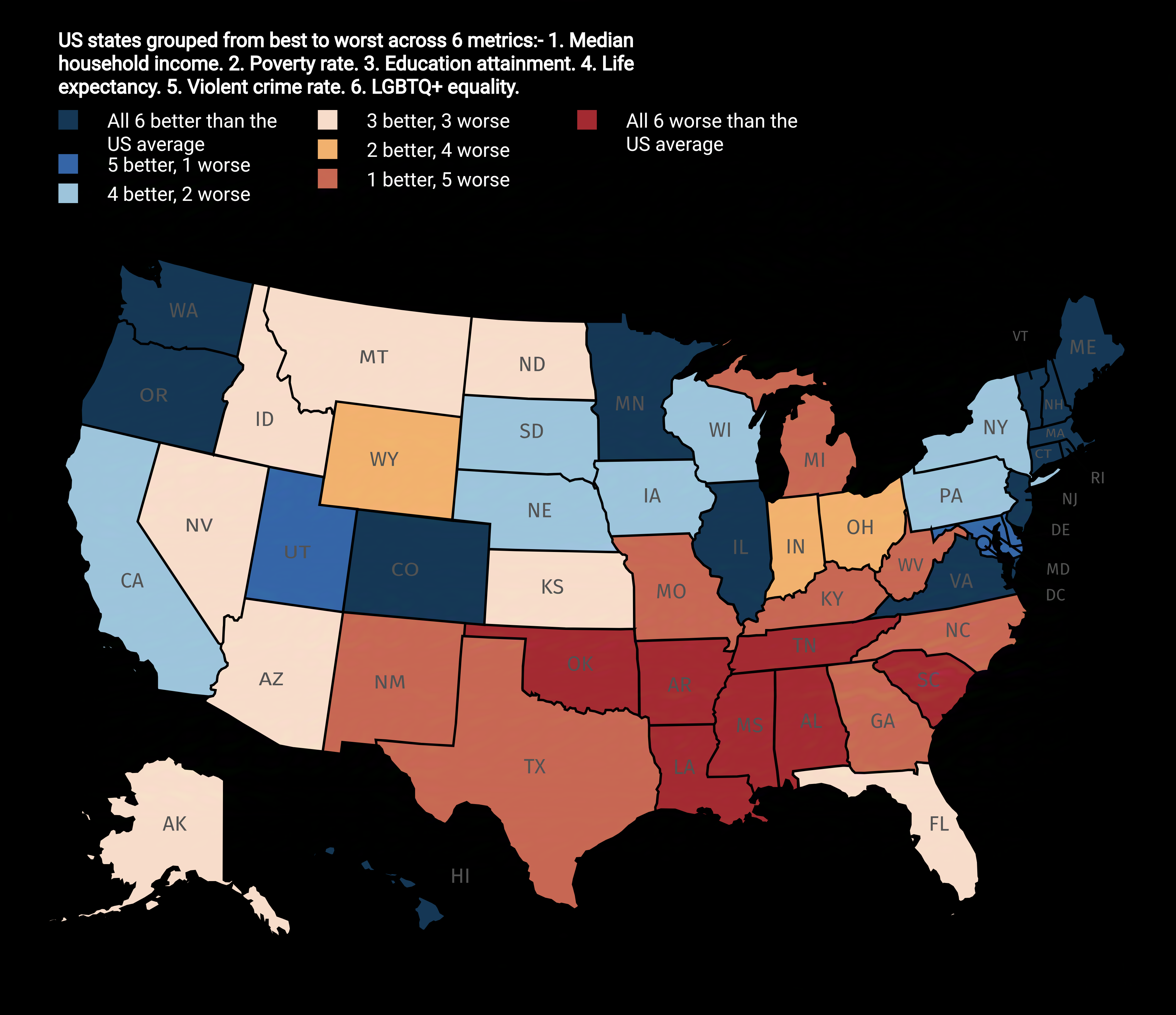
US States Ranked from Best to Worst Map
The "US States Ranked from Best to Worst Map" provides a visual representation of how each state in the United States me...
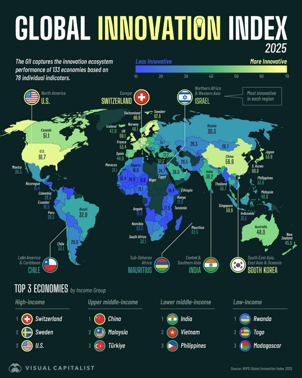
Global Innovation Index in 2025 Map
The "Global Innovation Index in 2025 Map" provides a visual representation of how various countries rank in terms of inn...
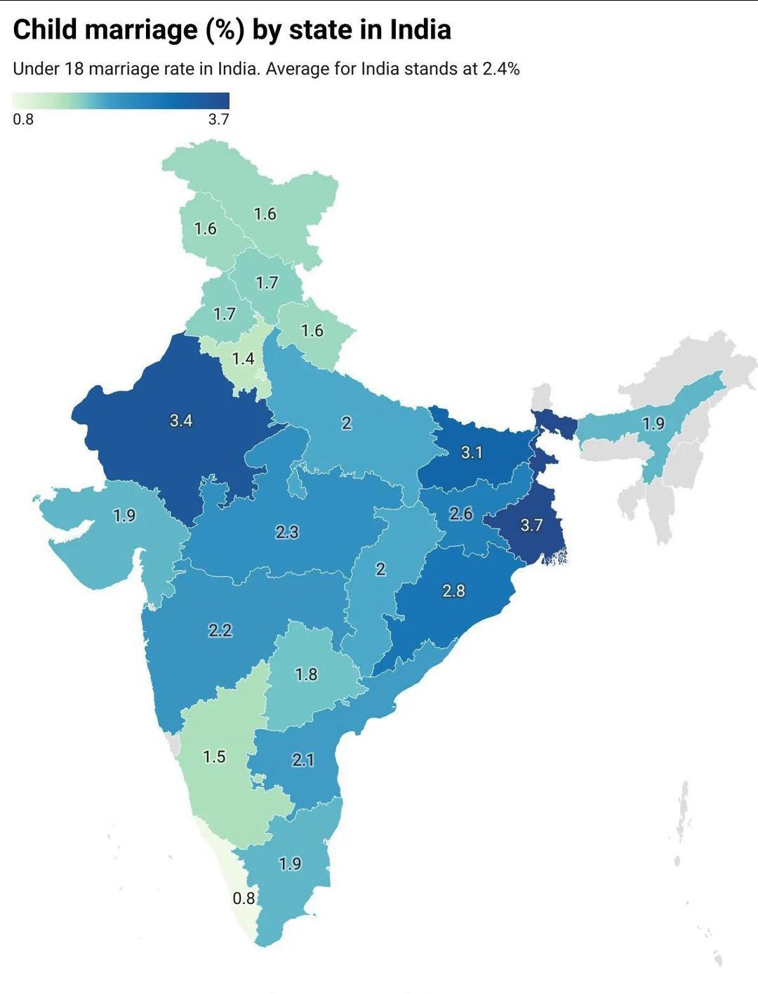
Child Marriage in India Map
...
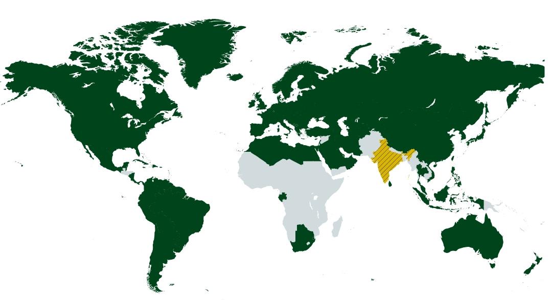
Map of Countries with Higher HDI than Maharashtra
This map visually represents countries that boast a higher Human Development Index (HDI) than Maharashtra, India’s wealt...
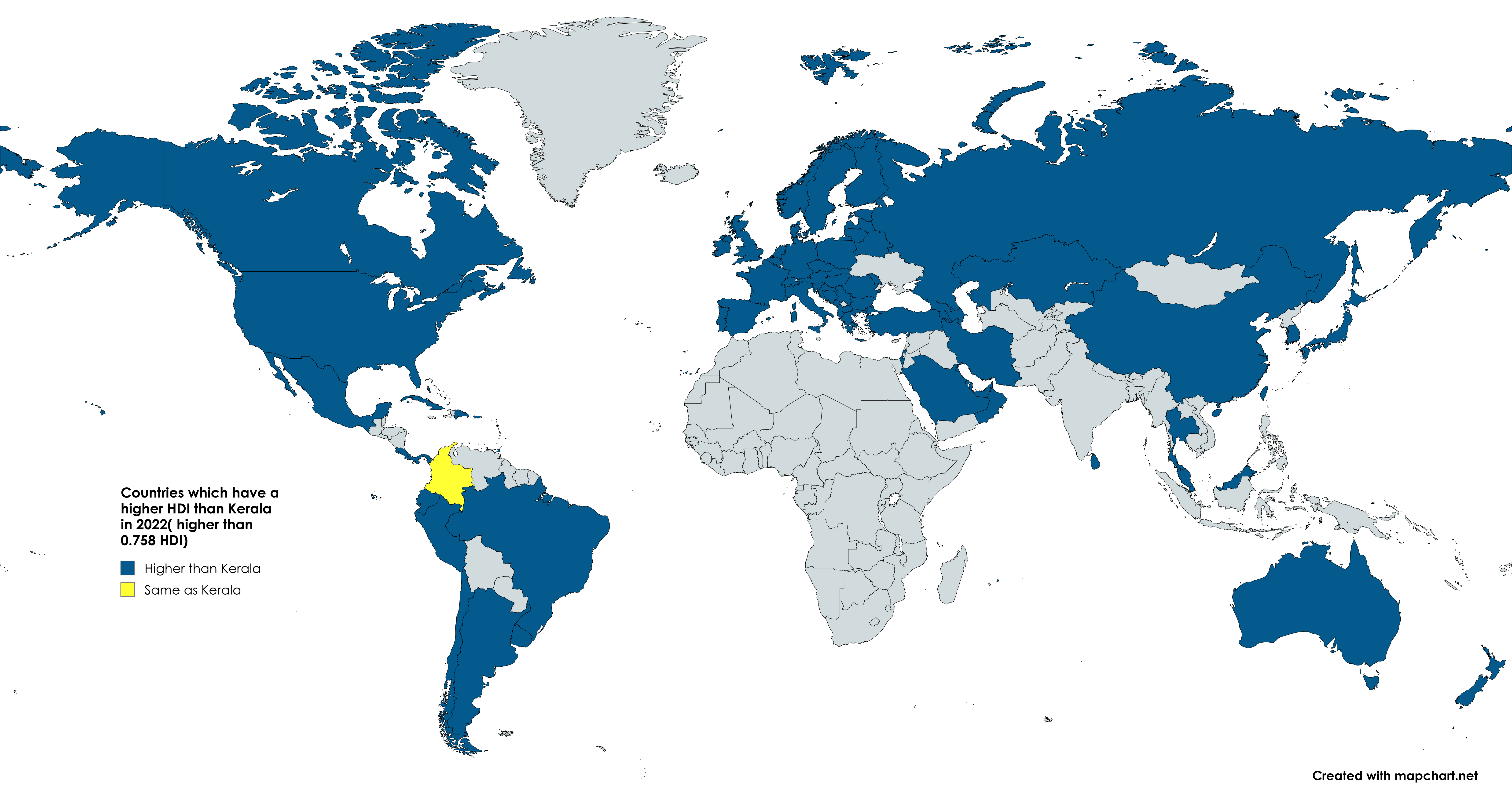
Kerala vs World HDI Map 2022
The map titled "Yesterday there was a post about Bihar. Now we will have the Indian state of Kerala vs the whole world" ...
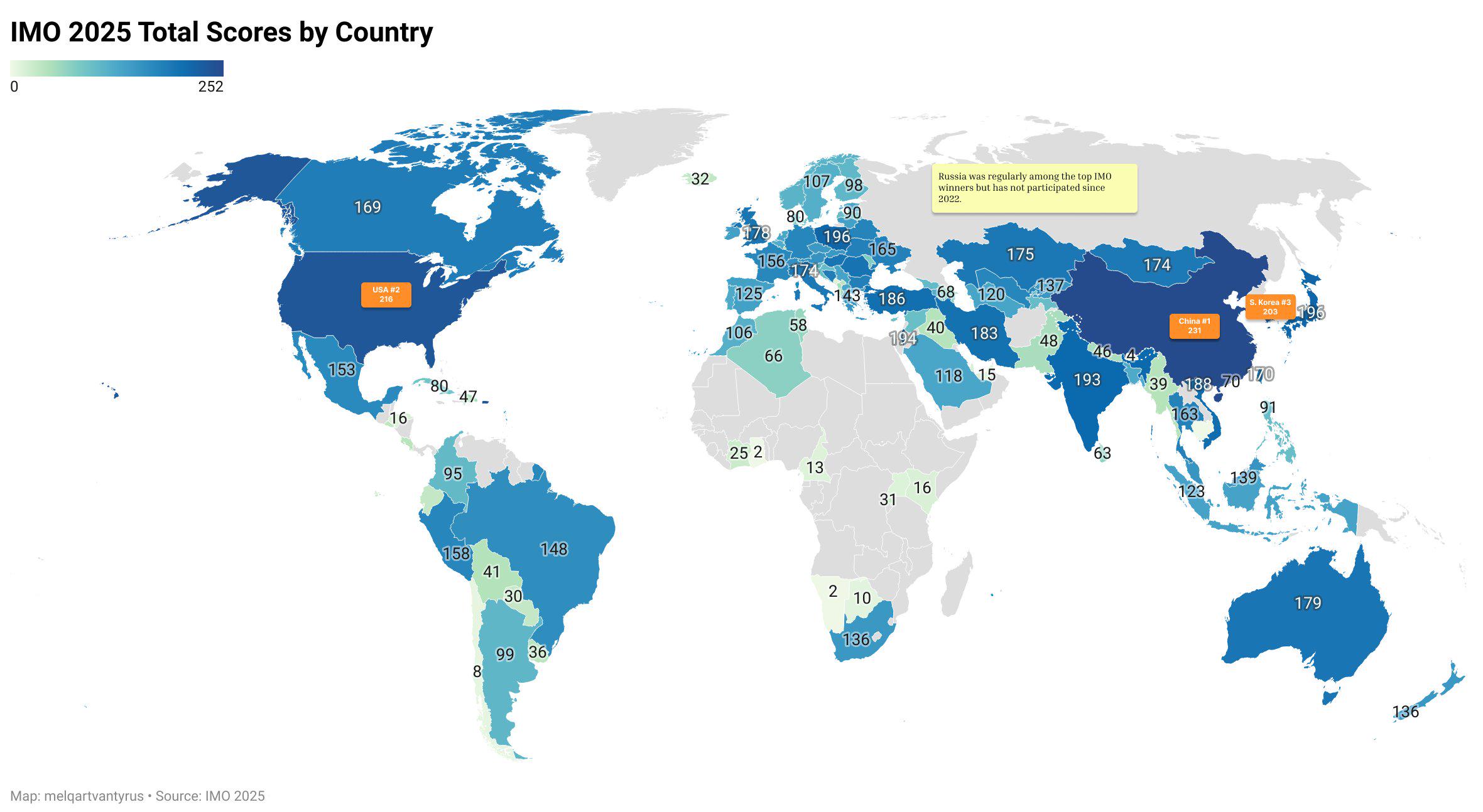
International Mathematical Olympiad 2025 Country Results Map
The "International Mathematical Olympiad 2025 Country Results Map" visually represents the performance of various countr...

Map of U.S. Counties Closing Schools for Jewish Holidays
This map illustrates the U.S. counties where public schools close in observance of Jewish holidays. It provides a visual...
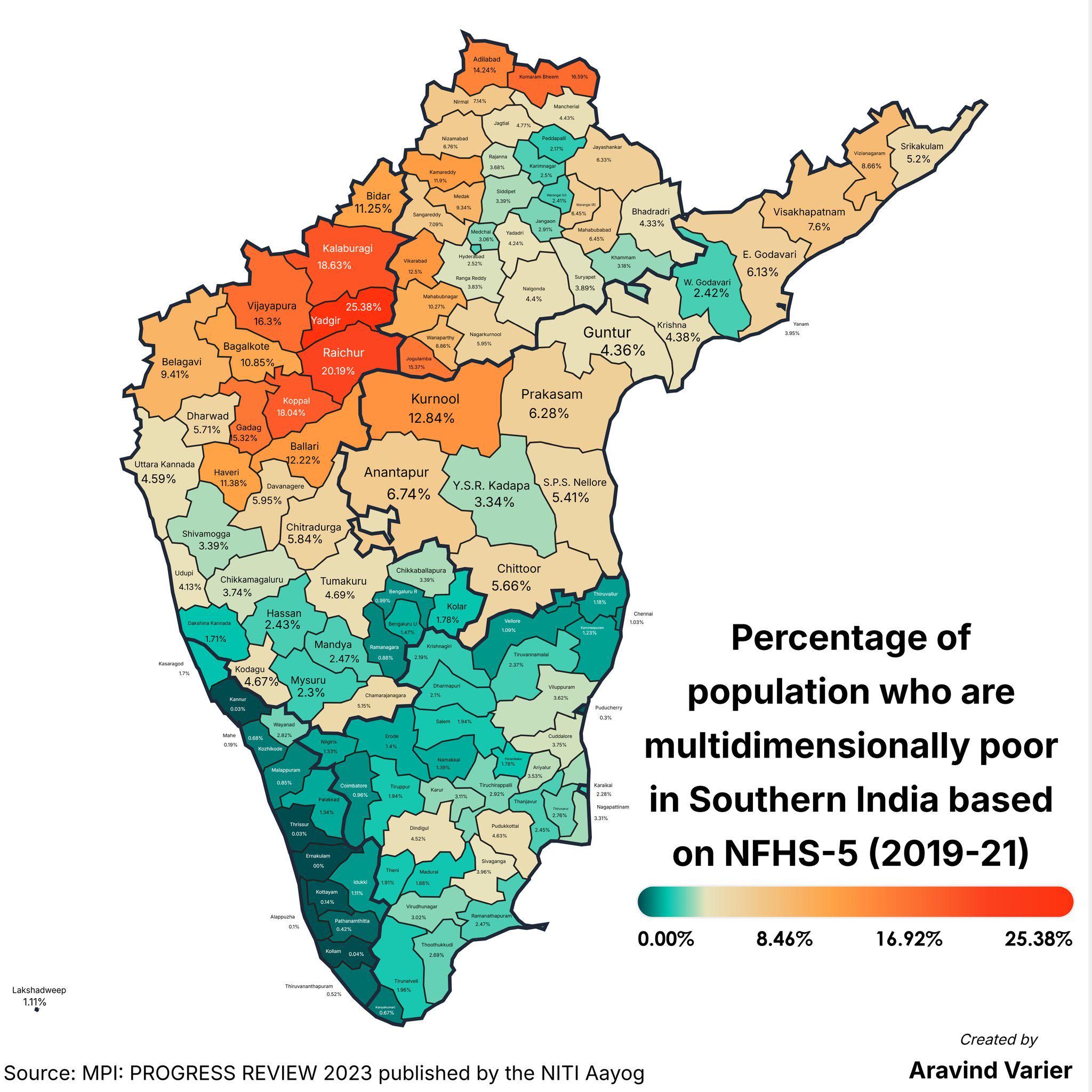
Multidimensional Poverty Percentage Map by District
The "Percentage of People Who Are Multidimensionally Poor (District Wise) Map" provides a detailed breakdown of multidim...
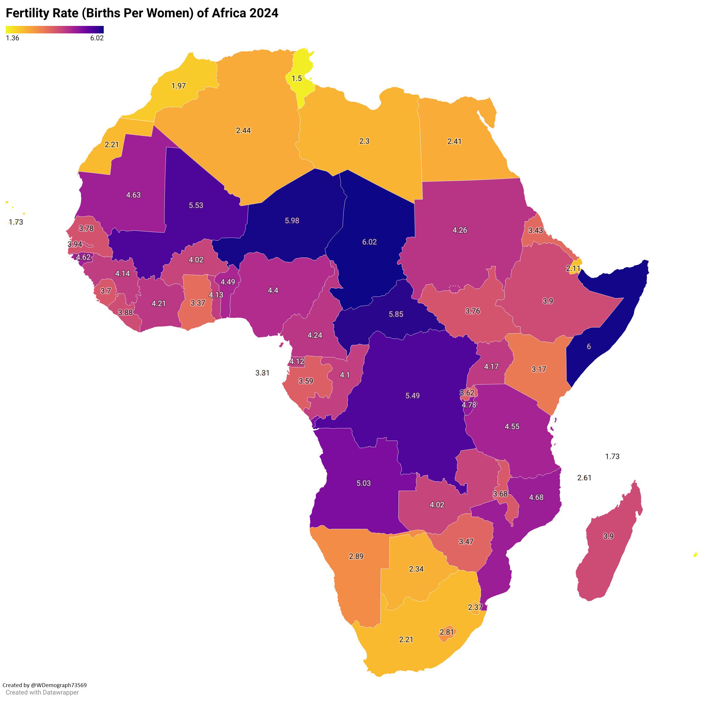
Fertility Rate of Africa 2024 Map
The "Fertility Rate of Africa 2024 Map" provides a comprehensive overview of the average number of children born per wom...
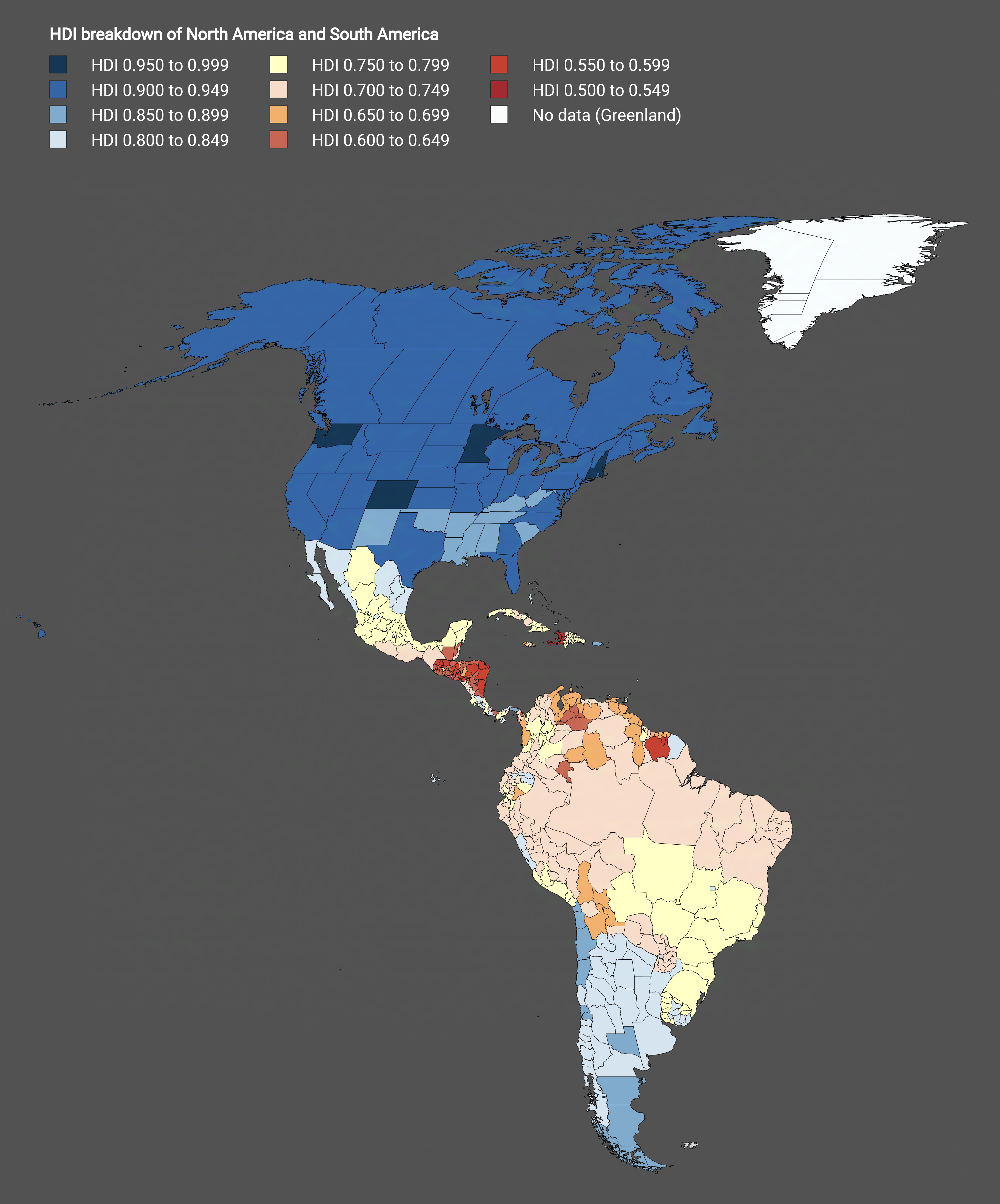
HDI Subdivisions Map of North America and South America
The visualization titled "Subdivisions of North America and South America by HDI" provides a detailed breakdown of Human...
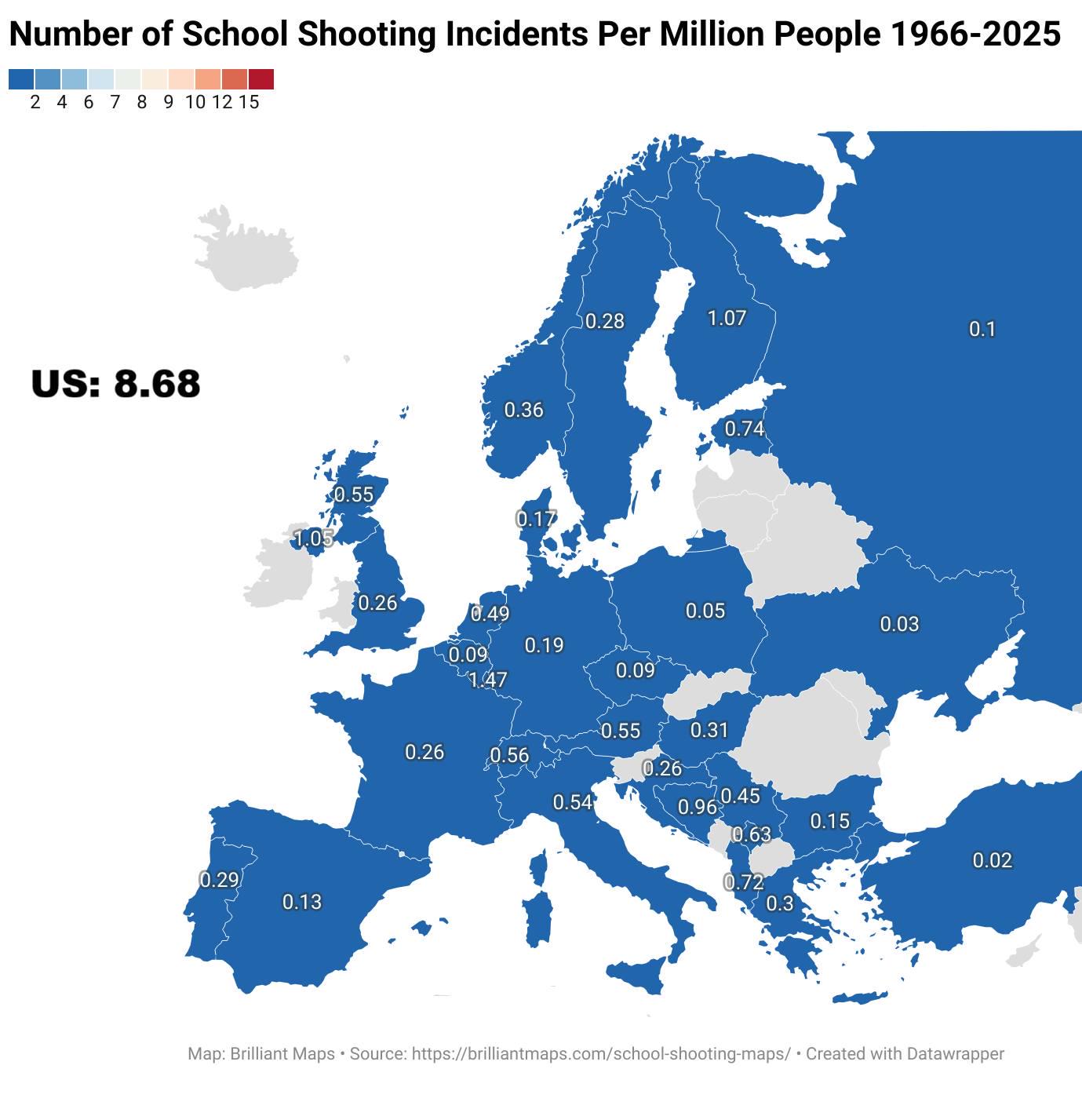
School Shootings Per Million People Map in Europe
The map titled "Number of School Shootings Per Million People By European Country Between 1966 and 2025" provides a star...
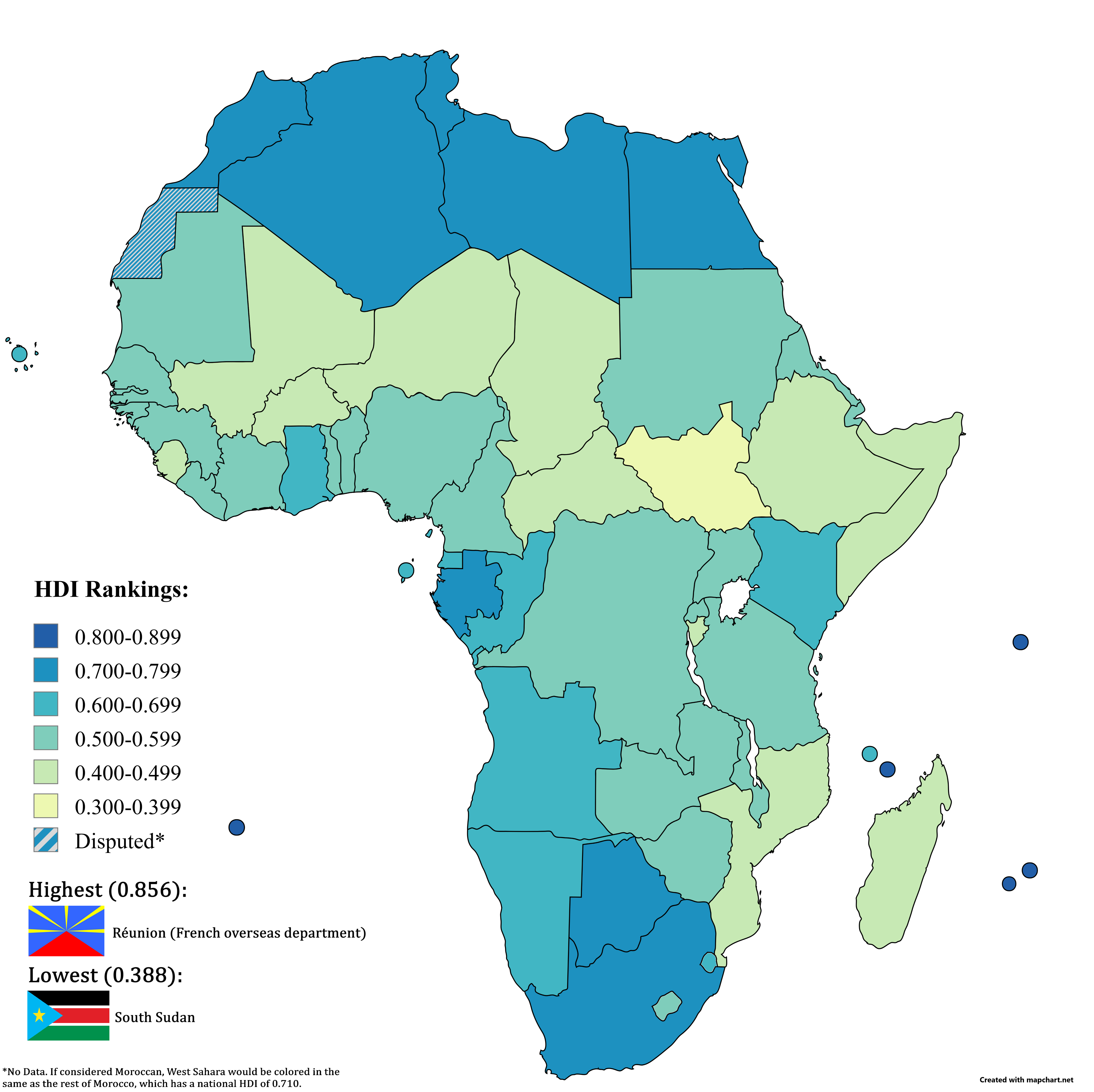
HDI in Africa Map 2023
The "HDI in Africa (2023 Data)" map provides a comprehensive overview of the Human Development Index (HDI) across Africa...
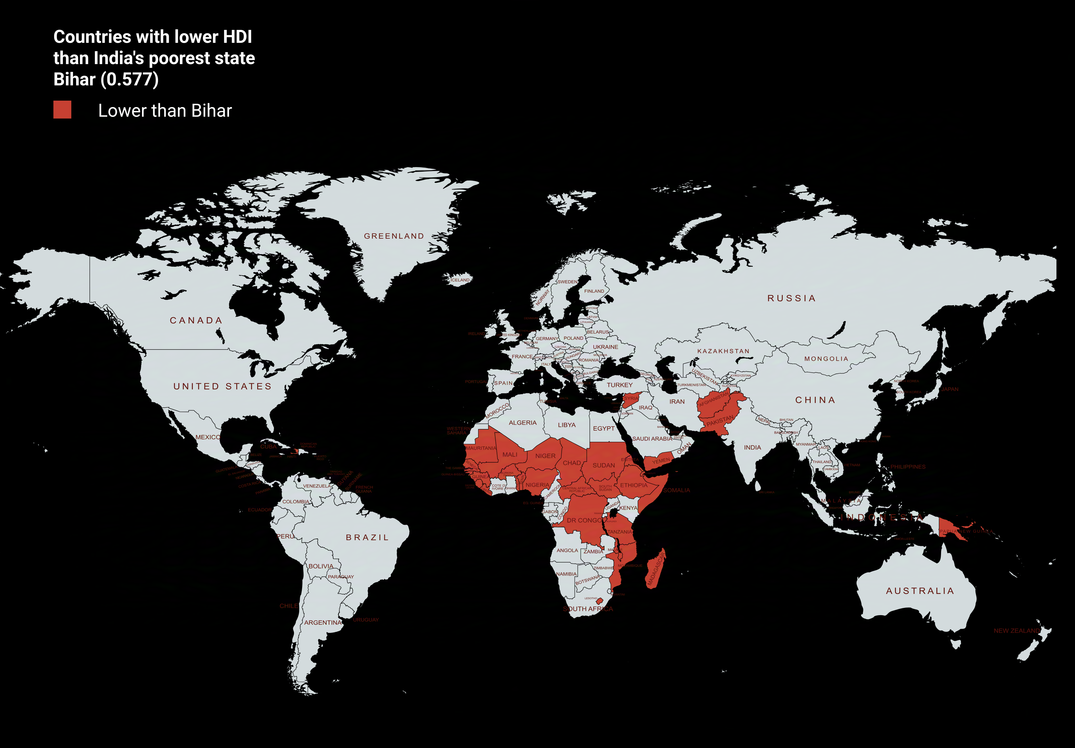
Countries with Lower HDI than Bihar Map
The visualization titled "Countries with Lower HDI than Bihar Map" provides a stark comparison of human development acro...