crop distribution Maps
4 geographic visualizations tagged with "crop distribution"

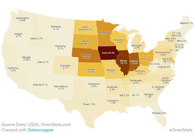
Corn Fields Percentage of Land Area by US State Map
The "Corn Fields as a Percentage of Land Area by US State" map visually represents the proportion of land dedicated to c...
👁 46📅 9/22/2025

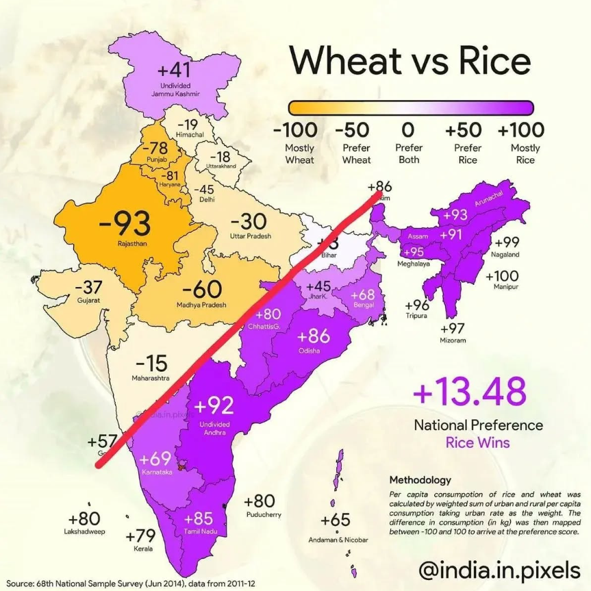
Wheat vs Rice Production Map of India
The "Wheat vs Rice Production Map of India" provides a comparative visual representation of the areas where wheat and ri...
👁 160📅 8/11/2025

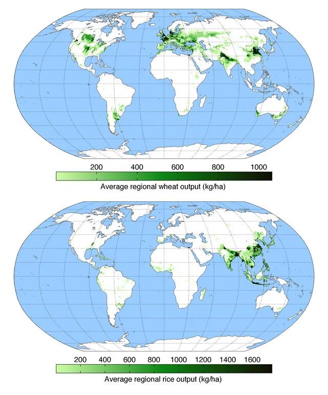
Wheat vs Rice Map: Global Cultivation Areas Map
The "Wheat vs Rice Map: Global Cultivation Areas" illustrates the primary regions around the world where these two stapl...
👁 44📅 9/27/2025

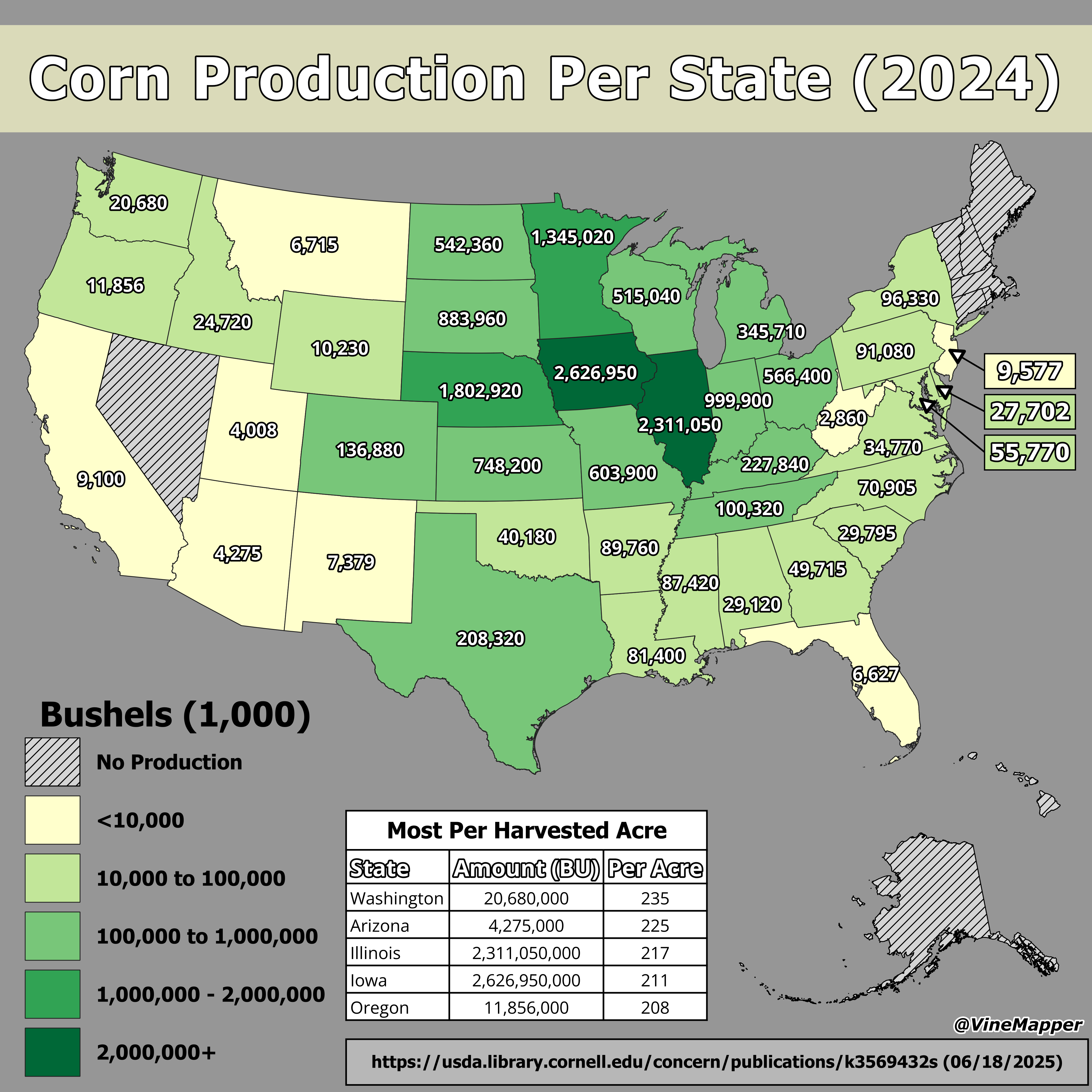
Corn Production Per State Map
This map illustrates the corn production levels across the United States, highlighting which states lead the nation in t...
👁 80📅 8/14/2025