consumer behavior Maps
26 geographic visualizations tagged with "consumer behavior"
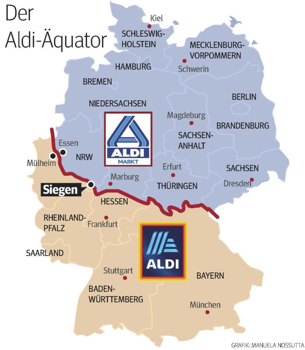
Aldi Equator Map in Germany
The "Aldi Equator in Germany" map visually represents the locations of Aldi grocery stores across Germany, highlighting ...
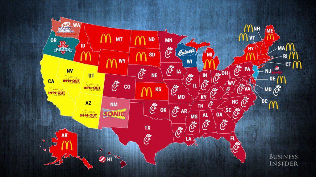
Most Popular Fast Food Chains Across United States Map
The \...
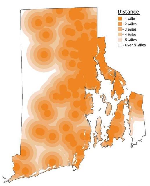
Distance to Farthest Dunkin' Location Map in Rhode Island
The map titled "Distance to Farthest Dunkin' Location in Rhode Island" provides a unique and engaging way to visualize t...
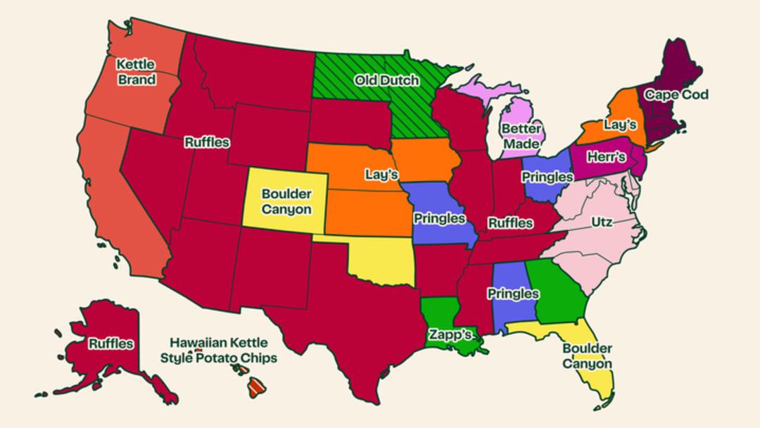
Most Popular Potato Chip Brand by State Map
The \...
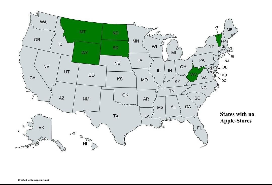
Map of States with No Apple Stores
The visualization titled "States with No Apple Stores" provides a clear geographical representation of the United States...
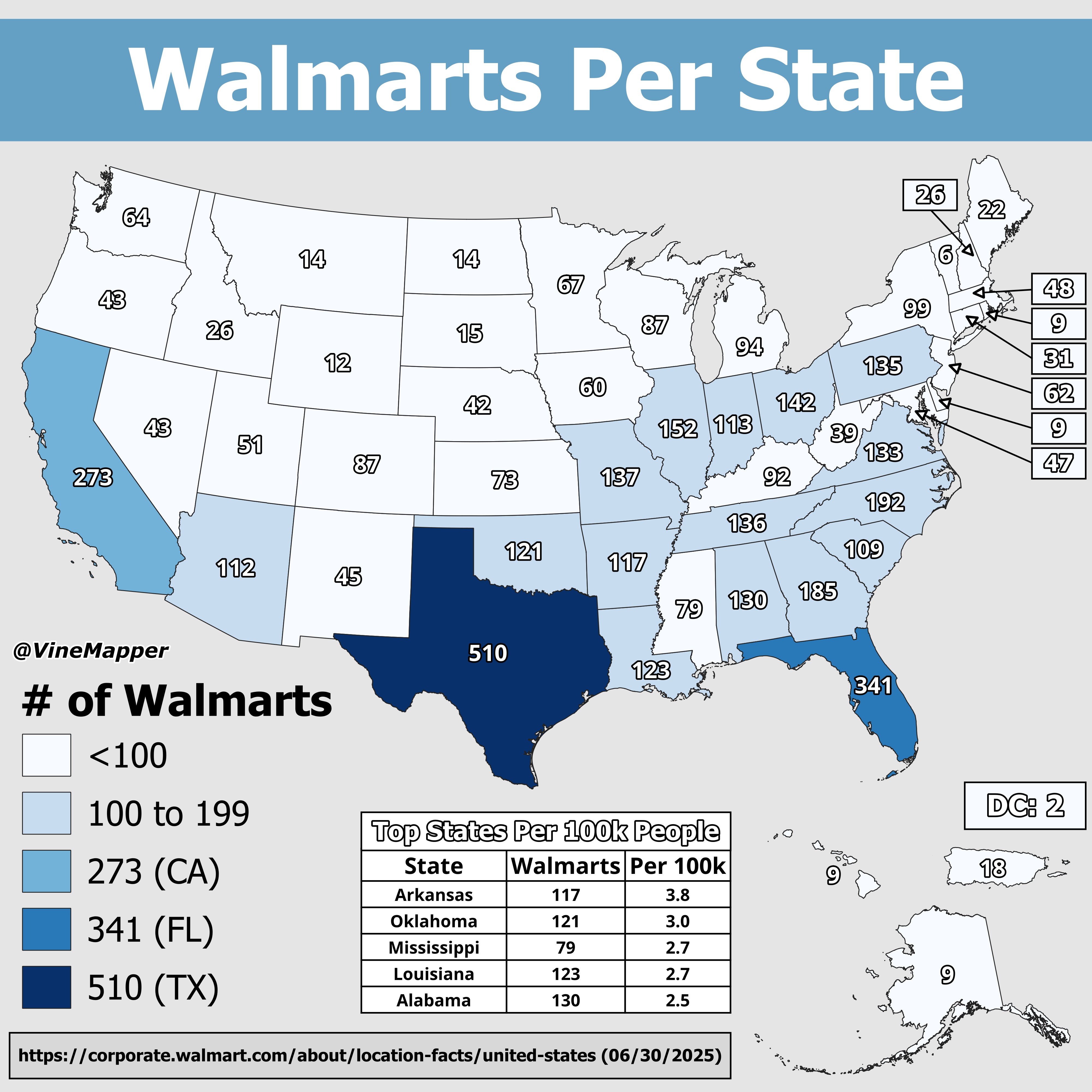
Walmarts Per 100k People Map
The "Walmarts Per 100k People Map" provides a striking visualization of the distribution of Walmart stores across variou...
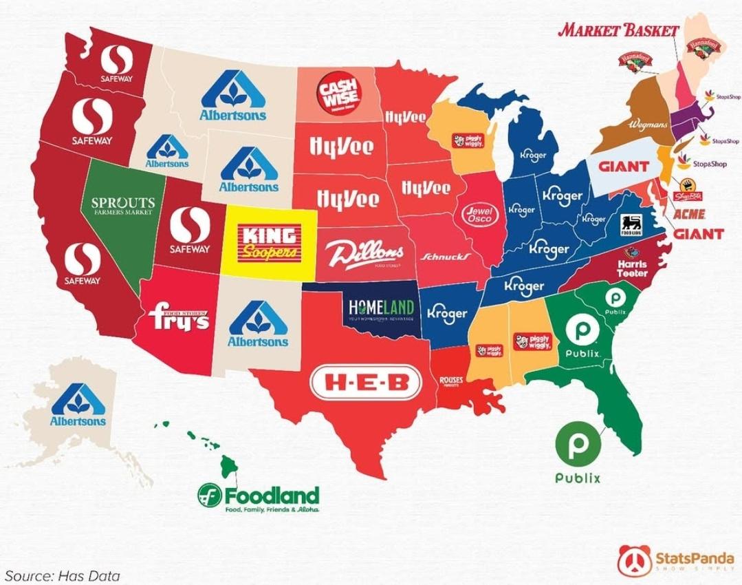
Most Popular Grocery Store by State Map
The "Most Popular Grocery Store by State" map provides a fascinating glimpse into American consumer habits by illustrati...
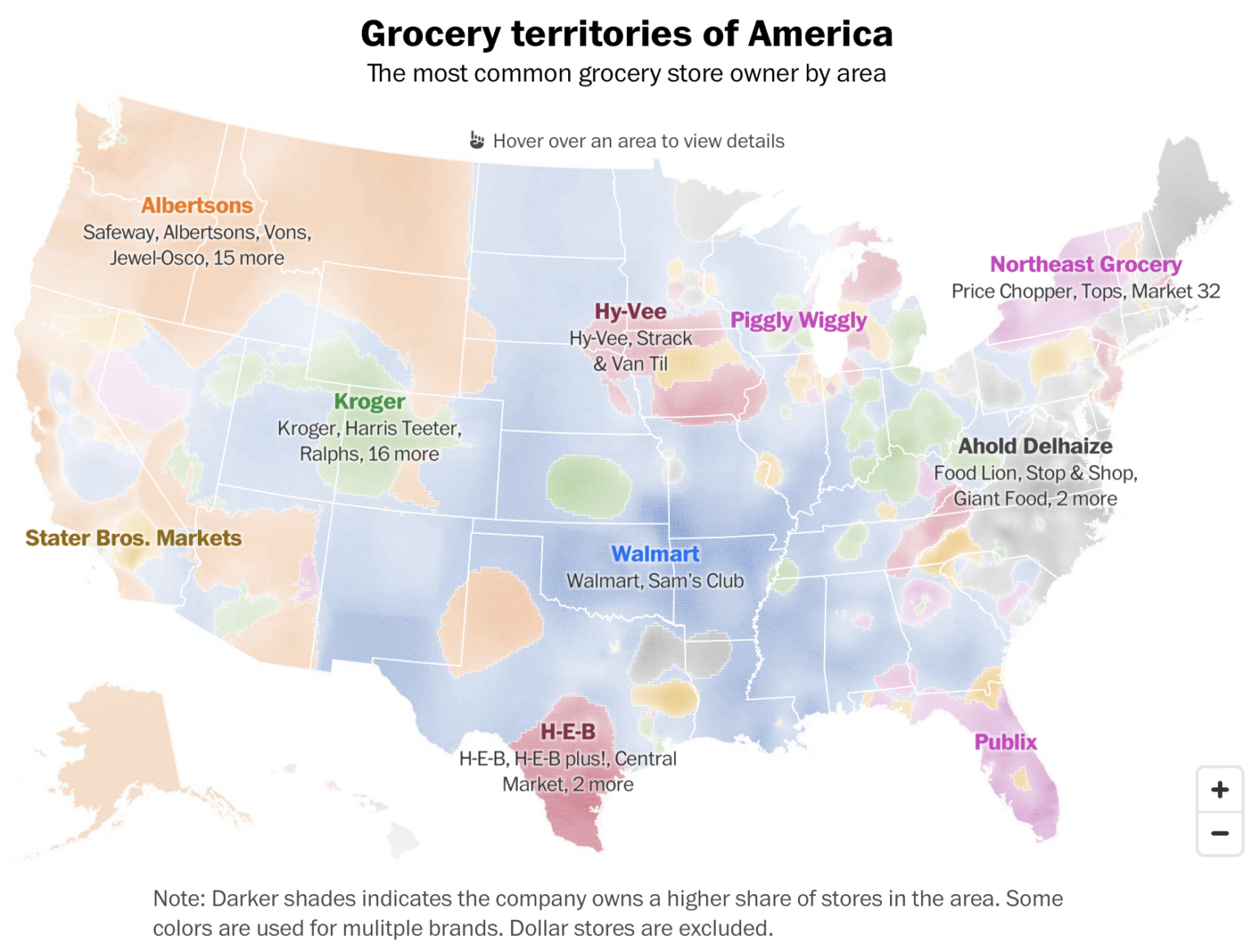
Grocery Store Dominance in the US Map
This visualization provides an insightful look into grocery store dominance across the United States. By illustrating th...
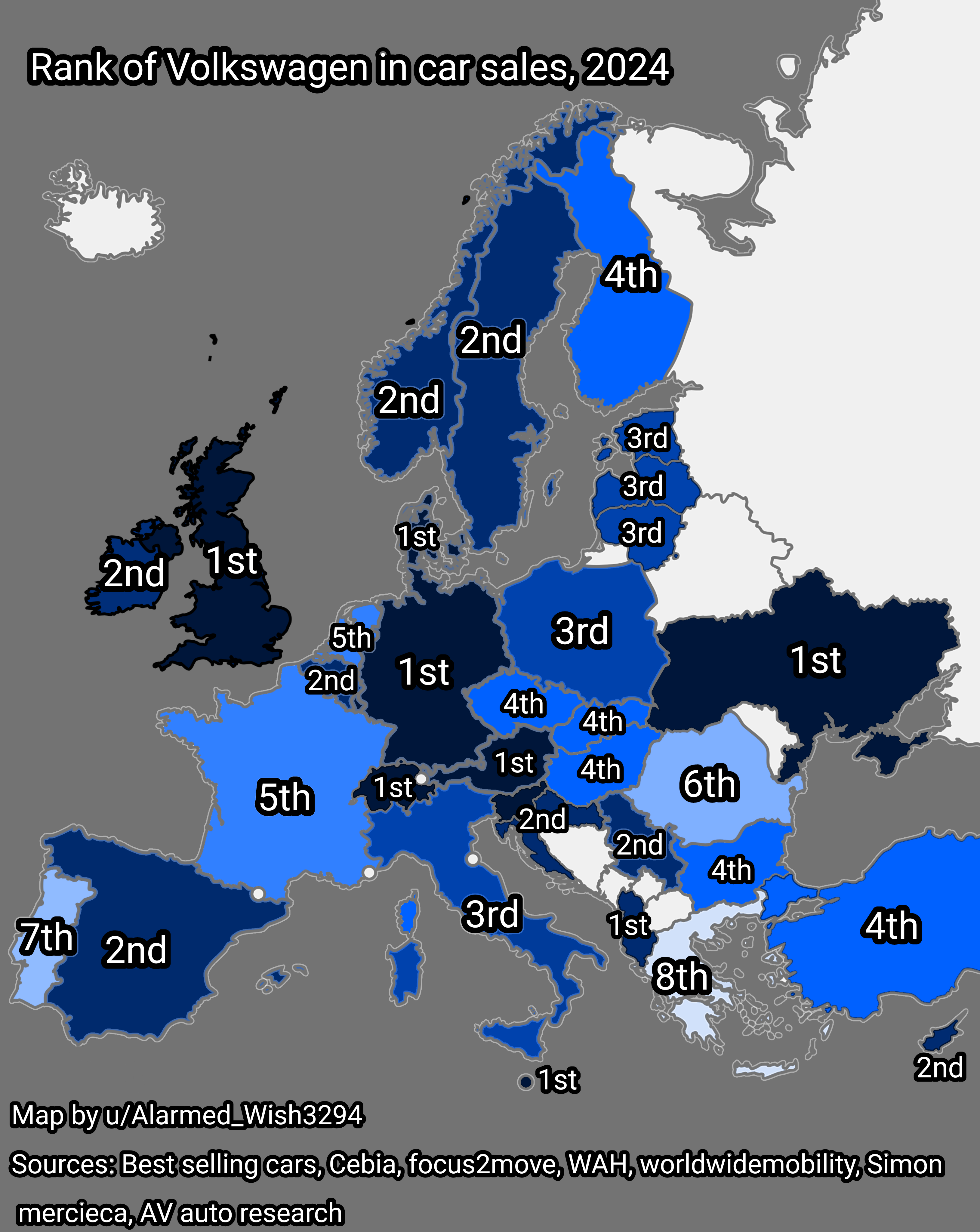
Volkswagen Car Sales Rank Map in Europe 2024
The visualization titled "Rank of Volkswagen in Car Sales, Europe, 2024" provides a clear representation of Volkswagen's...
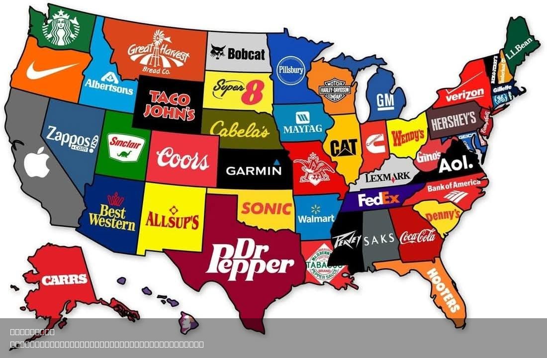
Famous Brands by State Map
In contrast, consider the state of New York, where you can find the iconic Coca-Cola brand, which, while not originally ...
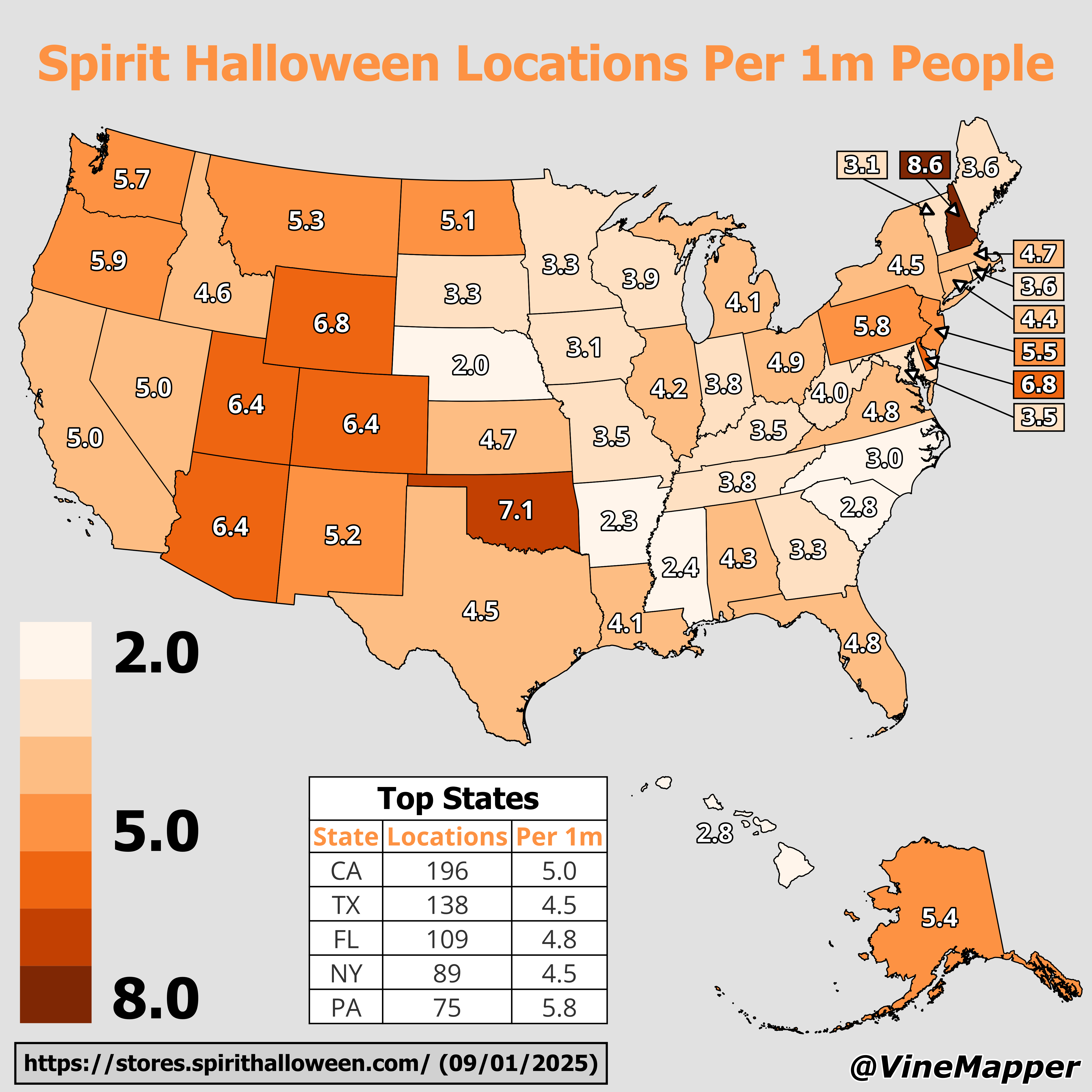
Spirit Halloween Locations Per 1 Million People Map
This map provides a visual representation of the distribution of Spirit Halloween locations across the United States, ad...
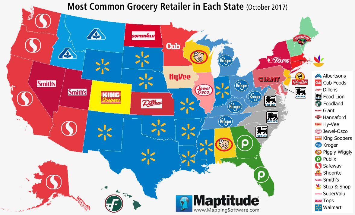
Most Common United States Grocery Chain Per State Map
The \...
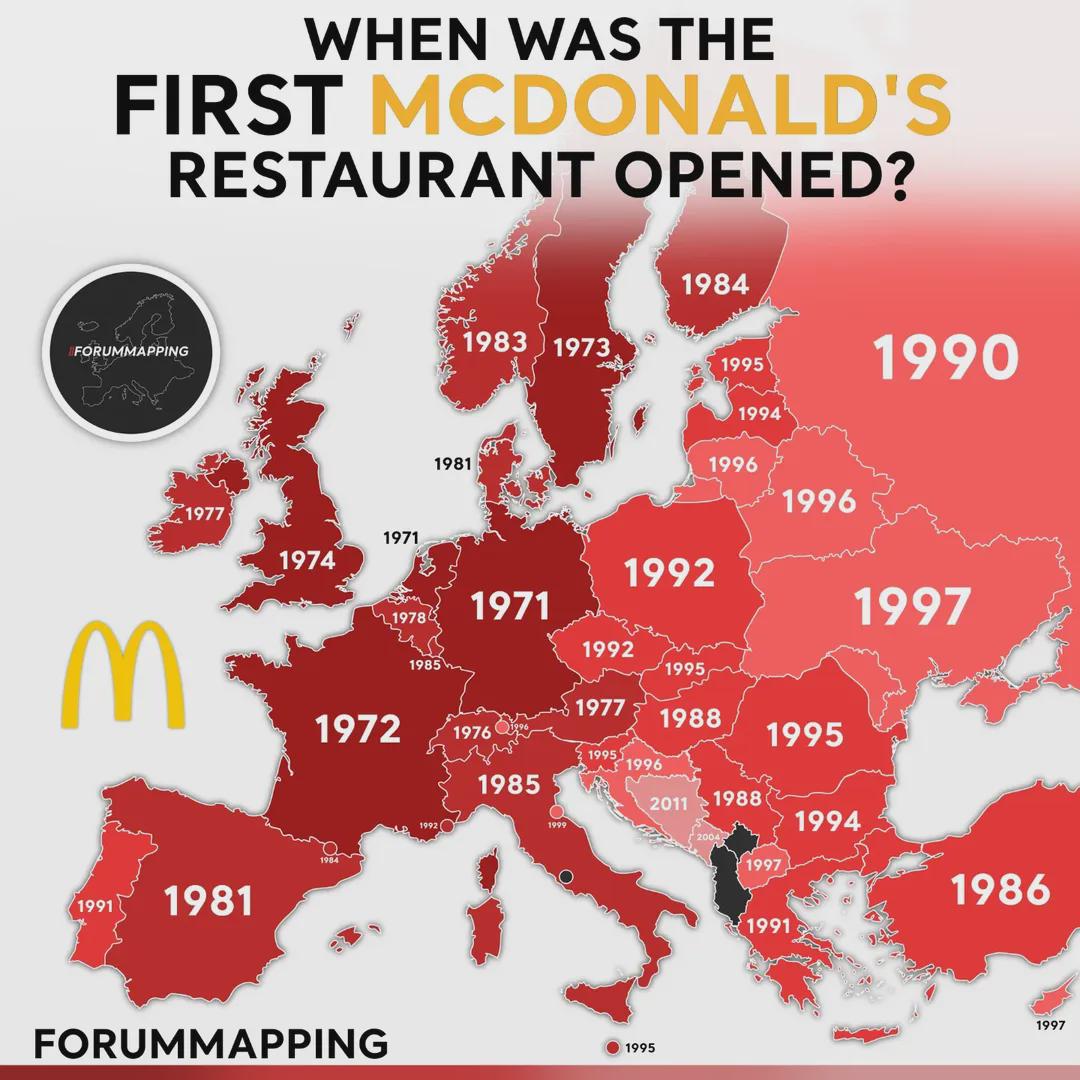
First McDonald's Restaurant Opening Dates Map in Europe
This visualization provides a comprehensive overview of when the first McDonald's restaurants opened in various European...
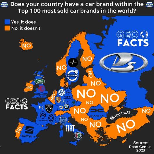
Car Brands in the Top 100 Map
Interestingly, the countries with established automotive sectors, such as Japan, Germany, and the United States, dominat...
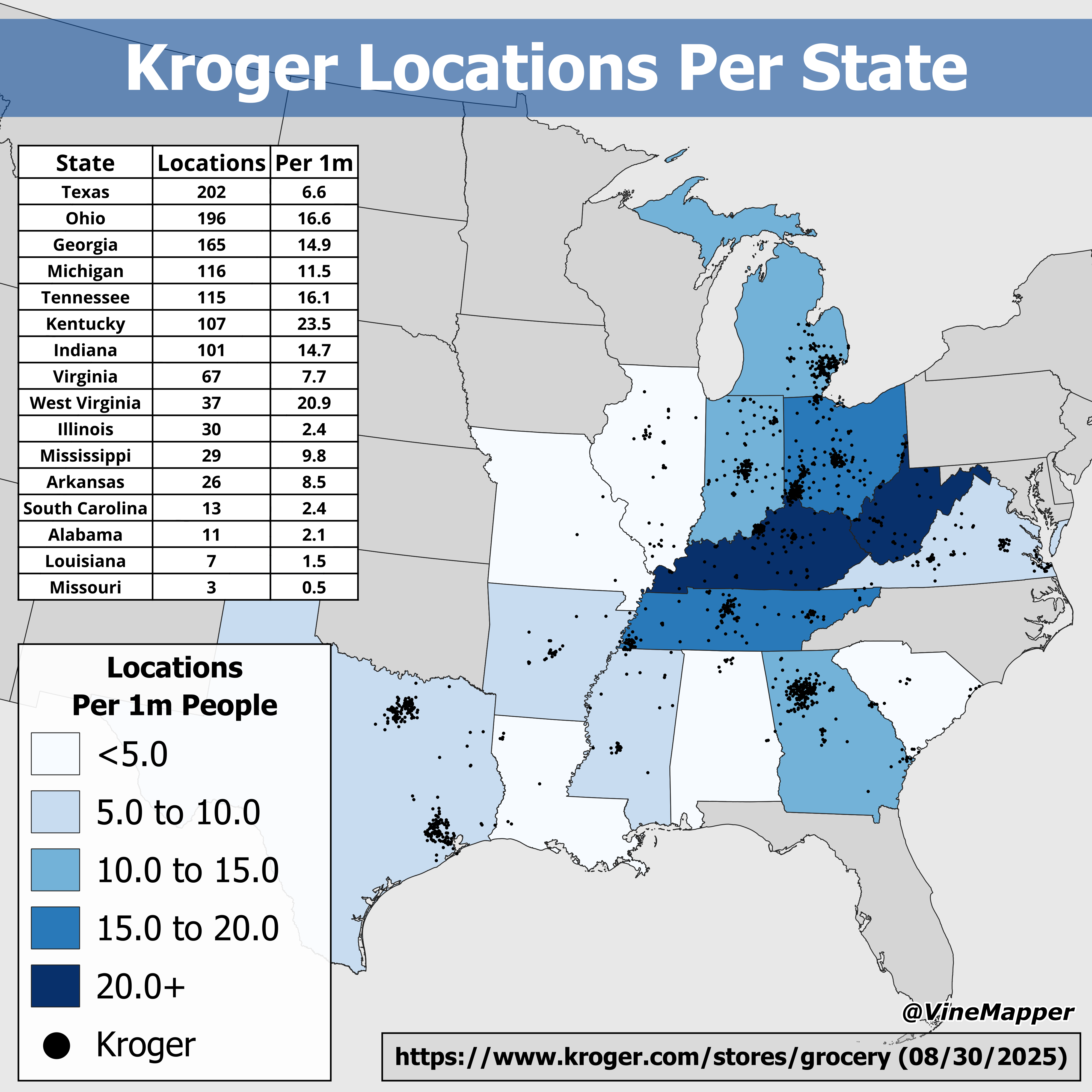
Kroger Locations Per State Map
The "Kroger Locations Per State Map" provides a comprehensive visual representation of where Kroger grocery stores are s...
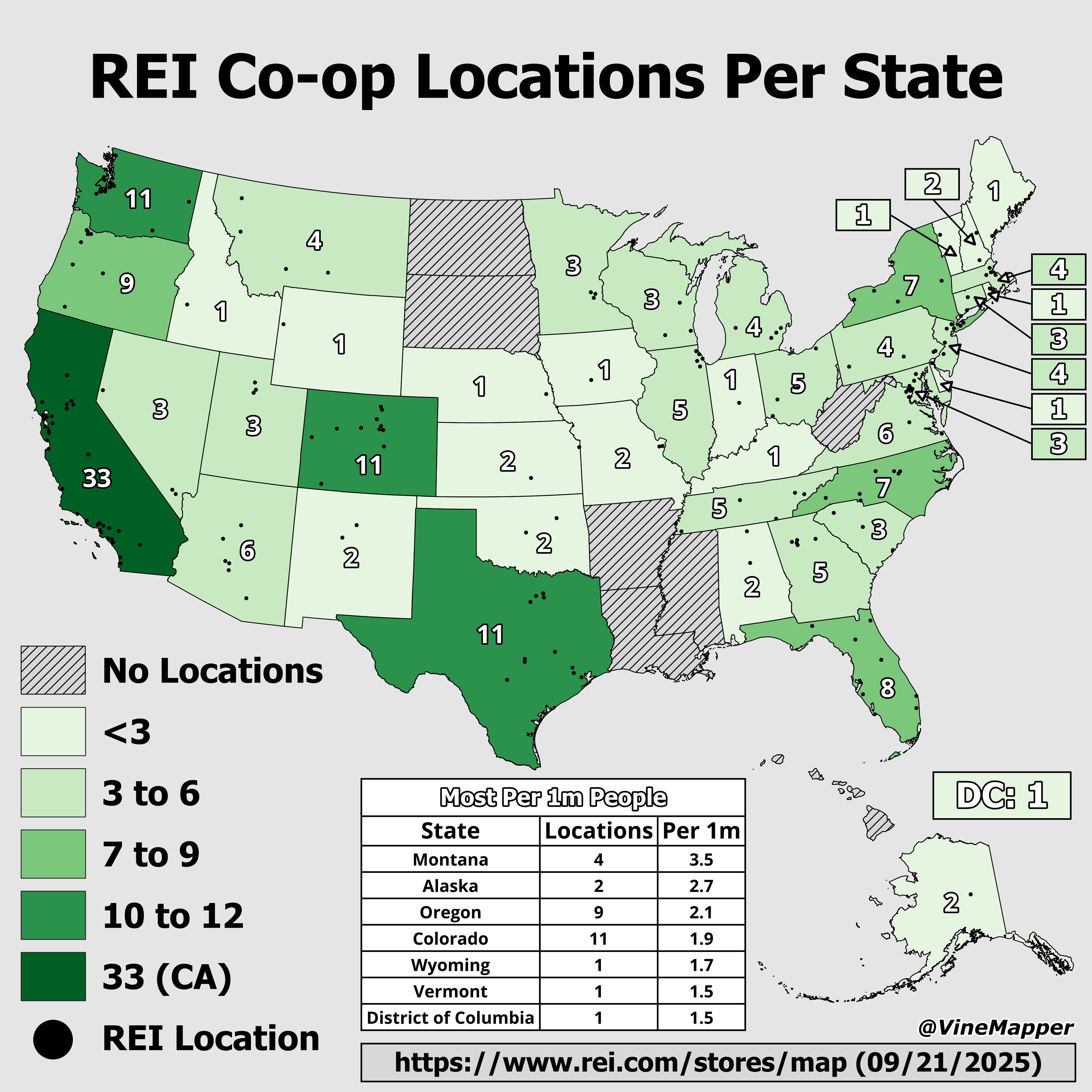
REI Co-op Locations by State Map
The "REI Co-op Locations by State Map" provides a clear visual representation of the distribution of REI retail location...
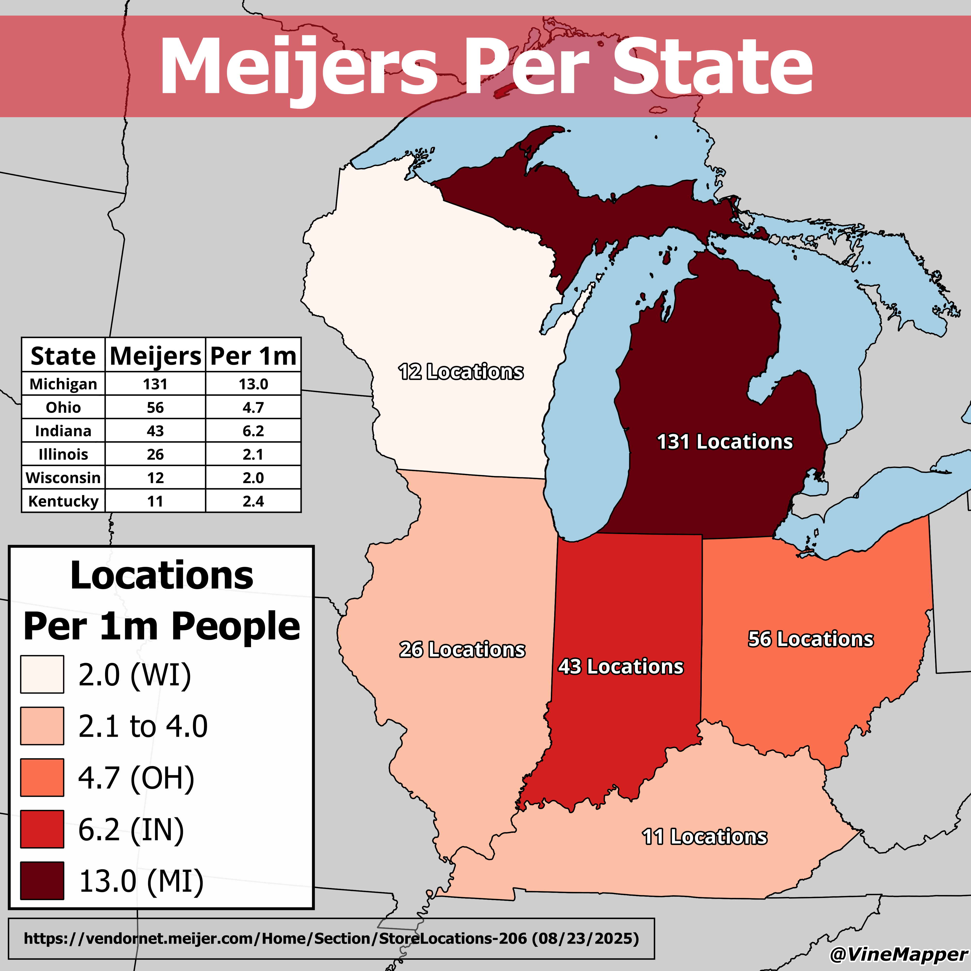
Meijers Per State Map
The \...
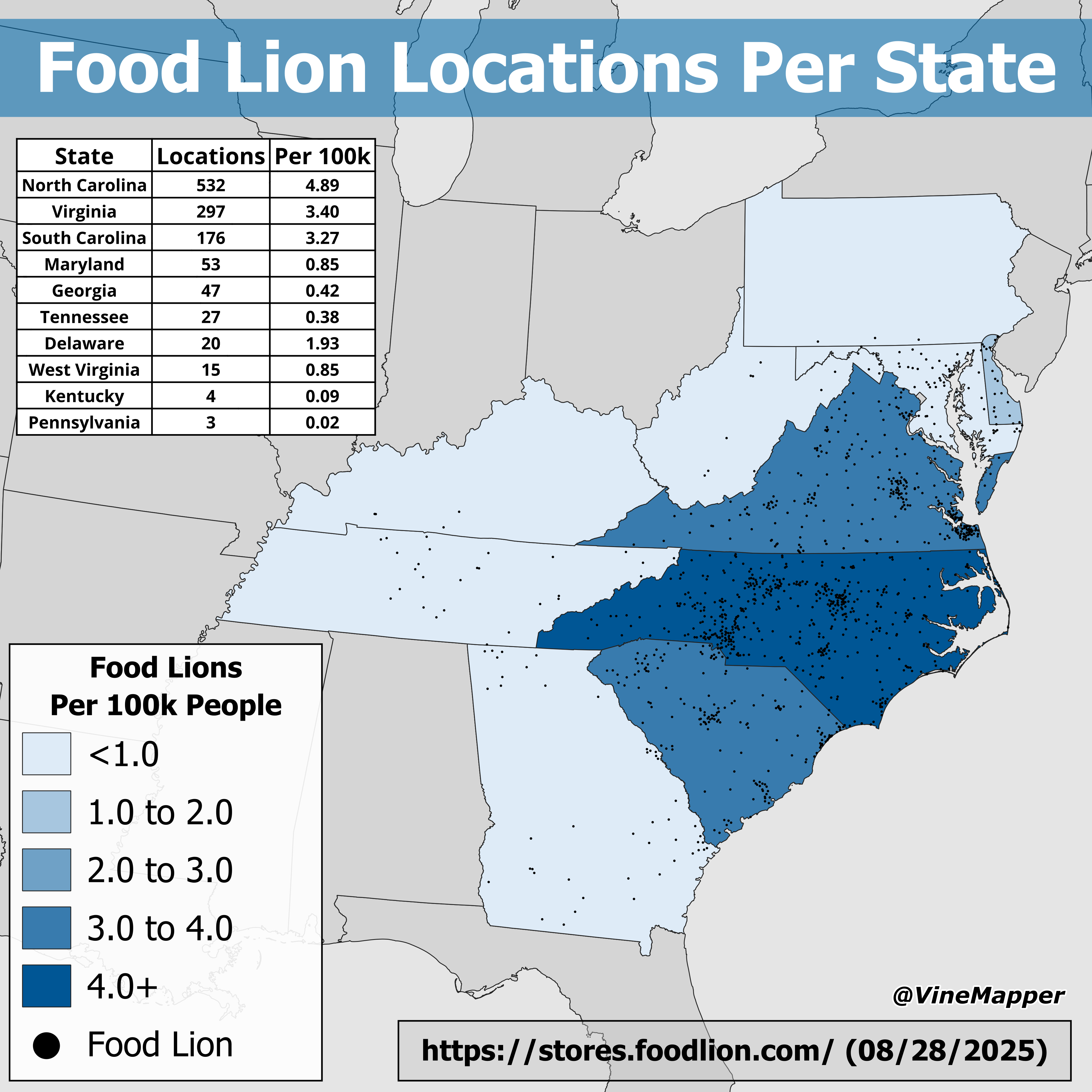
Food Lion Locations Per State Map
The "Food Lion Locations Per State Map" provides a comprehensive overview of the distribution of Food Lion grocery store...
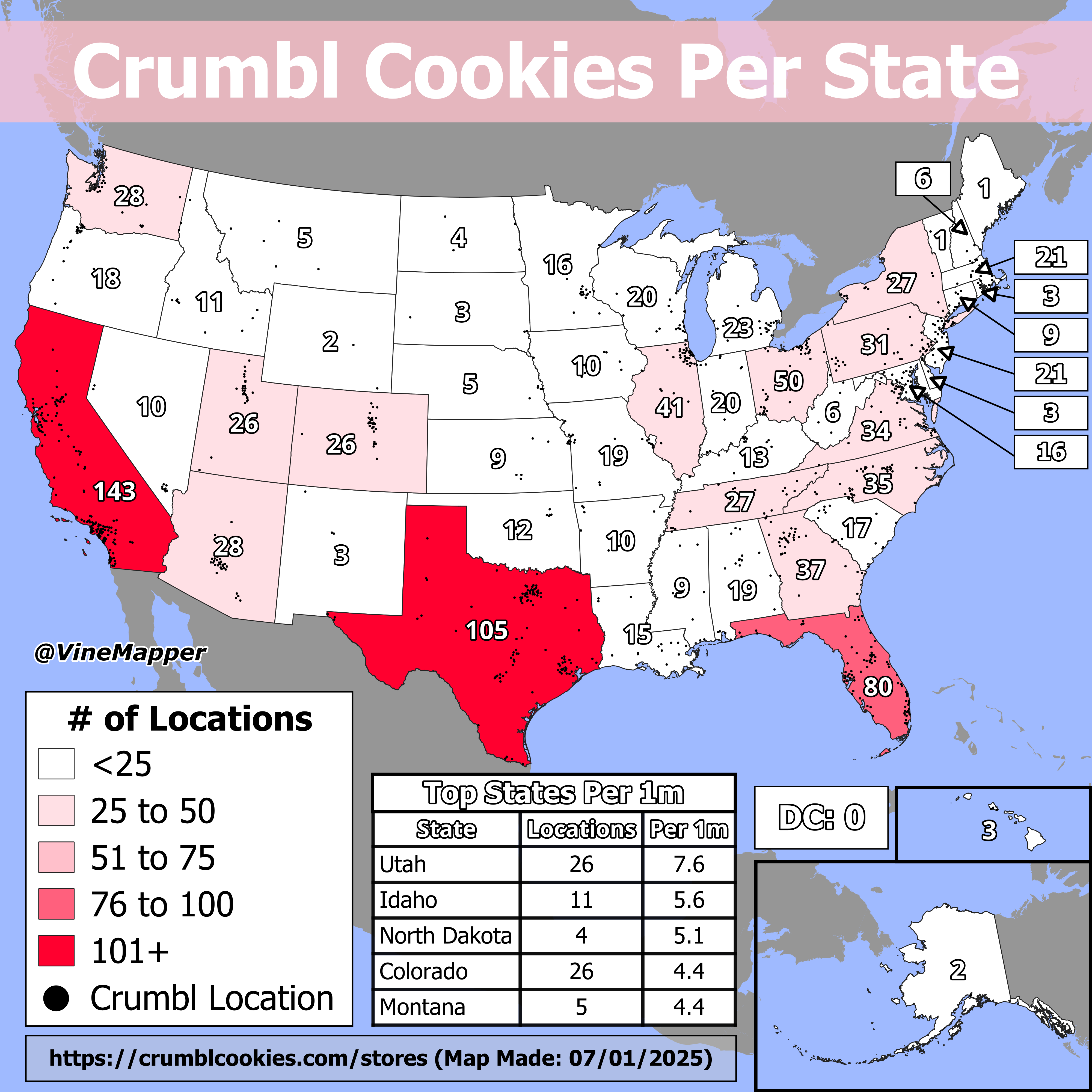
Crumbl Cookies Per State Map
The "Crumbl Cookies Per State Map" provides an intriguing visualization of the distribution of Crumbl Cookies locations ...
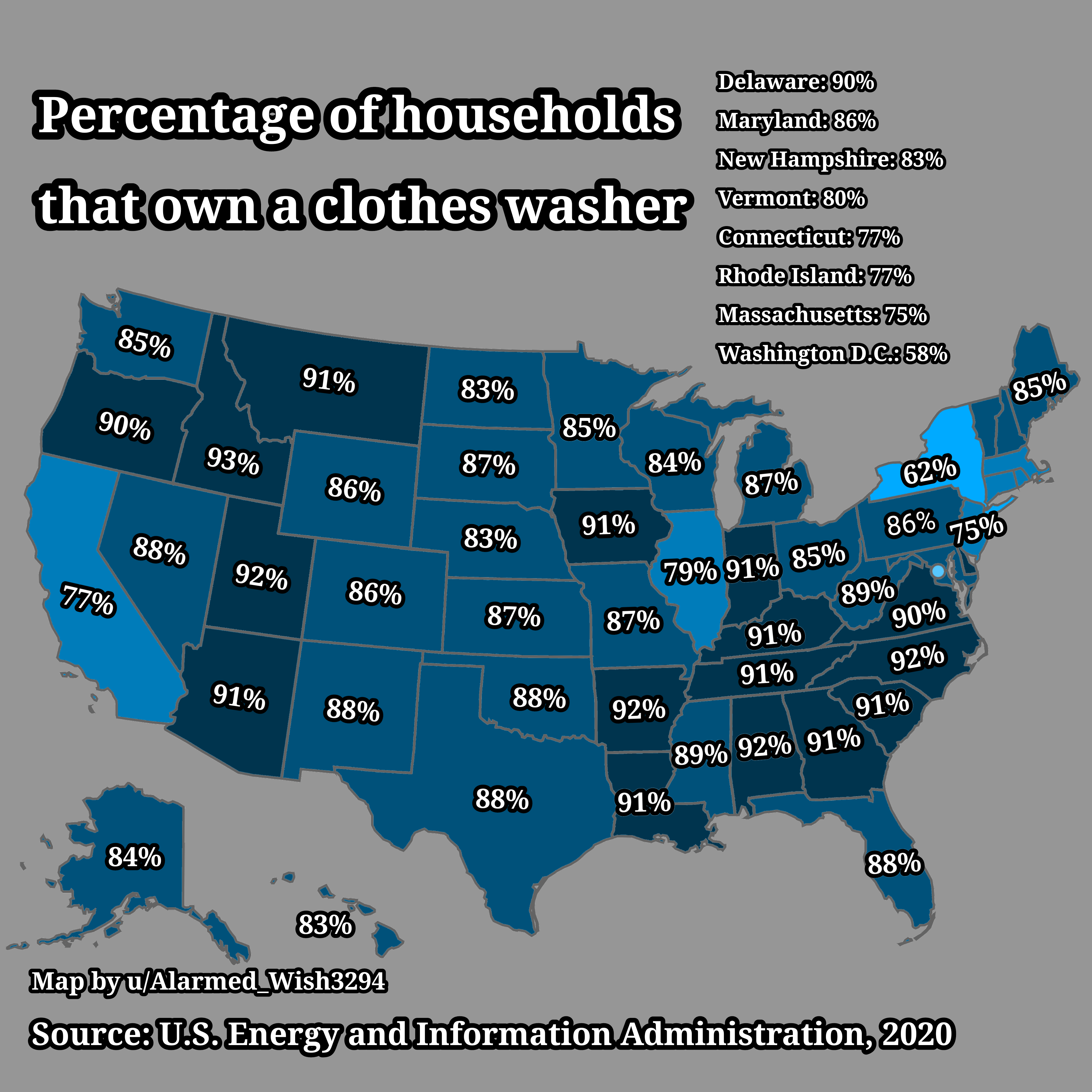
Clothes Washer Ownership Percentage Map in USA
Interestingly, the ownership of clothes washers can also be seen as a marker of technological adoption in households. Re...
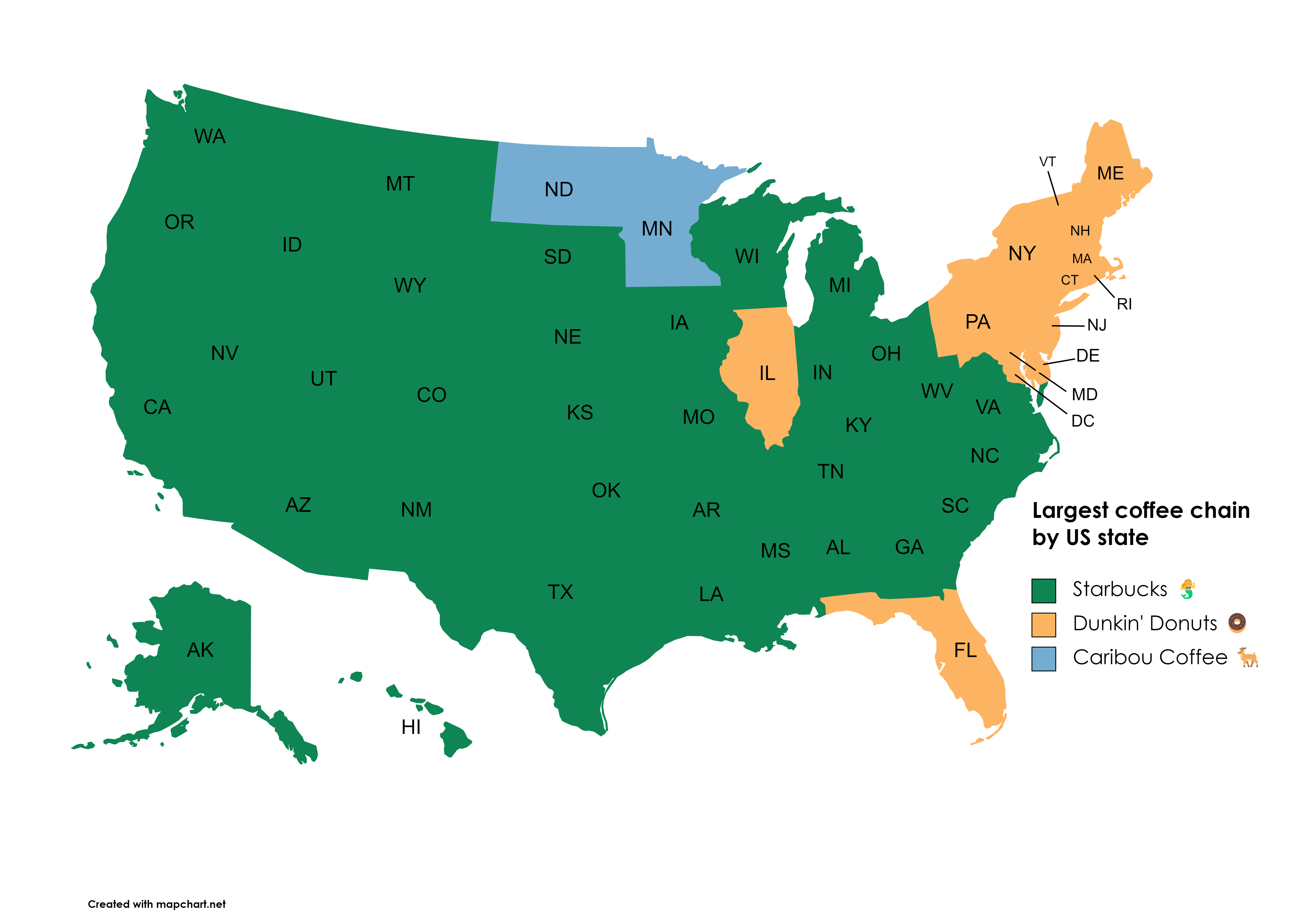
Largest Coffee Chains in the USA Map
This map illustrates the distribution and prevalence of the largest coffee chains across the United States. It highlight...
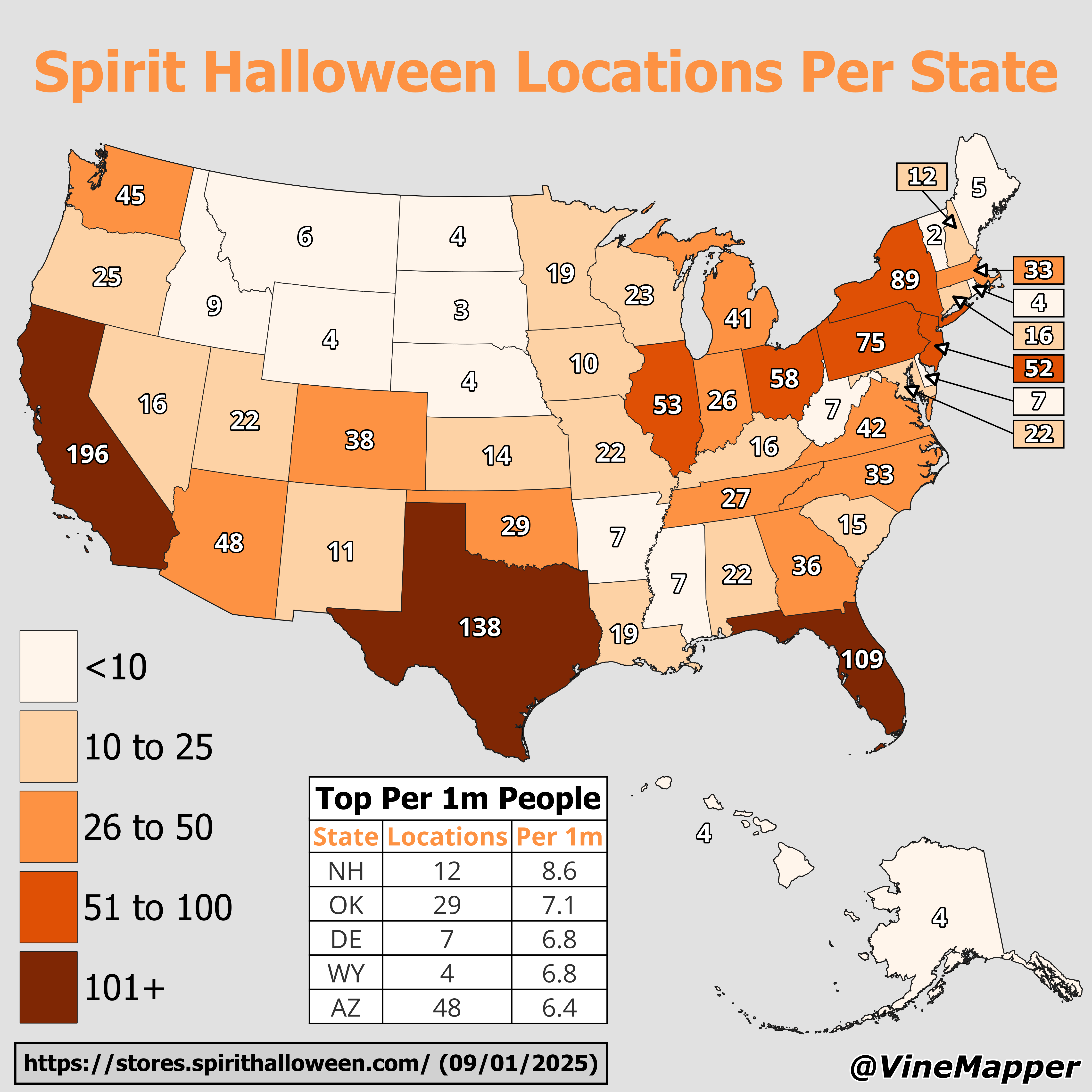
Spirit Halloween Locations Per State Map
This geographical visualization reveals the distribution of Spirit Halloween store locations across the United States, m...
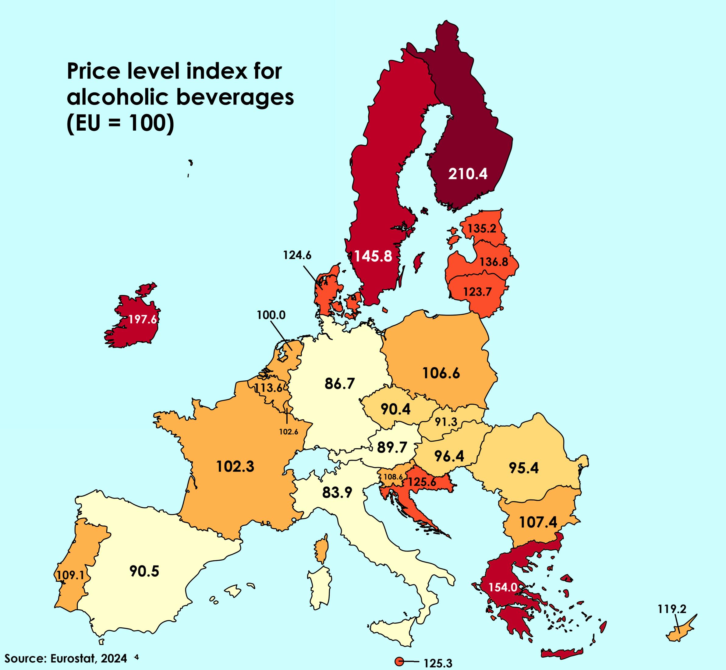
Price Level Index for Alcoholic Beverages Map
The "Price Level Index for Alcoholic Beverages" map provides a comparative visualization of the costs associated with al...
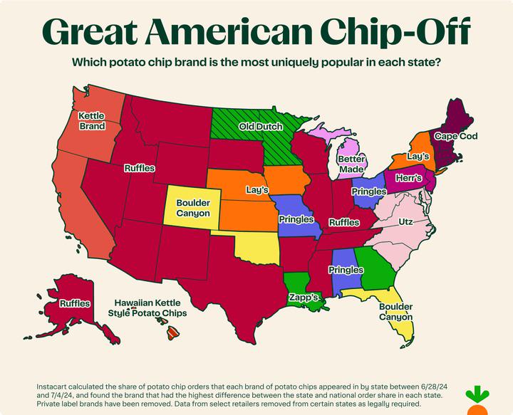
Most Popular Potato Chip Brands by State Map
The visualization titled "The Most Popular Potato Chip Brands By State" provides an intriguing look at regional preferen...
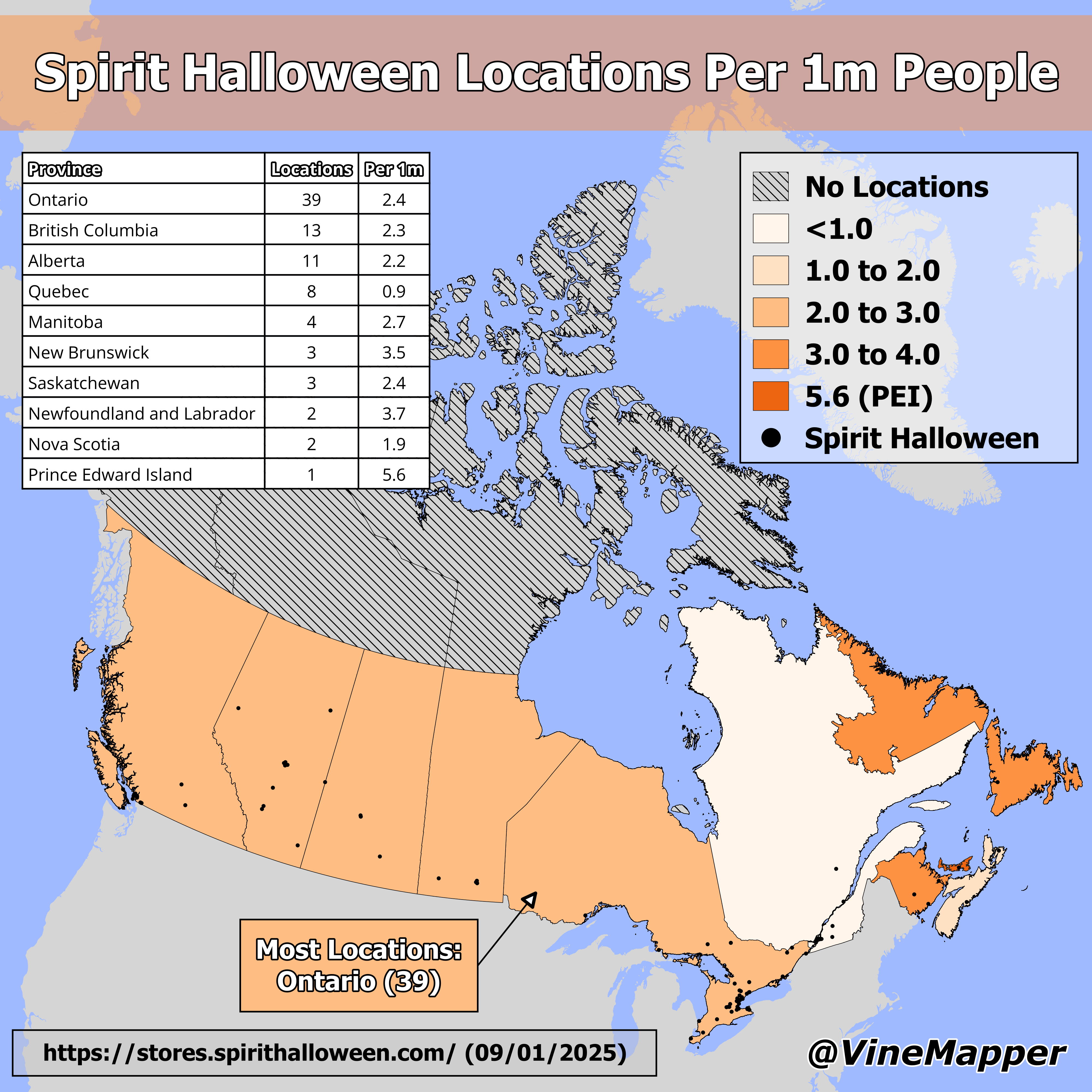
Spirit Halloween Locations by Canadian Province Map
The "Spirit Halloween Locations by Canadian Province Map" provides a visual representation of where Spirit Halloween sto...
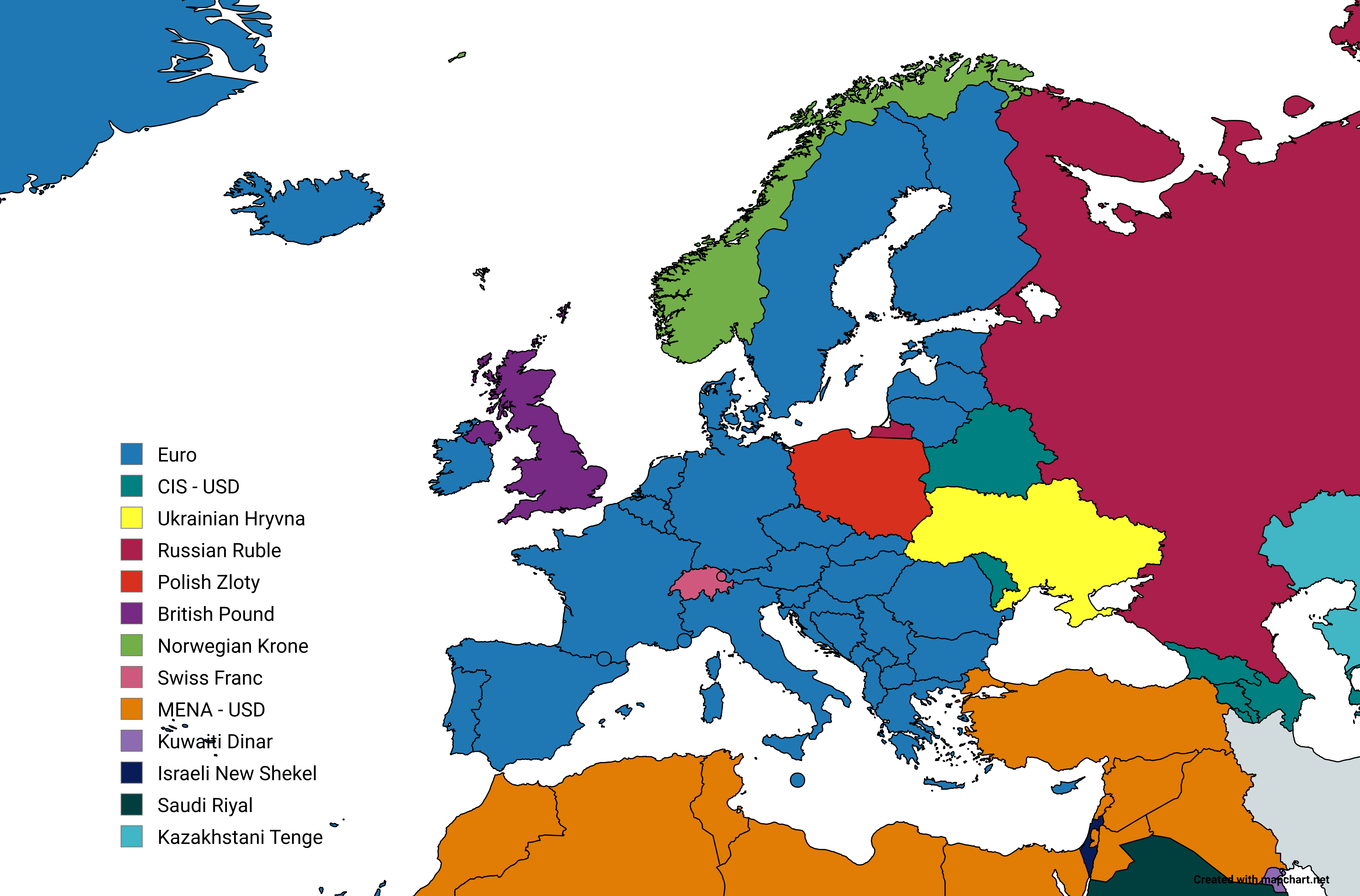
STEAM Pricing Groups Map by Country
The "STEAM Pricing Groups Map" provides a comprehensive visual representation of the various pricing groups assigned to ...