cities Maps
7 geographic visualizations tagged with "cities"
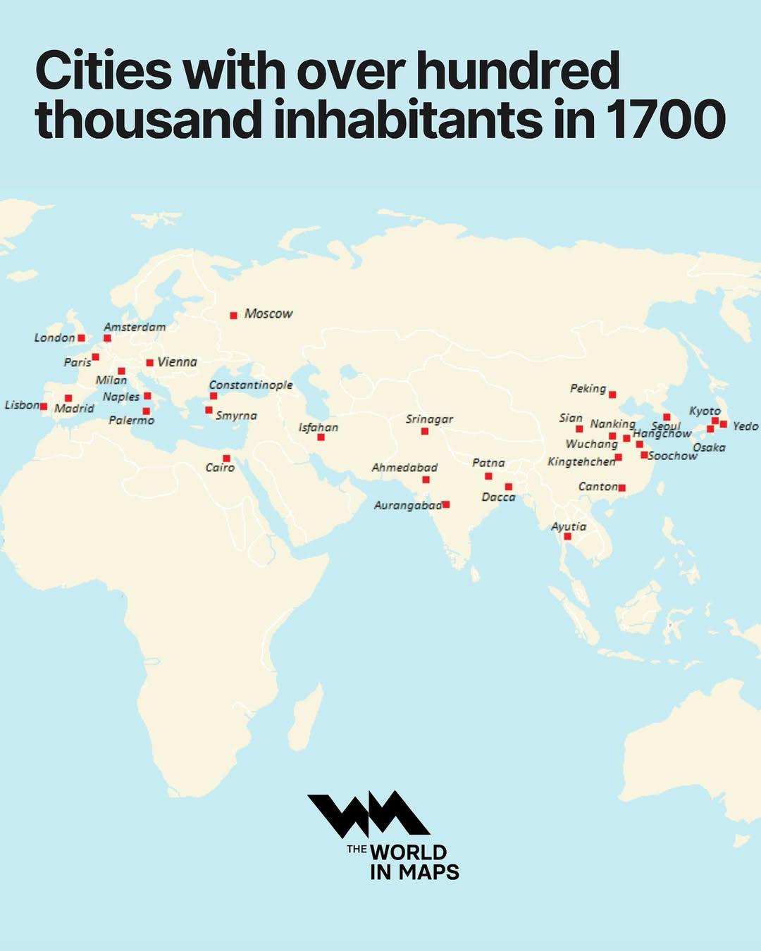
Cities with Over 100,000 Inhabitants in 1700 Map
The "Cities with Over 100,000 Inhabitants in 1700 Map" provides a fascinating glimpse into urbanization during the early...
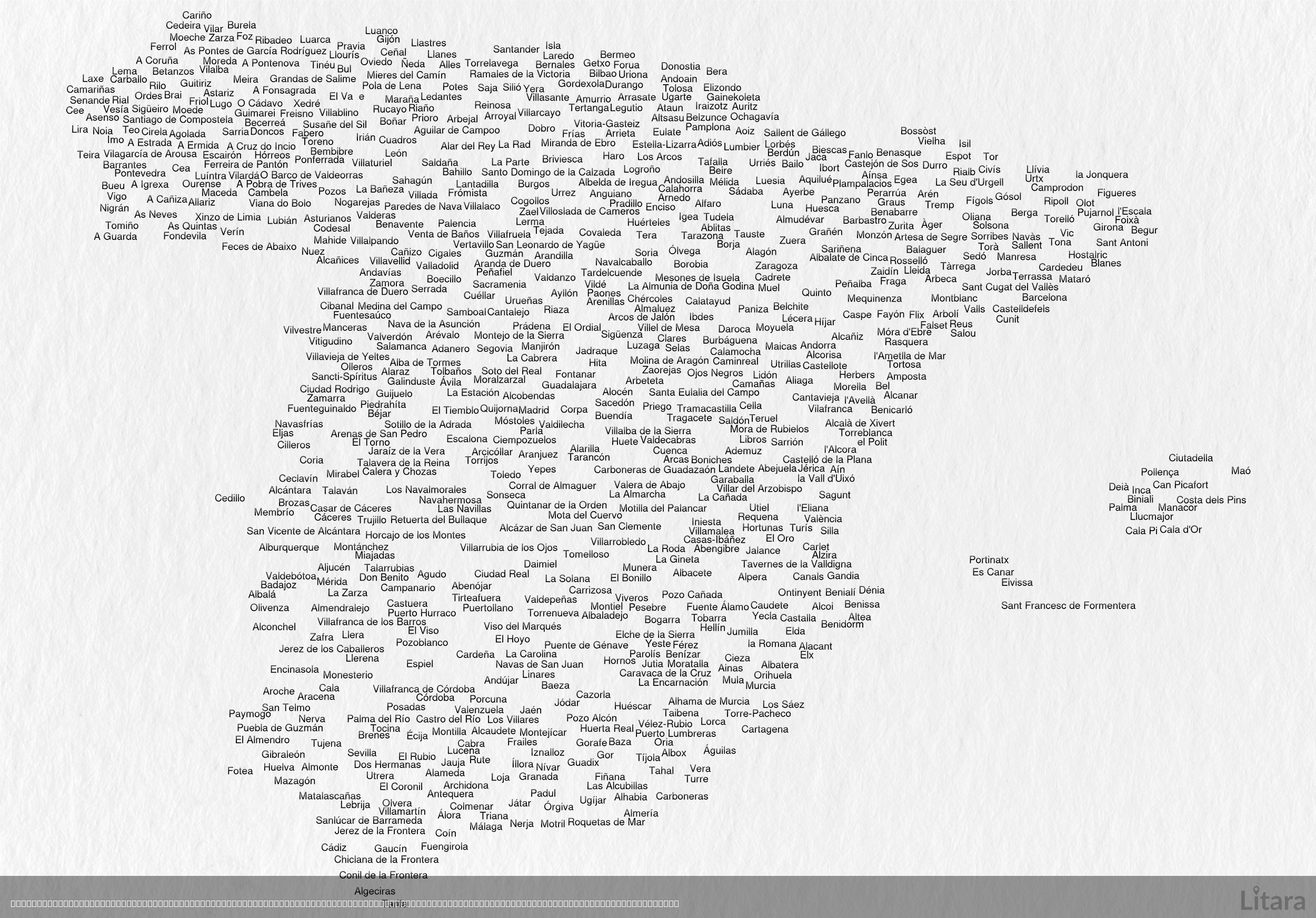
Typographic Map of Spain's Cities and Towns
This intriguing typographic map of Spain creatively illustrates the country's geographic shape using the names of hundre...
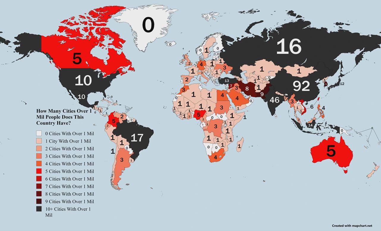
Countries Ranked by Cities with 1M+ Population Map
The visualization titled "Countries Ranked by Number of Cities with 1M+ Population Map" provides a clear representation ...
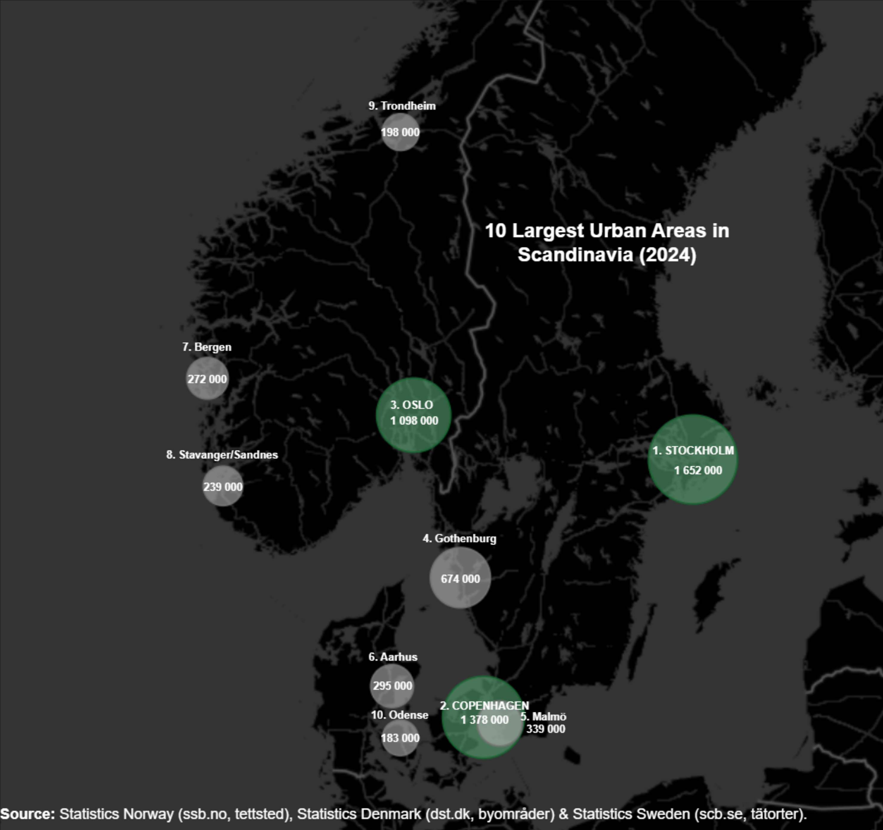
Largest Cities in Scandinavia Map
Scandinavia has experienced a steady increase in urban population over the past few decades. For instance, Stockholm, th...
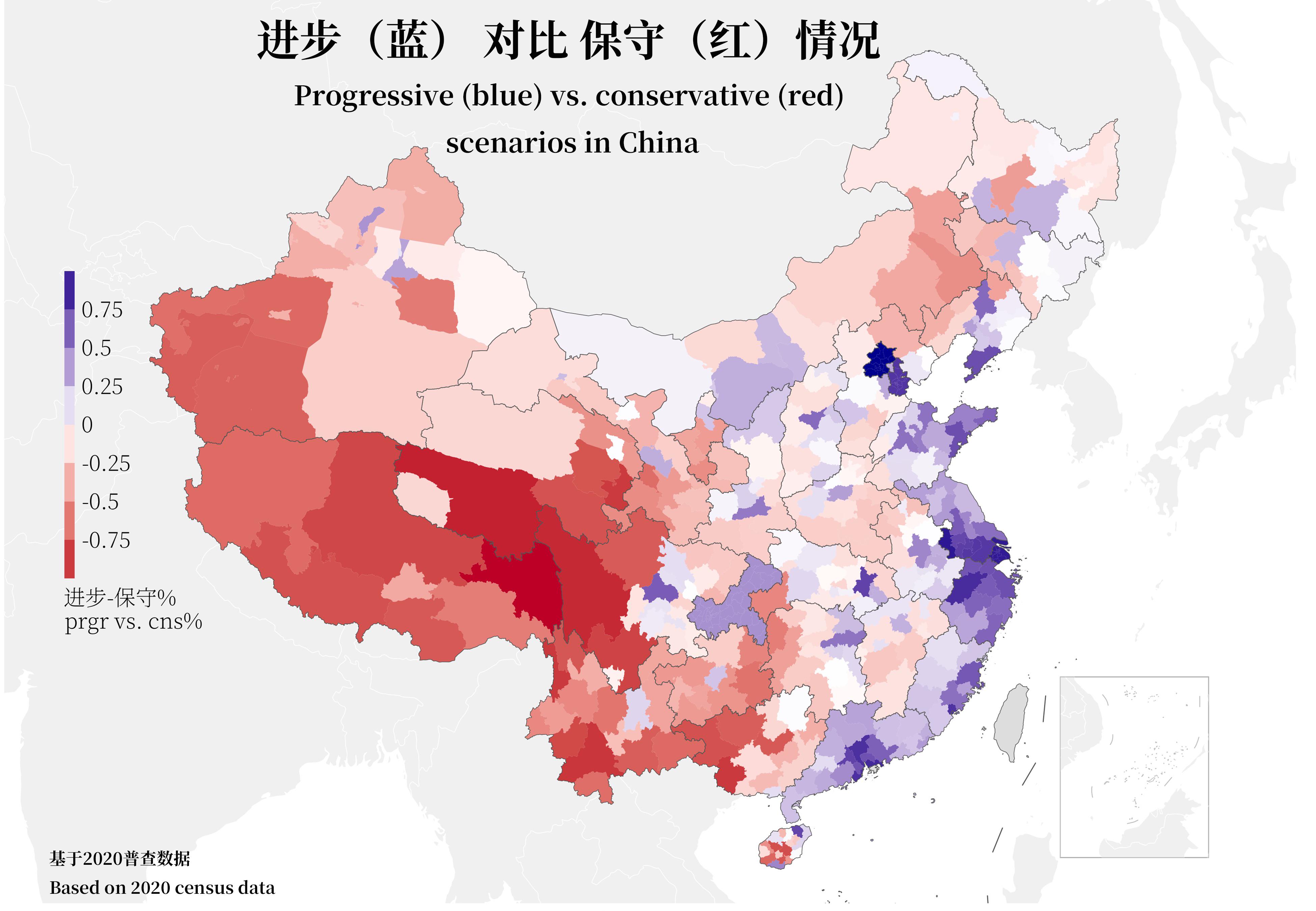
China's Ideological Spectrum by City Map
This visualization presents a detailed overview of China's ideological spectrum, breaking it down by city based on data ...
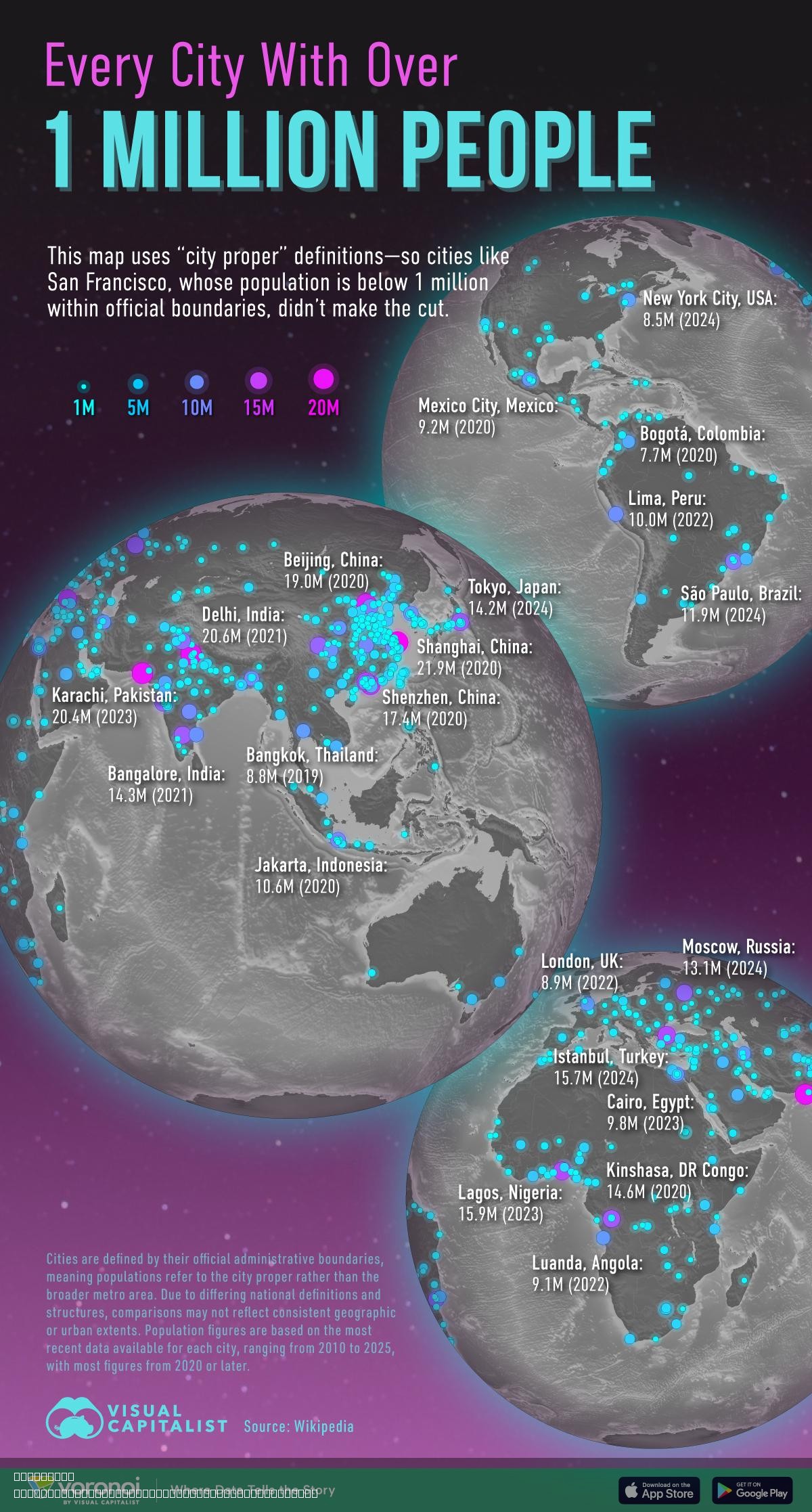
Map of Cities With Over 1 Million People
This map illustrates every city around the globe with a population exceeding 1 million people. It serves as a visual rep...
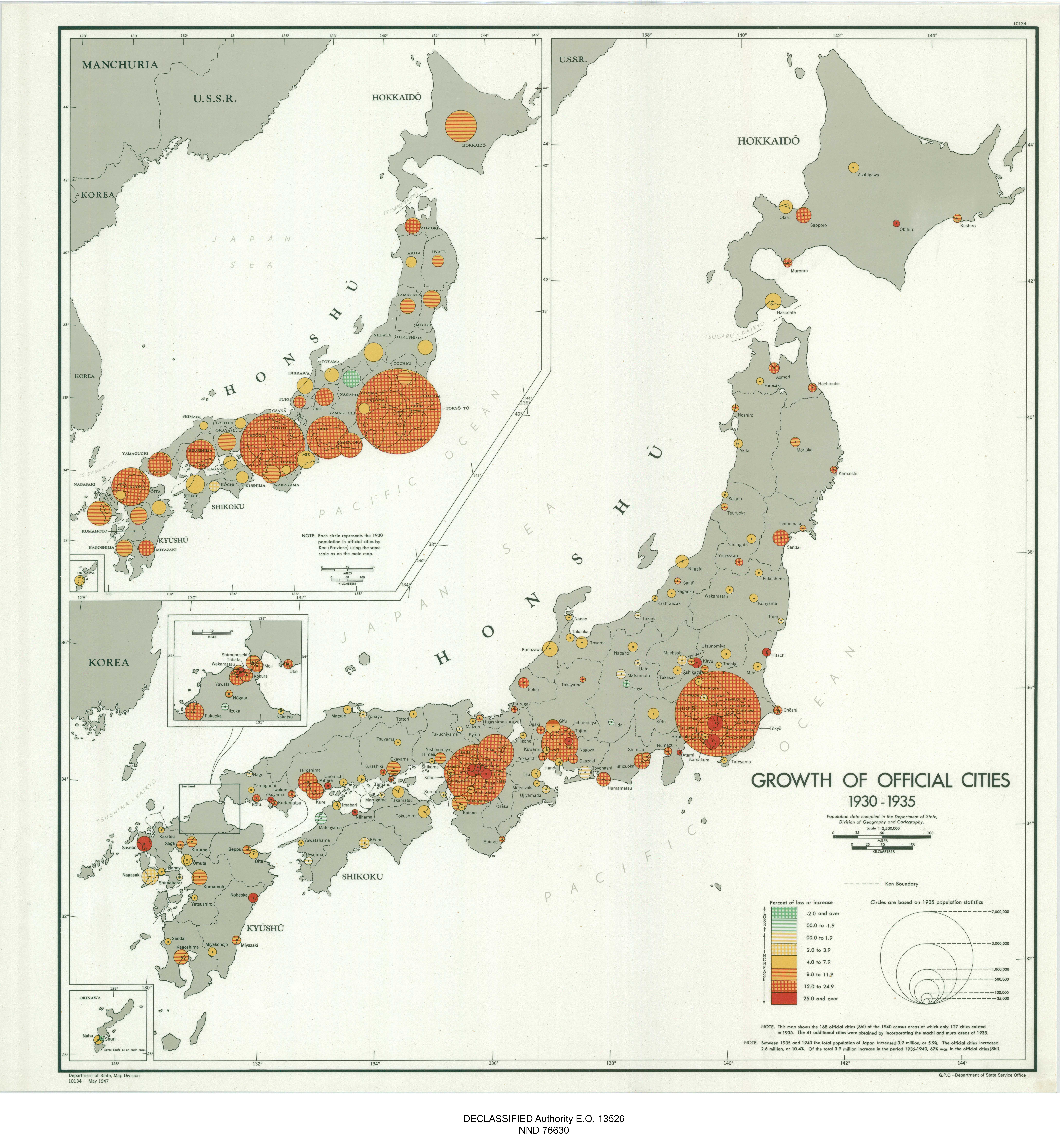
Japan Official Cities Growth Map 1930-1935
The "Japan Growth of Official Cities 1930-1935" map presents a pivotal look into Japan's urbanization during the early 2...