byzantine empire Maps
8 geographic visualizations tagged with "byzantine empire"
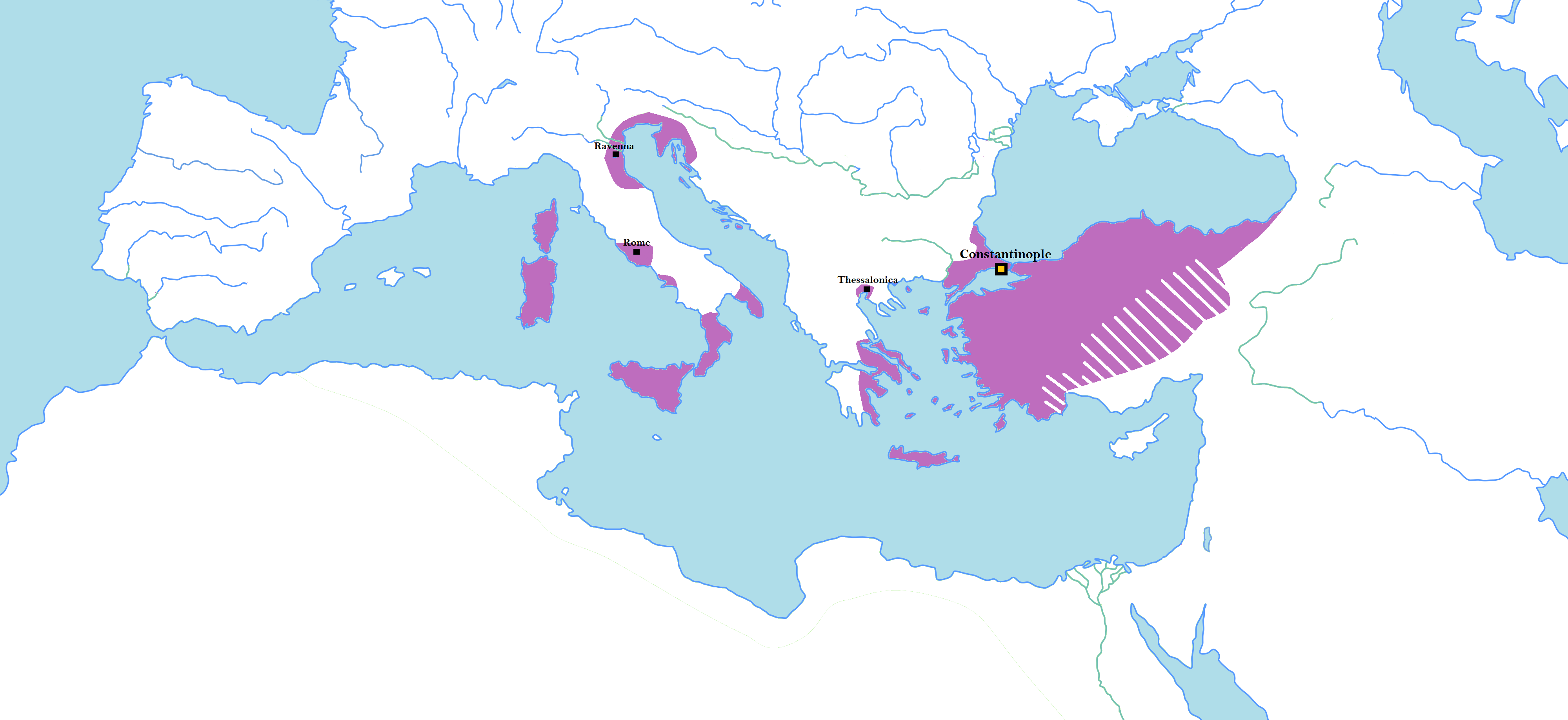
Map of Random Borders of Historical States
This map illustrates the unconventional and often perplexing borders of major historical states, highlighting areas wher...
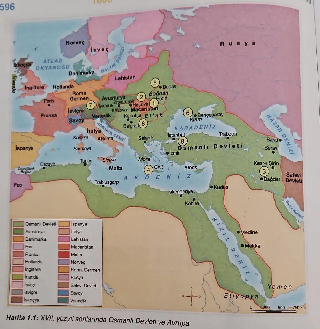
Historical Map of Turkey in Textbooks
This map, derived from a Turkish history textbook, offers a detailed portrayal of significant historical events, territo...
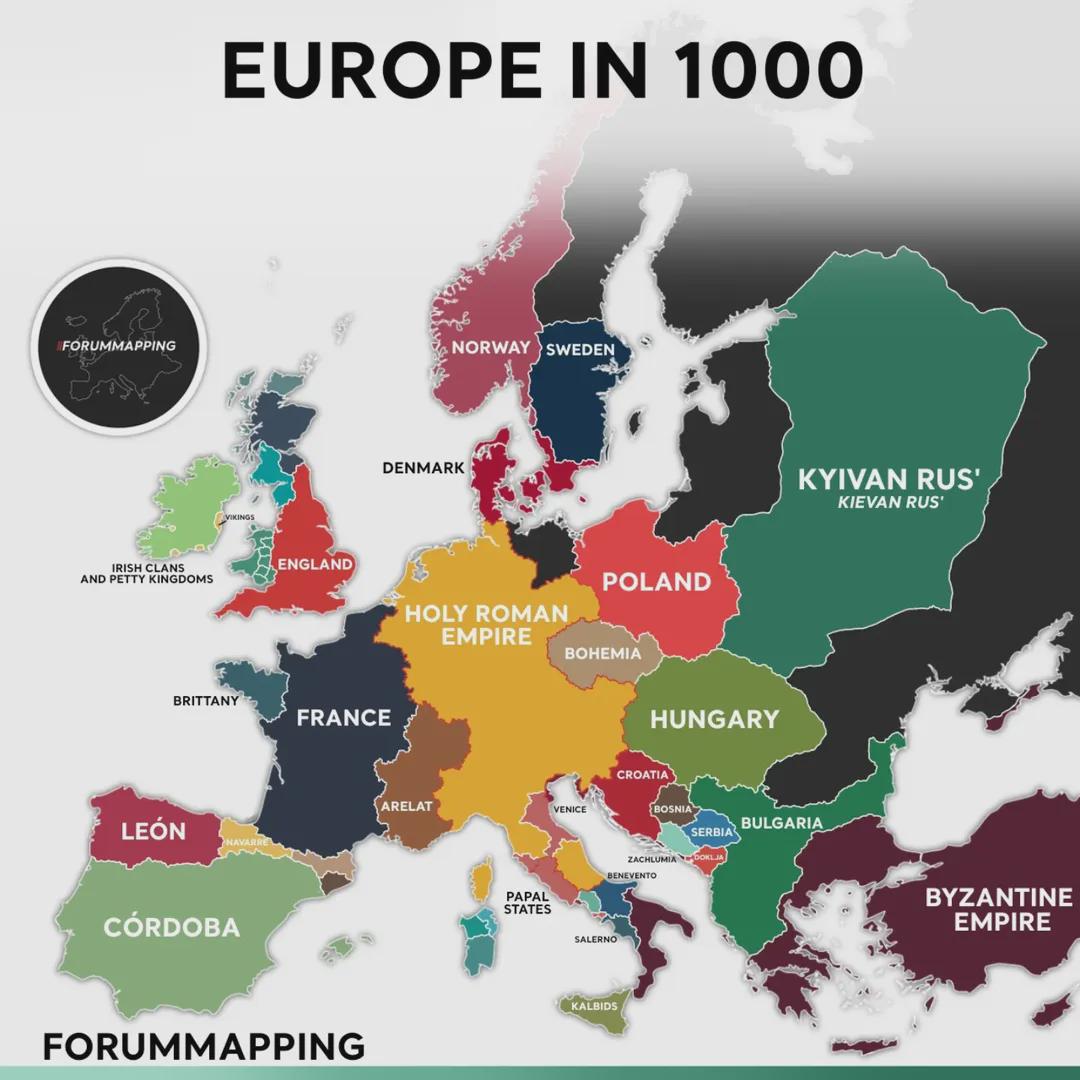
Map of Europe in 1000
The map titled "Europe in 1000" provides a fascinating glimpse into the political and cultural landscape of Europe at th...
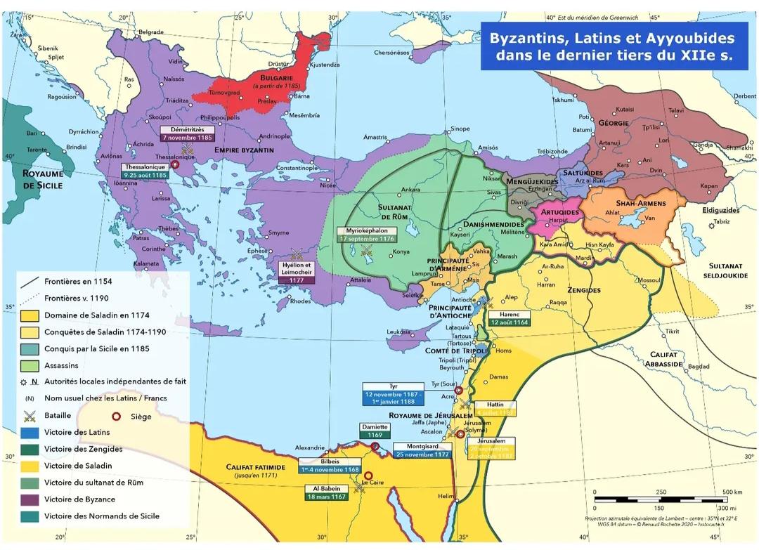
Byzantium and the Levant Map Before the Fourth Crusade
This map provides a detailed representation of the Byzantine Empire and the Levant region prior to the onset of the Four...
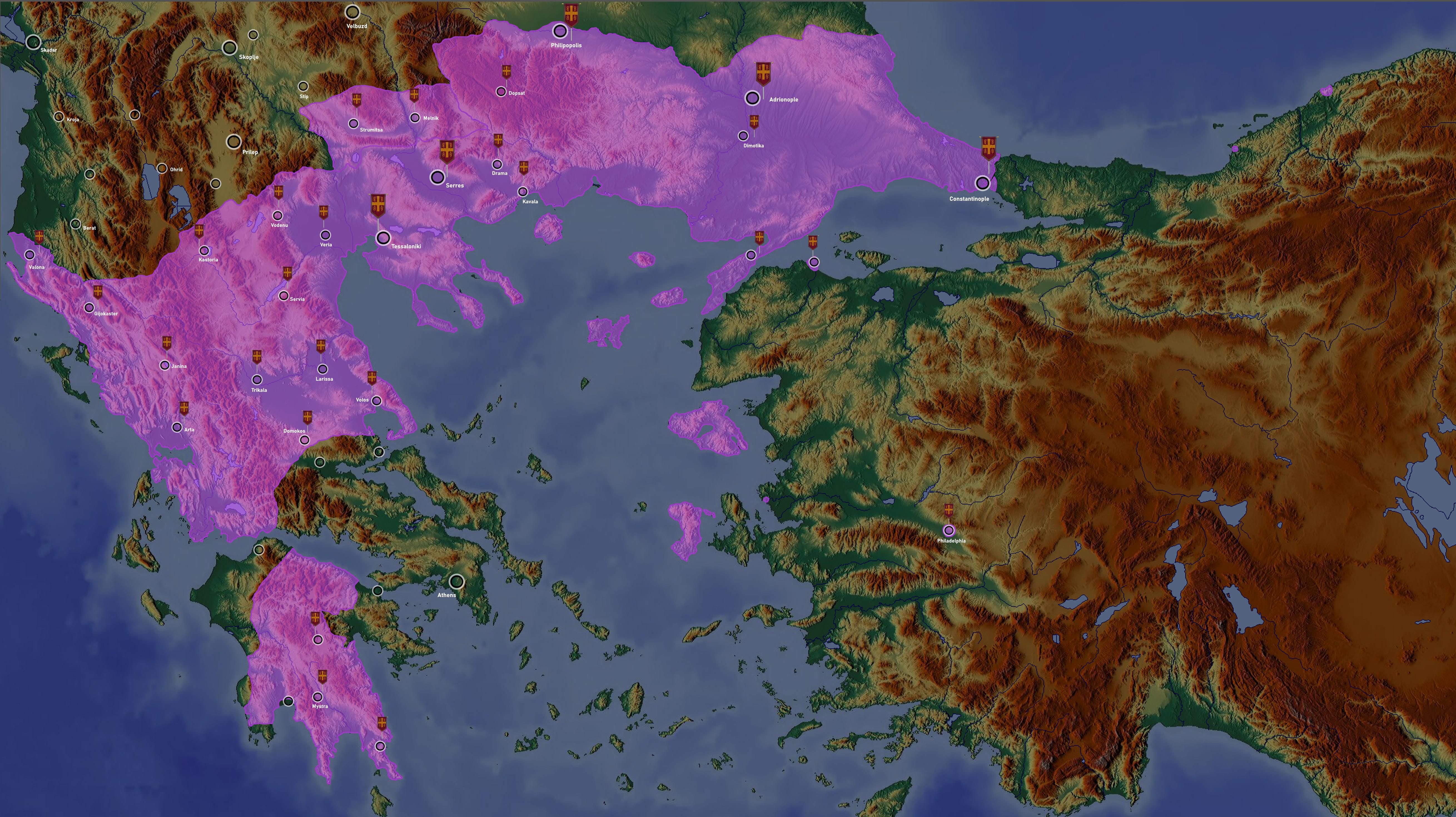
Eastern Roman Empire Map in 1341
The map titled "Eastern Roman Empire in 1341 (at death of Andronikos III)" illustrates the territorial expanse of the By...
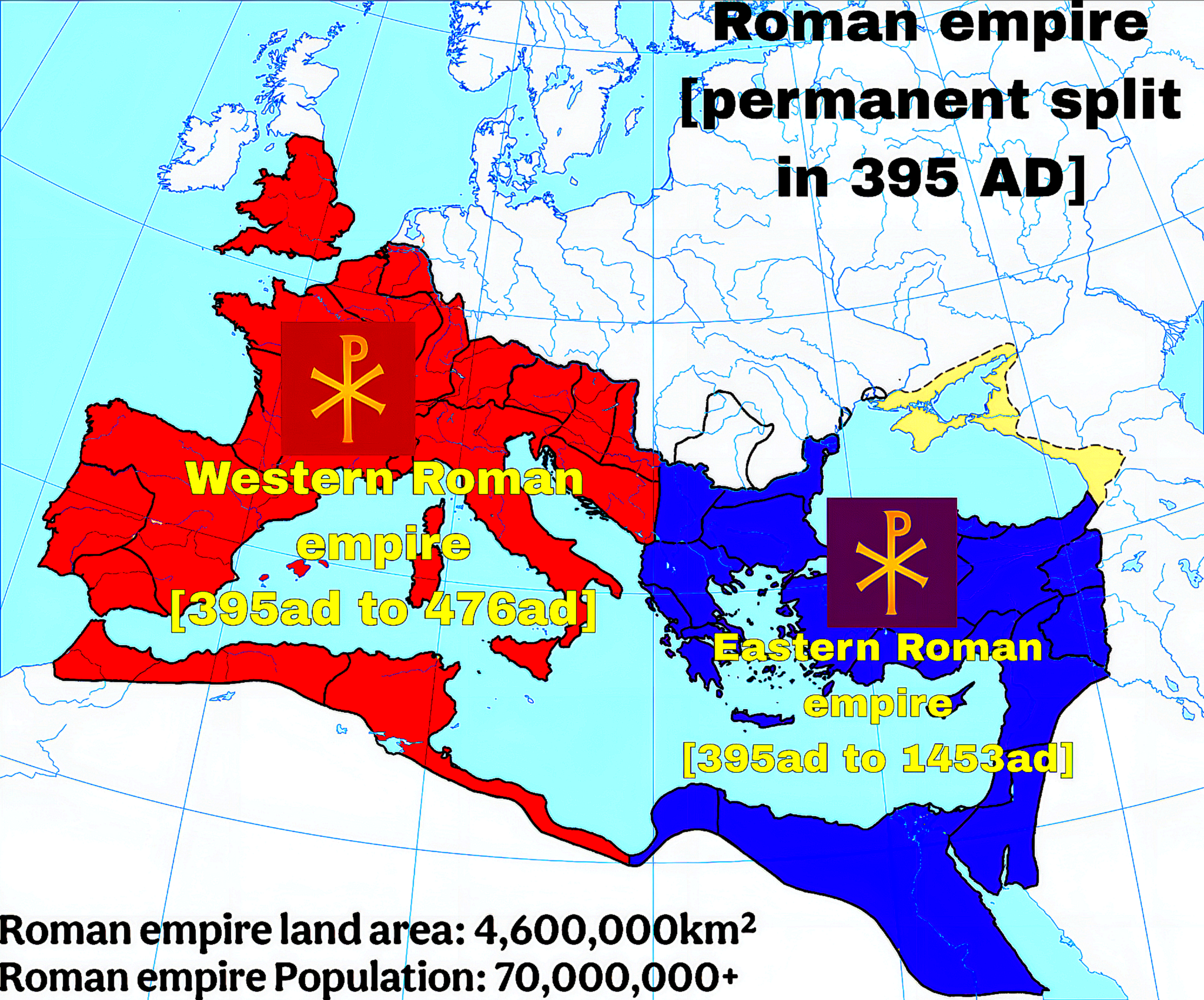
Map of the Permanent Split of the Roman Empire in 395 AD
The map titled "The Permanent Split of the Roman Empire in 395 AD" visually delineates the division of the Roman Empire ...
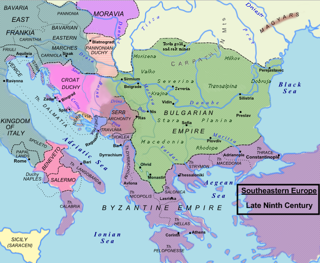
Political Map of Southeastern Europe in the Late 9th Century
The map of Southeastern Europe in the late 9th century AD provides a detailed representation of the political landscape ...
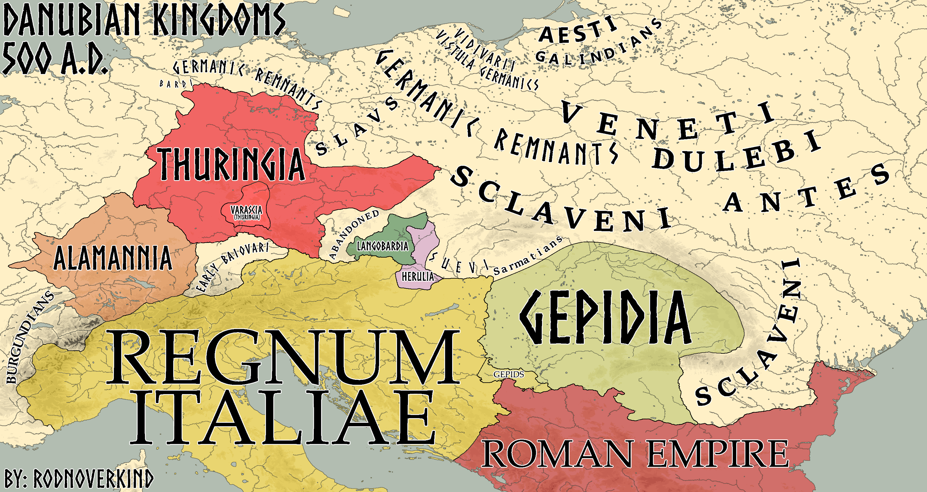
Map of the Kingdoms of the Danube AD 500
The visualization titled \...