australia Maps
23 geographic visualizations tagged with "australia"
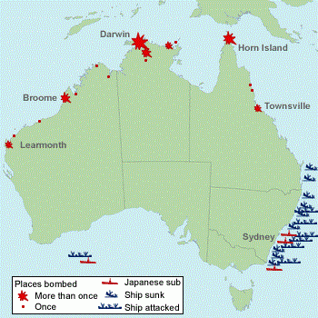
WW2 Attack Sites in Australia Map
The 'Sites in Australia Attacked in WW2' map provides a critical visual representation of the locations across Australia...
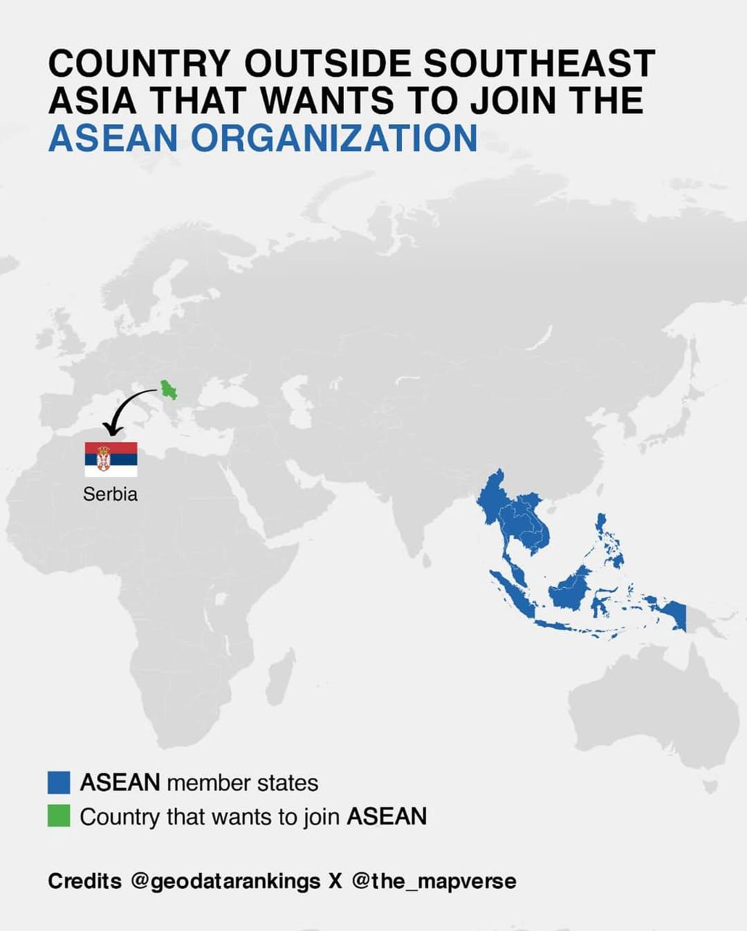
Map of Countries Outside Southeast Asia Wanting to Join ASEAN
This map illustrates the various countries outside of Southeast Asia that have expressed interest in joining the Associa...
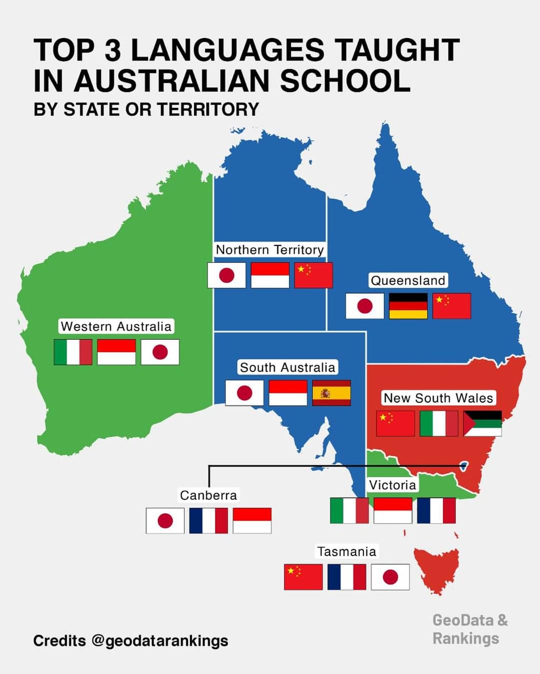
Top 3 Languages Taught in Australian Schools Map
This map provides a comprehensive overview of the top three languages taught in schools across various states and territ...
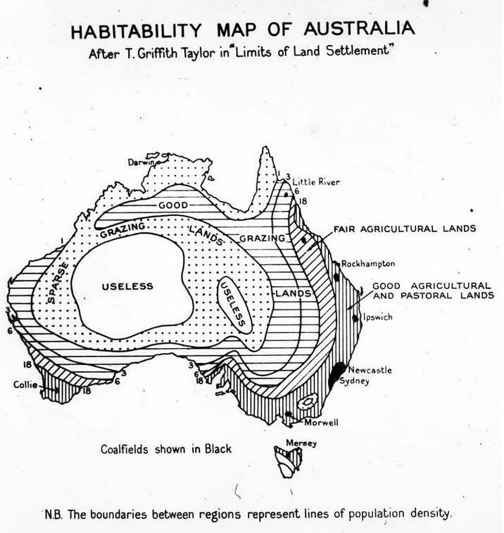
1946 Habitability Map of Australia
The 1946 Map of Australia that coded the "habitability" of the land presents a fascinating visual representation of the ...
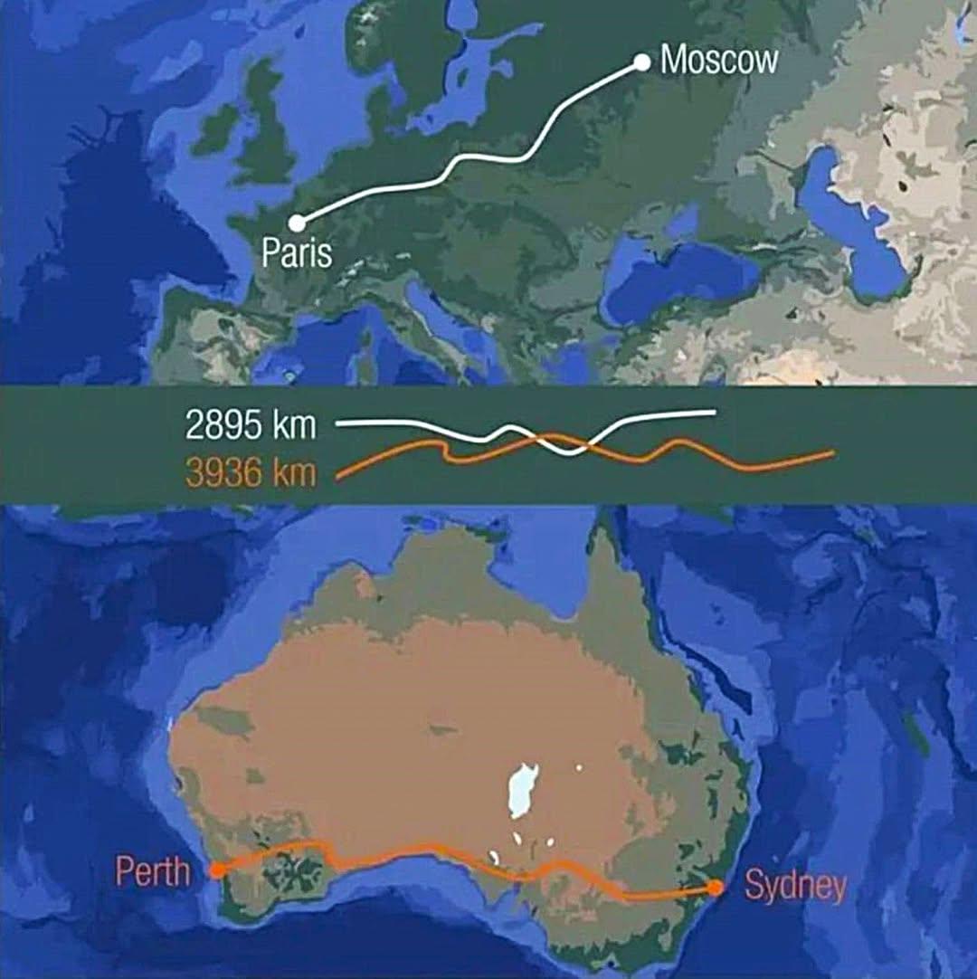
Distance Comparison Map: Australia and Europe
This visualization provides a striking comparison of distances by illustrating that crossing Australia from east to west...
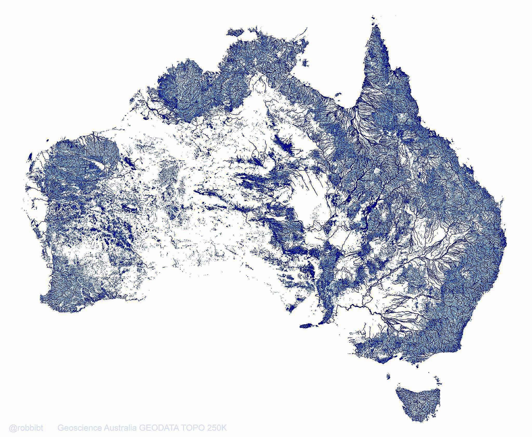
Australia Rivers Map: 1.3 Million Waterways
This map vividly illustrates Australia's extensive network of 1.3 million rivers, streams, and tributaries, which togeth...
Map of Australia's Climate Zones
The "Map of Australia's Climate Zones" provides a comprehensive overview of the diverse climatic regions across the cont...
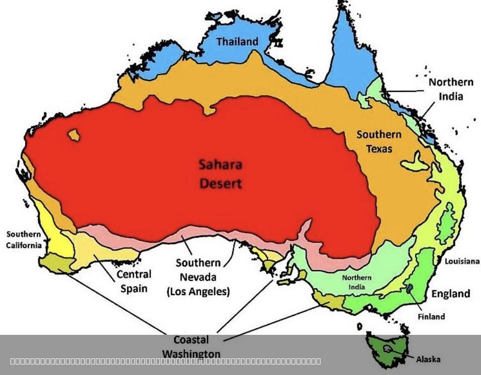
Climate Comparison Map of Australia and the World
The visualization titled "The Climate in Australia Compared to Other Places in the World" presents a comprehensive overv...
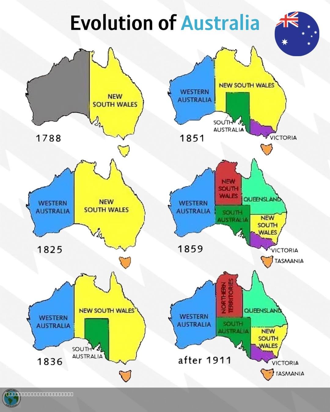
Evolution of Australia Map
...
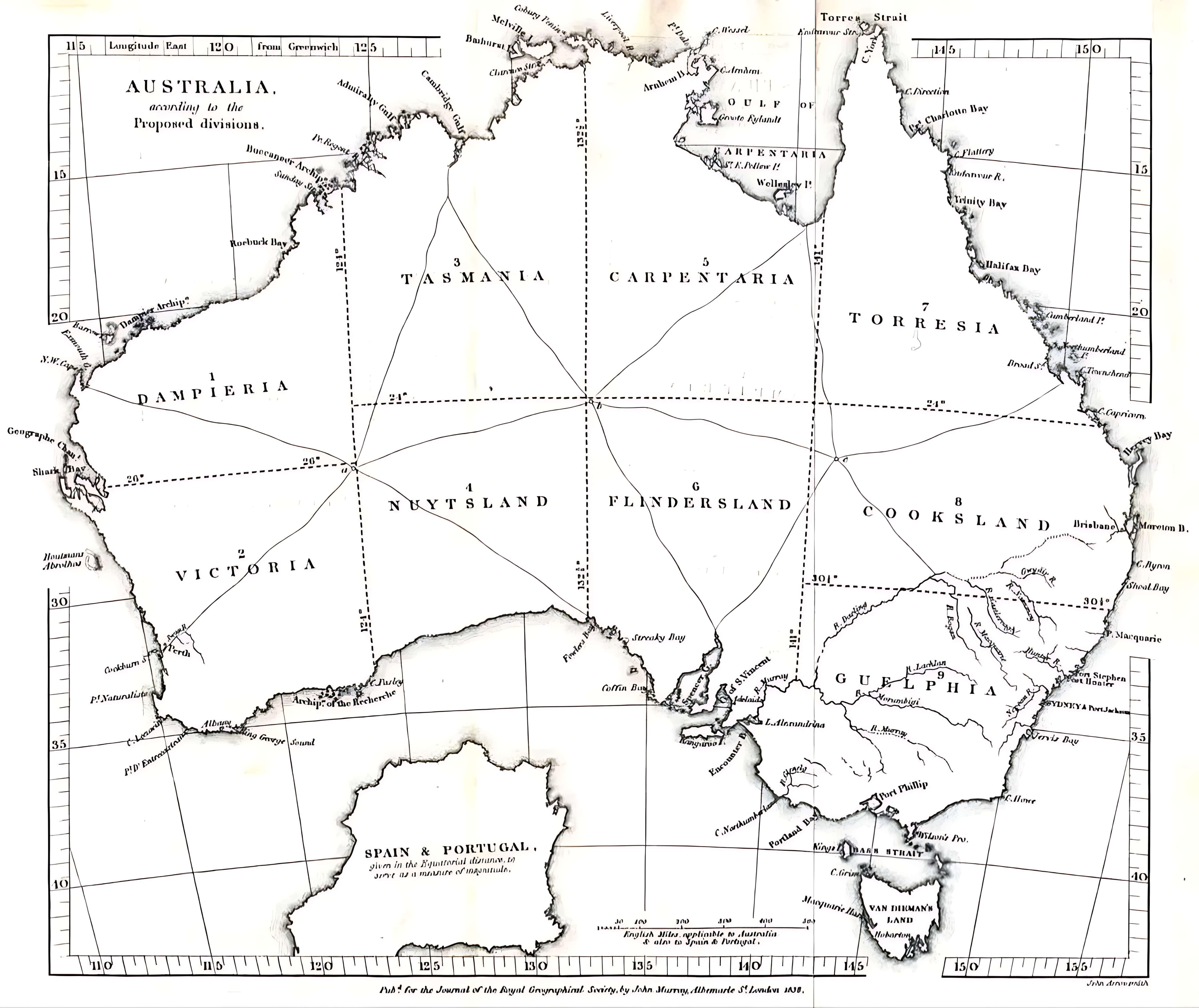
1838 Australia Division Plan Map Analysis
This map visualizes the proposed division of Australia as suggested in 1838, illustrating a radical restructuring of sta...
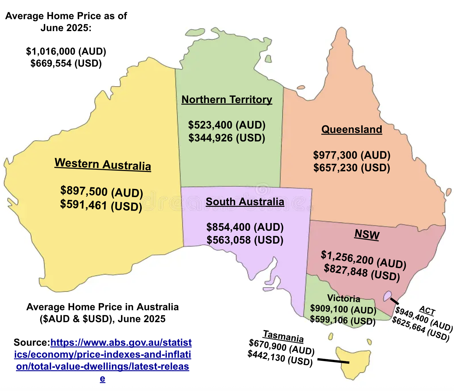
Average Home Price Map in Australia, June 2025
The visualization titled "Average Home Price in Australia ($AUD & $USD), June 2025" presents a detailed overview of the ...
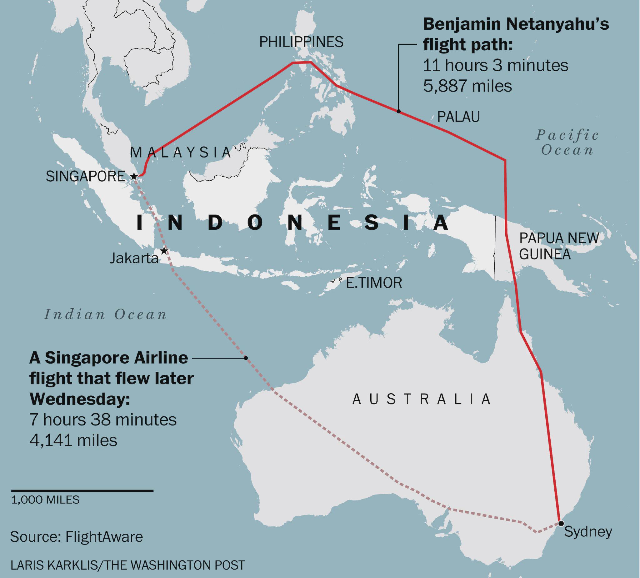
Flight Route Map of Israeli PM Avoiding Indonesia
This map visually represents the flight path taken by Israeli Prime Minister Benjamin Netanyahu during his journey from ...
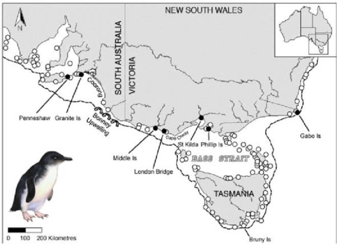
Map of Penguin Colonies in Australia
This map displays the locations of various penguin colonies across Australia, highlighting their distribution along the ...
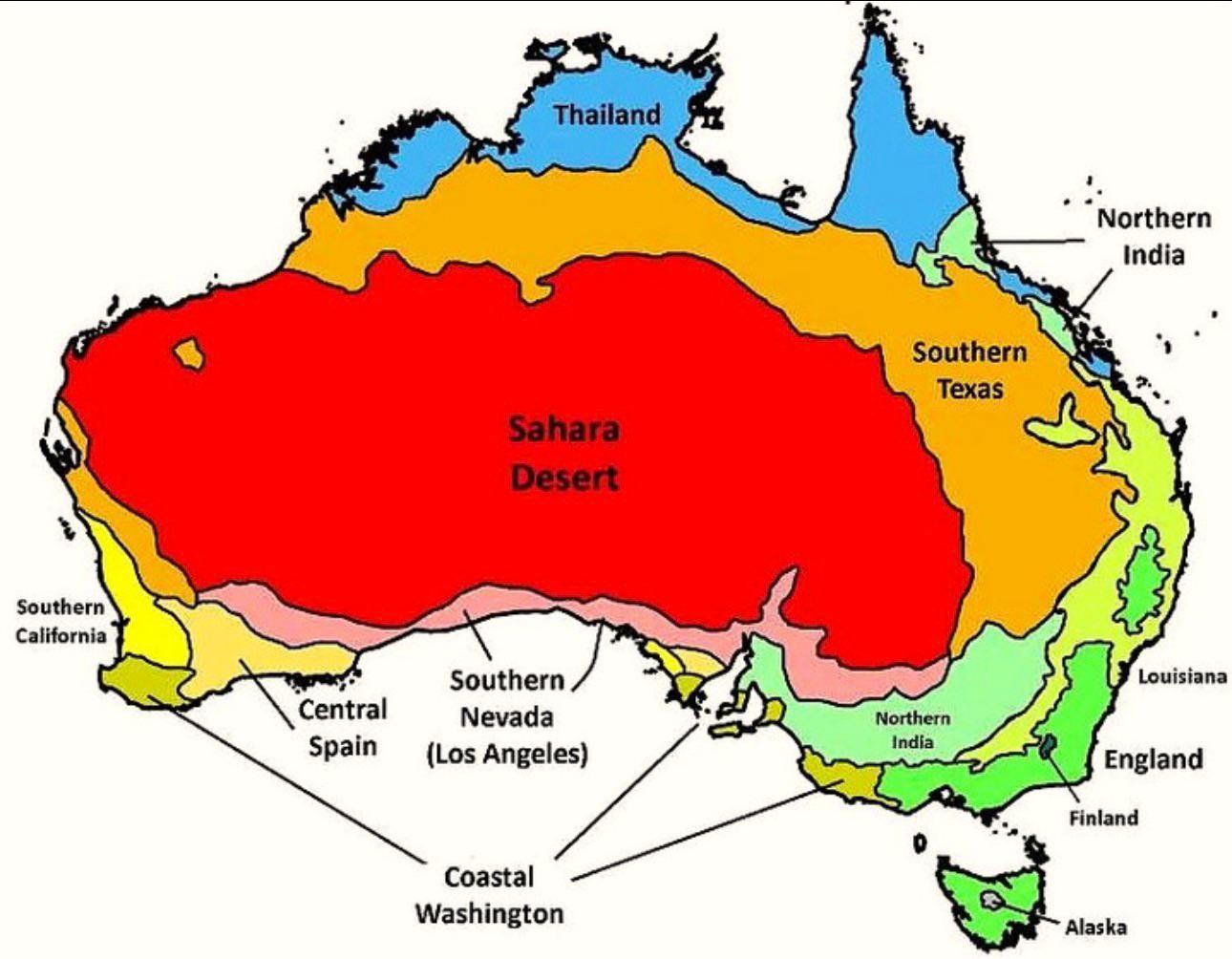
Australia’s Climate Compared to Other Countries Map
The map titled "Australia’s Climate Compared to Other Countries" provides a detailed look at how Australia's climate sta...
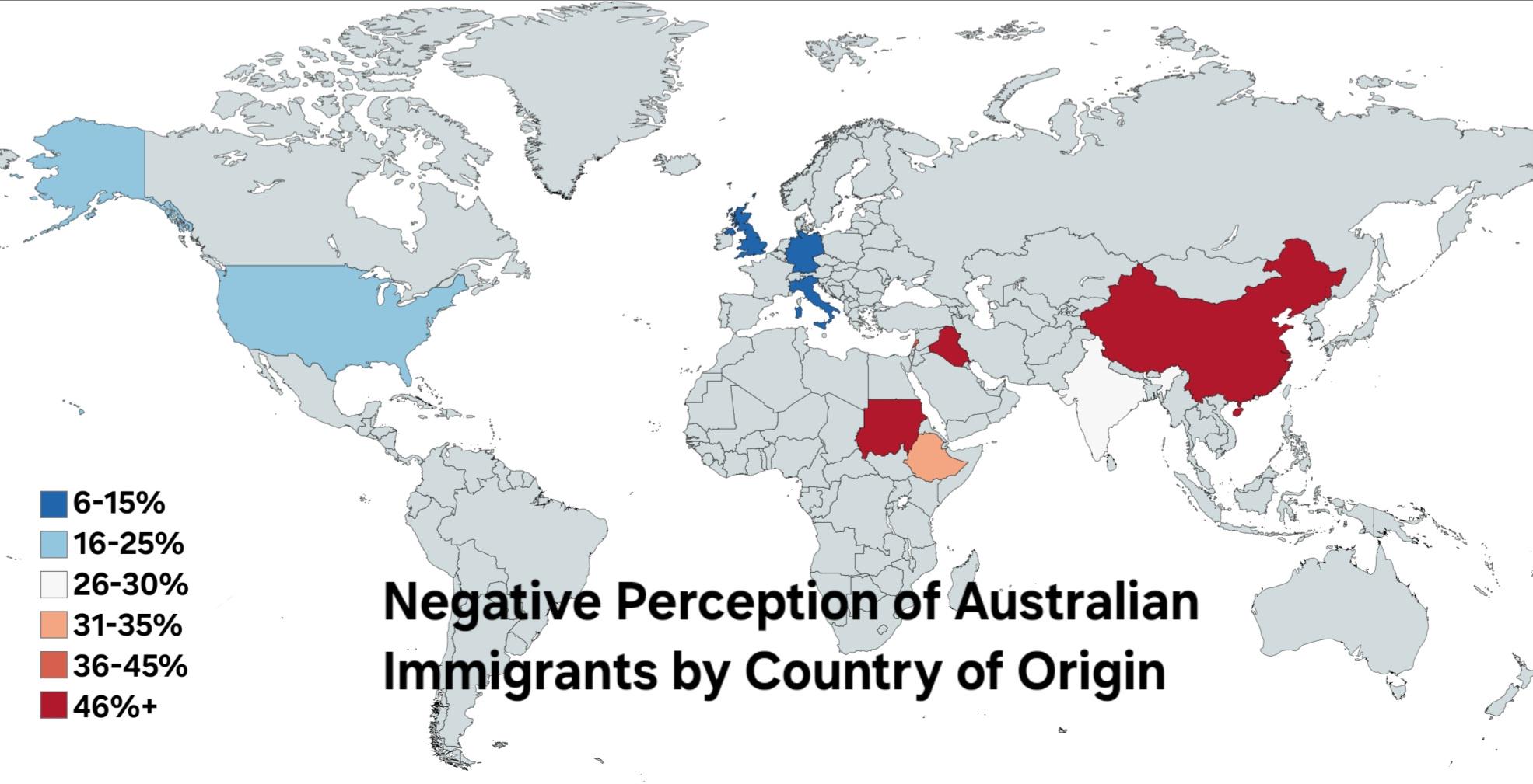
Negative to Very Negative Perception of Immigrants in Australia Map
The map titled "Negative to Very Negative Perception of Immigrants in Australia" provides a visual representation of pub...
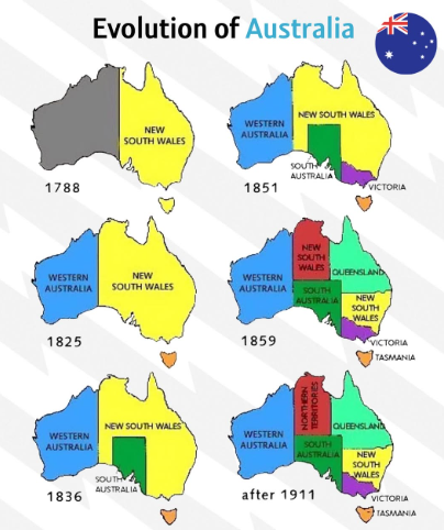
Evolution of Australia Map
...
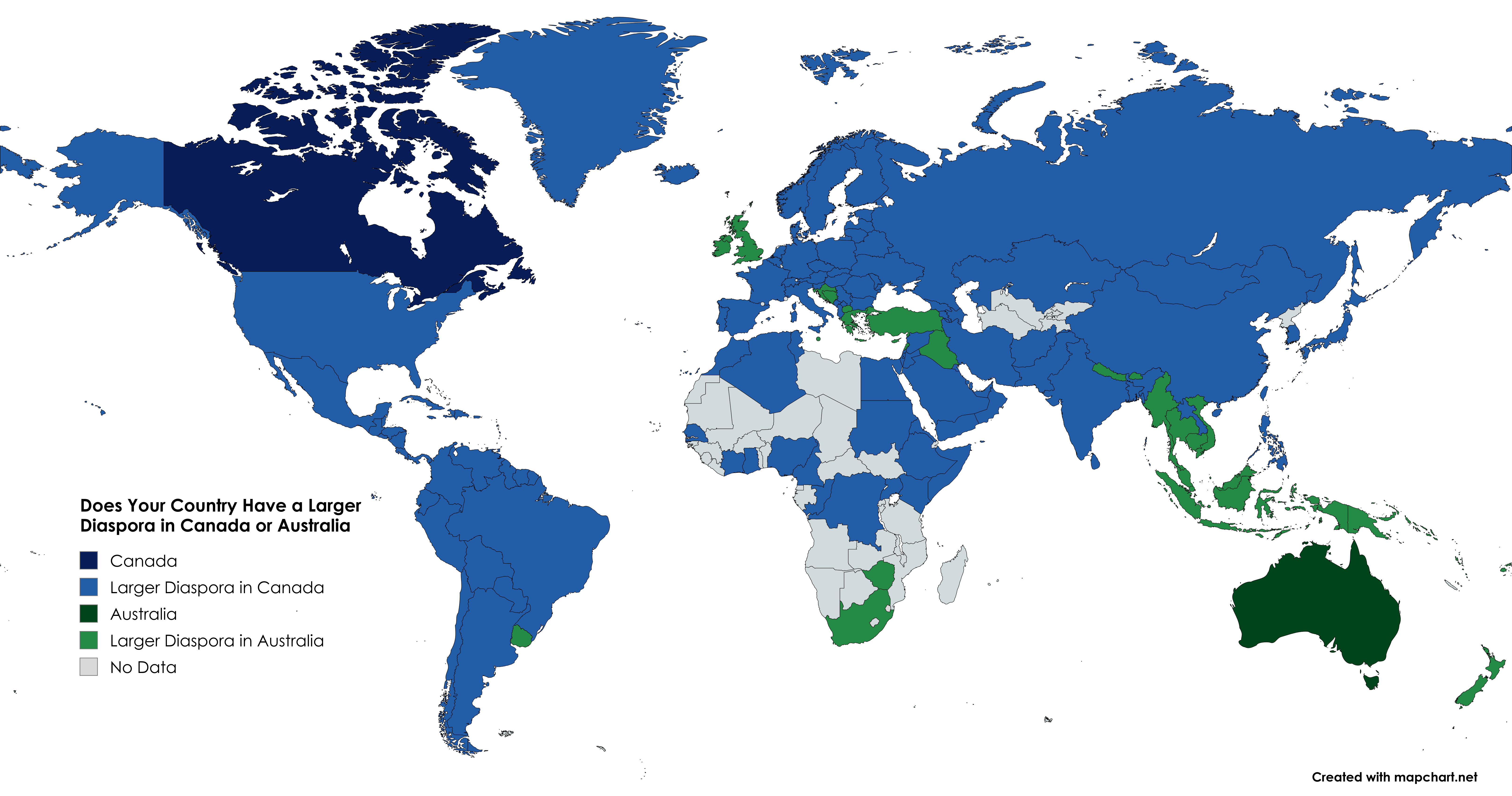
Diaspora Distribution Map: Canada vs Australia
This visualization provides an insightful comparison of the diaspora populations from various countries residing in Cana...
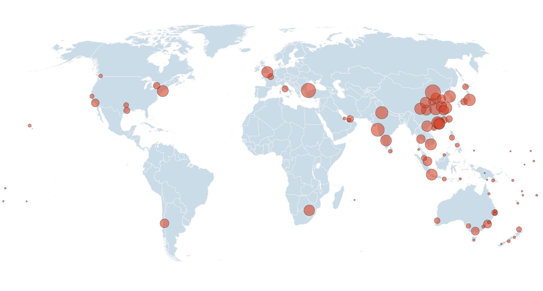
Direct Flights to/from Australia Map
This visualization presents a comprehensive overview of airports that offer direct flights to and from Australia. Each a...
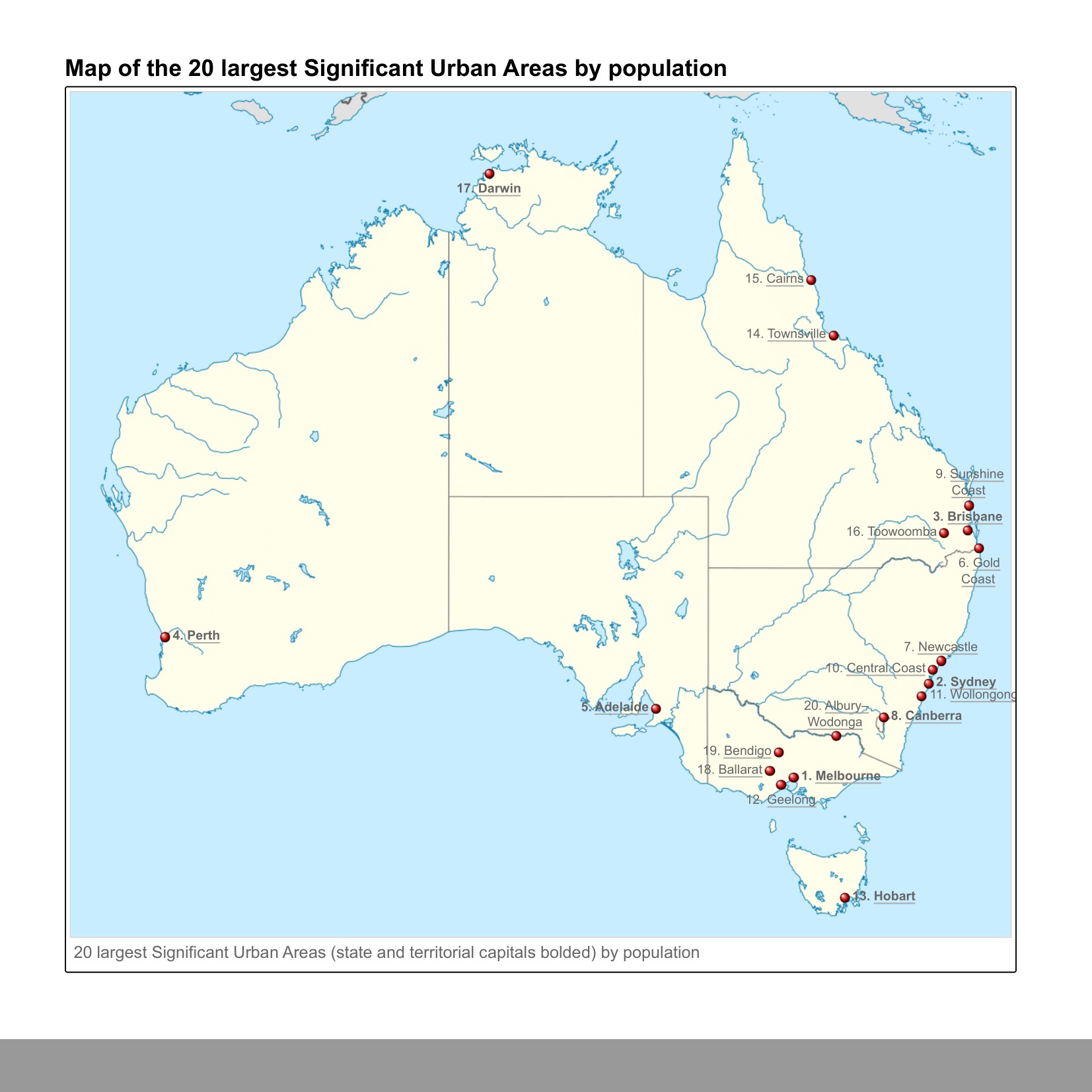
Twenty Largest Urban Areas in Australia Map
This map presents a visual representation of the twenty largest urban areas in Australia, highlighting population concen...
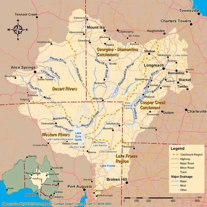
Lake Eyre Basin Map Australia
This visualization focuses on the Lake Eyre Basin, the largest endorheic lake system in Australia. Covering an expansive...
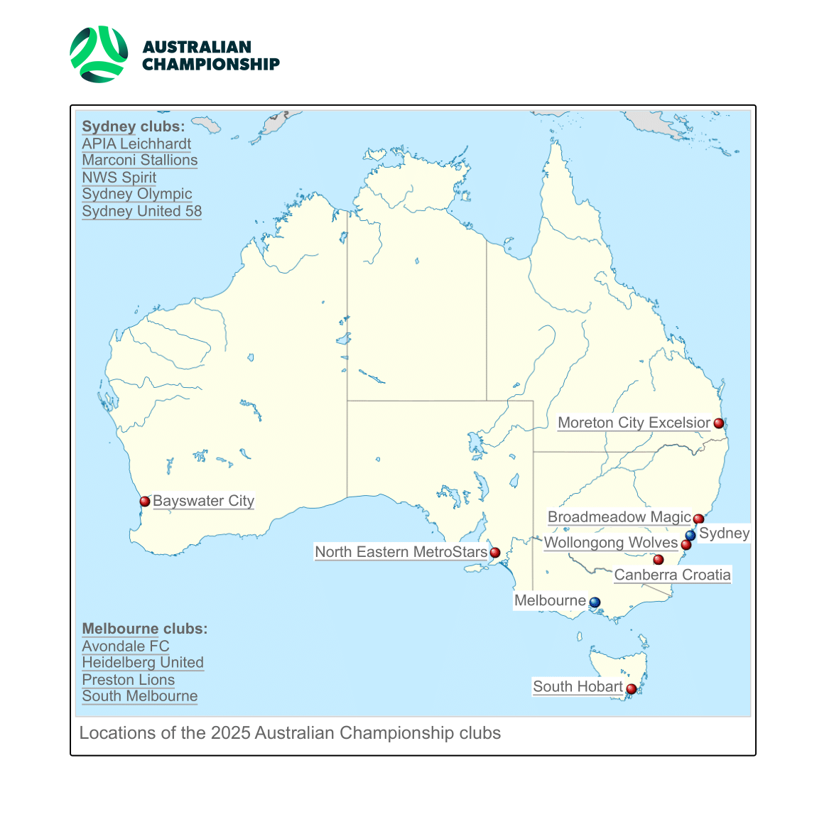
Australian Football National Second Division Map
This map illustrates the newly established national second division for Australian football (soccer), marking a historic...
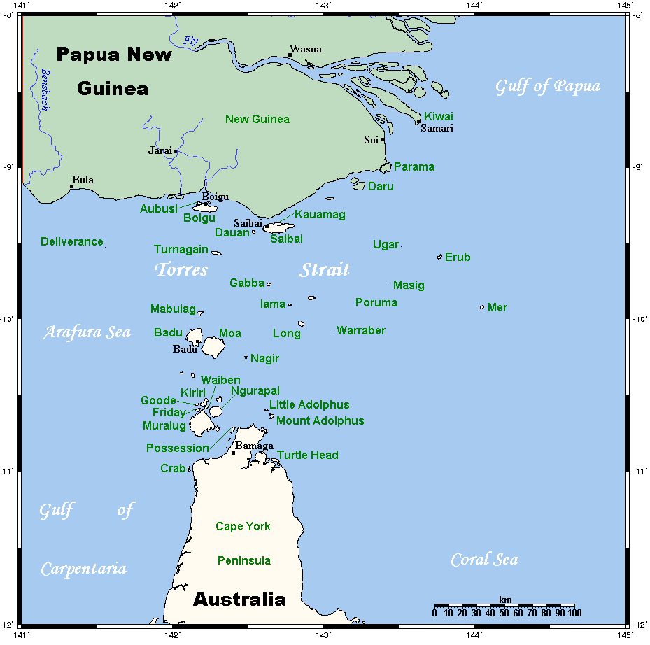
Torres Strait Islands Map of Australia
The map of the Torres Strait Islands illustrates a unique geographical area situated between the Australian mainland and...
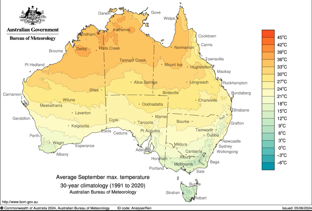
Average Maximum September Temperature Map of Australia
The "Average Maximum September Temperature in Australia" map provides a visual representation of the temperature variati...