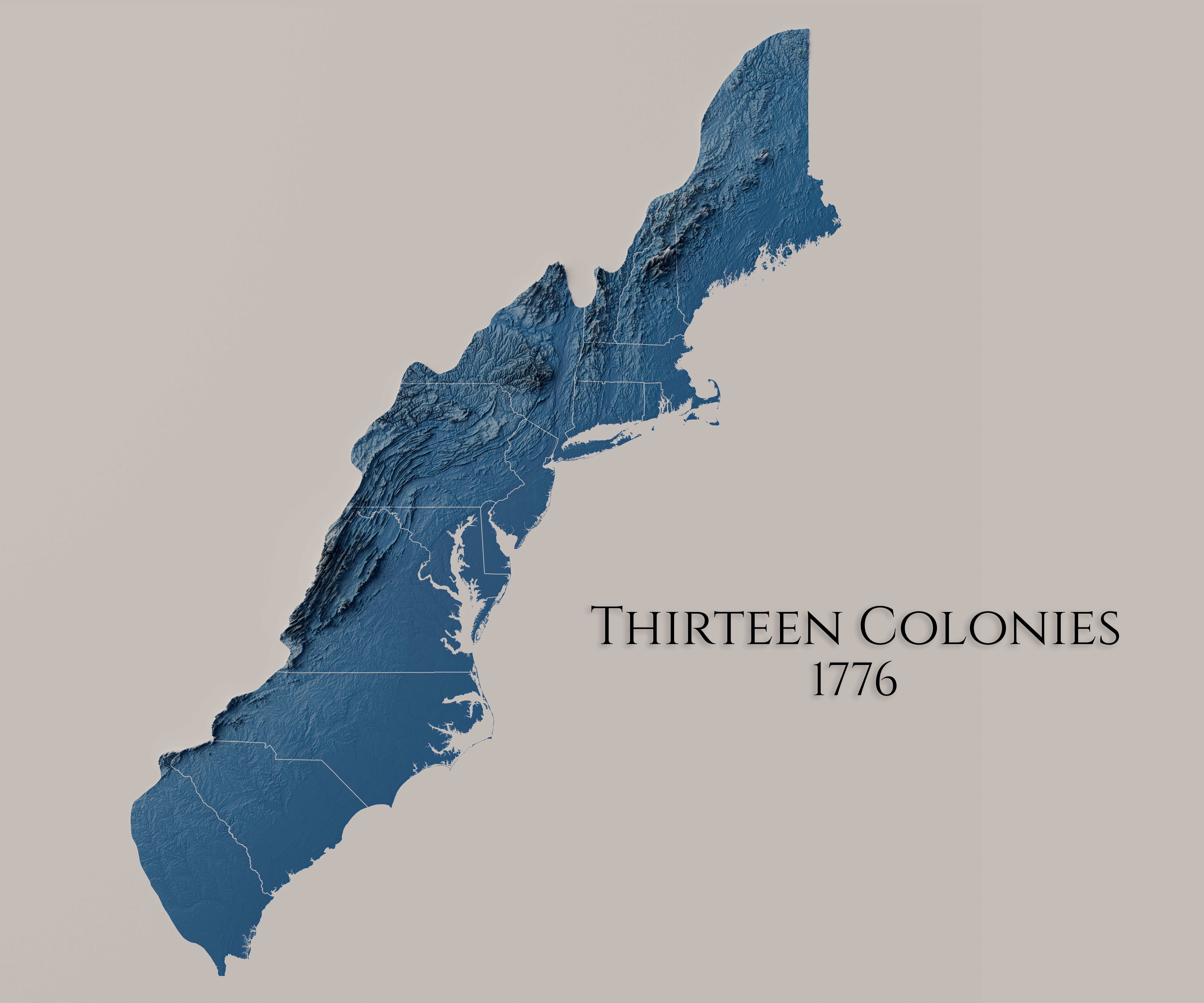
Relief Map of the Original Thirteen Colonies in 1776


Alex Cartwright
Senior Cartographer & GIS Specialist
Alex Cartwright is a renowned cartographer and geographic information systems specialist with over 15 years of experience in spatial analysis and data...
Geographic Analysis
What This Map Shows\nThe relief map of the original Thirteen Colonies in 1776 offers a striking visual representation of the geographical features that defined early America. This map highlights the diverse landscapes of the colonies, including mountains, rivers, and coastal areas, which played a crucial role in the development of the region. With its intricate details, this map allows us to understand how the physical geography influenced settlement patterns, trade routes, and even military strategies during the Revolutionary War.
Deep Dive into the Geography of the Thirteen Colonies\nThe original Thirteen Colonies were established along the eastern seaboard of what is now the United States. These colonies exhibited a variety of geographical features, which significantly impacted their economies, cultures, and interactions with Native American populations.
One of the most notable features of the colonies is the Appalachian Mountains, which stretch from the northern colonies down to the southern ones. This mountain range created a natural barrier that influenced migration patterns and access to resources. For instance, the western portions of the colonies were often less populated due to the rugged terrain, while the eastern coastal areas were bustling with activity due to their accessibility to trade routes.
Rivers also played a vital role in the social and economic development of the colonies. The Delaware, Hudson, and James Rivers are among the most significant waterways. These rivers facilitated trade and transportation, allowing goods and services to flow between the colonies and beyond. Interestingly, the navigability of these rivers varied, influencing settlement locations. For example, towns such as Philadelphia and New York City emerged as major urban centers largely because of their strategic locations along these rivers.
The climate across the Thirteen Colonies varied significantly, which further shaped agricultural practices and economic output. The New England colonies, characterized by a cooler climate and rocky soil, focused on fishing, shipbuilding, and small-scale farming. In contrast, the Southern colonies enjoyed a warmer climate, which was ideal for growing cash crops like tobacco and rice. The fertile lands of Virginia and the Carolinas made them the breadbaskets of the colonies, drawing labor from enslaved peoples to maximize production.
Regional Analysis\nExamining the Thirteen Colonies on a regional basis reveals distinct differences in geography and how it impacted each area’s development.
**New England Colonies**: Comprising Massachusetts, Connecticut, Rhode Island, and New Hampshire, this region was defined by its rugged coastline and mountainous terrain. The abundant forests supported shipbuilding and timber industries, while the cold climate limited agricultural diversity.
**Middle Colonies**: Including New York, New Jersey, Pennsylvania, and Delaware, this region boasted rich soil and a milder climate conducive to diverse agriculture. The presence of major rivers like the Delaware and Hudson enabled these colonies to become key trade hubs, fostering cultural diversity as people from various backgrounds settled here.
**Southern Colonies**: Comprising Maryland, Virginia, North Carolina, South Carolina, and Georgia, this area was marked by extensive agricultural land. The warm climate allowed for the cultivation of lucrative cash crops, resulting in a plantation economy heavily reliant on enslaved labor. The geography of the South facilitated the development of large estates and vast agricultural networks.
Significance and Impact\nUnderstanding the geography of the original Thirteen Colonies is essential for grasping the complexities of early American history. The physical landscape shaped not only the economic practices of the time but also the cultural and social dynamics. The reliance on agriculture in the South led to a distinct social hierarchy, while the trade-oriented economies of the North fostered a different societal structure.
What's fascinating is how these geographical factors laid the groundwork for future conflicts, both internal and external. The uneven distribution of resources and economic power contributed to tensions that would eventually lead to the Revolutionary War. Today, as we reflect on the historical significance of these colonies, we see how geography continues to influence modern American society, from urban planning to environmental policy.
In conclusion, the relief map of the original Thirteen Colonies in 1776 serves as a powerful reminder of how geography has shaped our history. By studying these physical features, we gain insight into the past and the factors that have shaped the nation we know today.
Visualization Details
- Published
- August 9, 2025
- Views
- 162
Comments
Loading comments...